Saturday, 12 October 2024
This morning, we headed west on a Matilda Byway towards Mount Isa using the Barkly Highway (A2). After crossing many dry rivers and creeks over the last few days we finally crossed an actual waterway, the Corella River about 50km west of Cloncurry. The river was dammed in1956/57 to provide town water for the Mary Kathleen Uranium Mine. I’m guessing that the dam enables the flow of the river to be managed through the wet and dry seasons?
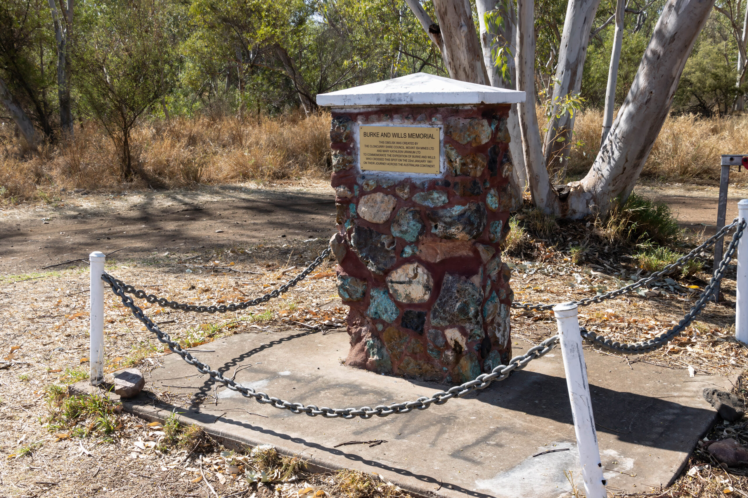
We made a quick stop at the Burke & Wills Memorial on the western side of the river. The memorial was well sign-posted so we were able to stop in for a quick photo. I have to question the planning decision which saw a big red bin installed very close to the memorial. Sure, great to have a bin BUT did it have to be put so close to the cairn that it is nearly impossible to photograph the memorial without the big red bin. And then there’s the frustration that some dirty pig had dumped the remains of their prawn roll and plastic packaging in the car park anyway – not two metres from said big red bin. Seriously, how are people so damn lazy? Cathy picked up the litter and Bernie lifted the ant-covered bin lid so that the rubbish was properly disposed of. Our travelling group’s contribution to keeping Outback Queensland beautiful.
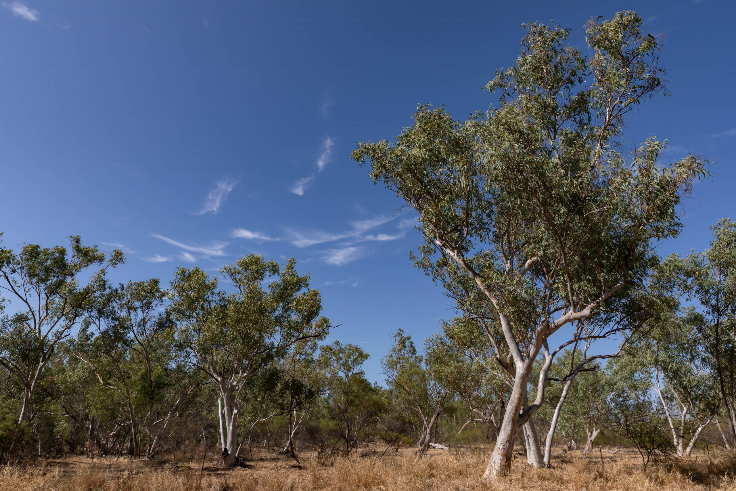
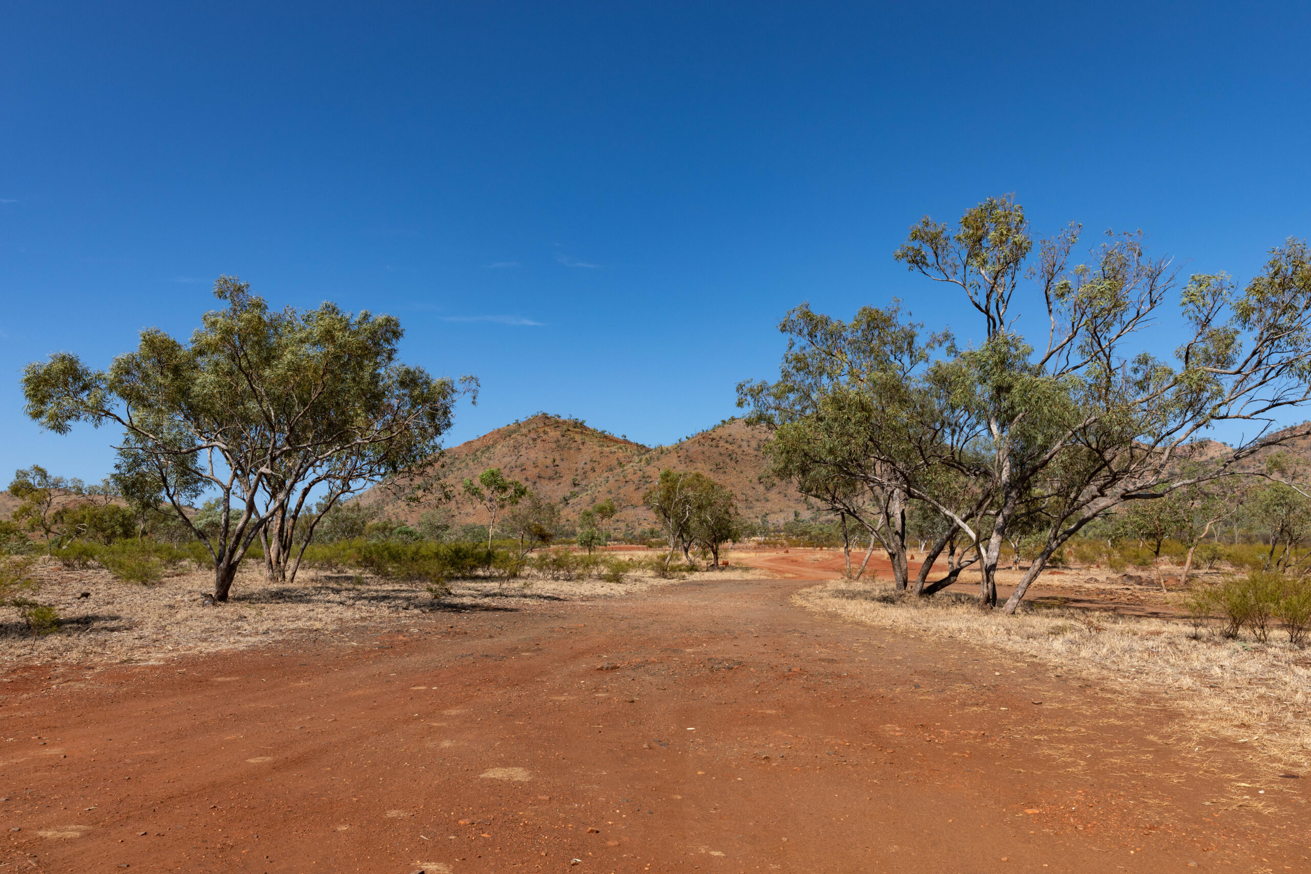
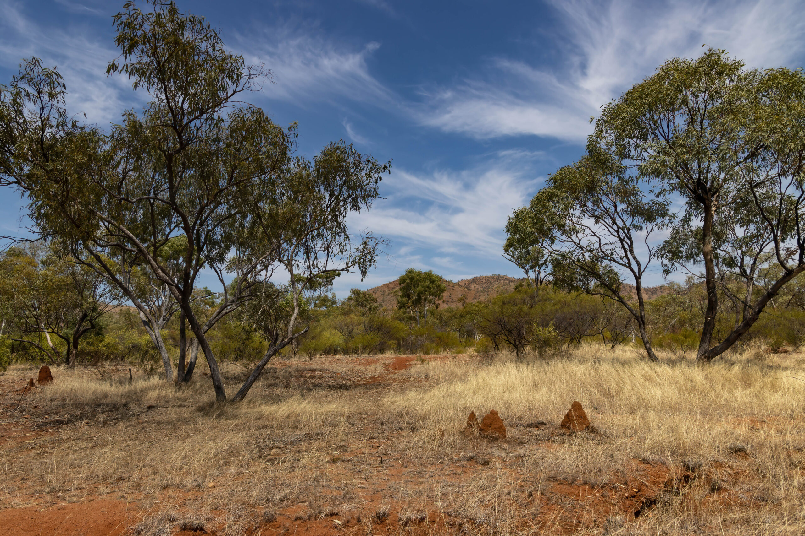
A very fast lizard (small) scampered across in front of us as we continued our drive through the spectacular Selwyn Ranges (aka Isa Highlands) between Cloncurry and Mount Isa. The landscape is very different from what we drove through south of Cloncurry. We have gone from flat, flat, flat with the occasional jump-ups to driving through a rugged mountain range composed of Proterozioc metamorphic rocks – ha, ha, basically jagged red outcrops all around us peppered with the ubiquitous termite nests. And today we had cow signs but no cows.
We arrived at the turn off for the abandoned Mary Kathleen township and uranium mine so turned off the highway to explore this piece of Australia’s mining history. The remains of the town start very close to the highway, and we had been given the tip yesterday to drive through the town remains rather than around the town as the ‘ring road’ is badly washed out in places.
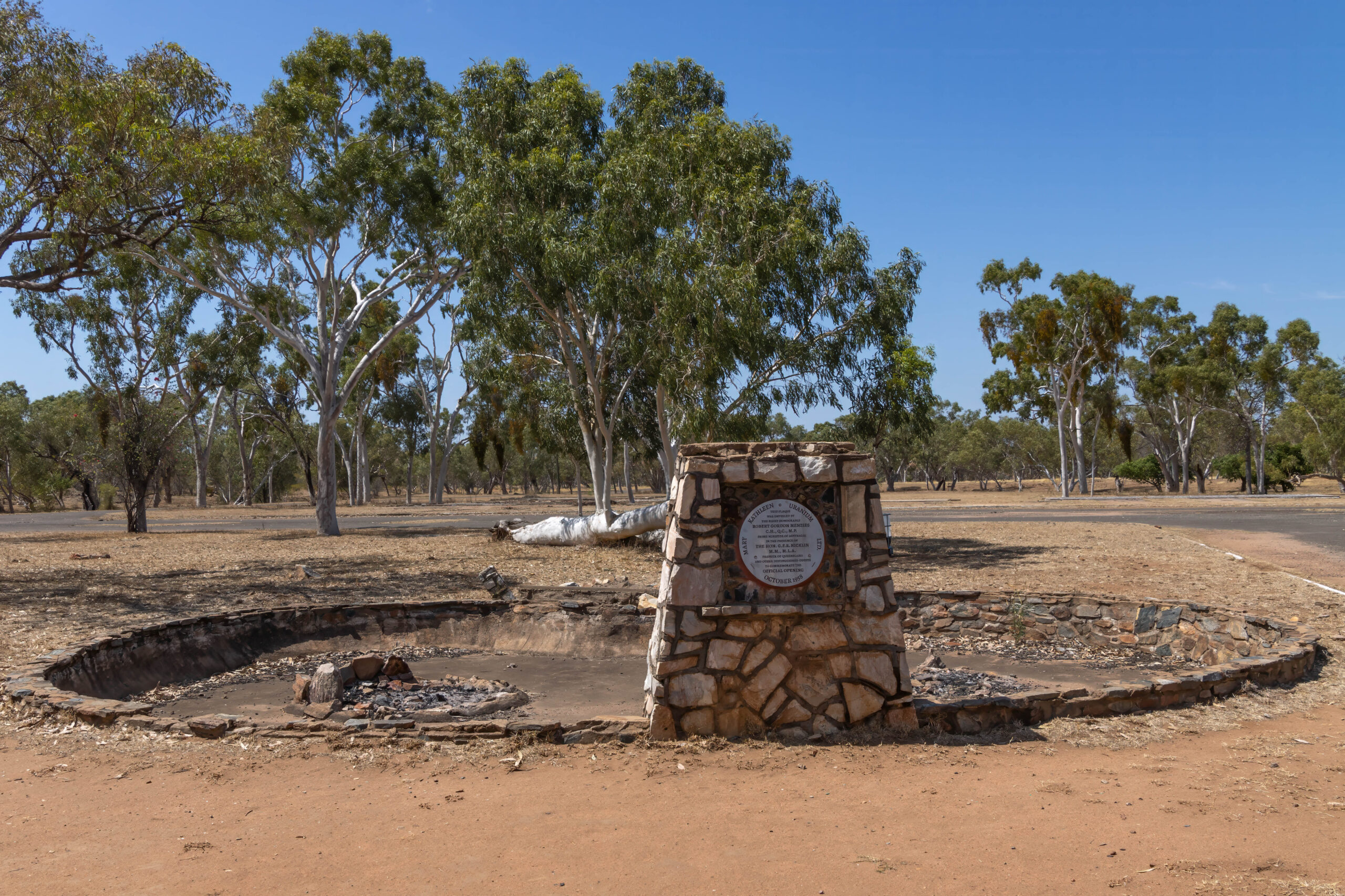
The Mary Kathleen uranium deposit was discovered by a syndicate of eight prospectors in July 1954. Two members of the group, Norm McConachy and John Walton broke down in a dry cry creek bed. While John was fixing the truck Norm took out the Geiger counter and the rest, as they say, is history. The claim was pegged and named after Norm’s recently deceased wife. Clem then secured a deal with Australasian Oil Exploration Ltd who paid the shareholders for the mining rights and agreed to a profit share arrangement on everything taken from the mine.
The company Mary Kathleen Uranium Mine Ltd was formed and the Rio Tinto group became a major shareholder. In the next two years the town, water supply, mine and production plant were constructed so that mining could start in October 1956 and production in June 1958. In the first five years of operation 4,080 tonnes of uranium oxide were produced. It was trucked in 44-gallon drums to Cloncurry, taken by rail to Townsville and shipped to England. The film we watched yesterday indicated that all this was done with little regard for health and safety!
With no sales contracts after this the mine and treatment plant were mothballed between the early 60s and 1974 when Rio Tinto was granted approval to export uranium to Japanese, German and US power suppliers. A further 4,802 tonnes of ‘yellow cake’ was mined and processed before production ceased in October 1982. All of the town and mine infrastructure was auctioned off and removed from the site. Many of the houses and buildings were transported to Mount Isa and Cloncurry where they remain in use today.
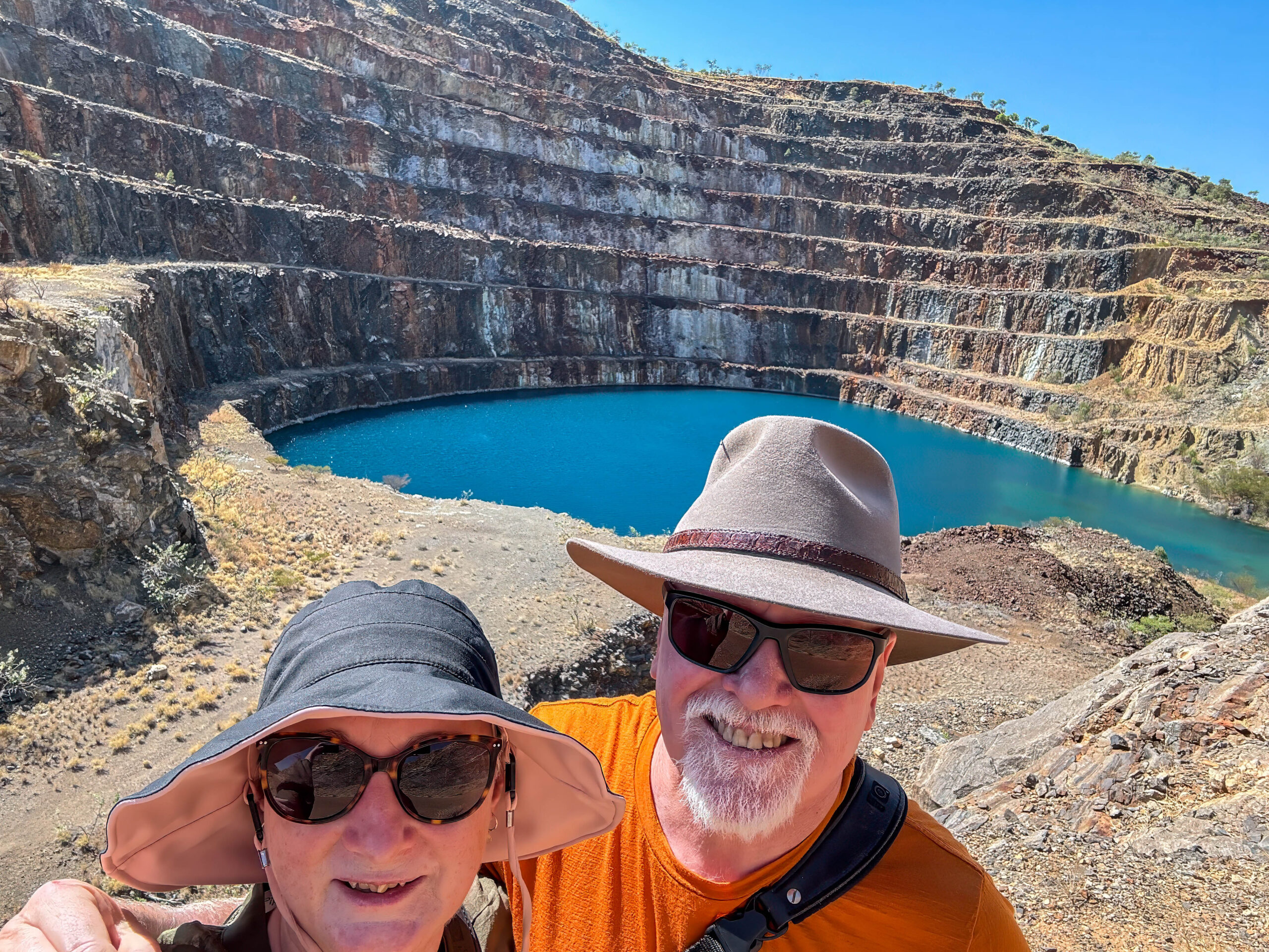
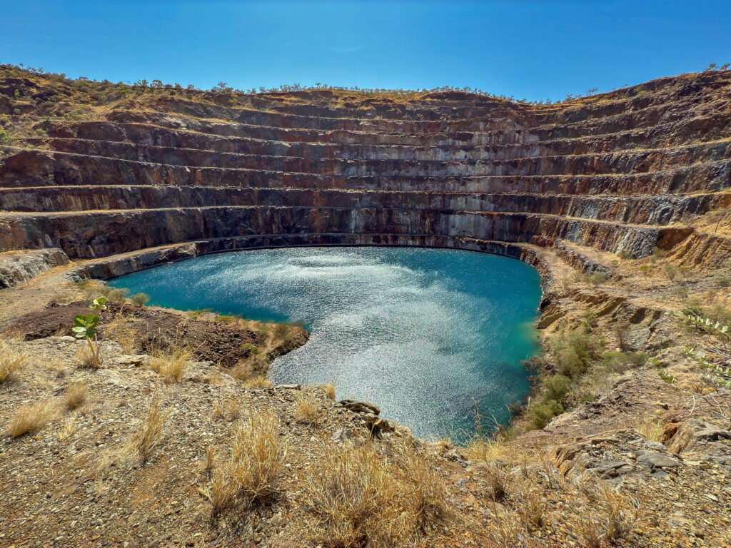
We found the road out the other side of ‘town’ and drove to the pit. The road wasn’t as bad as we though that it might be. The road top has survived for much of the five kilometres albeit with potholes. Bernie joked that it was no worse than a Victorian road! The end of the road was a bit more challenging to drive but we made it to the terraced mine face with its spectacular azure lake in front of it.
In fact, you can drive out to the mine in an M-UX, in a Subaru Forrester, in a Nissan X-Trail or in a Dodge RAM towing a caravan. We thought the family that towed their van out there were CRAZY. There are hectares of land in the old township where free camping is permitted, why not unhitch the van there and just take the RAM out to the mine??? To each his own, I suppose.
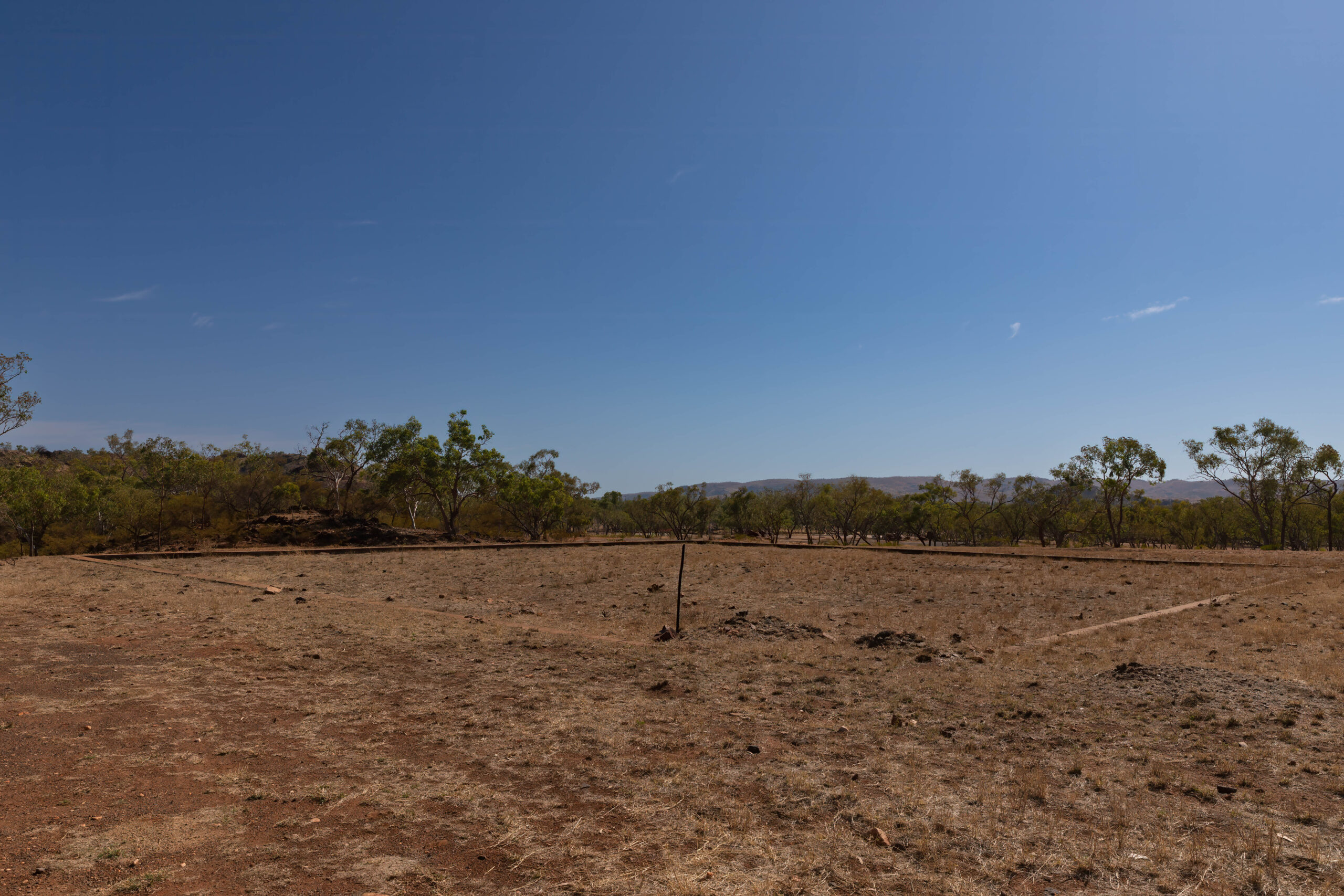
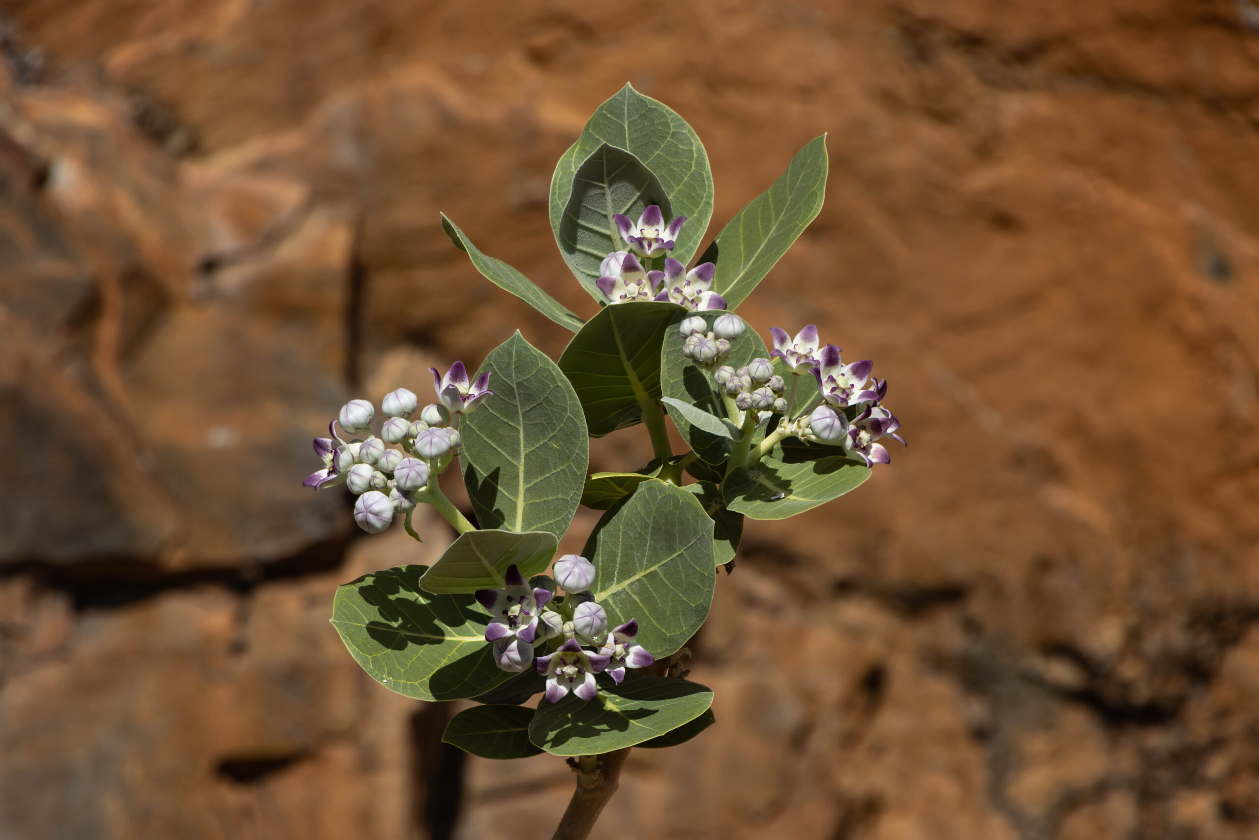
We drove back to the township without damaging either of our vehicles and drove to the old Town Square where we read the information boards that supplied all of that wonderful information recorded above. The township was once a green oasis with lush gardens, sporting grounds, a golf course and even a market garden. Today the only exotic plants that seem to have survived are a weird looking thing we had to Google – Calotropis procera (from Africa) – one hardy bougainvillea and a couple of oleanders. Roses once flourished in the gardens here, but they have not survived. Have to say that the concrete footings/driveways that remain make excellent places on which to set up your caravan annex, shower/toilet tents, etc if you decide to free camp here.
We made our way back out onto the highway. It was looking a bit frustrating that we had timed our return to the highway when an ore road train had just passed the turn-out. Groan, it was lumbering along v-e-r-y slowly. Fortunately, there was an overtaking lane shortly after and we were able overtake quickly before the overtaking lane disappeared early due to roadworks.
Before we arrived in Mount Isa, we crossed the Leichhardt River which is currently dry. Unlike many of the south-western Queensland Rivers that flow to Lake Eyre in South Australia, the Leichhardt River rises in the Selwyn Range to the south-east of Mount Isa, and it flows north to empty into the Gulf of Carpentaria.
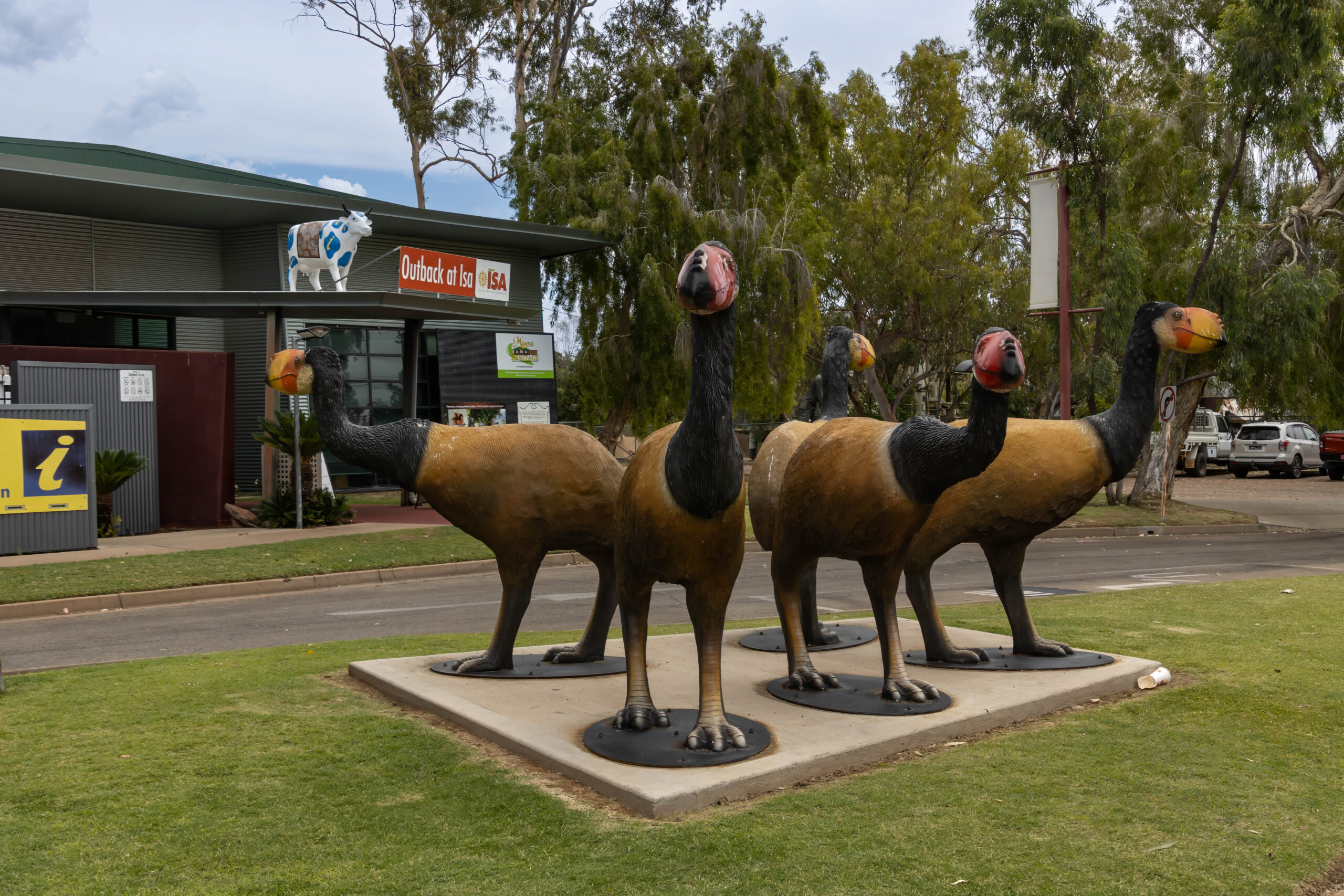
Upon our arrival in Mount Isa, we made our way to the Outback at Isa Visitor Information Centre. We booked on-line to do the Hard Times Mine Underground Tour tomorrow, so we confirmed our booking and completed our waiver forms so that we don’t have to sign our lives away tomorrow before we go underground. With some time to fill in this arvo we purchased tickets to go through the Riversleigh Fossil Discovery Centre.
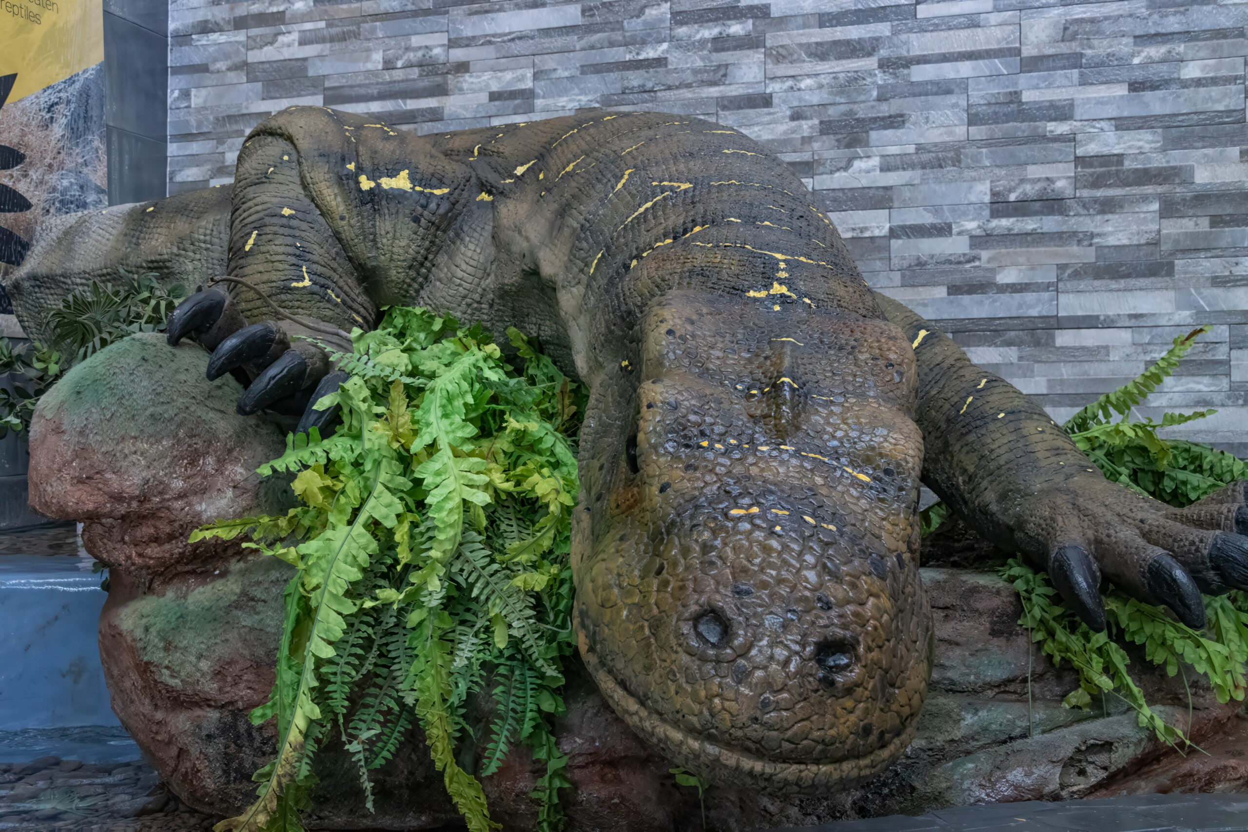
Located 279km north of Mount Isa, the Riversleigh fossil deposit is world-renowned as one of Australia’s richest and most important fossil field discoveries with some of the planet’s most unusual mammals being discovered here. The discovery centre provides an interactive exhibit that imagines what this part of the world was like 25 million years ago. Lush rainforest abounded and it was filled with carnivorous kangaroos, the antecedents of the koala and platypus, marsupial lions and moles, two-metre-tall flightless birds (dromornis) and diprotodons; the hippopotamus-sized wombat-like megafauna that we have also seen at Eulo and Naracoorte, SA.
We ate some lunch at the Outback at Isa Café before making our way upstairs to look at an interesting collection of photos of the Mount Isa Mine through the years. We were all amused at the food selections on the Crib Board. Miners had to order ahead the food that would be supplied to them during their break on the next day’s shift.
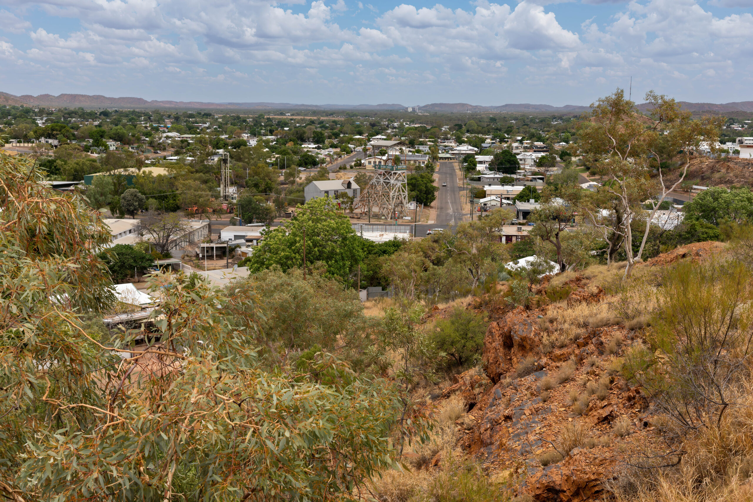
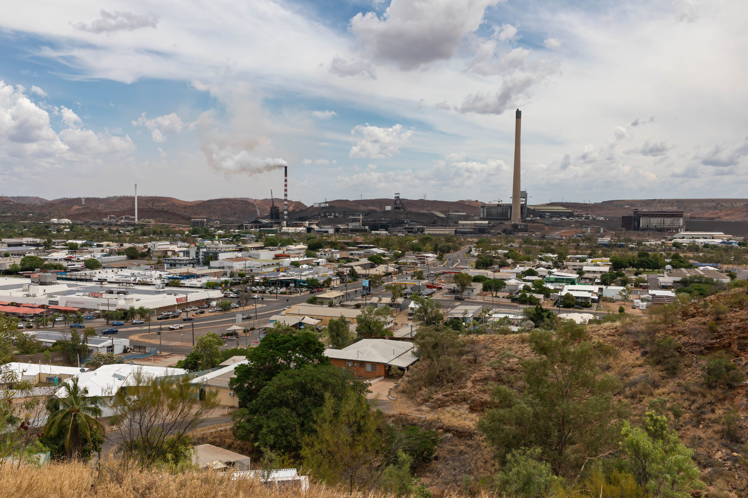
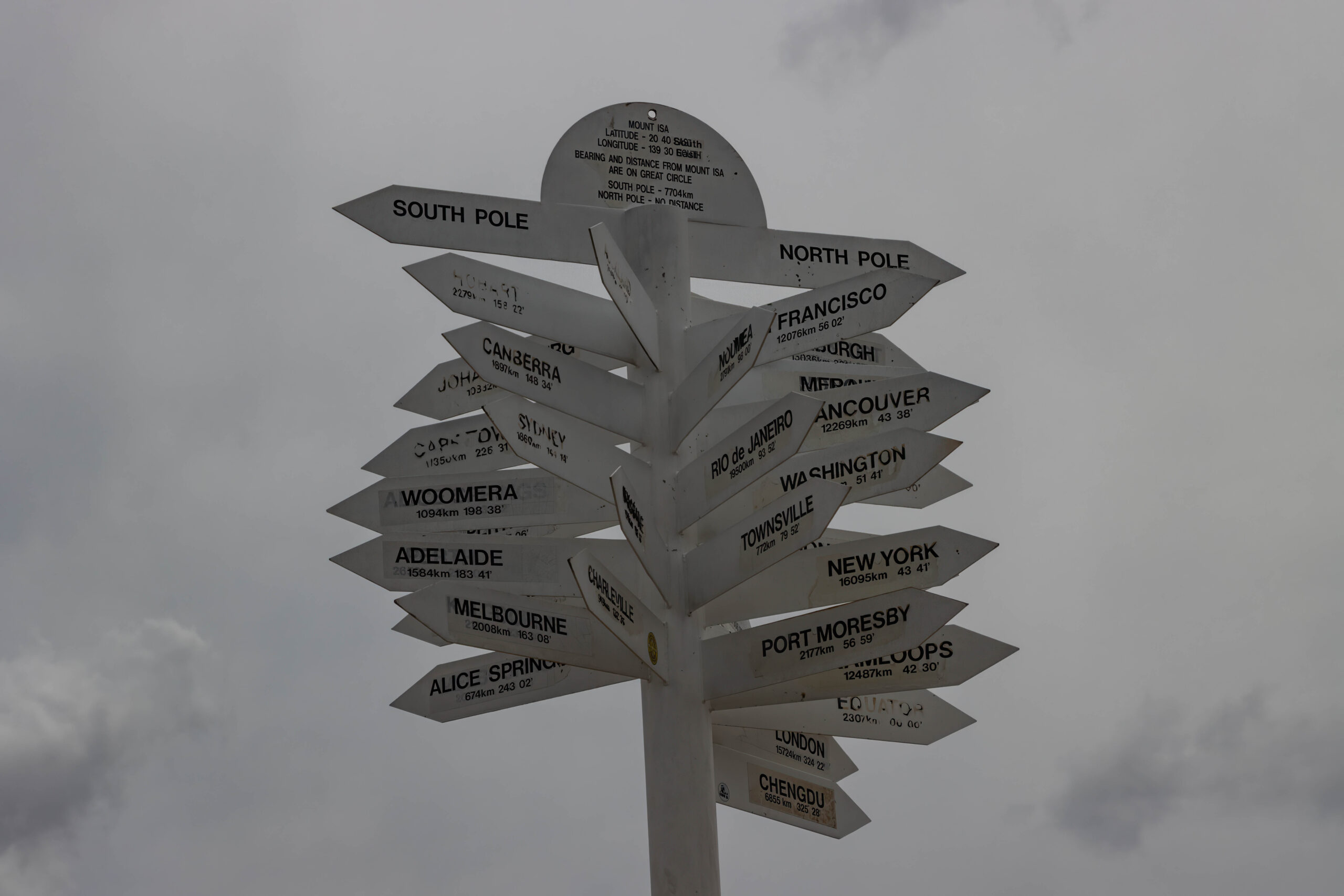
It is no longer possible to go onto a lookout on the Mount Isa Mines site so the staff member at the visitor information desk pointed us towards the City Lookout which is almost opposite. We drove up to the lookout for a panoramic view taking in the Acid Plant, Copper Smelter and Stack, Power Station, Urquhart Shaft Headframe, Lead Smelter and Stack and the all important Dome that provides an enclosed area as a control measure to manage dust and limit the impact of the mine on the environment and community.
Next stop the supermarket(s). We were spoiled for choice with both Coles and Woolworths operating supermarkets in Mount Isa. Our supermarket of choice was the Woolies with Cathy and Steve favouring Coles. We needed to shop today because neither of the supermarkets is open on Sunday way out here and only open until 6.00pm this evening. Tcht, we ended up at both supermarkets anyway because Woolies did not have my preferred A2 milk. We decided to try Coles just in case they had some in stock. Yes! At the rate I use it that should last me until we are in Charters Towers which we expect to be reasonably well serviced with supermarkets. It’s not quite as remote over there as where we are currently?? Fingers crossed anyway.
Argh, for the first time we have been allocated to motel rooms that are upstairs at the Spinifex Motel. In fact, this is the first two-story motel that we have stayed in. It required a little more effort to lug all our gear up to the second floor. At least we are here for two nights to make it a bit more of a return on the effort of moving everything upstairs, ha, ha.
We headed out to an early dinner at Giuseppe’s Cantina planning to have our meal and then have a look at the rodeo, the final rodeo in the 2024 Great Northern Rodeo Series. This is an event conducted under the auspices of the Australian Professional Rodeo Association for its members. However, as we sat eating dinner, we were watching lightning flashing around the outskirts of the city and started to think that that would not mix well with an outdoor event such as a rodeo. In fact, we finished eating and decided that we should just head to the register to pay so that we could get back to the motel before the weather hit.