Monday, 21 October 2024
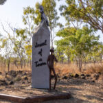
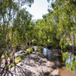
This morning as we headed out of Mount Surprise, we stopped to photograph the town sign on the eastern end of town and the Einasleigh River as it is one of the few rivers we have seen with water still flowing at the end of the dry season. It looked lovely down by the river with the morning sun shining through the eucalyptus trees.
As we drove back along the section of the Savannah Way (Gulf Developmental Road) that we drove with Maigread yesterday there was very little to see. Yesterday morning when Maigread was at the wheel there seemed to be more cattle and more roos (wallabies?) about. Today we were motoring along this section about half and hour later than we did yesterday but only spotted a couple of cows and one macropod.
We soon reached the turn off for Undara Volcanic National Park and could not believe that even with the windows wound up tight we could hear the cicadas that inhabit the savannah woodland in this area! They are so loud. After 56 kilometres heading east it was time to take a left onto the Great Inland Way (Kennedy Developmental Road) and point the truck’s nose south towards home.
On our left we could see a conical mountain which the map seemed to indicate could be Mount McBride which is yet another of the old volcanoes that dominate this area both in and around the Undara Volcanic National Park. And then something we haven’t seen before a cow with twins grazing by the road.
We had not been heading south for very long when we spied a caravan heading north. We speculated about whether it was people heading north to holiday despite the wet season approaching OR was it people who have been holidaying down south who are aiming to be back home in Townsville or Cairns before the wet season arrives? A question that we can never know the answer to.
As we drove, we were also noticing what looked like cotton bolls along the roadside. Knowing that a lot of cotton is grown up here in Queensland we thought it was highly likely that we were seeing bolls that have escaped from vehicles transporting the cotton to be processed. Unless they have blown to the roadside from fields where the cotton was grown but we were not seeing cultivated land as we drove so that seemed less likely.
There have been so many cows in the long paddock this morning and yet we hadn’t seen any of the yellow stock warning signs. The signs are very hit and miss. We’ve been finding that there are warnings of stock on the road for X kilometres and we never spot a cow and then on other occasions there are cows in the long paddock and yet there has been no signage warning drivers to watch for stock. I guess it pays to be alert ALL the time when your are driving because, really you never know that you might encounter.
We soon spotted a second van heading north and noticed that the landscape had changed as we headed south and away from the Savannah Way. The eucalypts seemed taller with more of a bushy understory compared with the grasses in the Savannah landscape.
We arrived at a huge Y intersection where the right option is towards Hughenden and the left option is towards Charters Towers on the Great Inland Way (Gregory Developmental Road). The map showed the Oasis Roadhouse right at the intersection, so we had been planning to stop for a leg stretch there. Damn it, the roadhouse signs indicated that it’s a couple of Ks along the road (Route 62) to Hughenden. Reluctant to go out of our way we turned onto Route 63 to Charters Towers expecting that there would be a Rest Stop soon for a leg stretch and toilet break.
We saw signs that a fire has been through and our third … and fourth caravans heading north. That was already more vans heading north on this route in one morning than we saw the entire time we were driving north on the Matilda Way. Perhaps it is a rush of caravanners aiming to be home before the wet season or maybe the Great Inland Way is just the more popular route north? Even more interesting that these vans heading north was an Oversize Load that appeared to be half a school portable. On a long rural drive you just seem to notice all the other traffic!
We were still 235 kilometres out of the City of Charters Towers when we noticed a sign telling us that we had entered the Charters Towers Region. And still we had not seen a Rest Stop 150 kilometres from where we started this morning. When we drove between Mount Isa and Karumba the Rest Stops were really well spaced, but we are finding this morning that they are non-existent thus far.
Finally … finally, we stopped at the Greenvale Roadhouse to stretch our legs and backs, use the facilities and purchase some drinks. As we tumbled out of the car a noisy apostle bird reception committee greeted us. These birds seem to be quite attracted to places that they associate with humans and easy food. We didn’t need any fuel, but we did need the loos! We probably spent a little longer at Greenvale than planned because the till froze which caused a hold up with processing transactions. Not to worry it was good to be out of the car and moving around for a little while.
Back on the road we found ourselves crossing Redbank Creek three times as is criss crossed Route 63. We crossed another river with signs that warned of a low-level bridge. Fine in the dry, but the flood markers had the capacity to indicate three metres of water if the river is in flood.
The landscape changed again with some flat-topped escarpments popping up from the surroundings and we were seeing some elegant trees (not sure what species) with very white trunks and something with a ferns/feathery leaf and yellow flowers, possibly a grevillea? And finally, 158km out of Charters Towers there was a Rest Stop with loos, but we didn’t need a Rest Stop anymore after availing ourselves of the facilities back in Greenvale.
We crossed the Clarke River which was another low-level crossing, and we were a bit taken aback to see markers able to indicate seven metres of flood water!! Looking out to the left of the truck I could see trees obviously washed over by a flood? This led to a discussion about whether the Clarke River would flow to the gulf or to the Pacific Ocean. I was going for the gulf, Bernie was sure it would be the Pacific. We haven’t passed (or seen) any sort of marker to indicate if we’ve crossed the continental divide which would tell us if we’ve crossed the point where rivers flow either east or west out of the Great Dividing Range.
We stopped for another brief leg stretch at Bluewater Springs then straight back on the road. More roadkill, more kites … and crows taking advantage of it. Most of the roadkill was roos but we also saw a deer and a couple of pigs. And that led to the macabre question as to whether birds that feed on carrion prefer roo to pork? On a less gruesome note we also spied some horses in roadside paddocks which made a change from cattle and Bernie spotted a couple of donkeys. No goats today!
We reached Fletcher Creek which looked like a lovely spot for some free camping. There were quite a few vans set up in an idyllic looking well-treed setting with some flowing water. We probably are on the wetter (eastern) side of the Great Divide now?
Arriving in Charters Towers after 1.00pm we made finding lunch a priority. We managed to make it into the Salt Lane Café just in time to order something from the cabinet. With closing time at 2.00pm the kitchen was closed so we couldn’t order anything from the menu. Bernie and Steve had BLTs on Turkish bread rolls while Cathy and I had chicken and cheese croissants. I even managed to have some FRESH avocado added to mine before it was toasted. With them mopping the floor around us we ate quickly and got out of their way.
We wandered back across Mossman Street to pick up some information from the Visitor Information Centre. There was a helpful map of North Queensland’s rivers on the wall that showed that the Clarke River flows into the Burdekin River which flows into the Coral Sea (Pacific Ocean) near Inkerman, south of Townsville so … Bernie was right. The friendly volunteer, Len, made quite a few suggestions and we booked for tonight’s ’Ghosts After Dark’ presentation in the amphitheatre at Towers Hill. Len suggested buying a takeaway to eat on the hill while we watched the sun set and then taking in the show at 7.00pm.
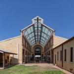
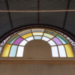
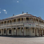
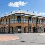
With several brochures and maps in hand we crossed again to Gill Street and walked along both sides admiring the city’s beautifully preserved old buildings while sneaking in an ice-cream in a cone from Kaffe & Cones. Damn it was hot again today so we decided it was time to check in at the Hillview Motel, purchase some food supplies and fuel and then spend some time enjoying the motel’s swimming pool.
Before we could buy our food supplies, we had to head out to the Mitre10 to buy a folding solar panel because Bernie hopes that it will improve the charge in our fridge battery which stubbornly remains at only 20% despite nearly 400 kilometres travelled today when it was supposed to be bulk charging from the car battery. The first panels that we found were either solid panels or ridiculously expensive at over $500!!
Right at the end of the aisle on the other side Bernie finally found the panel that he had seen on the internet. But then there were two – same brand, almost identical in size but one had fancy packaging and a higher price tag than the other plain wrap version. We took the cheaper one to the desk and Bernie asked if he could see what it looked like. They were happy to oblige, Bernie confirmed that it had all the leads necessary, with Anderson plugs (whatever than means) and a carry case. Yes, yes and yes. OK, I’ll take it and you can keep the box.
With that sorted we shopped at Woolies, topped up the car and then drove back to the motel. While Bernie drove the truck out the back to set up his new accessory in the sun I joined Cathy and Steve in the pool. When Bernie joined us in the pool it was to report that solar charging doesn’t seem to make any difference. The lights on the battery show that it starts to bulk charge when power is fed into it BUT within minutes it defaults back to trickle charge which is not enough to get it fully or even decently charged.
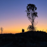
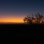
Just before 6.00pm we headed out to the Golden Mine Chinese Restaurant. They do smorgasbord style to eat in or take away. We packed our selections into containers and took them to the till to be rung up. Up onto Towers Hill where we ate with an audience of magpies and rock-wallabies and pretty much missed sunset because we forgot that we have travelled east, and the sunset is earlier. Anyhow, the colours were actually better about 20 minutes after the sun had set so we still took some lovely photos.
We then enjoyed the interesting presentation about Charters Hill’s past on the big screen in the open-air amphitheatre. The show was hosted by fourth generation Charters Towers local, Bill and provided us with information about the discovery of gold at the base of Tower Hill in 1872 which led to one of Australia’s biggest gold rushes. Other information that Len shared was about Charters Tower’s role in WWII when Towers Hill was used to create bunkers to store bombs, detonators and ammunition.
While showing us old images of the goldfields and the mines Len read out statistics about the astonishing amount of gold that was mined from Charters Towers … and sent to England (the majority of mine-owners were English) to fund the building of beautiful cities like Bath. Fortunately sufficient wealth remained in Charters Towers for it to become established as Queensland’s second biggest city.


