Saturday, 1 November 2024
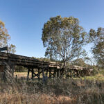
Unhampered by the go-slow Gaffneys the go-go Gatts were gone by 7.30am this morning keen to get back to Melbourne after 34 days on the road. We were not long after them departing the Camellia Motel at about 8.05am. Still on holidays we decided to take a short detour down to the historic trestle bridge beside the Sturt Highway to take one of our last few snaps on this road trip before getting underway.
Spanning the Murrumbidgee River and the Sturt Highway (the section over the highway has been removed), the two-span continuous bridge was designed by John Flower, an eminent British consulting engineer in the late 1800s. The design is one commonly seen in British colonies and it is listed as having significant merit in engineering heritage. Of course we could only photograph it from outside a fence line, but it’s still amazing to see this bit of rail history surviving. Astonishingly visitnsw.com says that Narrandera’s Rail Bridge was only taken out of service in the 1980s when rail services ceased.
While we were parked near the bridge Bernie programmed Cobram into Apple Maps. A friend had mentioned some metal sculptures in the Cobram area that we might want to check out on our way back to Melbourne depending what route we planned to take. Why not we thought, we might as well eke out the last few touristy experiences before getting home to our usual routine.
I assumed that we would head down the Newell Highway through Jerilderie, Finley and Tocumwal but, of course, Siri had other ideas! Only a few kilometres into our journey and she directed Bernie to turn right onto Gap Road. Whaaaat? Why??? But who am I to second guess the navigation goddess, Siri?
Gap Road was a re-run of yesterday, wheat, wheat, wheat and more wheat. We did eventually pass another random collection of beehives, and I wondered if they have been moved near a particular tree in blossom to make an exotic flavoured honey? It also amused me that we were seeing the beginnings of some bread and honey, ha ha.
We turned right onto Strontian Road and suddenly I could see on the road atlas exactly where Siri was taking us. Looking at the map I couldn’t see the logic and said to Bernie are you sure you programmed the SatNav to take us to Cobram because this seems like a really weird way to get there. He was sure but to humour me he pulled over to check, almost squishing a lizard sunbaking on the side of the road. Thank goodness we missed it. Despite the seemingly bizarre alternate roads we were travelling Bernie showed me that the route programmed in did indeed say we would arrive in Cobram at 10.22am.
We resumed travelling and to add to the back roads feel of the journey we happened upon a section of road were the tumbleweeds lay thick upon the bitumen. When we turned right onto Ormes Road, and I could see that our next turn would be a right turn onto Boree Creek Road heading for Urana it finally seemed that we could actually be heading towards our planned destination.
We passed a lone kangaroo that was out on the roadside rather late this morning and then on Boree Creek Road we caught a glimpse of Lake Cullival before hanging a left onto Federation Way and making our way into Urana. OK, this strange route was just about worthwhile to find ourselves turning right towards Jerilderie and finding ourselves on Cocketgedong Road!
But not for long as we soon executed another left turn onto the Back Berrigan Road. You know you’re off in the boonies when the road is actually called the back road! Still bemused by our route I put ‘Narrandera Trestle Railway Bridge to Cobram’ into Google Maps which estimated 1hr 56mins travel time on the Newell Highway compared with 2hr 01mins by way of the route we were on. So, very equivalent journey times and Bernie swore he chose the fastest route at the time of choosing. I, on the other hand, have this theory that Siri has remembered the crazy indirect routes that we have travelled the last two days, and she’s decided to give us a bit more of the same??! THAT I could believe!
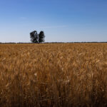
I had been saying to Bernie that as we were travelling all the backroads, we should keep an eye out for a photogenic tree to photograph standing in the middle of a wheat field. First the fields were all on the same side as the morning sun and then there were too many trees! Finally, we stopped for a me to take a photo of a tree – not the prettiest of trees but I’d given up on spotting a better one! – in a field of gold while we were on the Back Berrigan Road. Also noteworthy on this stretch of road was spying a wedge-tailed eagle hunched atop a power pole. Watching out for some breakfast no doubt?
I had been Googling about the metal sculptures to try to find out a bit more precisely where they are located. Noting that they are near Ulupna I questioned whether WE should have checked earlier in case that might have resulted in a more direct route being suggested. I thought perhaps we could check in Berrigan in case it would be better to cut across to Finley and head over the river at Tocumwal?? Certainly, this would be my choice navigating from the road atlas.
We took a right turn onto Berrigan Oaklands Road and as we drove closer to Berrigan, we started seeing irrigation channels and water tractors in the fields. A sign that we were nearing Riverina country. We pulled into Berrigan, the Birthplace of Federation according to the sign at the entrance to town. Ooh, that’s controversial as a quick Google search now I’m writing this at home says that nearby Corowa holds this honour because it was the site of a people’s conference in 1893 which agreed that federation would be better for the present and future prosperity of the Australian colonies. Of course that’s not the single event that led to federation. I suspect Tenterfield, the venue for Sir Henry Parkes’ rousing address calling for ‘a great national government for all Australians’, might also claim to be the Birthplace of Federation??
Stopping in the main street near the toilet sign Bernie made a beeline for the loos. I wasn’t sure if he was desperate or annoyed that I had been questioning the route that Siri chose??
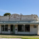
When I came out of the toilet he was gone. I figured he had headed off to photograph the old building that he had commented on as we drove into Berrigan. Not to worry we were parked right beside No. 42 Chanter Street a vintage clothing shop filled with secondhand wares and curios so I popped in there to see what treasures I could find. I found a brooch that I liked so asked the proprietor for a price. Twenty-five dollars she said and asked if I was in town for the races. Apparently, the races are on in Berrigan today. No, just passing through on the way back to Melbourne I said after 34 days on the road.
I only had a $50 and she had no change. I said I would see what my husband had in his wallet, and she wandered across the street to see what one of the traders on the other side of the street might have. Fortunately, Bernie had the right money, so I exchanged the brooch for the $$. She thanked me for buying something and then apologised for the cluttered state of her store saying she hasn’t been well and hasn’t had the energy to keep things straight. I told her that my sister would LOVE her store and part of the charm of a vintage store is poking around to find a treasure. She thanked me again and hoped that I’ll visit again next time I’m passing through.
Before leaving town, Syri was consulted and she still insisted that the quickest way for us to go would be through Cobram and then on to Ulupna Island for the sculptures. OK then. Continuing south on Berrigan Road the landscape was still the same as yesterday – mostly wheat, bales of hay, occasional paddocks where sheep or cattle were grazing and then … we passed some grapes. We are definitely in the Riverina now!
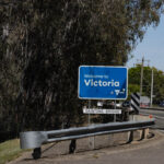
We passed through Barooga noting its High Noon Motel which certainly sounded a bit Way Out West. Then finally, on the 34th day of our road trip we drove across the Barooga-Cobram Bridge over the Mighty Murray River, back into Victoria. Yay, our number plates won’t mark us as ‘foreigners’ anymore.
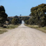
From Cobram Siri directed us north-west on the Cobram-Koonoomoo Road then through a dog leg turn onto Mywee-Koonoomoo Road. We resisted the temptation to photograph the Big Strawberry at Koonoomoo. Been there, done that, have the photo to prove it, ha, ha. Aargh, Bernie had to negotiate a bit more gravel road driving. The last few days we seem to be finding lots of unsealed roads to drive on.
We found ourselves on the Bearii-Mywee Road (which was sealed) and then turned right onto the unsealed Ulupna Bridge Road. We crossed the Ulupna Creek, and we were on the island which is formed by the Murray River running around the north of it and the Ulupna Creek around the south. It’s completely south of the Murray so we assume it’s ‘in’ Victoria?
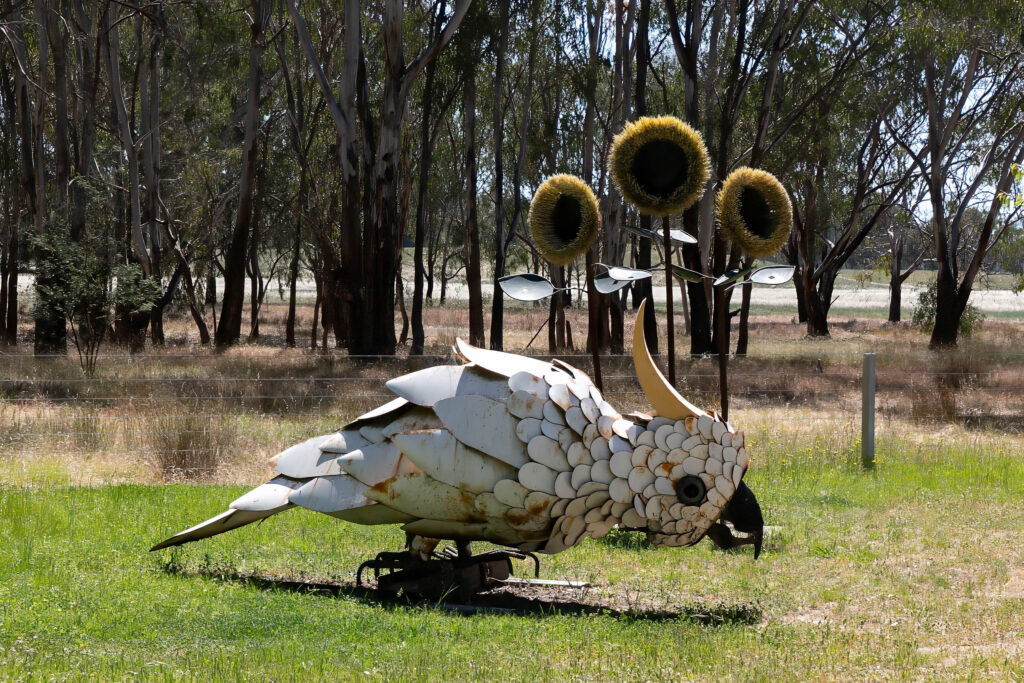
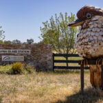
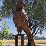
We found the first sculpture – of a kookaburra – almost immediately, inside the fence of the Ulupna Island Station. I had read somewhere that the sculptures are on private property but accessible for photographing. With signal lost all we had to do now was try to find the other sculptures. Working from memory I said I thought we needed to keep driving north towards the Murray River. Only a few hundred metres further along we found the second sculpture – of a wedge-tailed eagle – inside the fence line again but this time with a few pesky trees starting to obscure it from the road. We still got our photos though.
Damn, it’s a long weekend in Victoria and there were so many campers around! So many 4x4s churning up the dust on this dirt road. We continued north meandering between fence lines. We could see that there were lots of campers already set up on the river and it’s not even lunchtime on Saturday. Perhaps they extended their long weekend with a day off yesterday too? We could also see house boats on the water and pulled up onto the shore.
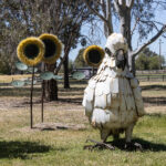
We eventually found the cockatoo sculptures, got our photographs of those and then wondered where to next with no signal to programme ‘Home’ into Apple Maps. We started out re-tracing our steps hopeful that we would get into range for satellite navigation to kick in OR see a sign for Numurkah or Shepparton. It’s not like we had no idea where we were and where we needed to go!
Ha, not long after we re-crossed the bridge from the island, we picked up the satellite and received instructions to turn right onto Bourchiers Road which eventually brought us into Strathmerton. At the T-intersection we turned left to head south-west on the Murray Valley Highway. It was novel to see some dairy cows grazing in a paddock as we have only seen beef cattle for weeks.
Finally, a left turn onto the Goulburn Valley Highway to have the truck’s nose pointing south. We are really heading for home now! Driving through the outskirts of Numurkah Bernie felt no tug of nostalgia having lived there as a young boy for a year or so. He said all he could remember was living near an irrigation channel and going yabbying in it.
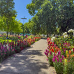
We continued through Wunghnu and Tallygaroopna before driving into Shepparton for a lunch stop. We picked up some toasted Turkish bread rolls that we ate in the shade at the front of the bakery. We walked across to Queens Gardens looking for a toilet admiring the colourful roses and annuals in the garden beds. My worst nightmare was finding that the public toilets were capsule toilets! I used them without the door opening in the middle of proceedings and I was able to get out when I was done. Phew!
Despite a couple of offers to take a driving shift Bernie resumed his position being the wheel for the final leg to home. Our ETA was 2.31pm as we left Shepparton and despite some confusion on the ring road where we were in the wrong lane and took the wrong exit we still backed into the driveway at 2.33pm. Yay, Home Sweet Home, there’s no place like it!
A total of 34 days on our epic road trip to the Gulf of Carpentaria with 8,099 kilometres added to the truck’s odometer. The MU-X never missed a beat even though she had to make do on a diet of regular diesel fuel instead of the premium diesel she is accustomed to.

