Saturday, 16 August 2025
It was a bit of a drag this morning, we had to make our own breakfast again. It’s so much easier to have breakfast included although, of course, you’re actually paying for it in your room tariff. So cheap and self-catered breakfast today.
We were on the road just before 9.00am and Peterborough was looking pretty dead. Bernie was checking on things to do in Peterborough the other day, even though we were only passing through, and discovered that their Steamtown Heritage Rail Centre – which we have visited before – is temporarily closed. Their website says ‘… due to the Council’s current financial position the Steamtown Heritage Rail Centre and Visitor Information Centre will be temporarily closed while a new operating model is developed.’ What a shame. We thought the experience was really interesting when we passed through on a previous road trip. It seems a terrible shame that they cannot find a way to keep their main tourist drawcard operating while they try to develop a more cost effective operating model. We wonder if it will ever reopen??
We headed out of town on Cleary Road before Syri told us to turn right onto the A32 (Barrier Highway) and go straight on for 146 kilometres. The intersection was a bit wet suggesting there had been a shower of rain here that we hadn’t experienced in Peterborough. Just a few kilometres down the road Bernie pulled in at the BP Servo in Terowie to top up the tank. The servo wasn’t open but there was a provision to pre-pay your fuel so you could still fill your tank. Standard diesel again for the truck.
Bernie asked where would be a good place to stop for lunch and I said it was hard to say, because we were about to drive out of the area covered by the Flinders Ranges Atlas & Guide that I had on my lap. That’s why we should have brought our other atlas because I can see straight away what lies ahead of us! So, I had to resort to Google and with our route heading through Renmark, that seemed like it was going to be a good place to take our lunch stop.
We entered the area governed by the Regional Council of Goyder and Bernie thinks he saw a sign about the Goyder Line. It certainly did seem to be a case of entering this Goyder zone and all of a sudden there were wheat fields rather than sheep in the paddocks to either side of the road. The use of the land certainly reflected the fact that Goyder surveyed a line through South Australia which denotes the northernmost latitude for intensive agriculture. North of the Goyder Line is considered more suitable for grazing sheep than growing wheat.
And wind farms! We were driving through land that has clusters of wind turbines standing on all the nearby hills. We thought that this was probably the other side of the wind farms that we saw as we drove north on the R M Williams Way through Jamestown a week or so ago. Maybe, or perhaps just MORE wind farms in this area that is good for harvesting the wind?
We were also driving past frequent ruins of stone cottages. Evidence of dwellings much closer together than you would normally expect in an agricultural area. We wondered if the cottages were so close together because they were the homes built on soldier settlement farms which were much smaller than usual for farming. Ha, Google tells me that there WAS a soldier settlement scheme in the 1920s located at the Sheoak Hills Homestead near Terowie so, we might be right?
When we’re travelling, Bernie has our UHF radio on and set to Channel 40, the trucker’s channel. Usually, all we get is an occasional bit of static and more rarely still some dialogue. This morning we heard a trucker say to a caravan – I’m going to go around you after that 4WD. Pretty sure the 4WD in question was us because the oncoming traffic consisted of a caravan and caravan with a truck jammed up behind them itching to pass.
We drove through Hallett and that was a wrap for the map. We are not flying blind by any means BUT the route only unrolls on the SatNav screen as we travel. I like to have an old-fashioned map on my lap to keep an eye on what it coming up, especially those red notations showing points of interest. You never know when one of those might be worth a look.
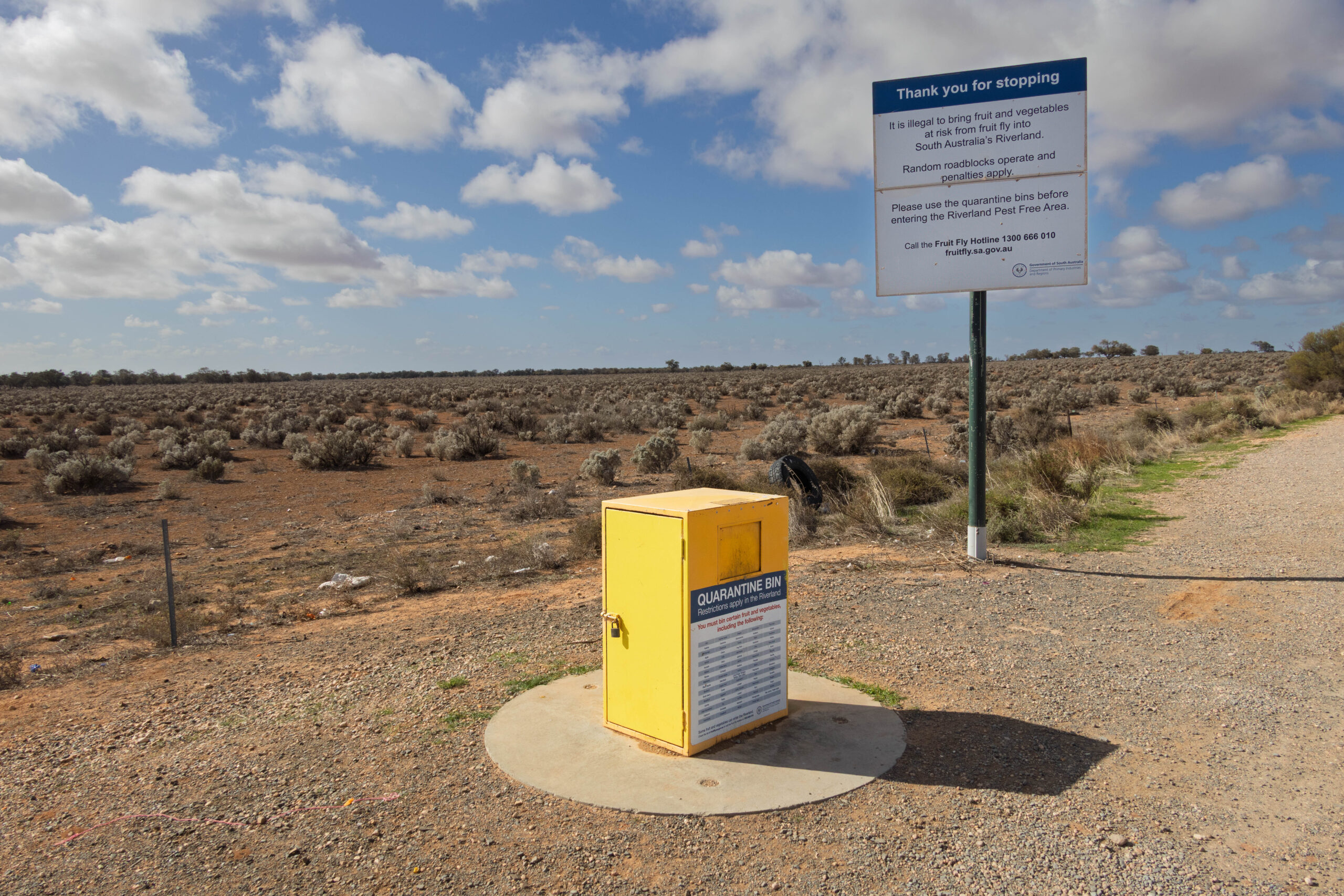
We continued through Mount Bryan and, just before Burra, we turned onto the Goyder Highway (B64) heading east towards the border. Dang, we were approaching the quarantine checkpoint and remembered we still had one mandarin on board. To throw it in the bin or eat it was the question. We pulled into the bay beside the honesty bin behind a car and caravan. We decided that we could scarf half a mandarin each rather than bin a perfectly good piece of fruit. If we had remembered about the quarantine restrictions going into the Riverland District we would have eaten the extra mandarin with breakfast.
The guy from the rig in front of us got out to bin half a punnet of strawberries moaning about having to force feed yourself fruit … especially after you have eaten cream cakes at the bakery this morning. He and his partner had managed a couple of mandarins too but the strawberries were being consigned to the bin. The bin has a COMPREHENSIVE list of fruit and vegetables that must be binned in the big yellow bin. Had to have a laugh that it included durian. I mean how many people are travelling the Goyder Highway with a durian on board!!?
Rather distressingly we now entered something of a road kill alley. We have been seeing dead roos on the side of the road during our time in the Flinders Ranges but not as many as we feared we might. This section of road between the quarantine bin and Morgan was, unfortunately, littered with dead roos.
As we approached Morgan Syri suggested a ‘ring road’ option. When Bernie saw it was an unmade road he declined the suggestion and continued to the intersection with the B81, then turned left to continue on the Goyder Highway. Now the roadside distance markers were ‘R’ for Renmark, 110 kilometres to go. Entering the Riverland District there were oranges ad grapevines as far as the eye could see and hectares of new stone fruit trees judging by the blossom on some of them.
Eventually, we turned left onto the Sturt Highway (A20) to make our way into Renmark just a few minutes before noon. We found the Renmark Bakery and Patisserie which was busy, busy, busy with OAPs having an early Saturday lunch at the bakery! We did nothing to drag down the average of the patrons, ha, ha. Still, busy is good, they must be doing things right if they are packed to the rafters with customers.
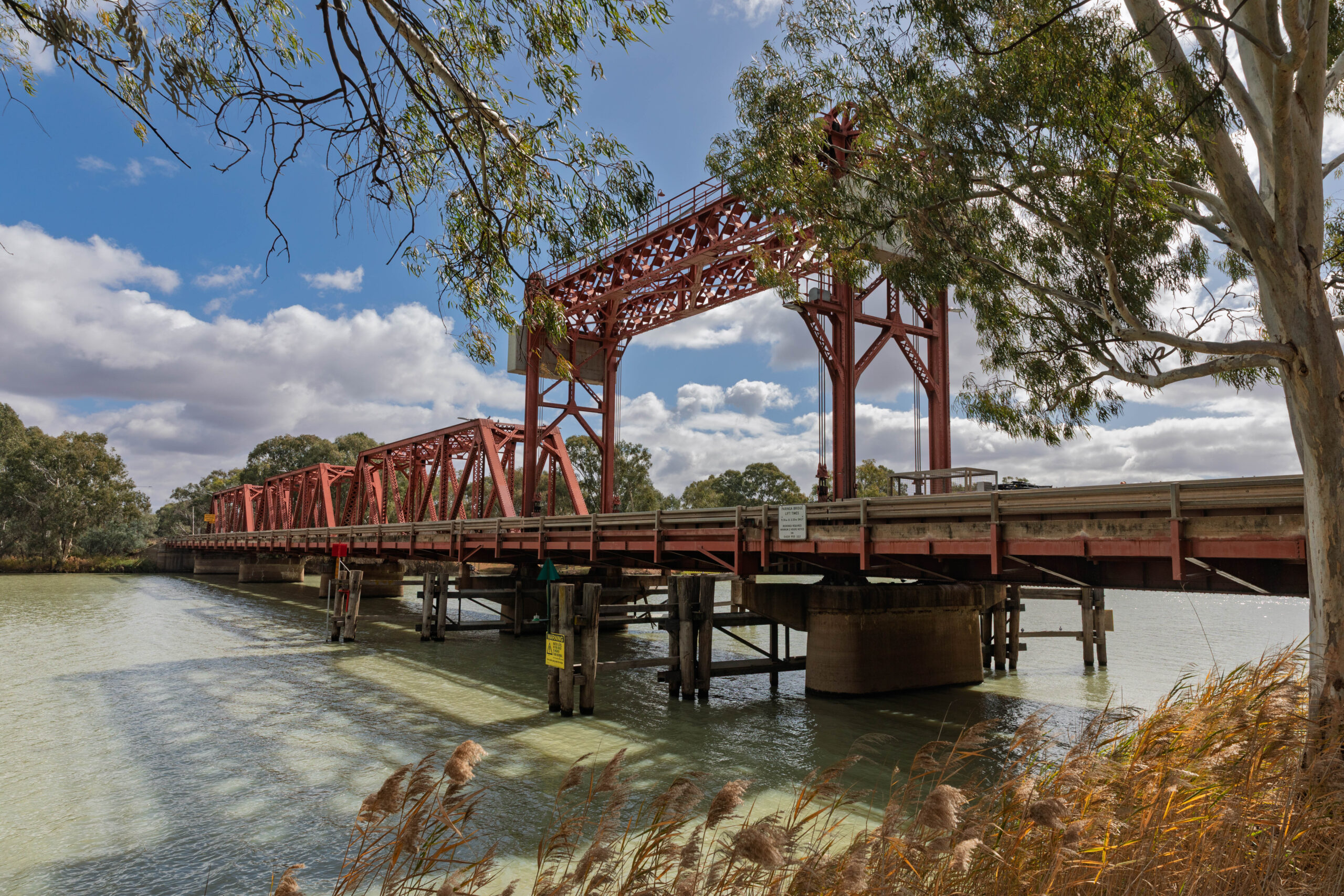
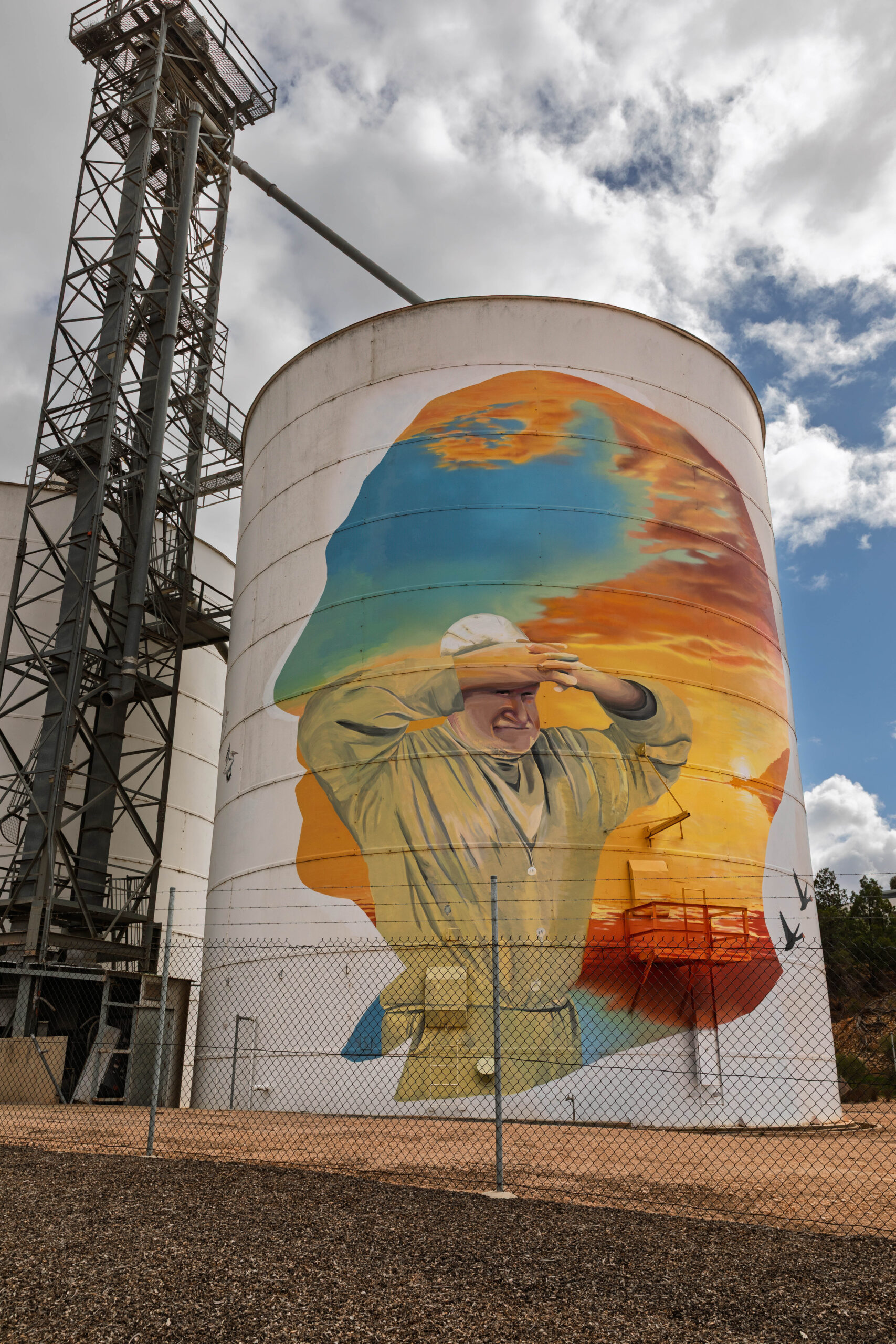
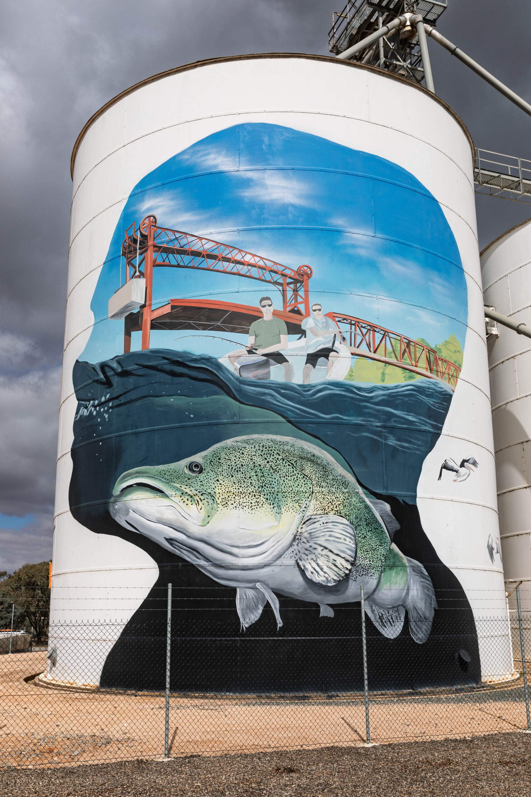
After lunch we returned to the Sturt Highway where Syri told us to continue straight on for 123 kilometres. Well, except for crossing the Historic Paringa Bridge over the Murray River and having to turn off to the Bert Dix Memorial Park to take photos of the bridge. Then there were the art silos where we had to stop for more photos.
The silos were painted by Jack Fran and Sam Brooks. Each of the fours silos has a silhouette likeness of a local hero of the region (Sister Elaine Balfour-Ogilvy, Charles Francis Chaffey, Pearl Wallace and George Disher), then within that image, stories of the district are told about irrigation, local identity David James Jones aka ‘Possum’, paddle steamers and Murray cod.
About 1.00pm we crossed the quarantine checkpoint for those travelling west into the Riverland District. This one a much more official, staffed checkpoint but, not for us travelling east, only those travelling west. At 1.03pm we pinged a Victorian phone tower and the time flipped to 1.33pm but in less than a kilometre we were back on Australian Central Standard Time so, we crossed the border at 1.06pm/1.36pm. Take your pick. Then my phone decided it was back in Victoria and we had two time zones on two different phones in the car. Have to love border areas where time is confused and confusing. It was 1.45pm (Eastern Standard Time) before Bernie’s phone was convinced it was in Victoria.
Making a quick side trip to Wentworth (so we could do three states in one day!) we turned left onto Meridian Road towards Wentworth and then left again onto the A79 (Calder Highway) to take the Abbotsford Bridge across the Murray River. Entering NSW we took a left onto the Silver City Highway (B79) to travel through Curlwaa to Wentworth. Wentworth is surrounded by water and accessed via a bridge over Tuckers Creek and another over the Darling River.
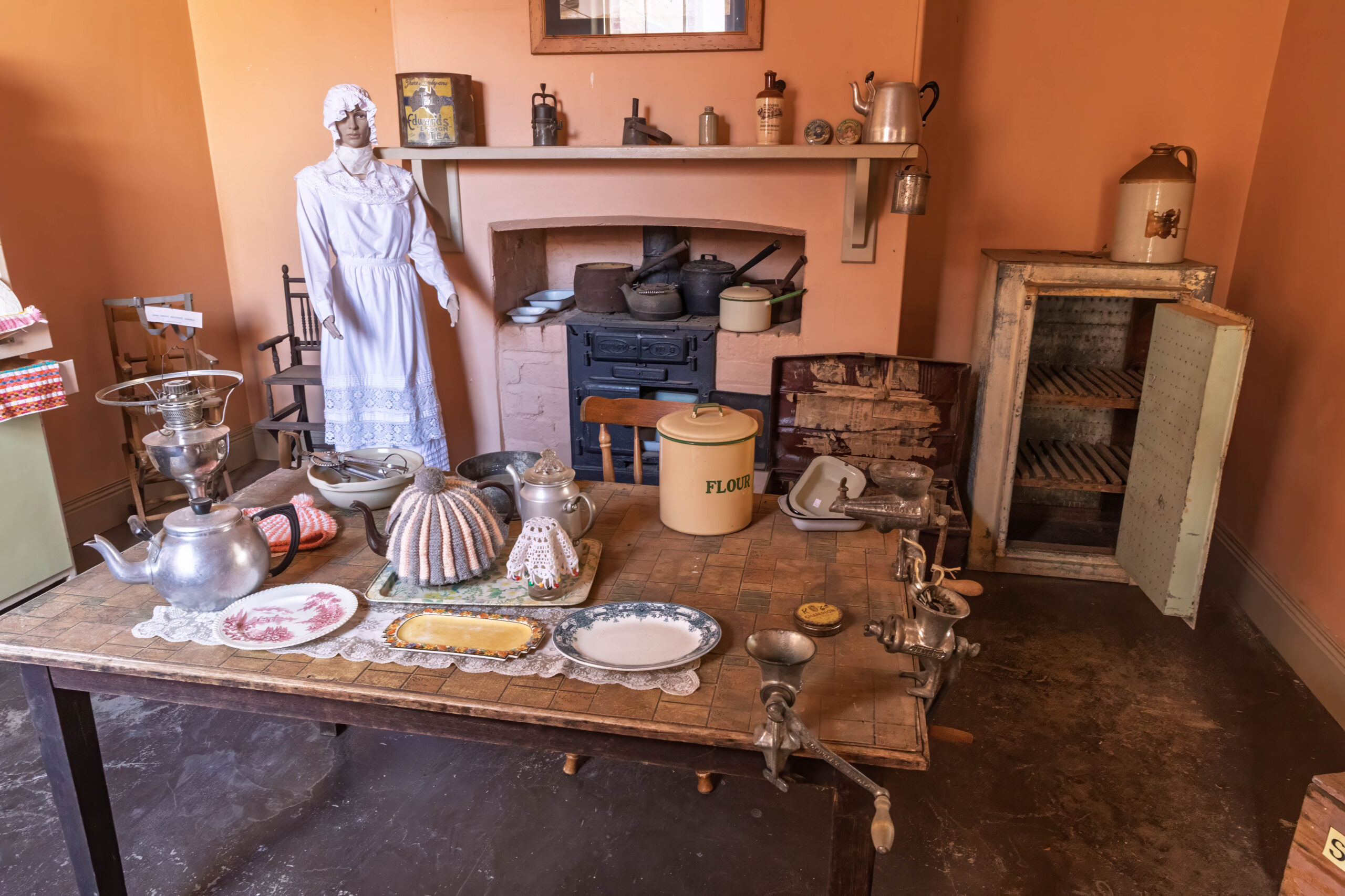
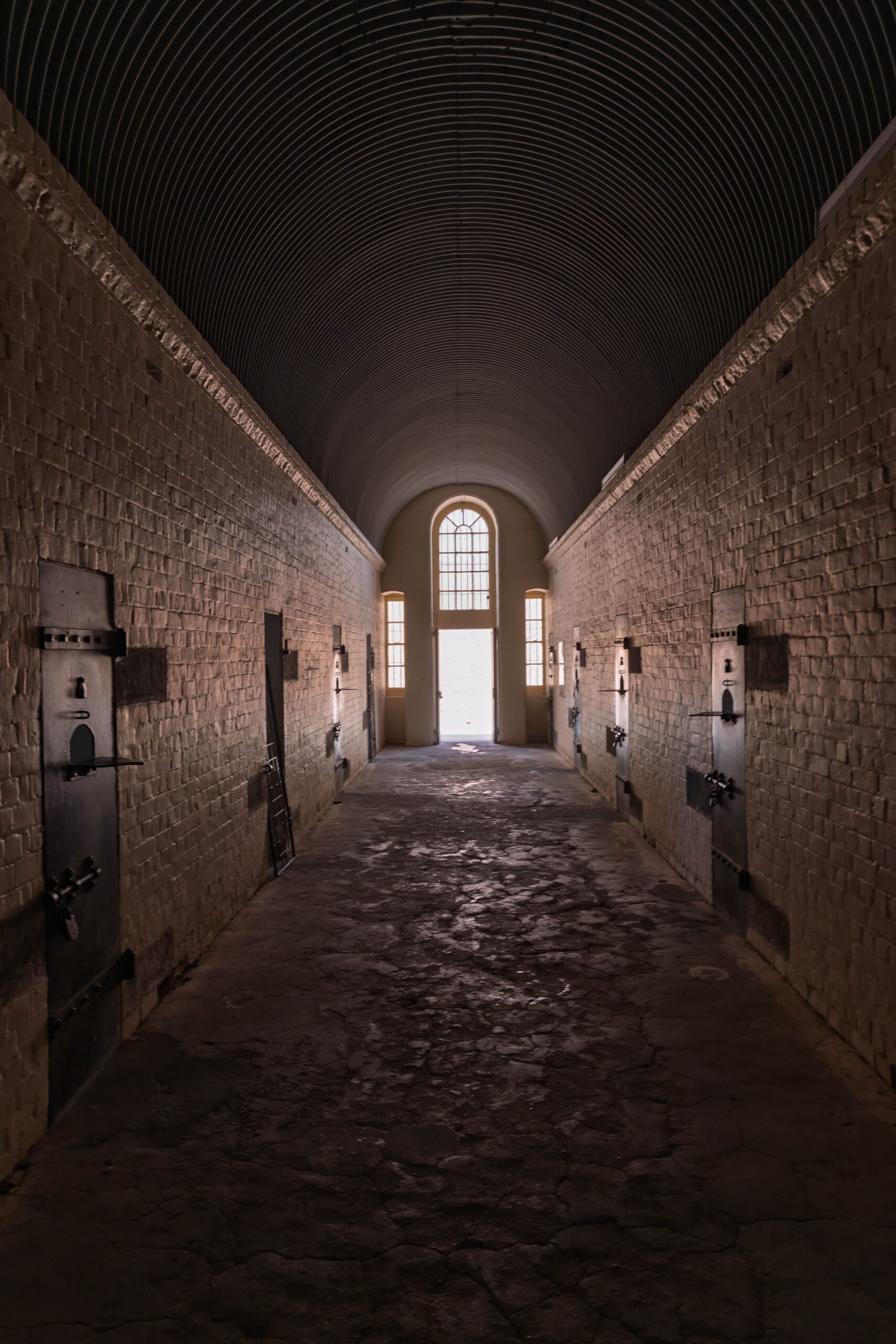
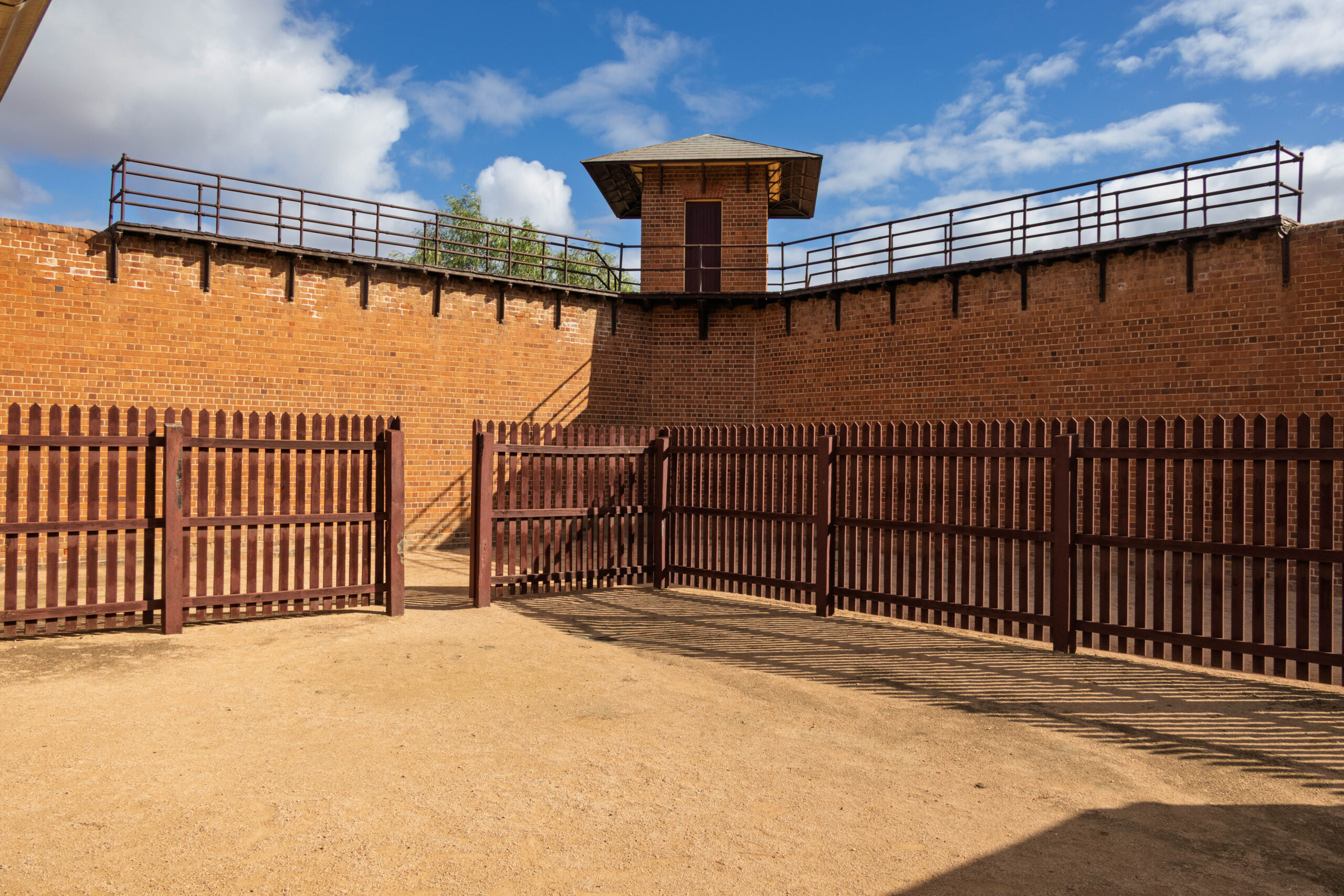
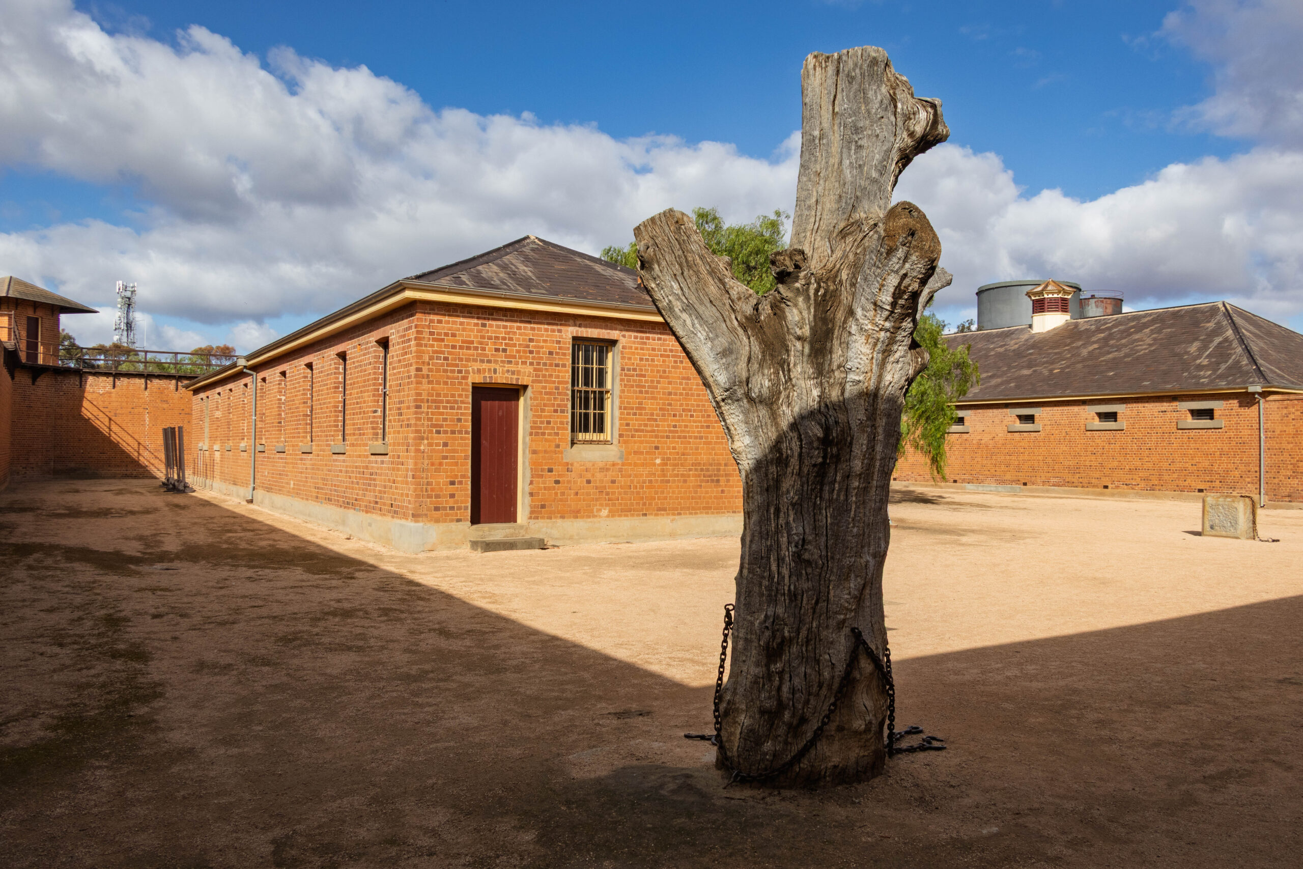
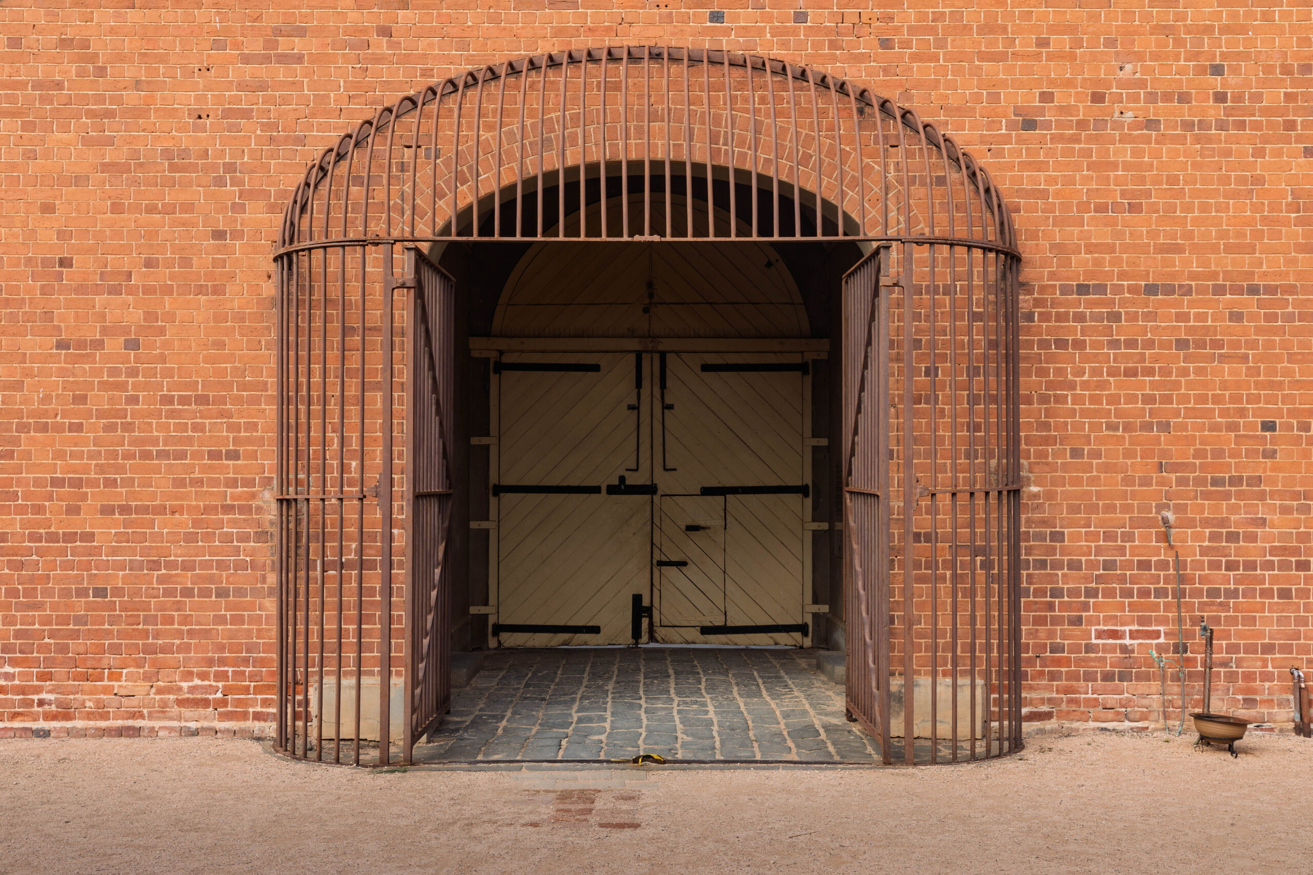
We made our way to the Old Wentworth Gaol which operated between 1880 and 1927. The architect of the gaol was James Barnet who held the post of NSW Colonial Architect from 1862 until 1890. The brickwork of the gaol remains in amazingly good condition to this day, standing as testament to the skills of a master craftsman, brick maker Josef Fritsch.
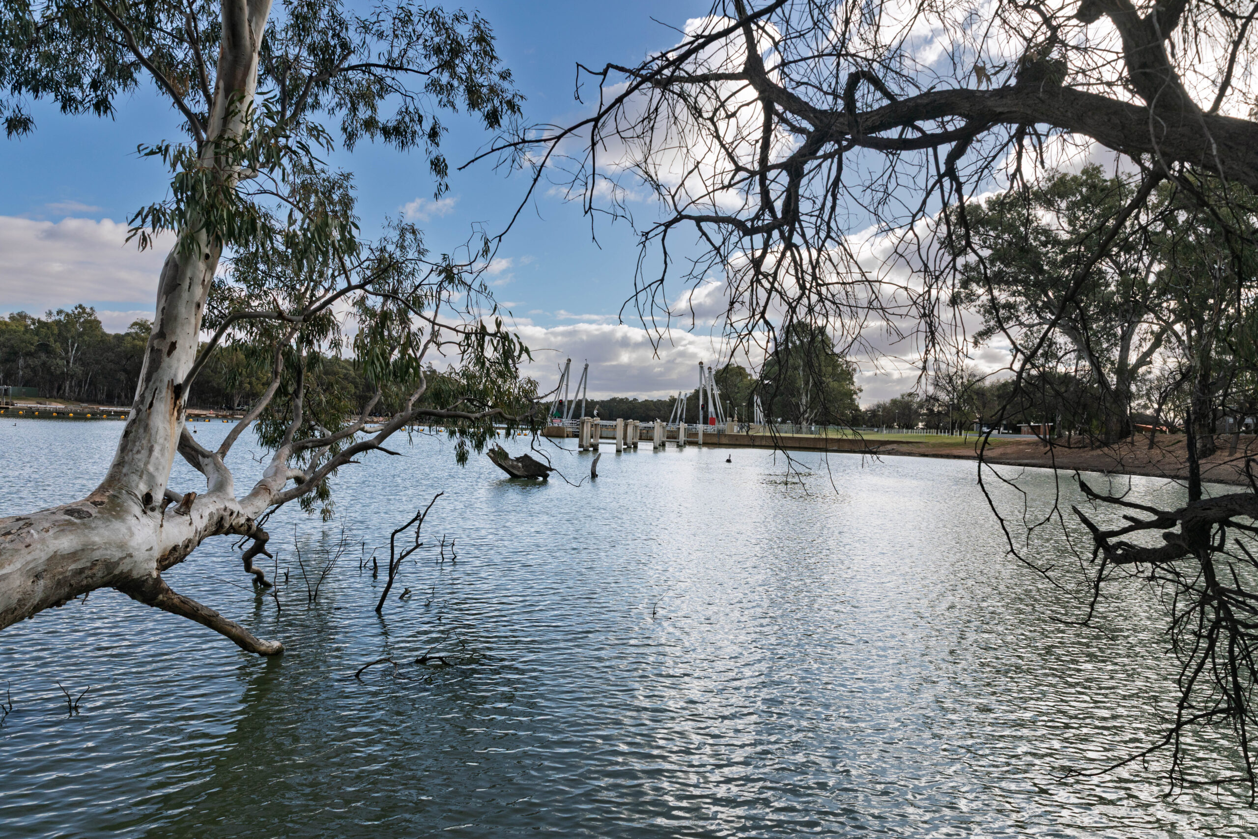
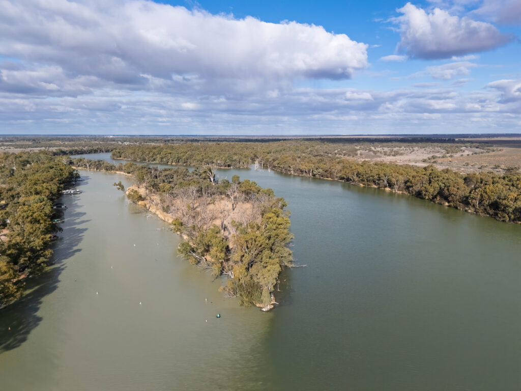
After our turn around the gaol, we drove to the viewing point for the confluence of the Darling and Murray Rivers and Lock Ten (State Water NSW Lock & Weir No. 10). We took the short riverside walk to Lock Ten first than walked back to look at the place where two mighty rivers converge. We took the steps up to the top of the viewing platform to take a couple of photos of the confluence. Slightly anti-climactic. We’ve had mixed reports on this. Friends had told us it’s quite dramatic and you can see the rivers are different colours. While we’ve been away others have told us it’s a bit, meh.
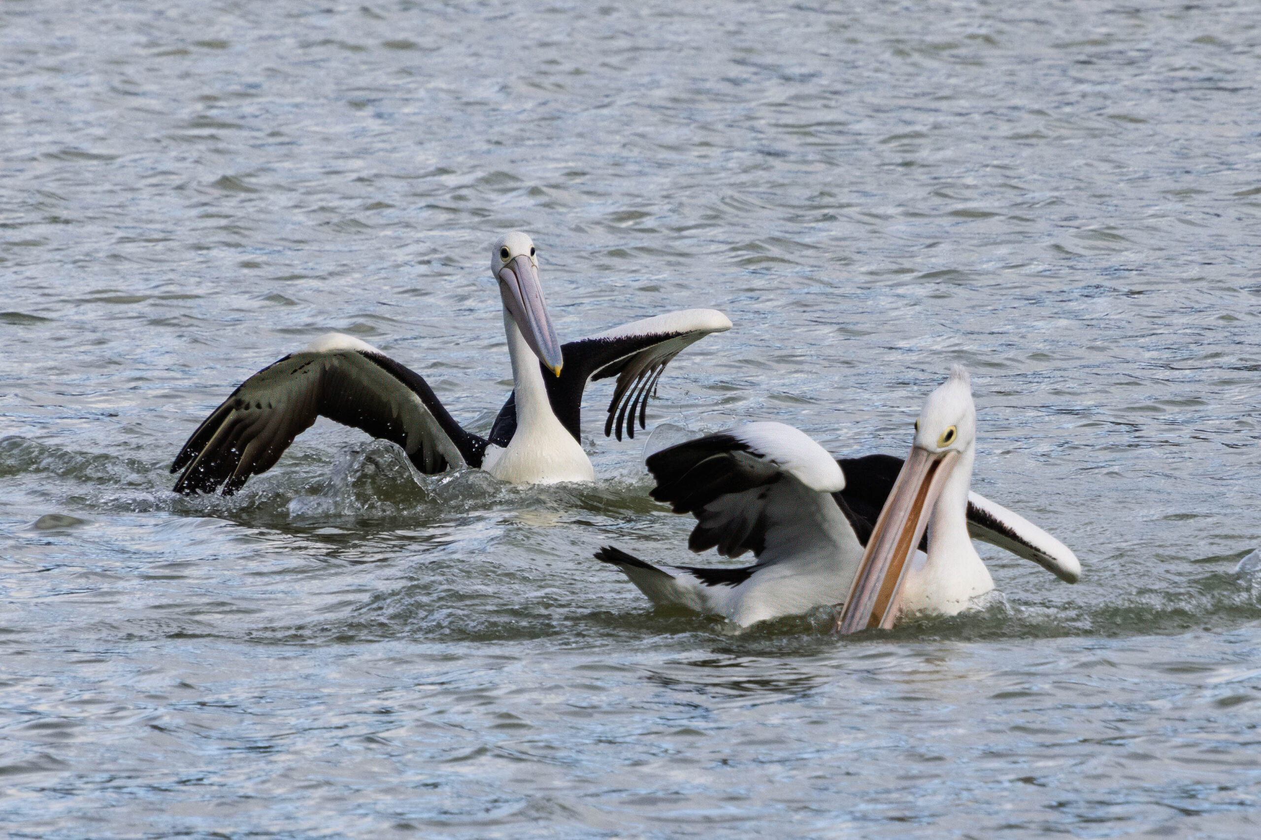
There were no signs up to say that drones were prohibited, so Bernie put the drone up and bravely flew it out over the river to take photos. With an audience. He had one guy on the ground with drone envy, who was keen to watch AND he had an audience of four up on the viewing platform. It was nearly a disaster before the drone was a metre off the ground with a dog racing over to attack it. Fortunately, it had just enough height that the dog didn’t manage to snatch it out of the air! The dog’s owner ambled over and I apologized for the drone exciting his dog. He said – no problem, it’s already killed one drone!!
After the excitement of nearly losing the drone to a dog with a personal hatred for drones, Bernie piloted it to mid confluence and snapped a few pics. Looking at those this evening I CAN see that the two flows are different colours. Amazing what a bit of extra altitude can reveal. The guy watching over Bernie’s shoulder this afternoon was impressed with the photos taken and insisted that his wife look at what can be achieved with a drone. I think she was almost convinced that he should have one??
When Bernie instructed the drone to return home it was coming down into a huge eucalyptus. Although it probably would have self-corrected (rather than crash into the tree) Bernie resumed control to bring it in safely. When he landed it, he received a round of applause from the group on the viewing platform! Thank goodness it didn’t crash into the river or the tree with an audience.
One final stop in Wentworth to take a photo of the Old Past Office and then it was time to get ourselves to Mildura for the night. We re-traced our route back to Victoria then made our way to Mildura along Wentworth Road and Ranfurly Way (C256) via Merbein. We found the Woollies supermarket to pick up some fruit and juice to make our own breakfast for the next two days then checked-in at the City Colonial Motor Inn. Our room for the next two nights is a definite improvement on last night’s room.
Another fine dining experience tonight with dinner at Stefano’s. We’ve had this on our radar for a while but just haven’t managed to find our way to Mildura on our way to somewhere else and … it’s a long way to come from Melbourne just for dinner. It fitted in perfectly to come home from the Flinders Ranges via Mildura. We were not disappointed and enjoyed our meal very much.
Steps: 8,394 (5.69kms)