Saturday, 25 April 2026
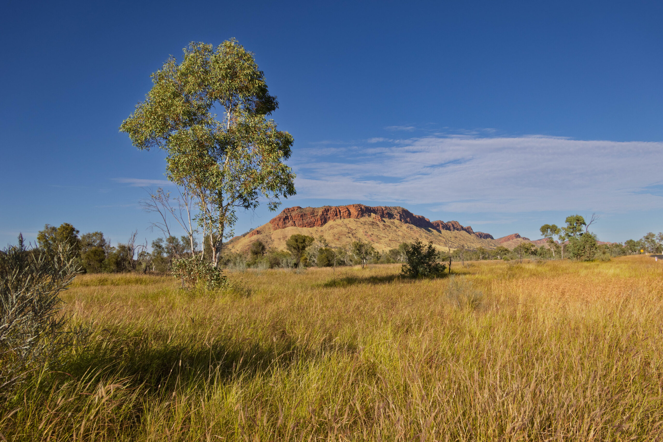
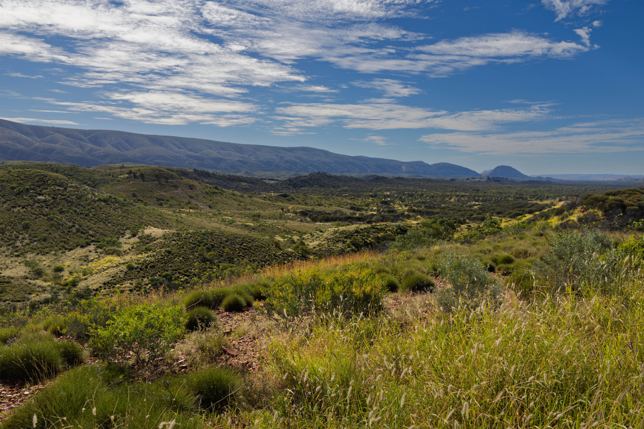
This morning we drove out of Alice on a road that had us joining Larapinta Drive, slightly west of Simpsons gap. Bernie was worried that putting air in the tyres yesterday afternoon when they were hot may have left them a little under optimum pressure. We pulled into a convenient drive way and pumped some more air into the tyres. Fortunately, we stopped in a very picturesque spot so I was able to snap a couple of photos of the ranges in the morning light while we were there.
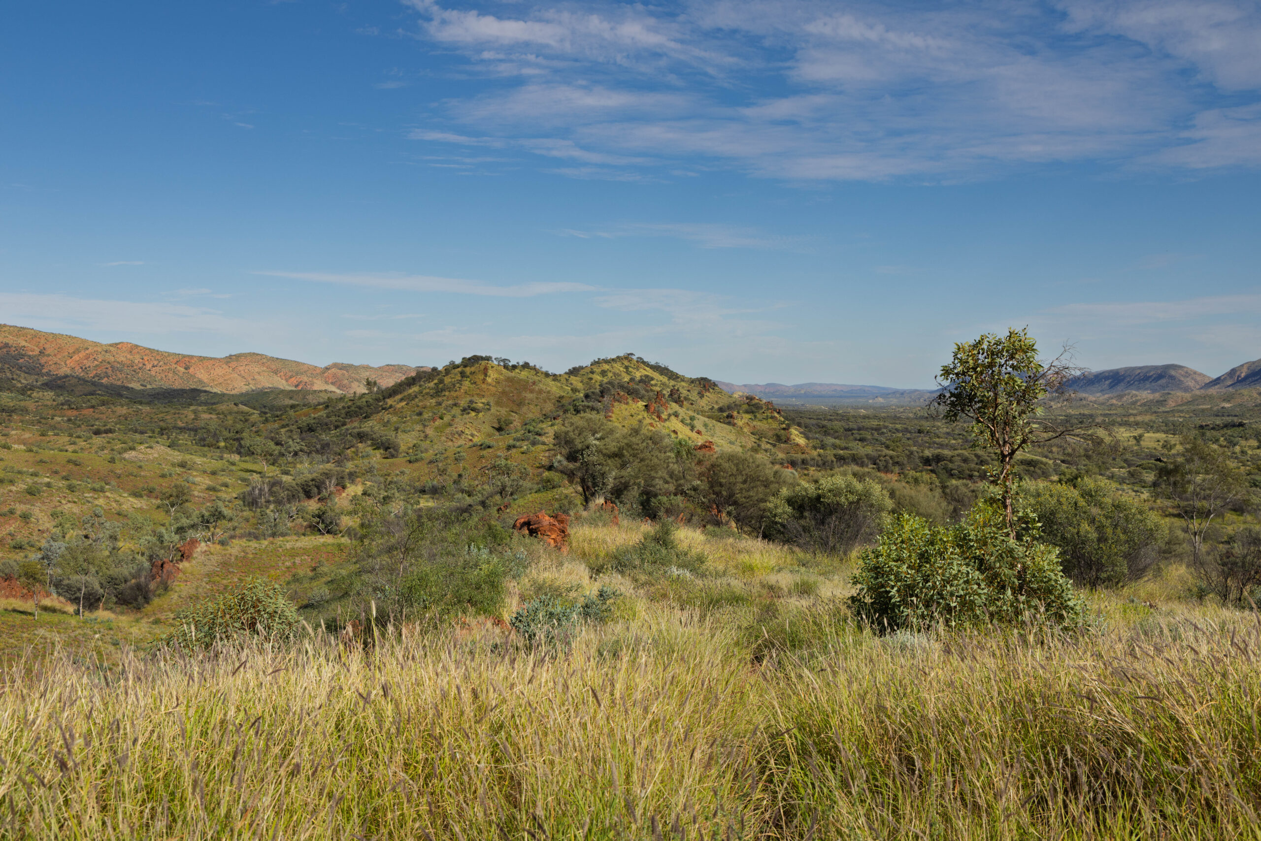
When we reached the intersection with Namatjira Drive, we turned right to continue west on our way to explore Tjoritja (pronounced choor-it-ja), previously known as West MacDonnell National Park. The MacDonnell Ranges stretch over 640 kilometres running east-west through Alice Springs. The range is estimated to be at least 340 million years old and was formed when two tectonic plates collided. Wind, water and time have worn a once giant mountain range down to a mere skeleton of what once existed.
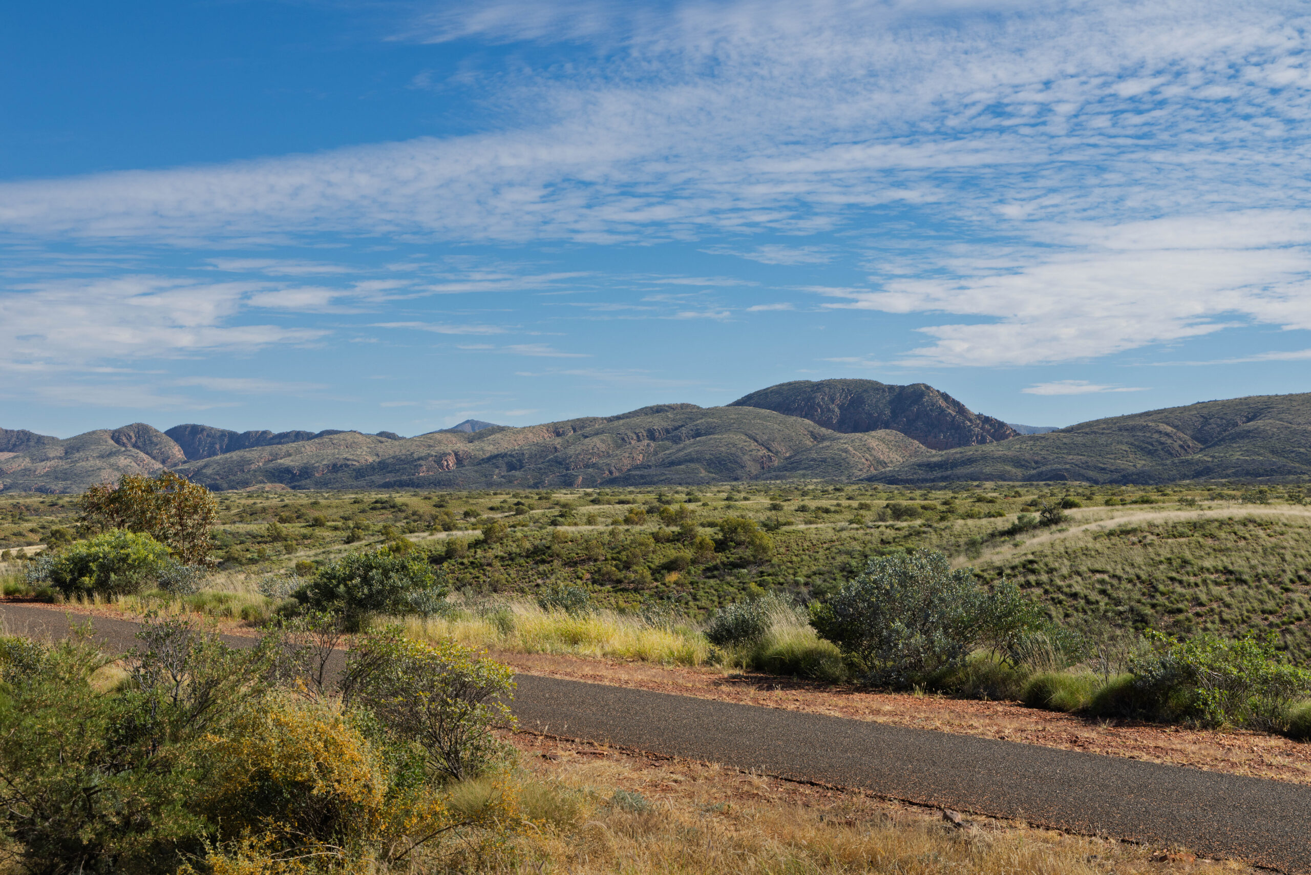
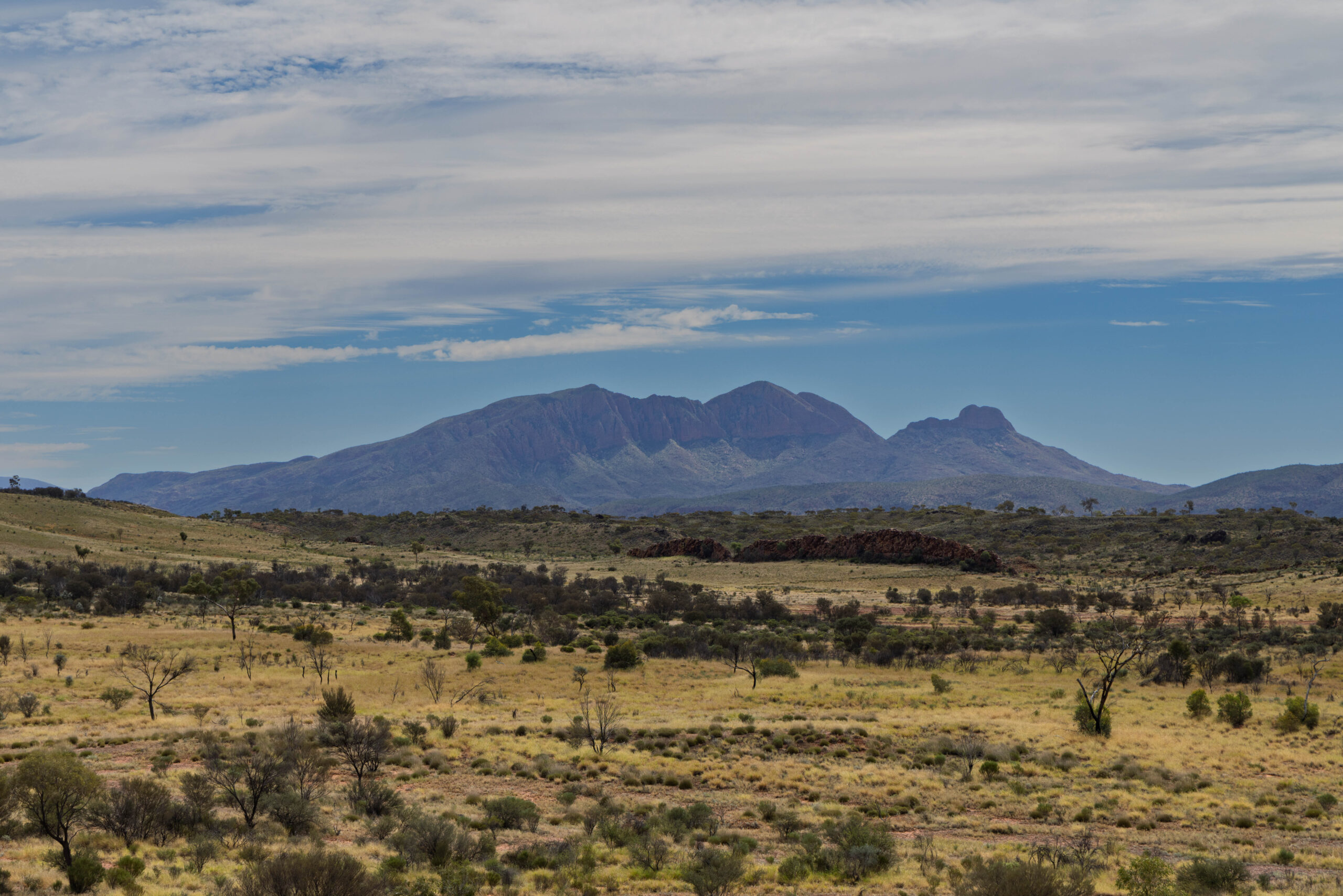
Our first stop was at Point Howard Lookout. With so much amazing scenery we were pleased to be able to pull of the road to take our scenic photographs safely! We had decided to drive out to Ormiston Gorge to explore it first, and then work our way back towards Alice Springs via the various points of interest that we were motoring past this morning. We did stop again though, at the Neil Hargrave Lookout, where we had a tantalising but obscured view of Mount Sonder in the distance.
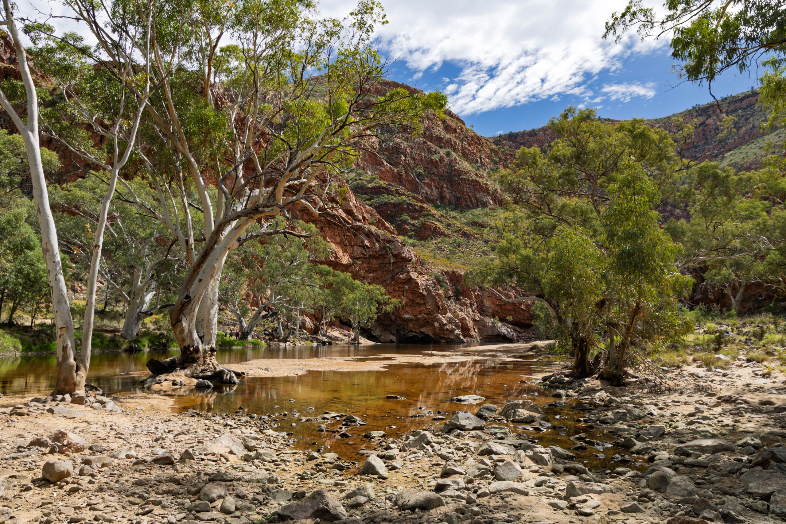
About 10.15am we pulled into the car park at Ormiston Gorge, which is one of the most popular destinations in the West Macs. Although we were 135 kilometres from Alice Springs there is a kiosk supplying drinks and snacks out here at the gorge. With plans to return to the kiosk for lunch we headed off to the trailhead. There was a notice up for the Pound Walk. ‘Due to the big rain events that happened in April, the water levels are higher than normal. The last creek crossing of the Pound Walk is a swim. It is about 15m wide and very cold water. Please proceed with caution. Thank you Park Rangers’. Oh well, just as well we weren’t planning on doing the three to four hour Pound Walk then!
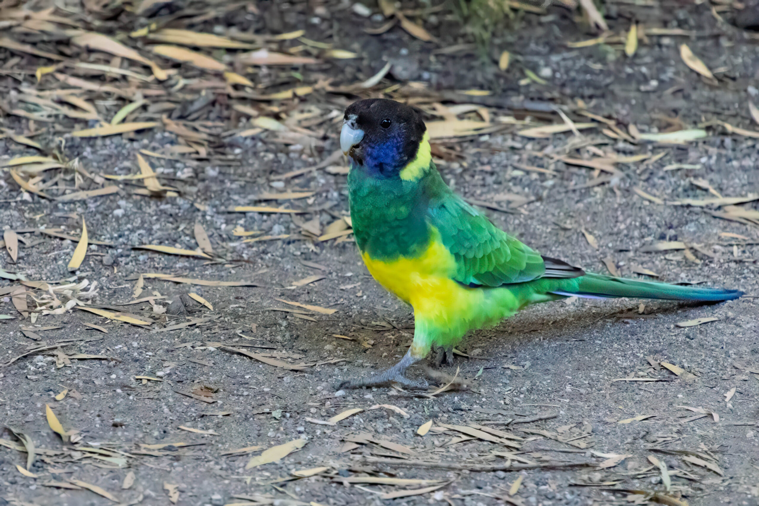
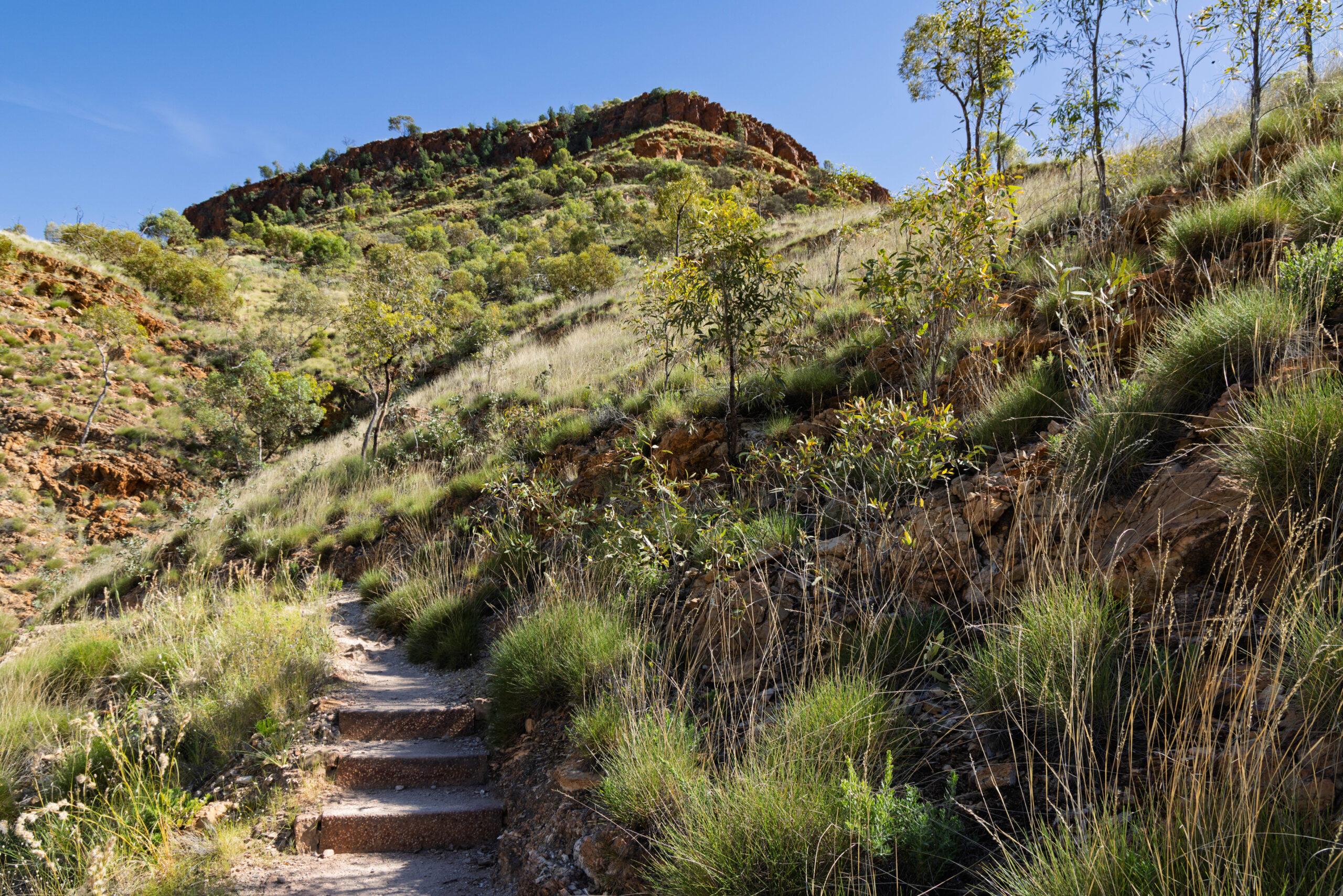
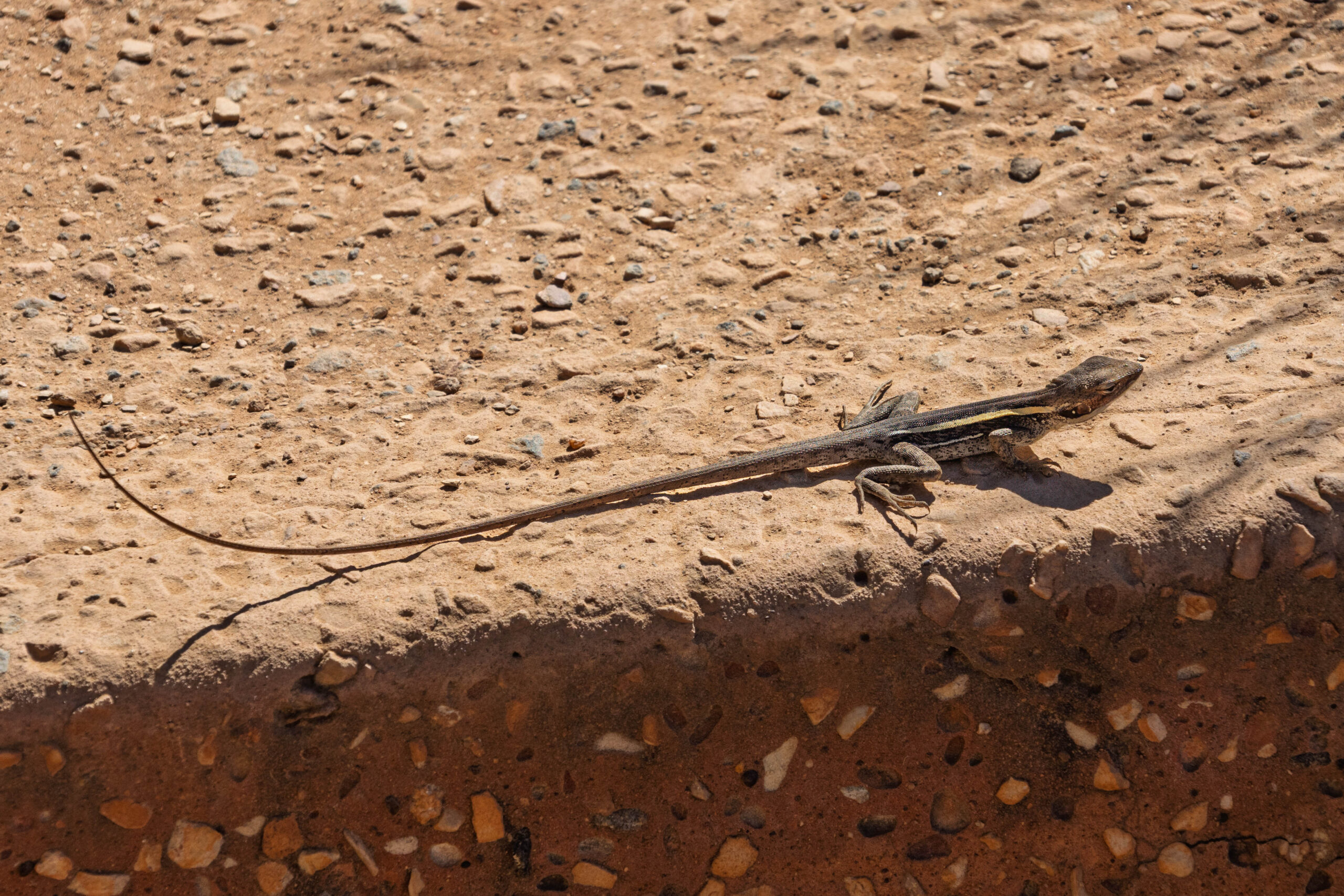
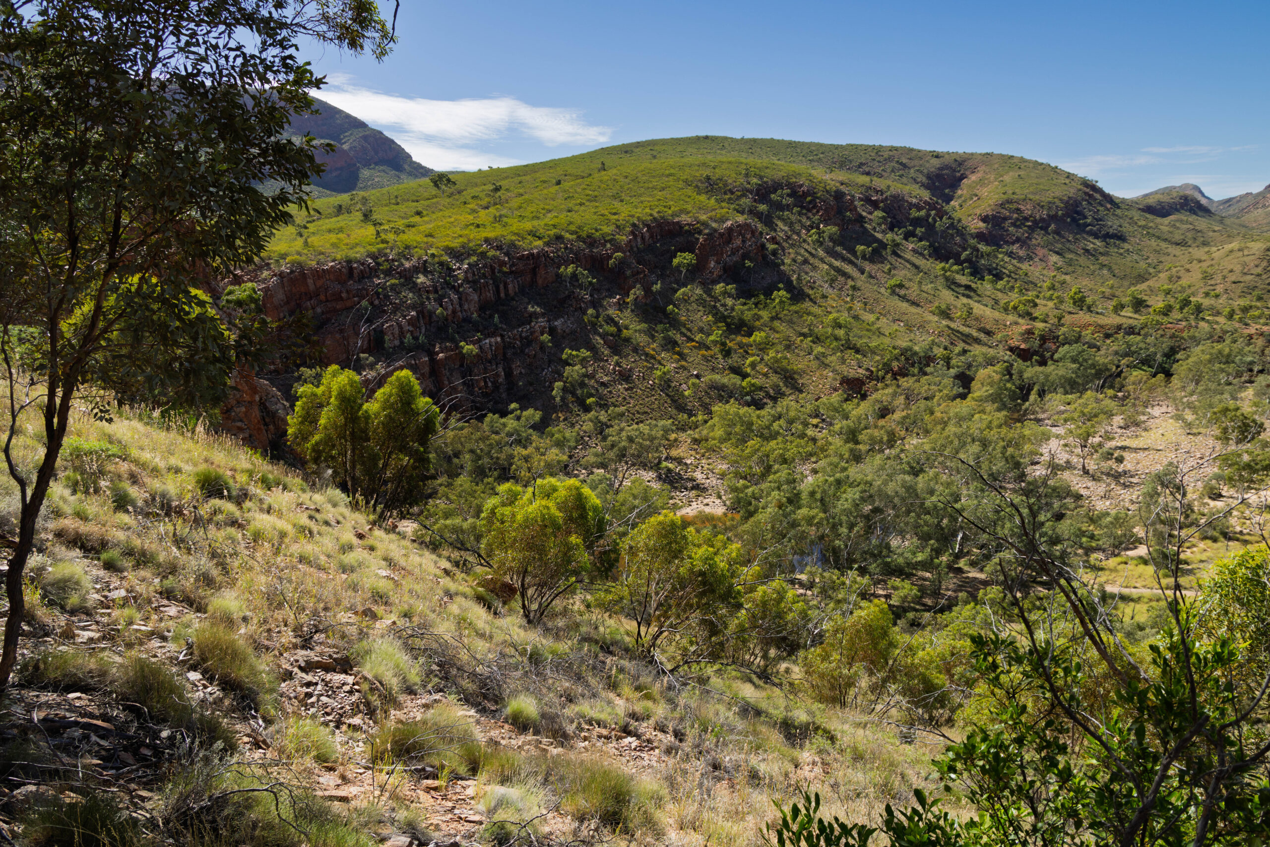
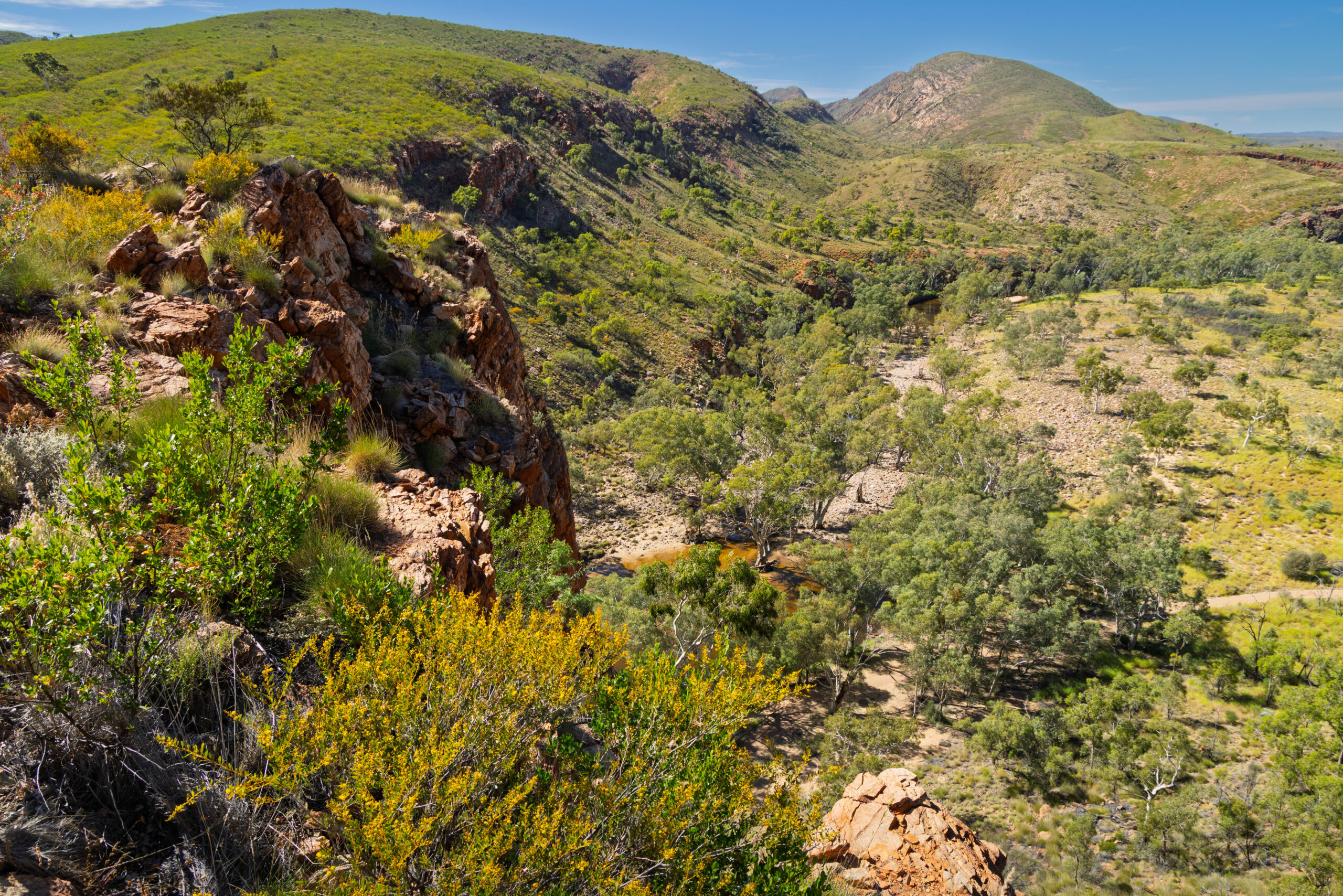
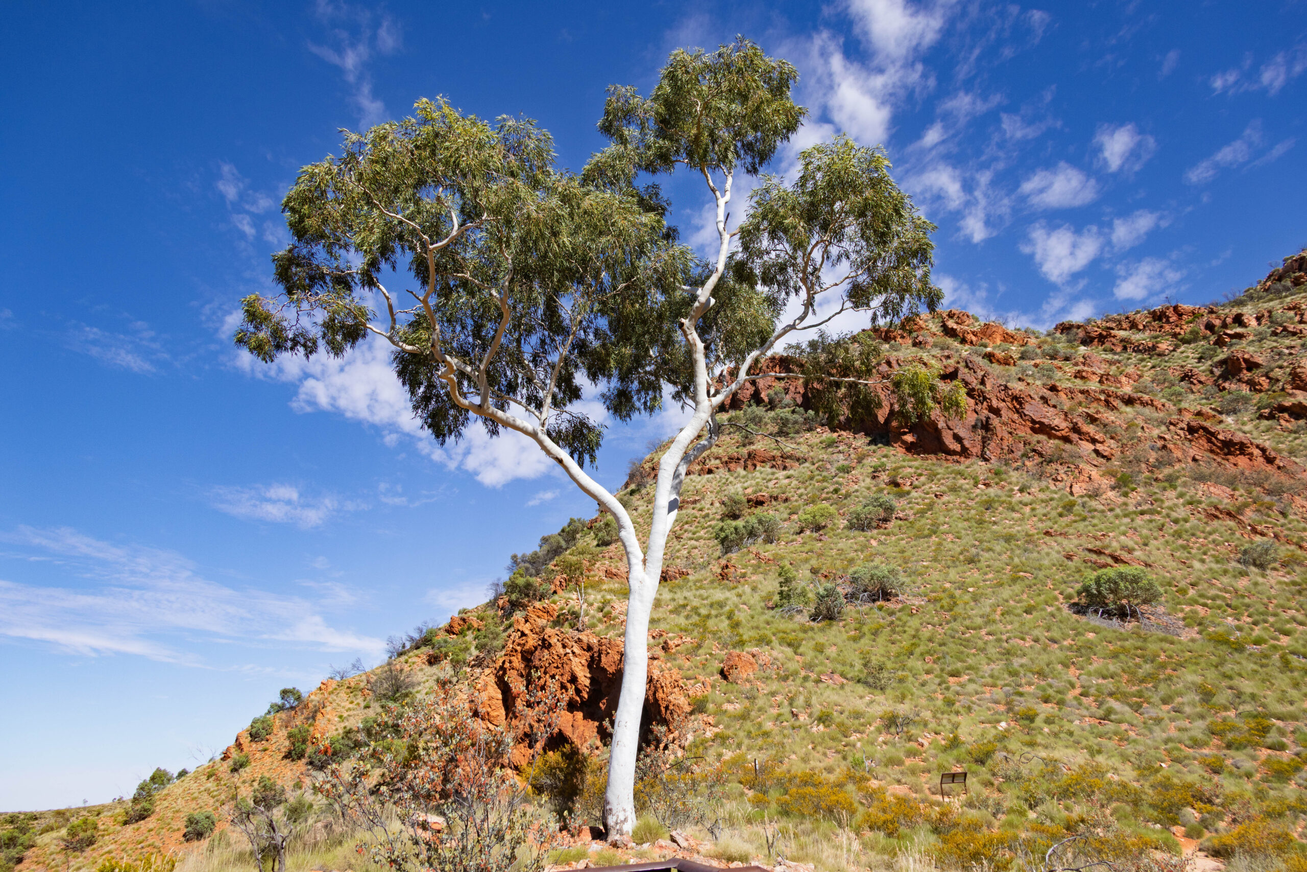
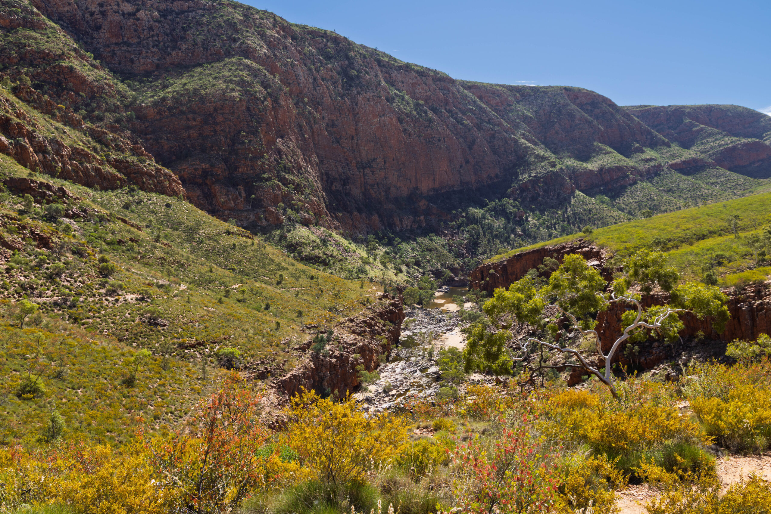
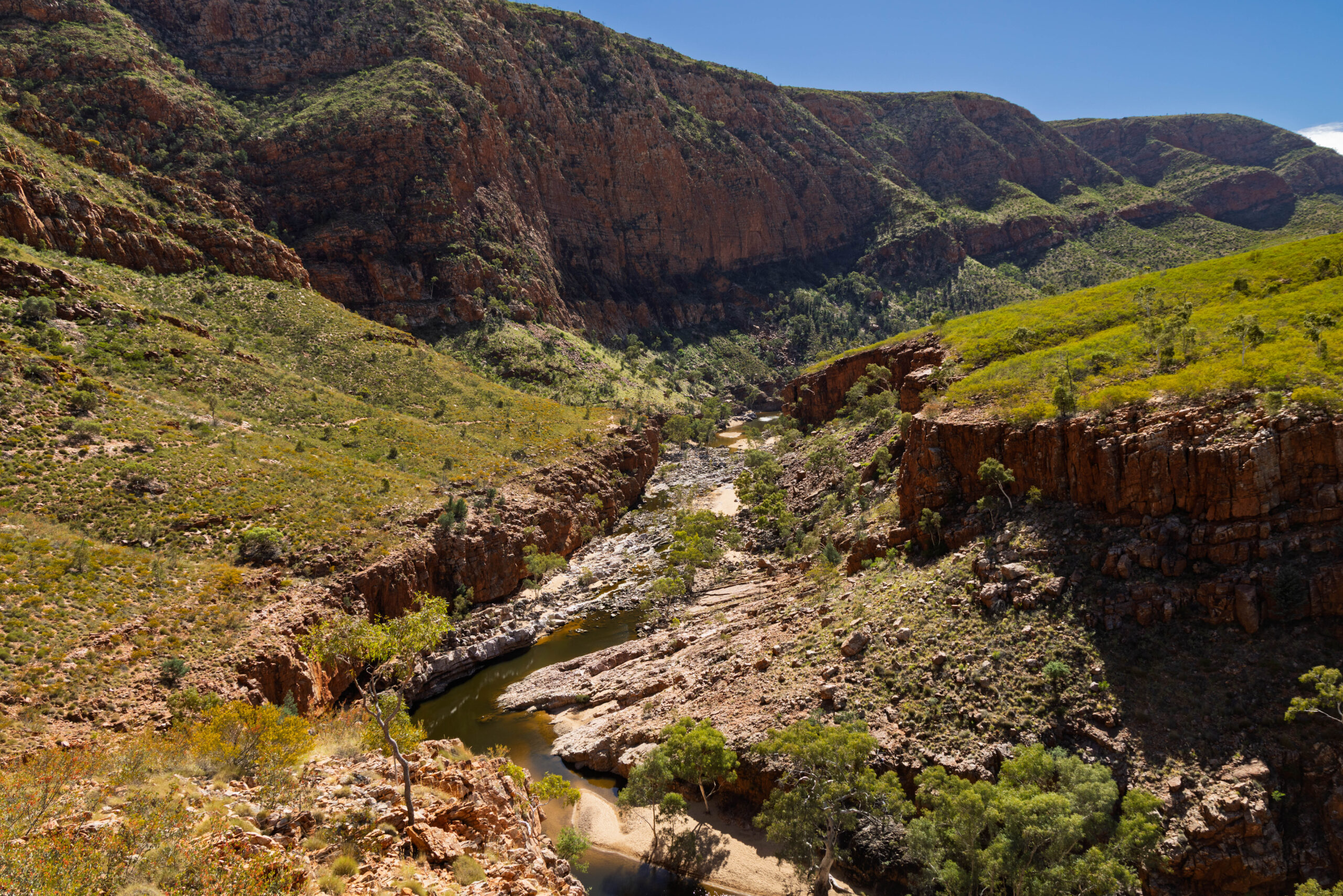
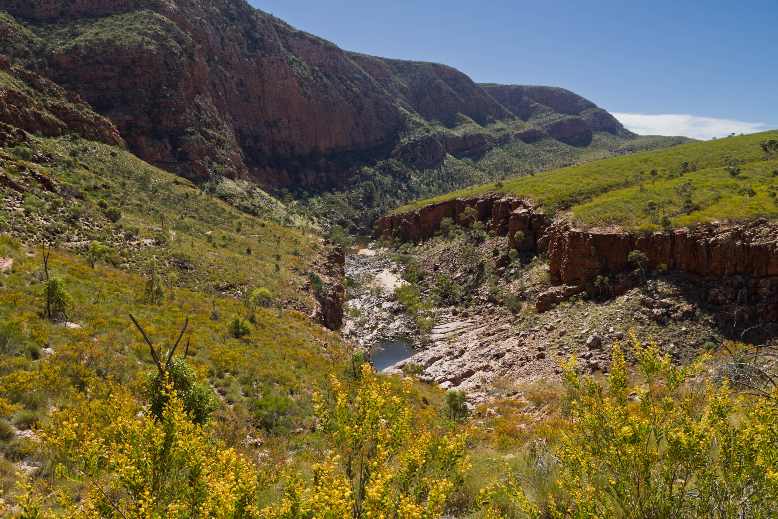
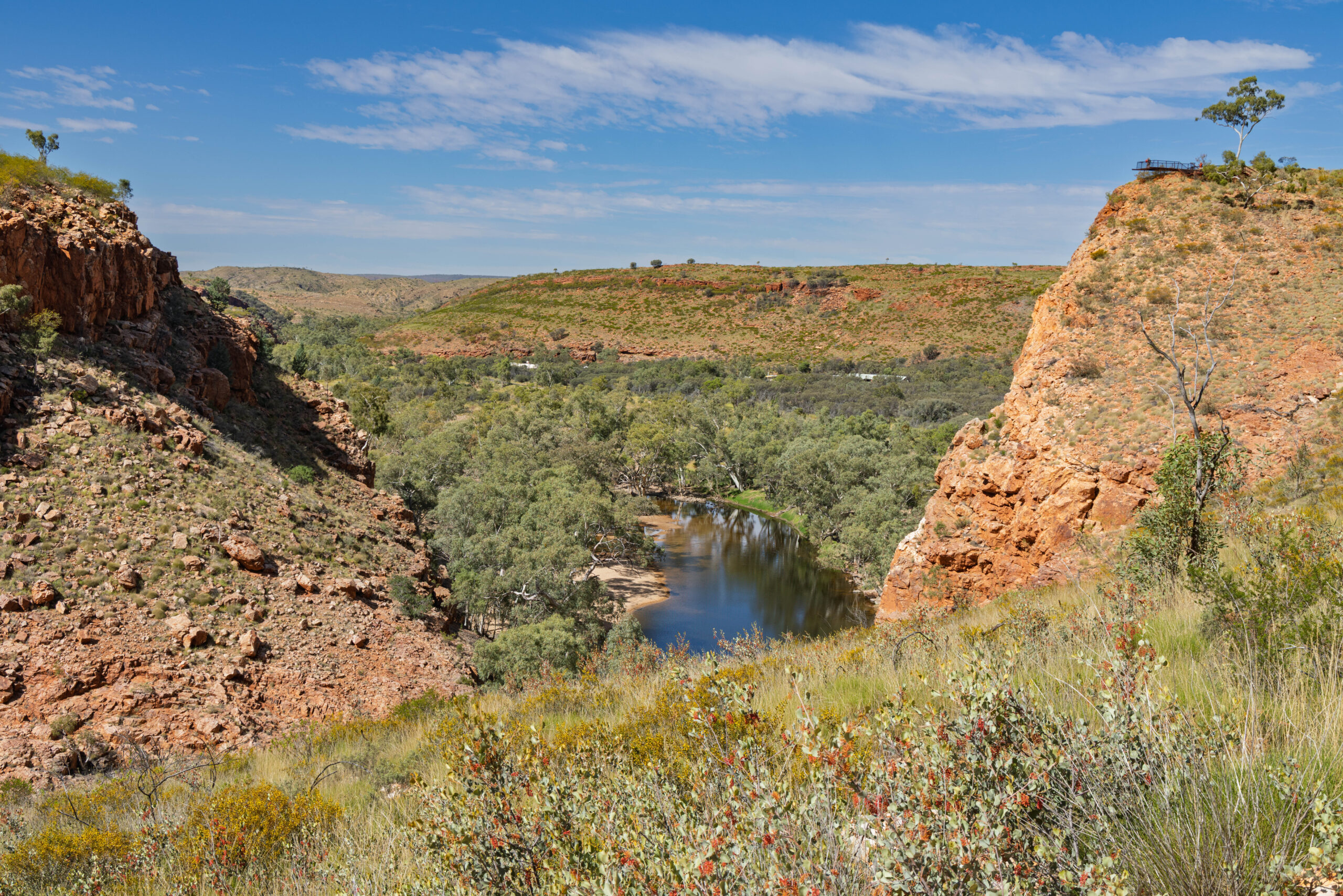
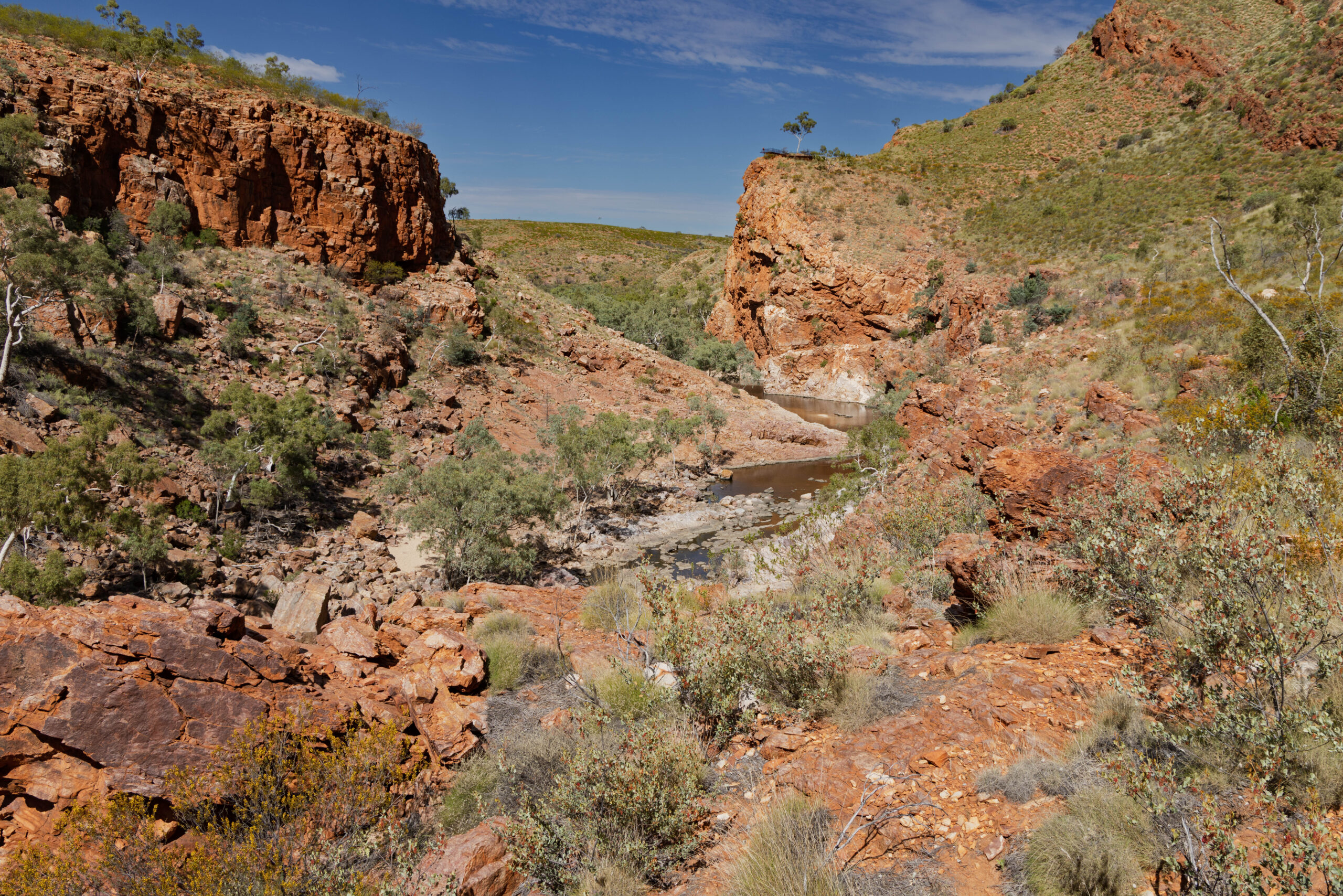
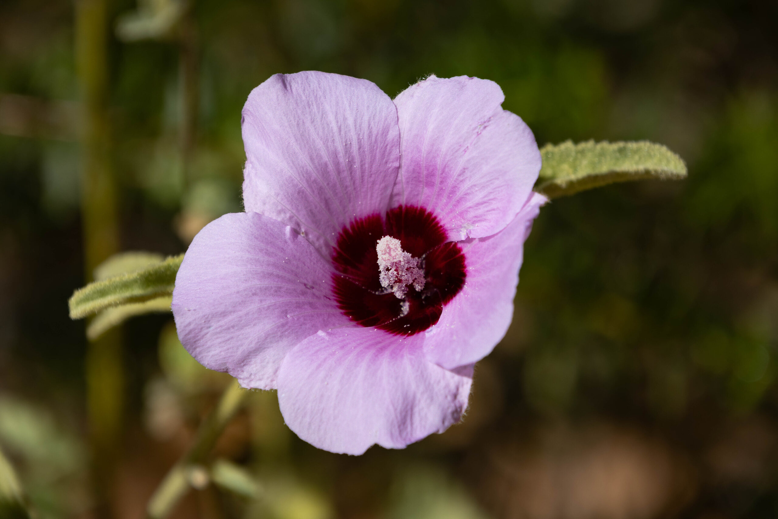
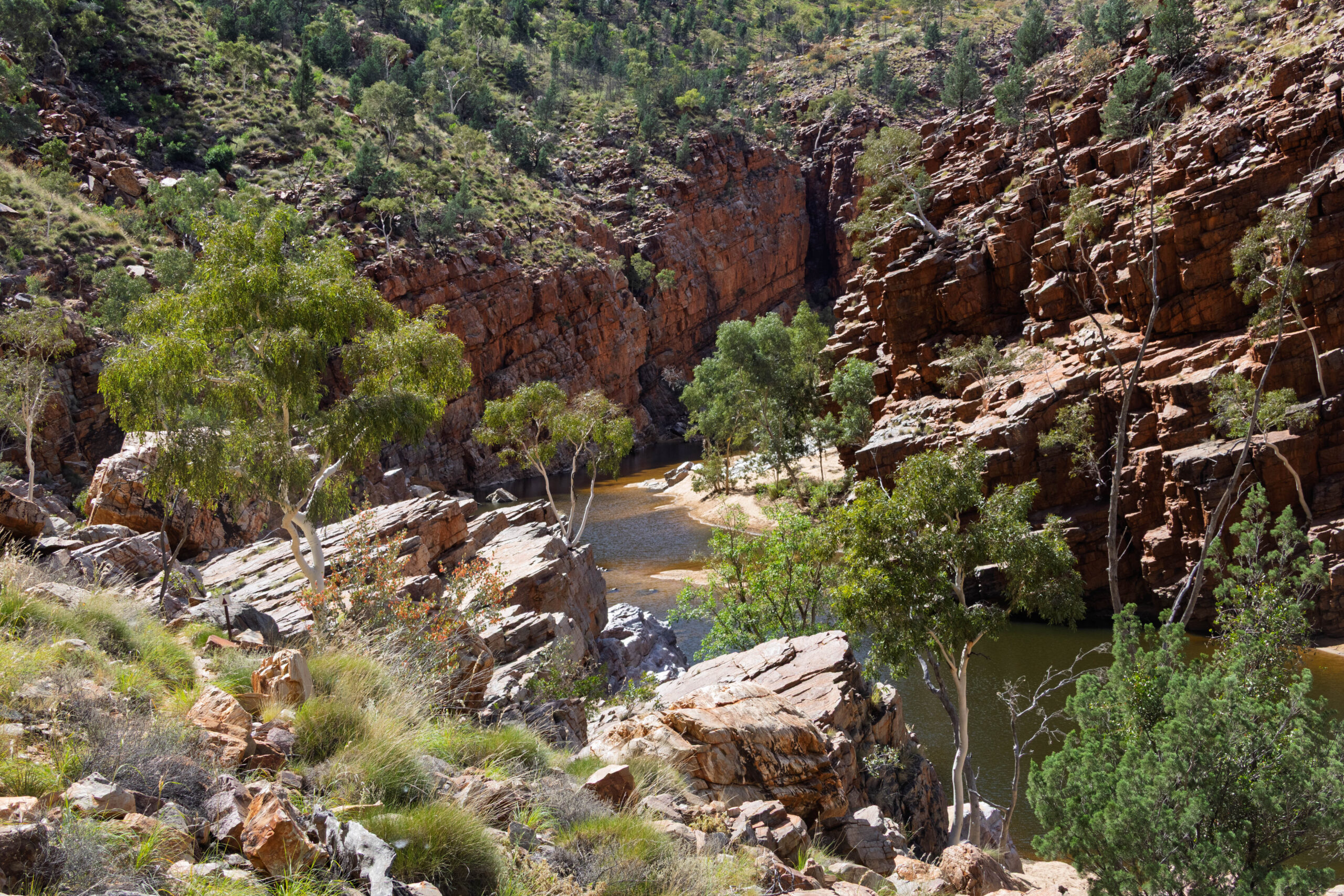
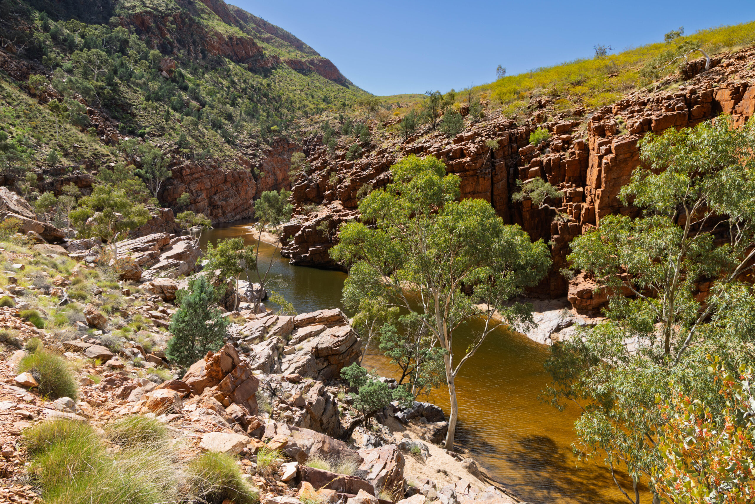
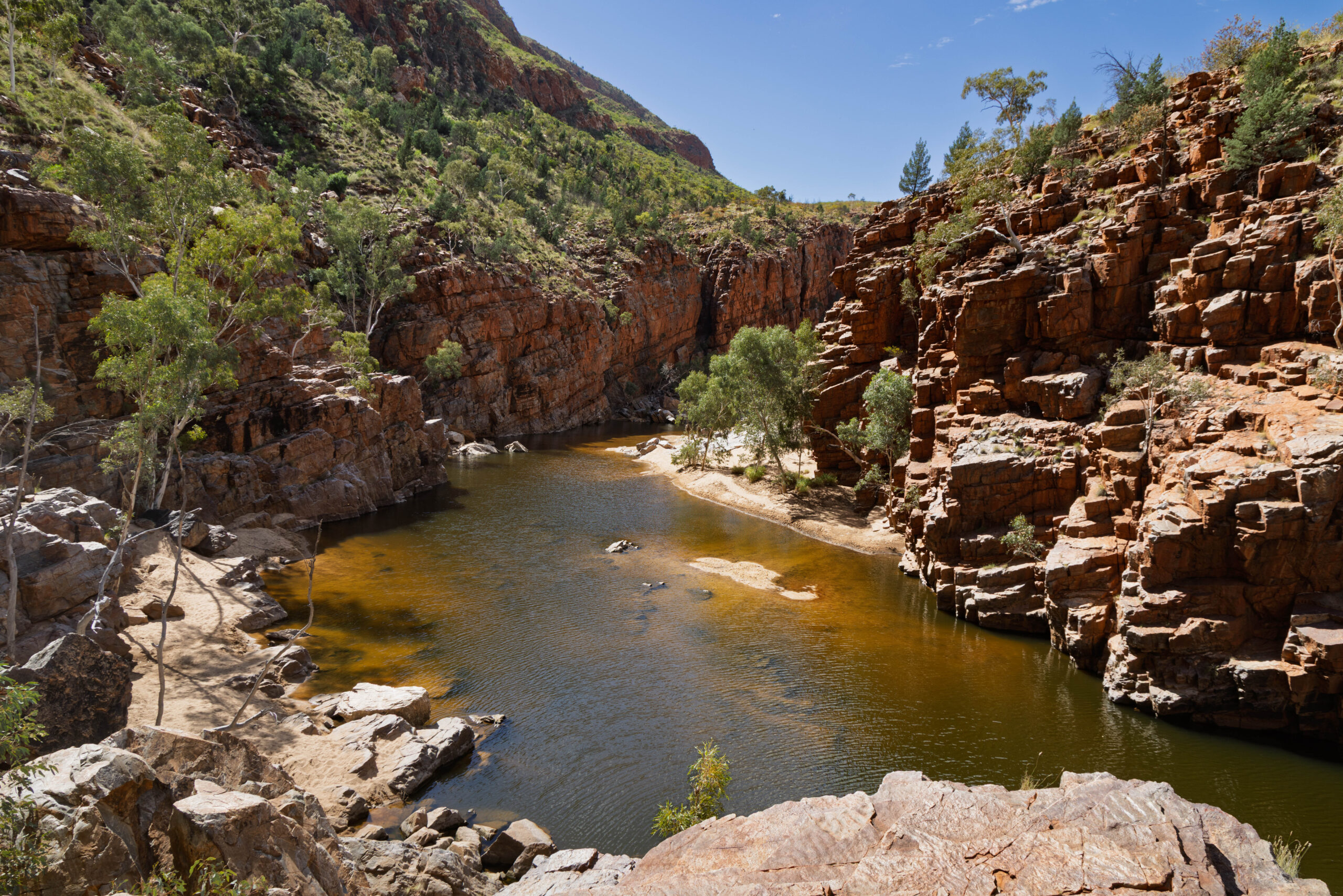
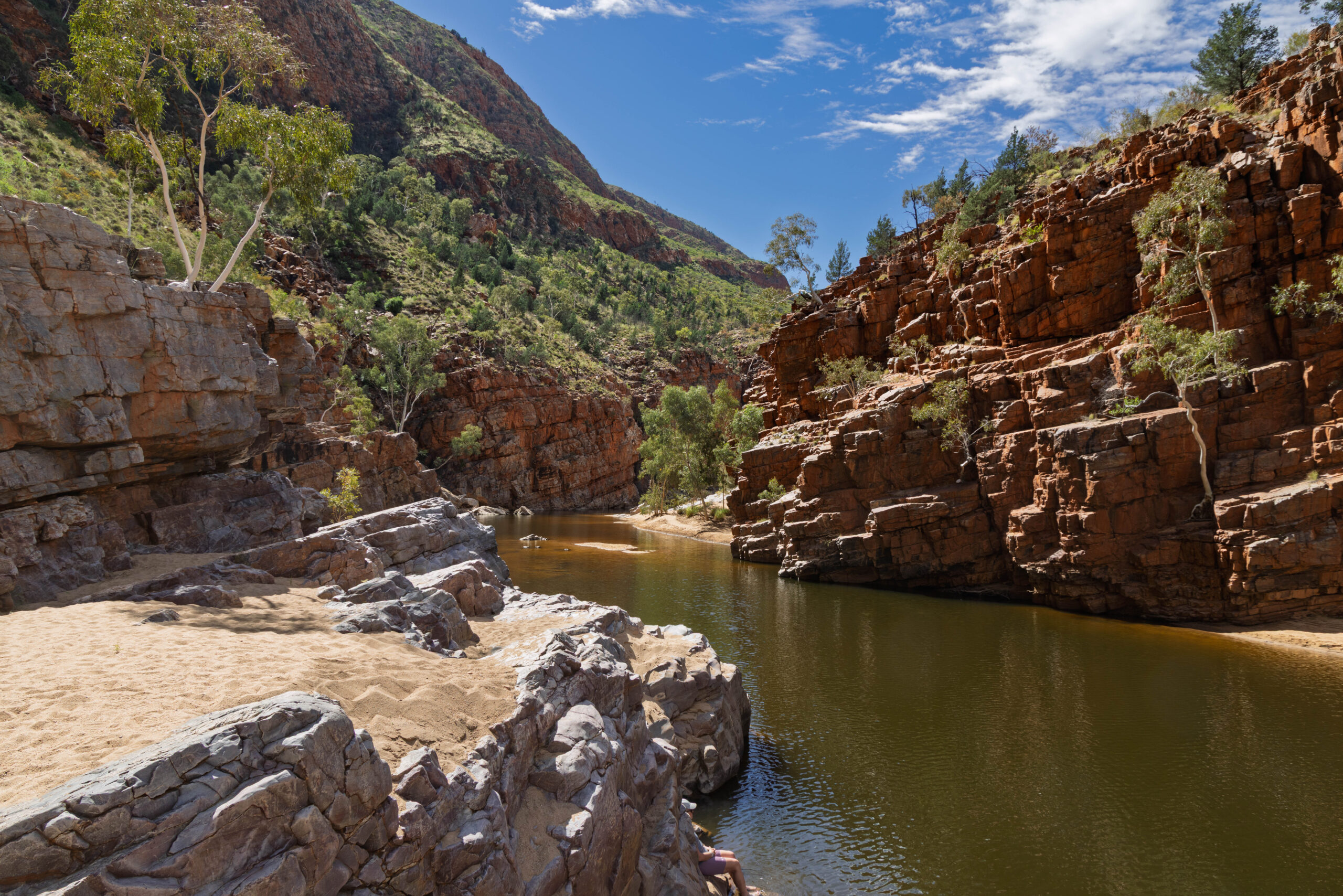
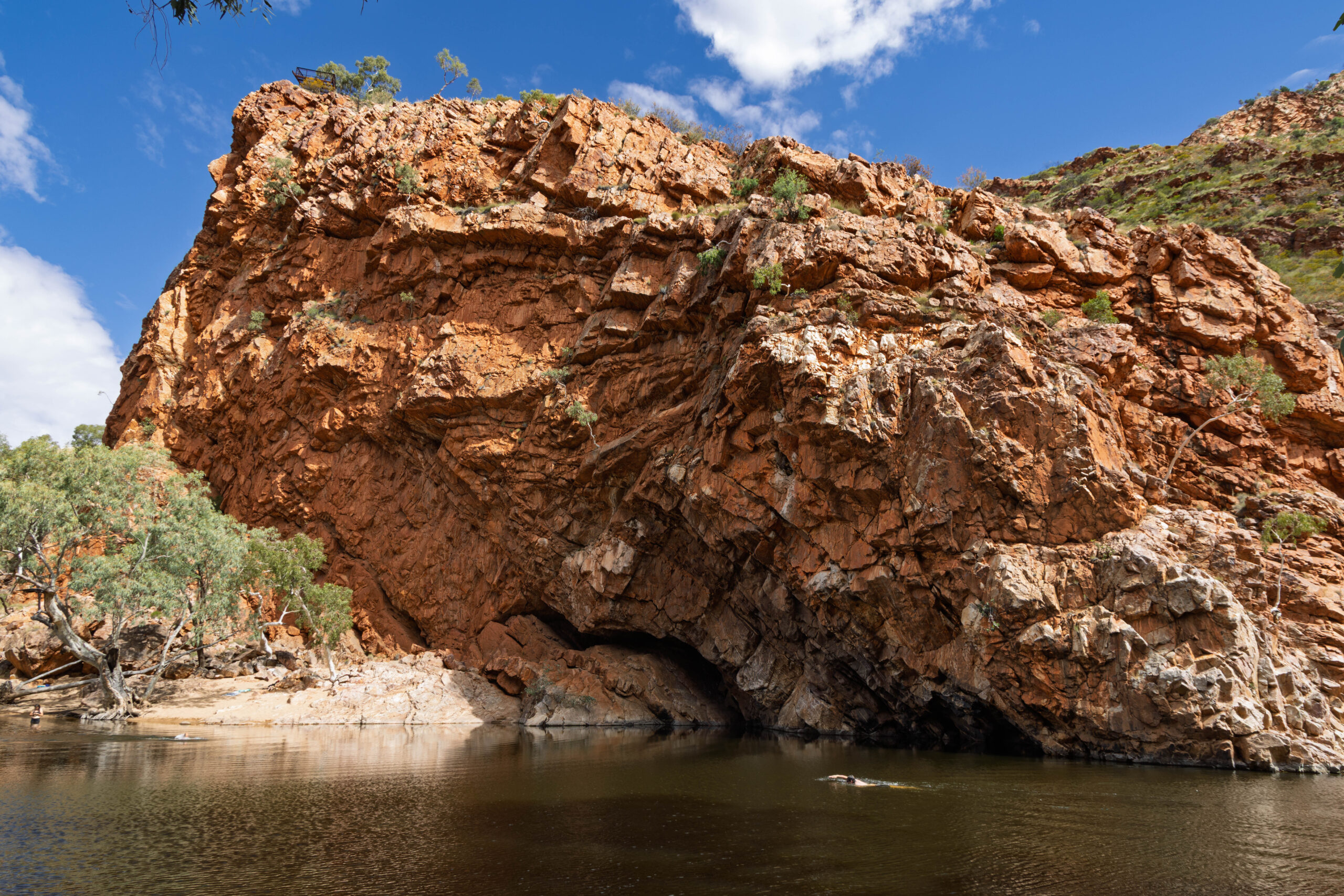
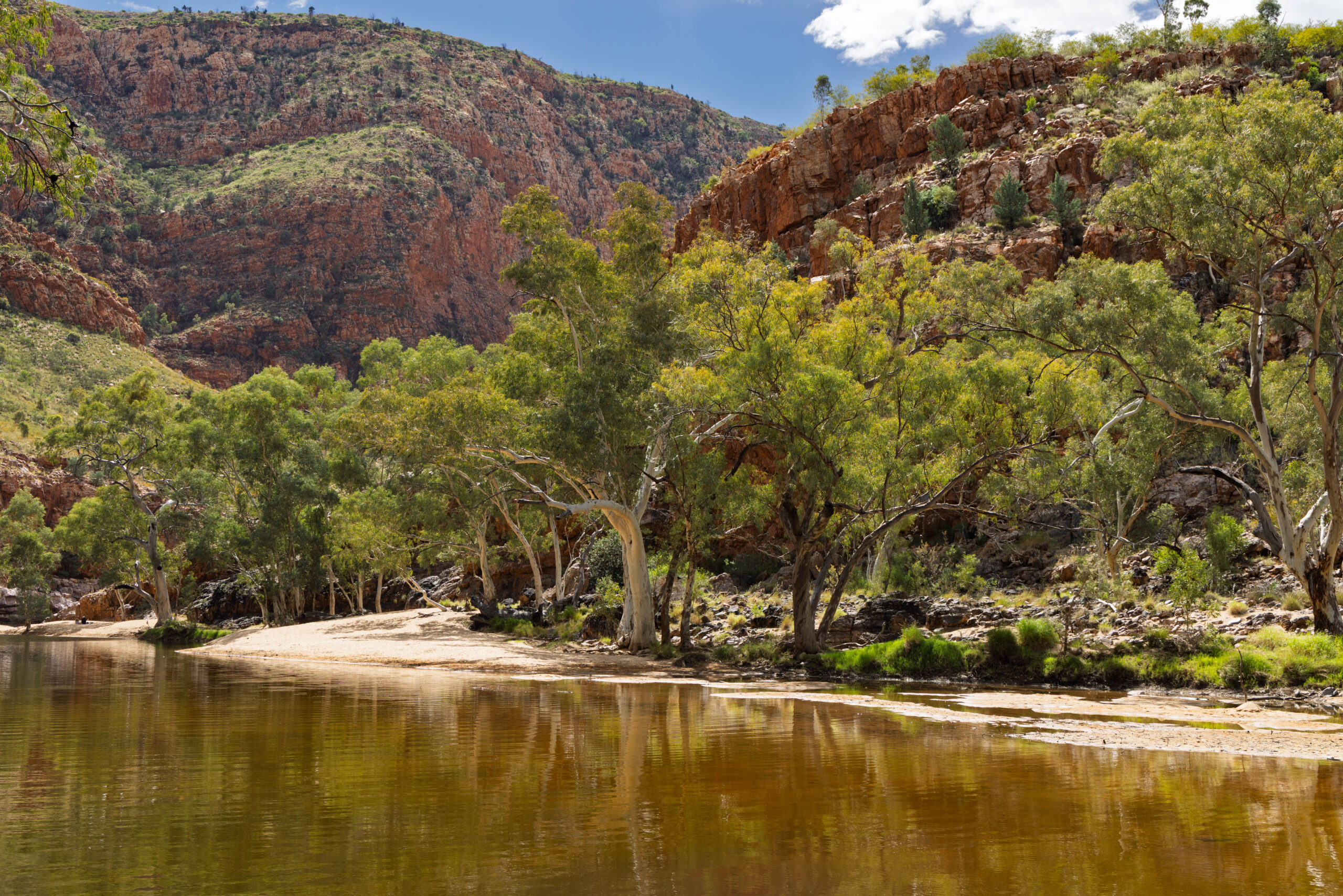
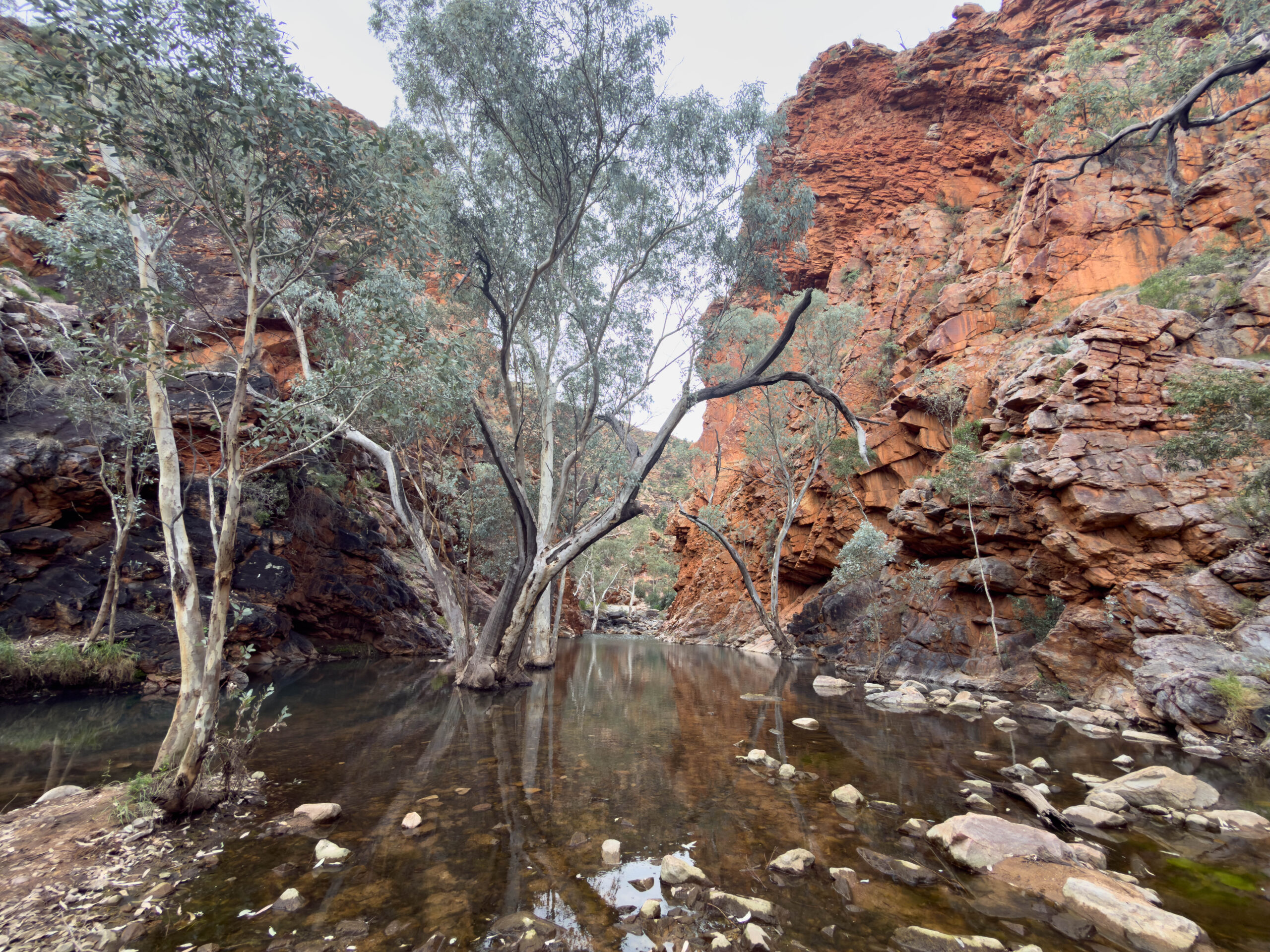
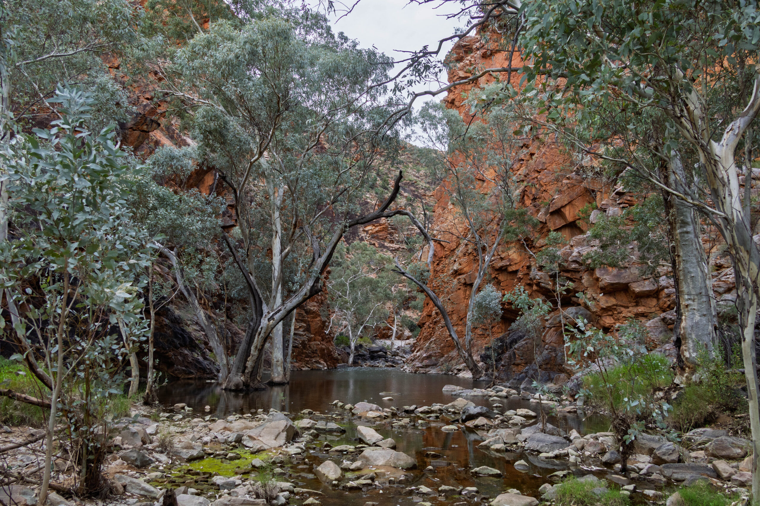
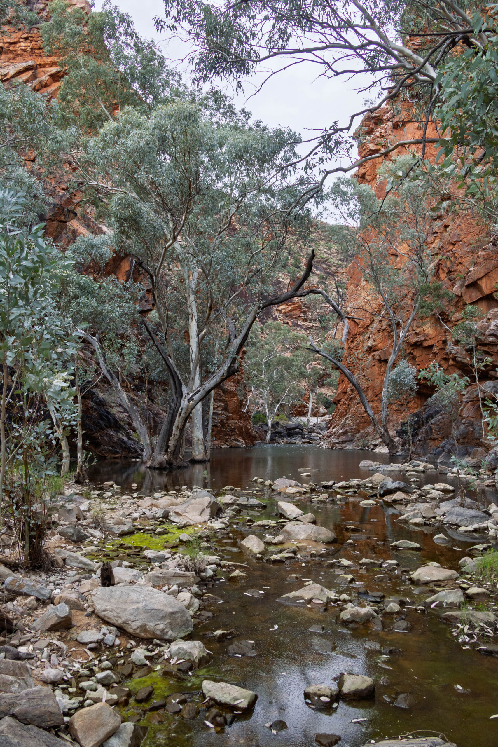
We set off to the Ghost Gum Lookout, planning to continue from there on the spectacular Ghost Gum Walk, which was supposed to take us about an hour. On our way up the path, we spied a Long-nosed Dragon characterized by the two pale stripes running along its back and an extremely long tail. We reached the lookout, which has been constructed adjacent to a very elegant ghost gum, where we were afforded amazing views over the Ormiston Gorge and the Ormiston Creek running through it. From the lookout we continued on the walk, heading down towards the creek. Ahem, we reached the creek and the arrow pointed into the creek, not the dry creek bed, the actual creek. Whaaaaaat?! We thought we got to stay dry on this walk.
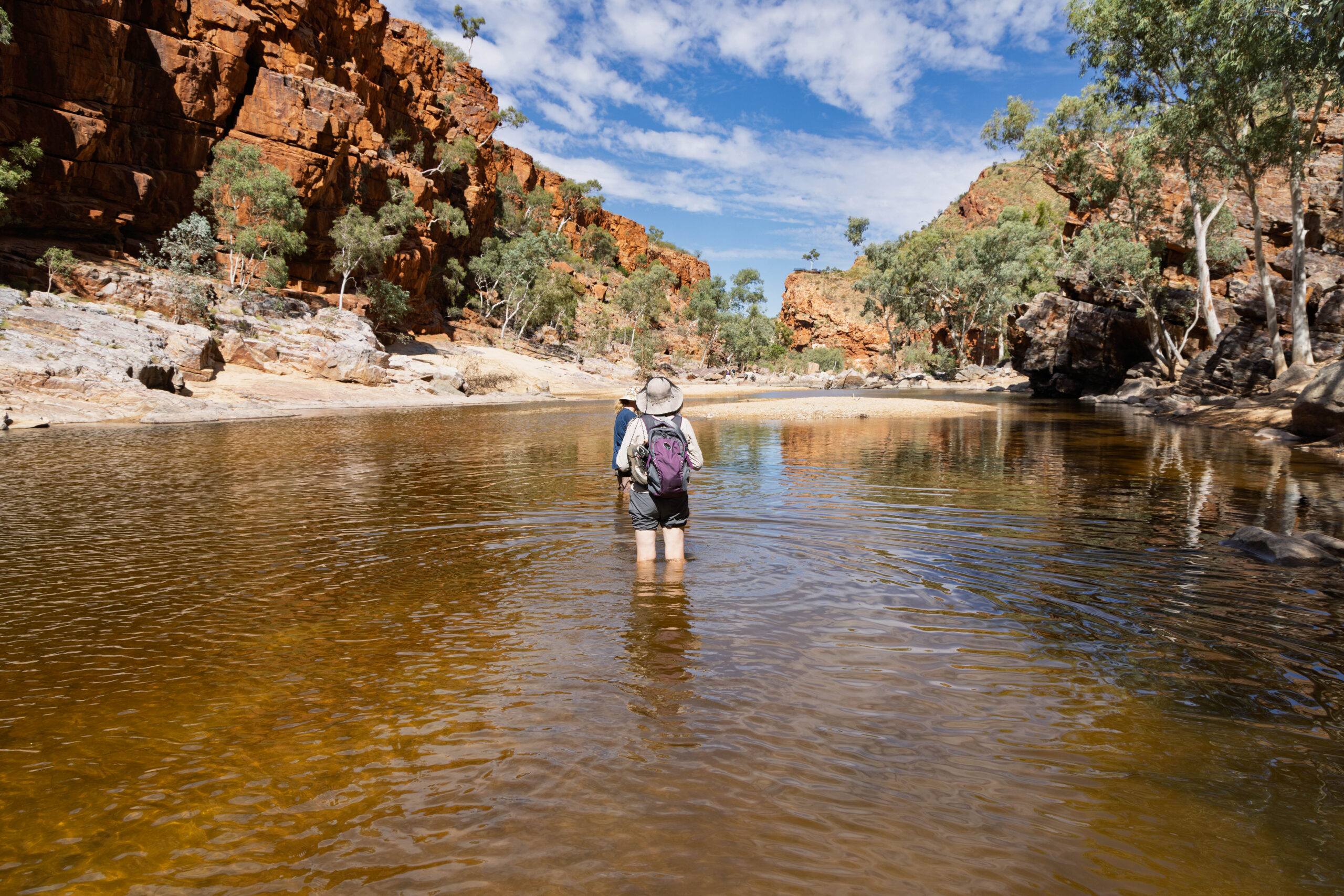
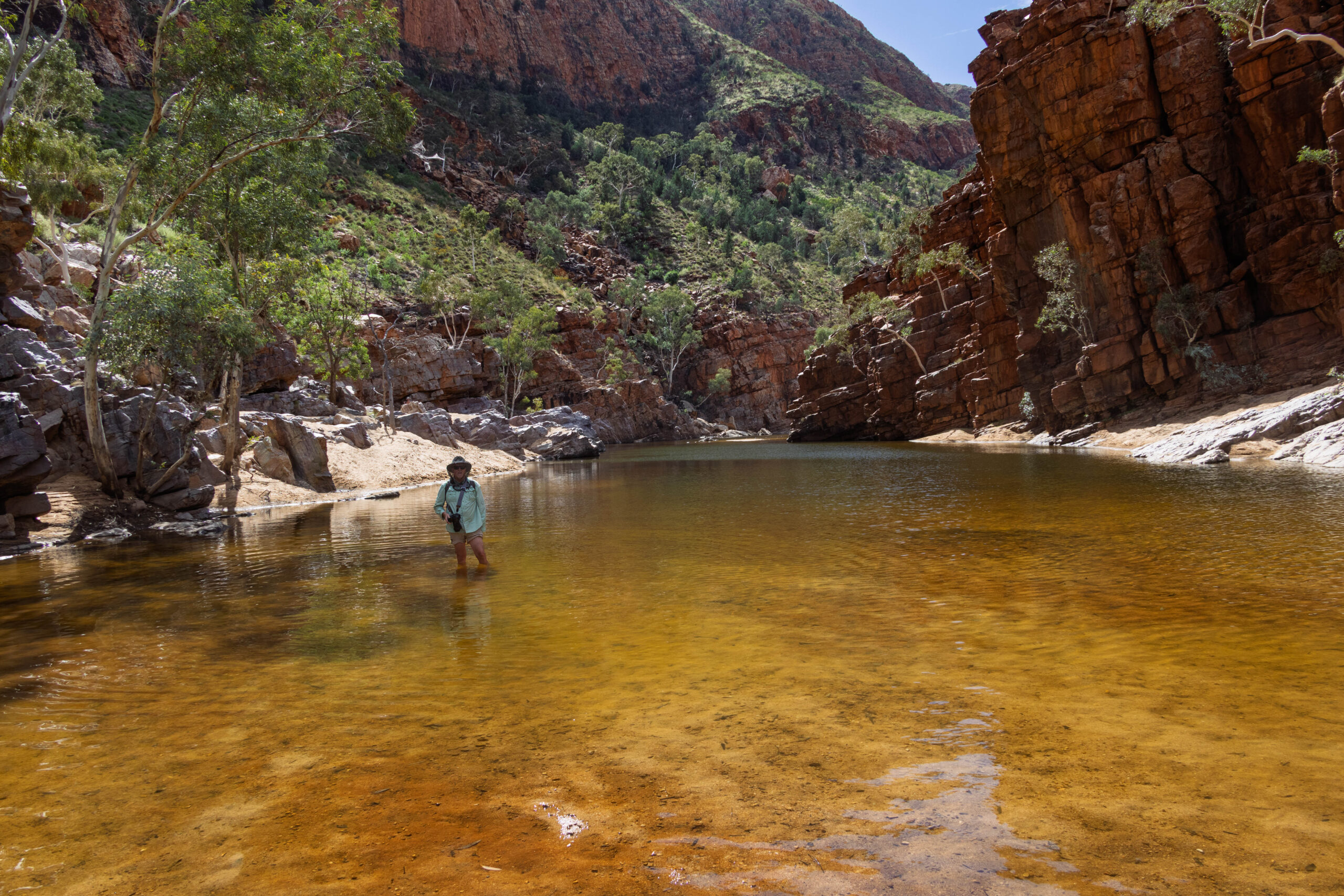
Other hikers were taking off their hiking boots and socks and carrying on. After watching a few make their way across the creek and, seeing that it was only about thigh deep, we decided what the heck, let’s do it. We are supposed to be on an outback adventure, time to be adventurous. We did buy water shoes for this trip, thinking that we might be walking through water in some of the gorges BUT, where were they? In the car. D’oh, note to selves – chuck our water shoes in our back packs in future, along with our water bottles. Of course the other concern is our cameras. If we tripped and fell in the water or stepped in a hole, we would dry out OK, the cameras, probably not. Second note to selves, maybe a big zip lock bag in each of our back packs.
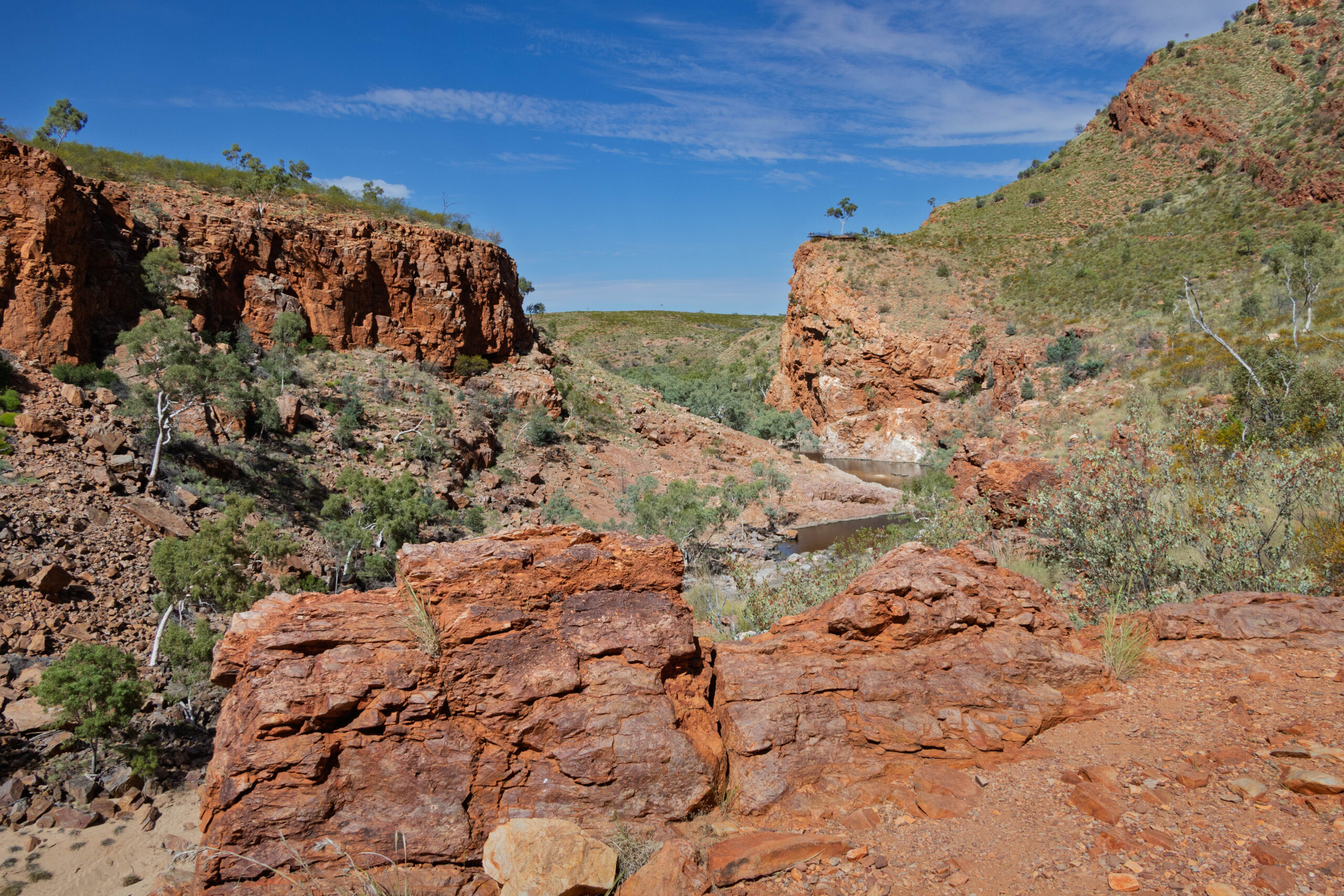
We navigated the water successfully and put our socks and hiking boots back on, and everything was going well, until we were confronted with a rock bluff that is still jutting out into the water, this time much deeper. More wading depth than paddling!! Caught between a rock and a wet place, we made like mountain goats and started clambering over the rocky bluff. It wasn’t too bad going up, but it was pretty much rock climbing to make it down the other side of the bluff onto the lovely sandy beach. I admit that much of this section was completed in a crab-like fashion, using my hands to assist me on the way up and, after the actual rock climbing down one section, I scootched down on my butt to the sand. Thank goodness that was achieved without injury. Absolutely TOFTS but keep pushing myself to keep up with the go harder, go stronger boy.
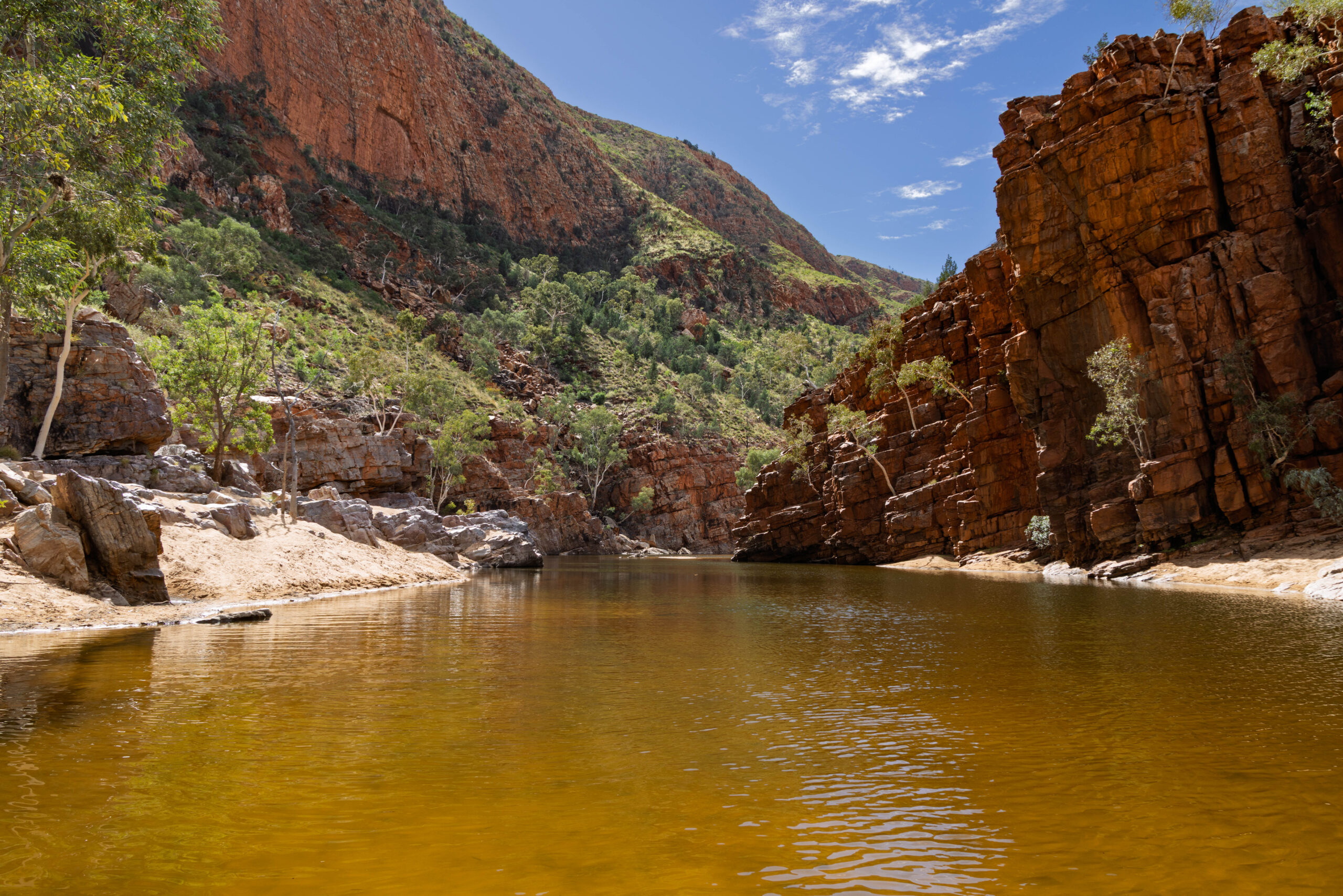
After an easy section along the beach, we were confronted with stairs on the other side of the creek which we assumed denoted the path and was the 15 metre swim section that was mentioned?? Fortunately, for this bit we were able to rock hop over a dry section a little further downstream and … make it to the other side with out having to get wet. Phew.
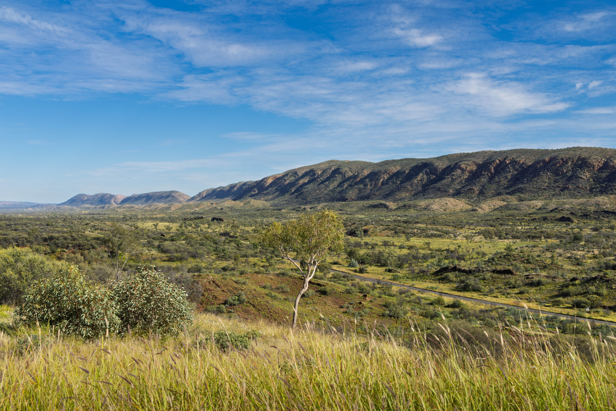
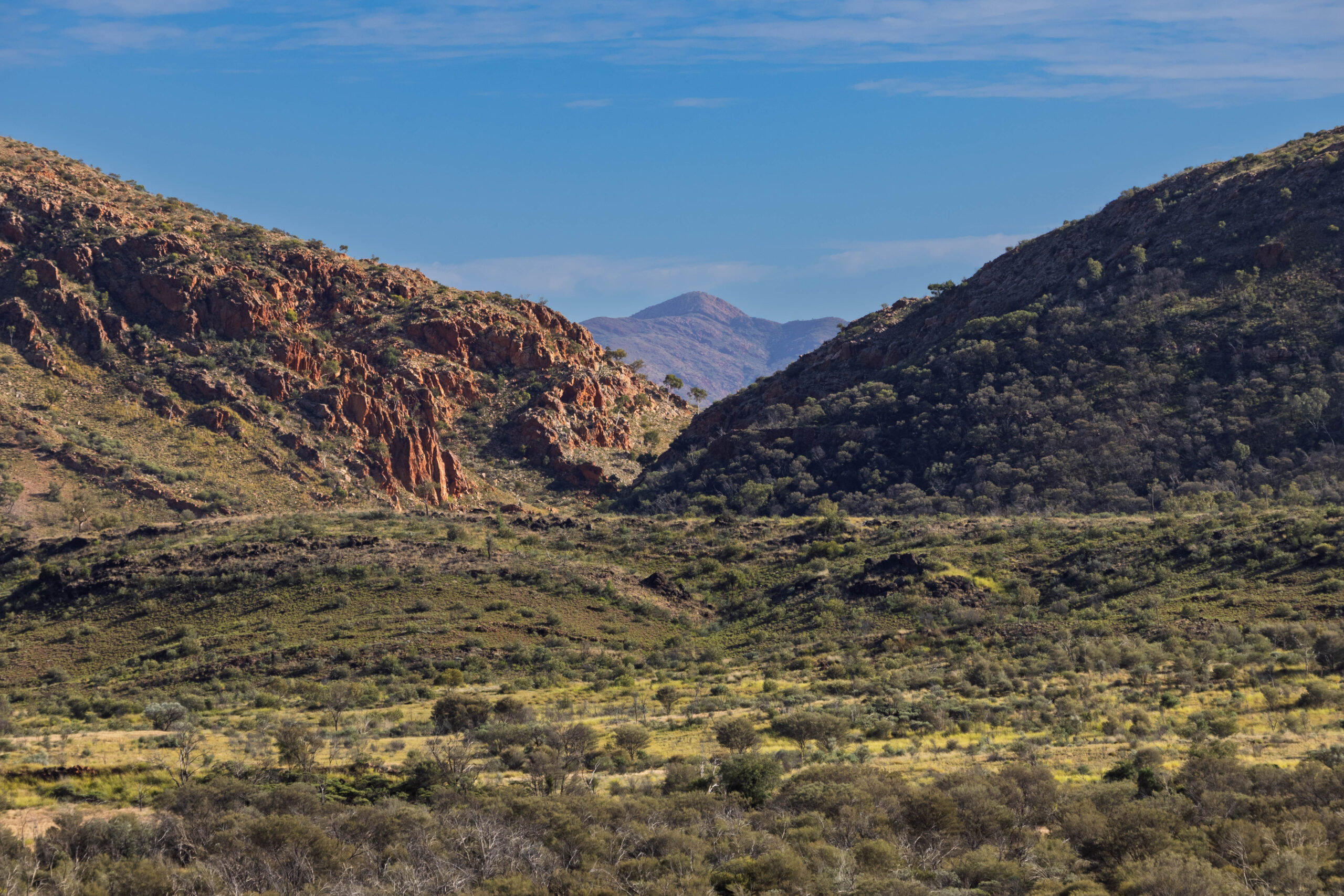
Back at the kiosk we ordered toasted sandwiches for a well-deserved lunch. Ham, cheese and tomato for Bernie and vegetarian for me. Delicious, generously filled toasties which were quite a surprise so far from civilisation. After eating, we headed back towards Namatjira Drive. I noticed on our map that it looked like there was a lookout, looking towards Mount Sonder, a little further west. Sure enough, just a few more kilometres and we were able to pull into the Mount Sonder Lookout for a good view and a couple of photos. On our way we saw a monitor lizard ambling across the road. In this part of Australia it could have been a perentie? Anyhow, a much bigger lizard that the one sunning itself on the path up to the Ghost Gum Lookout.
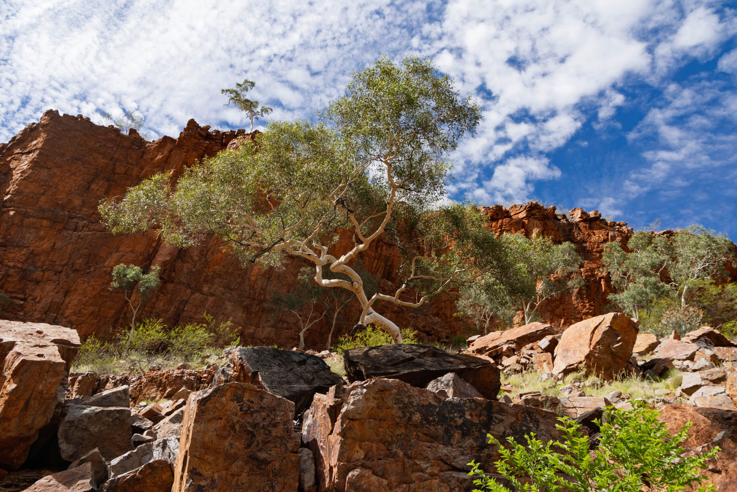
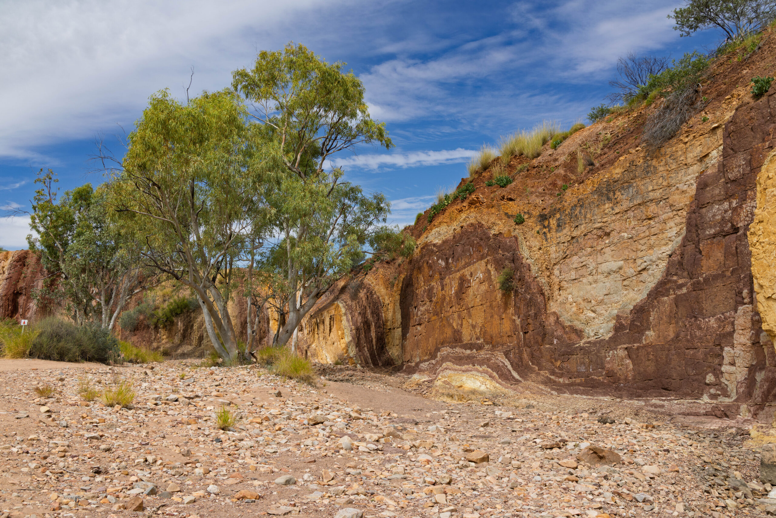
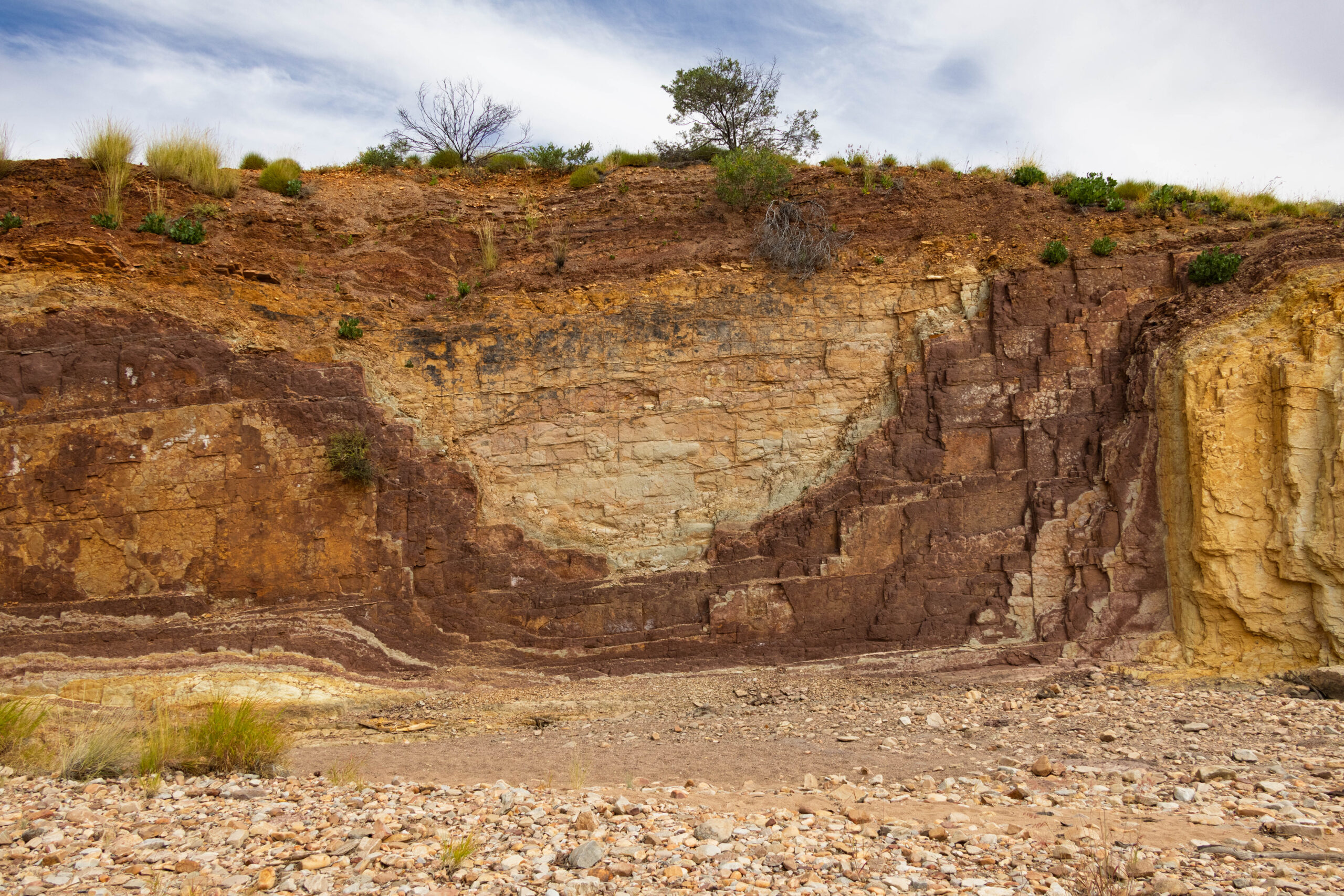
Now it was time to start working our way back towards Alice Springs. We drove back past the turn out for Ormiston Gorge and then pulled in at the Ochre Pits. The colourful, ochre-bearing cliffs were laid down around 700 million years ago when the area was submerged beneath a massive though shallow inland sea. Three hundred million years ago, as the MacDonnell Ranges were created, the sedimentary layers were pushed from horizontal to almost vertical resulting in the swirls and curves seen today.
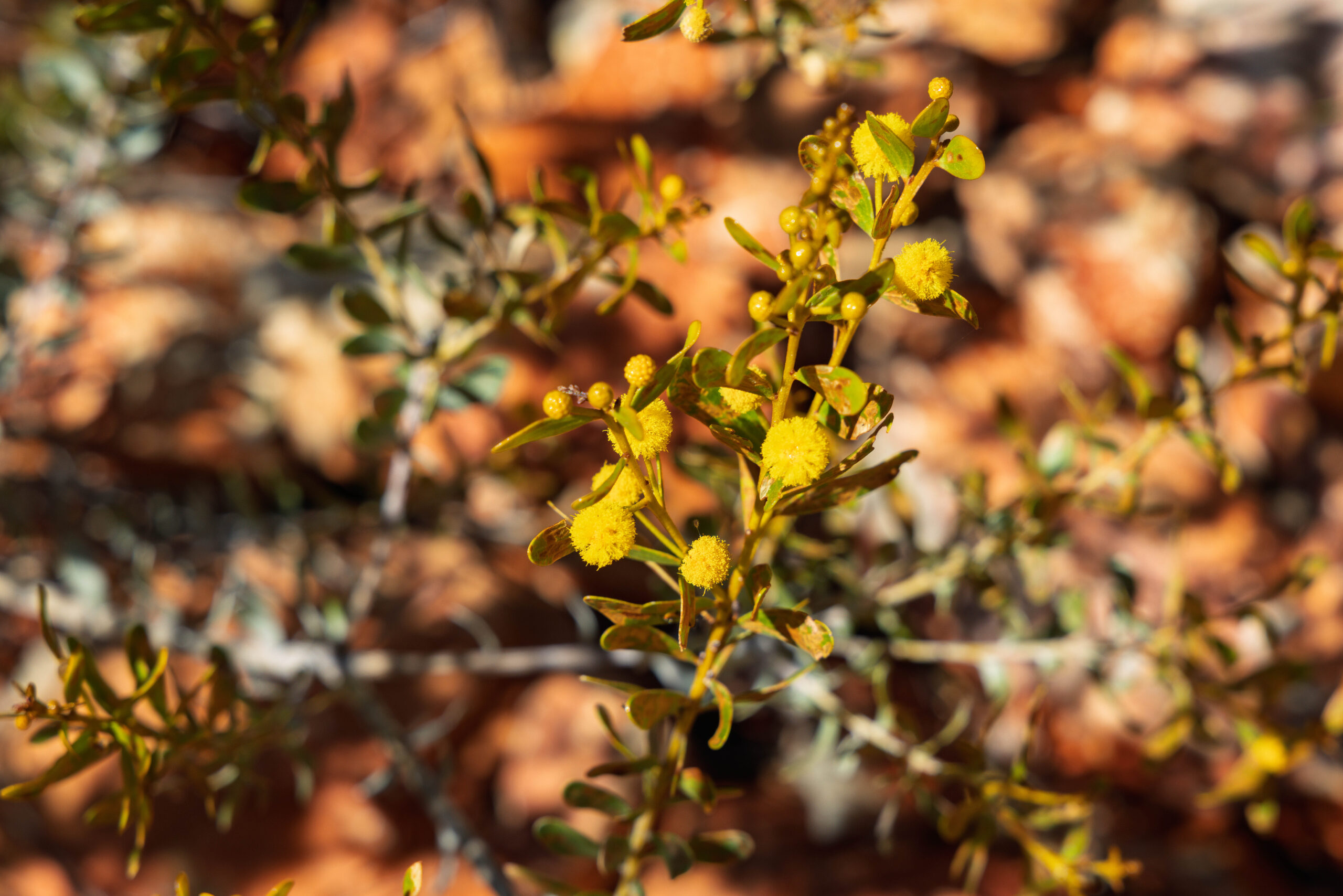
Playing an important role in the culture of the Western Aranda people, ochre has been collected here for thousands of years for use in ceremony, dance and decoration, in burial rites and as an important commodity to trade. We completed the easy 300-metre path to the viewing platform, and felt fortunate that visitors are invited to step down into the creek bed for a closer look at the colourful cliffs, providing the ochre isn’t touched or otherwise interfered with.
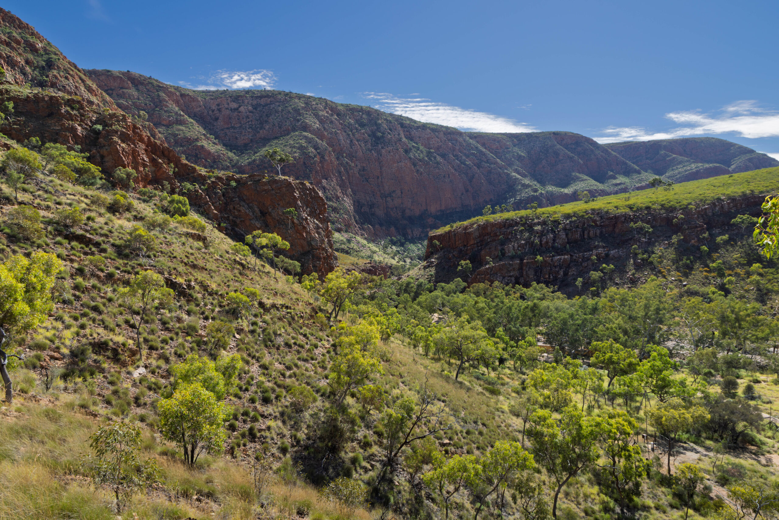
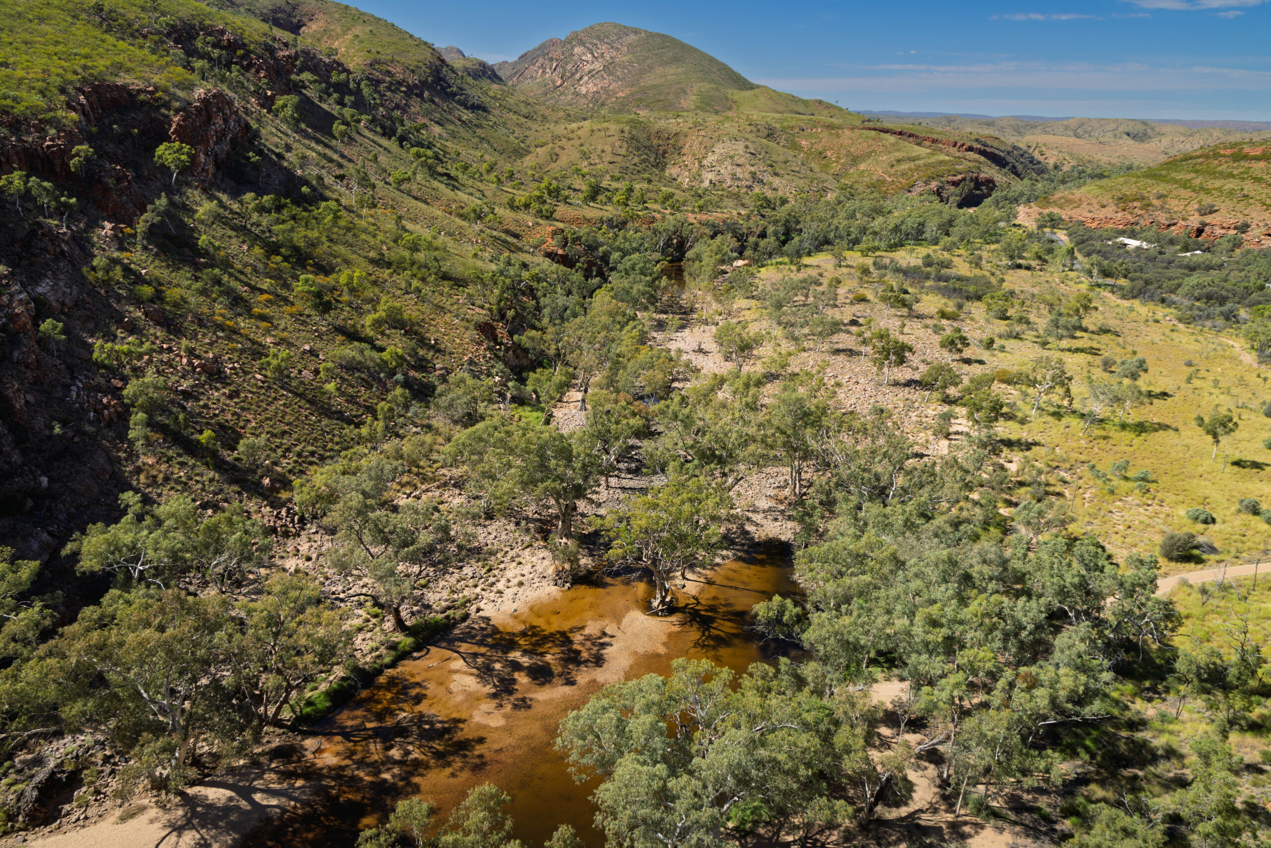
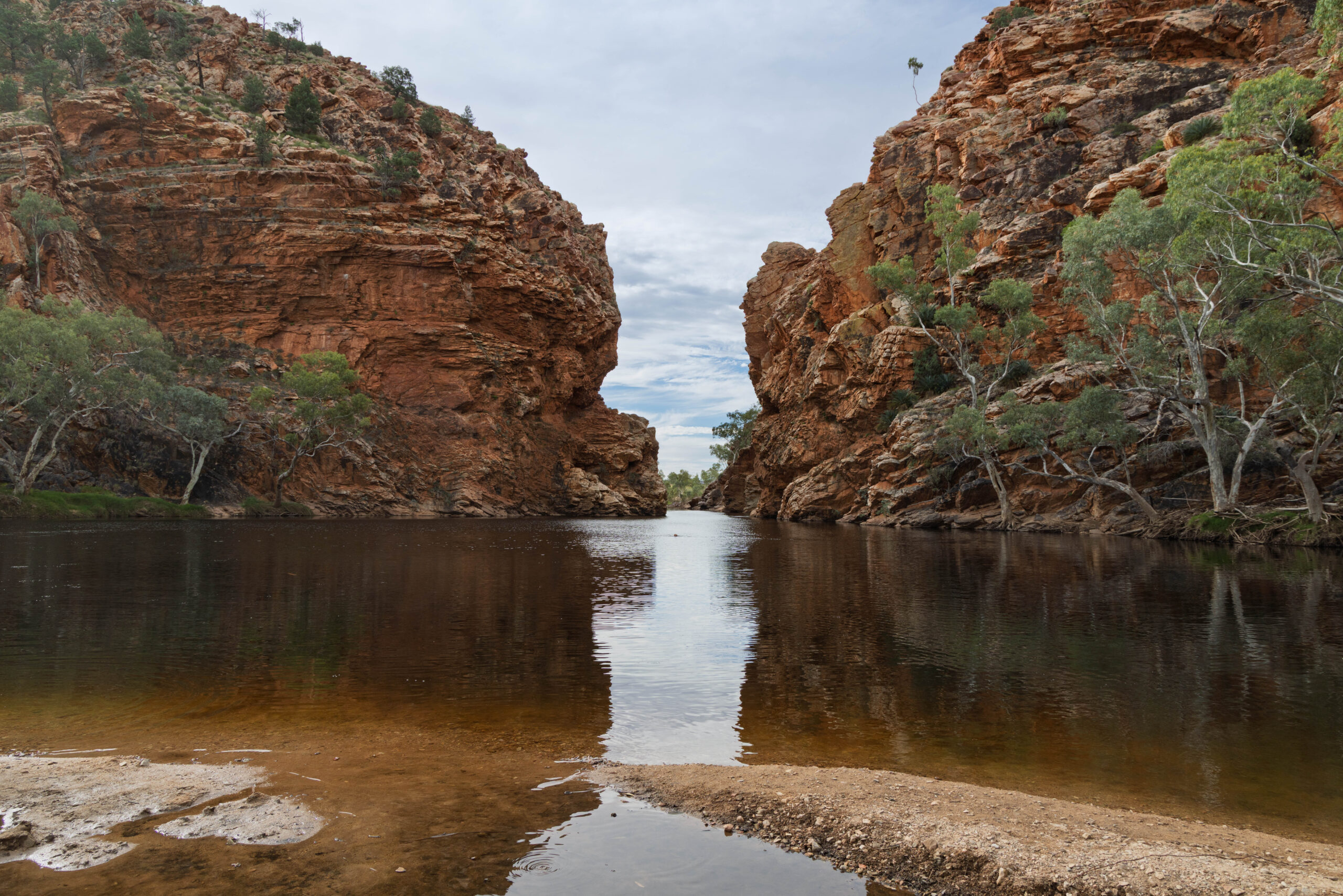
Our next stop was at Serpentine Gorge. As we walked in, we encountered a group who were completing the Ellery Creek Big Hole to Serpentine Gorge sector of the Larapinta Trail. The whole trail runs for 223 kilometres but can be completed in sections and is considered to be one of the planet’s top 20 treks. Not up for quite that much of a challenge, we are lucky that so many of the main sights can be accessed from the road … with just a little bit of walking.
At the foot of the lookout track, we chatted with Peter and Kate who are camping in their van at a number of free camp sites along Namatjira Drive. After a while, Peter said can I ask a question out of left field (or something like that) – why the difference in your footwear? One of you in sandals and one of you in hiking boots? Bernie decided after lunch that he couldn’t bear to have his feet in his hiking boots any more and had changed into his Teva sandals. I told Peter that it is because I am MUCH MORE afraid of snakes than Bernie is!
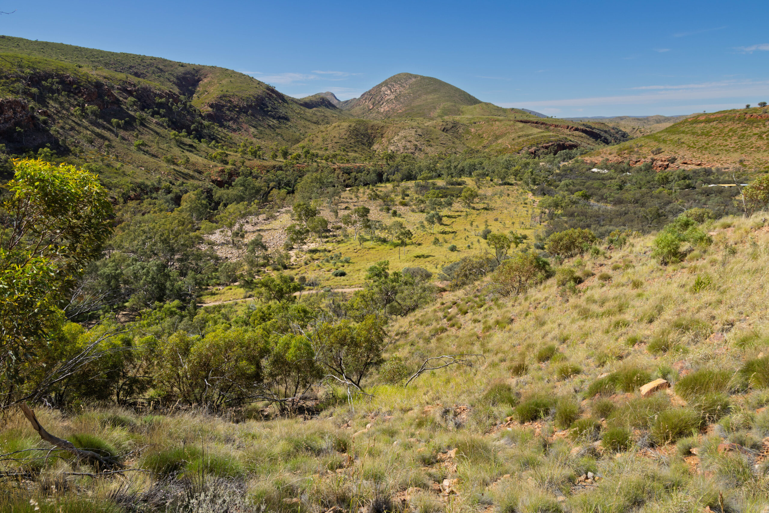
After this diversion, comparing road trip stories, we completed our walk into Serpentine Gorge. Yet another peaceful and idyllic spot, until Bernie’s camera battery went flat. And where was his spare camera battery? In the car, of course. I took the photos I wanted to take and then let him use my camera to take the photos that he wanted to take. So many photos today, this landscape is incredibly picturesque. I’m already thinking that our Outback Road Trip photo book is going to be books, plural. As we walked back to the car from the gorge, we said hello to another couple heading out. I’m not sure why, but they felt compelled to tell us they have seen four snakes in the last 24 hours! One near their caravan last night (I think they were free camping not at the Discovery Park where we are?), one on the road and two in Ormiston Gorge earlier today. And I thought that I was a snake magnet!!! We have not seen one … yet. Touch wood.
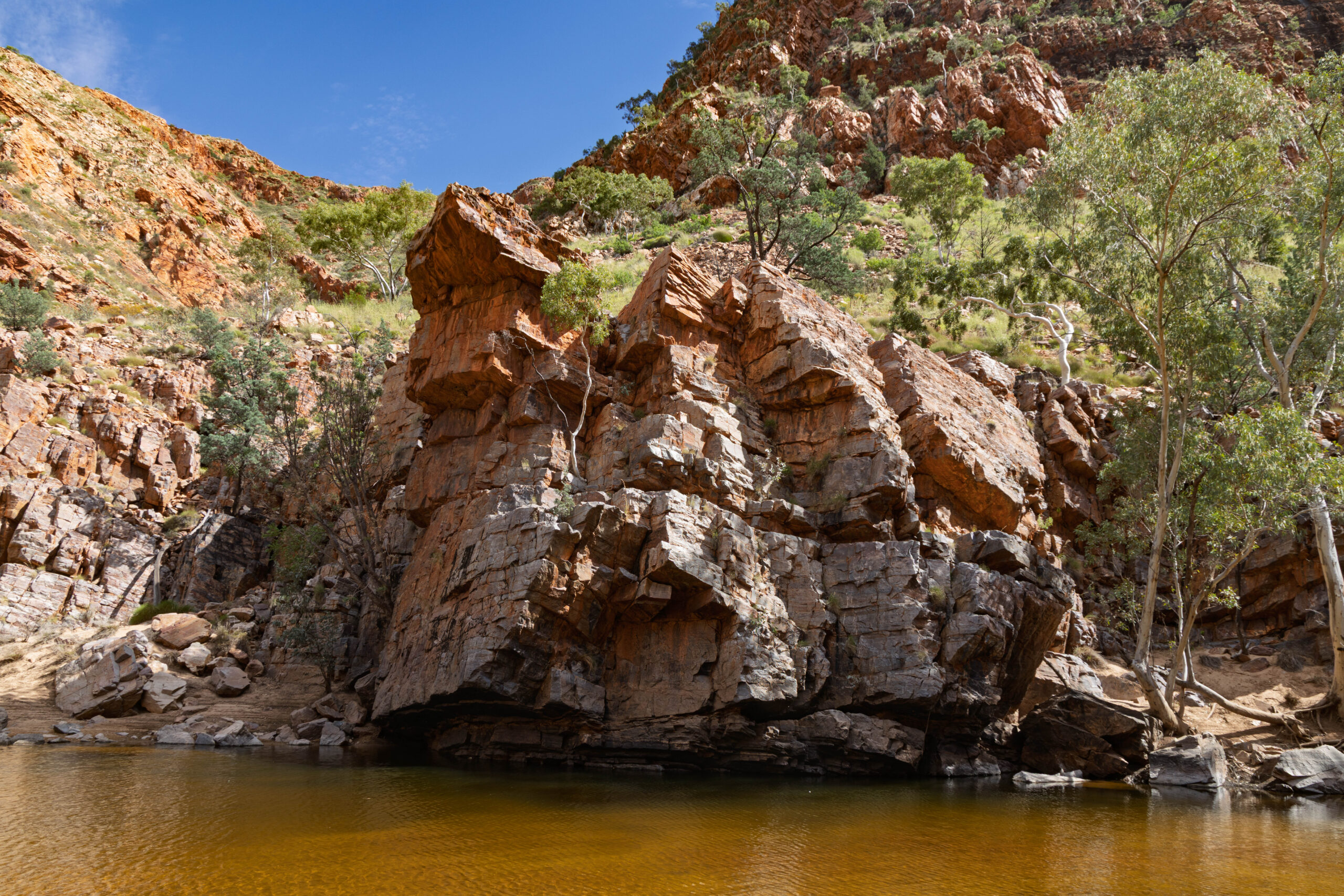
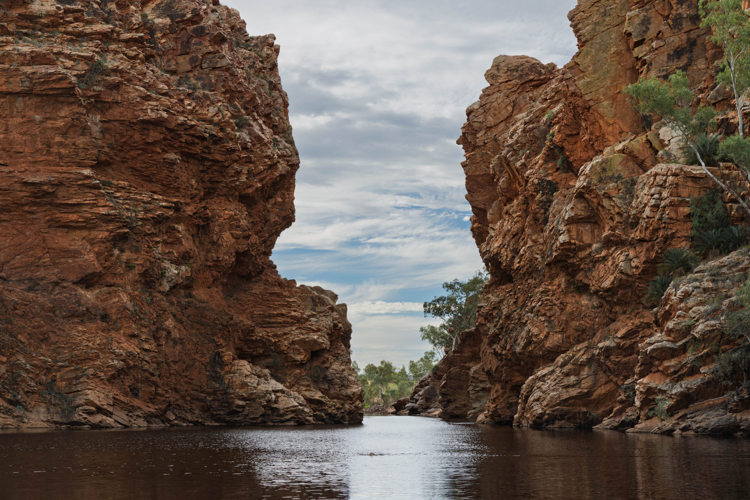
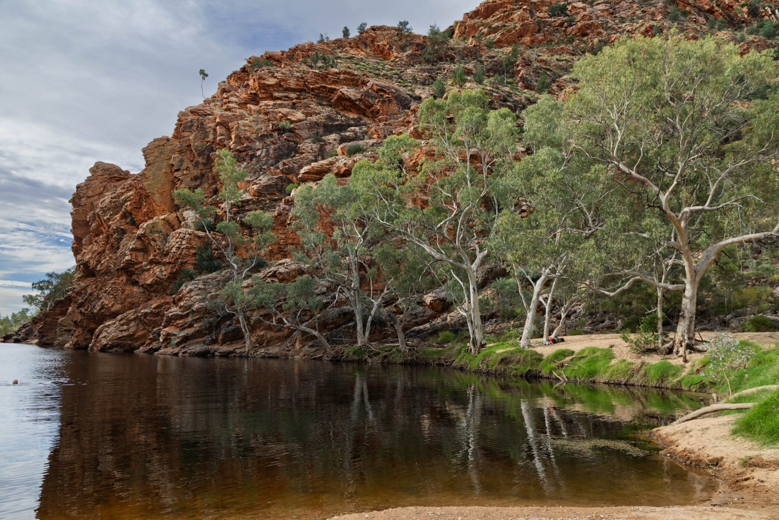
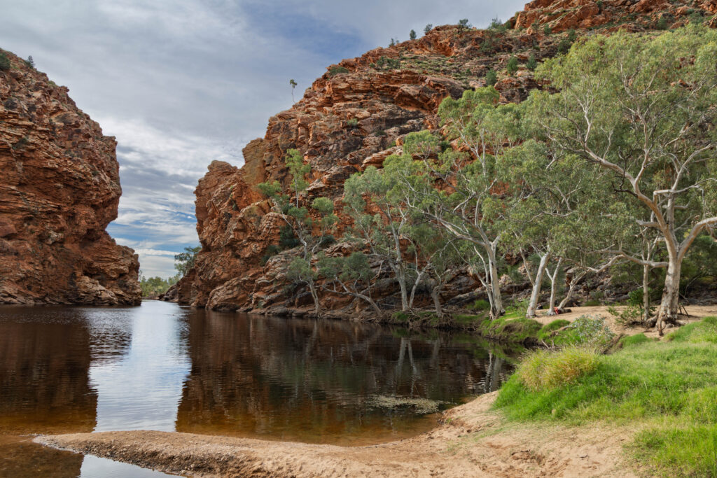
And on to Ellery Creek Big Hole. This is the largest permanent waterhole in Central Australia and, once again, spectacular. At 90 kilometres from Alice Springs it is the closest waterhole that allows swimming. Unbelievably, on a warm autumn day, that is also a public holiday celebrating Anzac Day, there were few people enjoying its cool (cold?) waters. We thought about swimming, but decided we couldn’t be bothered changing into our togs. Not being a confident swimmer I was also a bit nervous about wild swimming in a HUGE waterhole of unknown and probably inconsistent depth.
With today’s sightseeing agenda completed we headed back to town, picked up a few more supplies at Woolies and made our way back to our cabin. Bernie cooked our steaks on the BBQ while I peeled the tops of the salads we purchased yesterday for an easy ‘home cooked’ dinner.
Steps: 14,017 (8.74kms)