Wednesday, 6 August 2025
Another glorious day in the Flinders Ranges. How lucky are we? Thank goodness we didn’t holiday over this way a week or so ago when it was extremely wet and roads were closed.
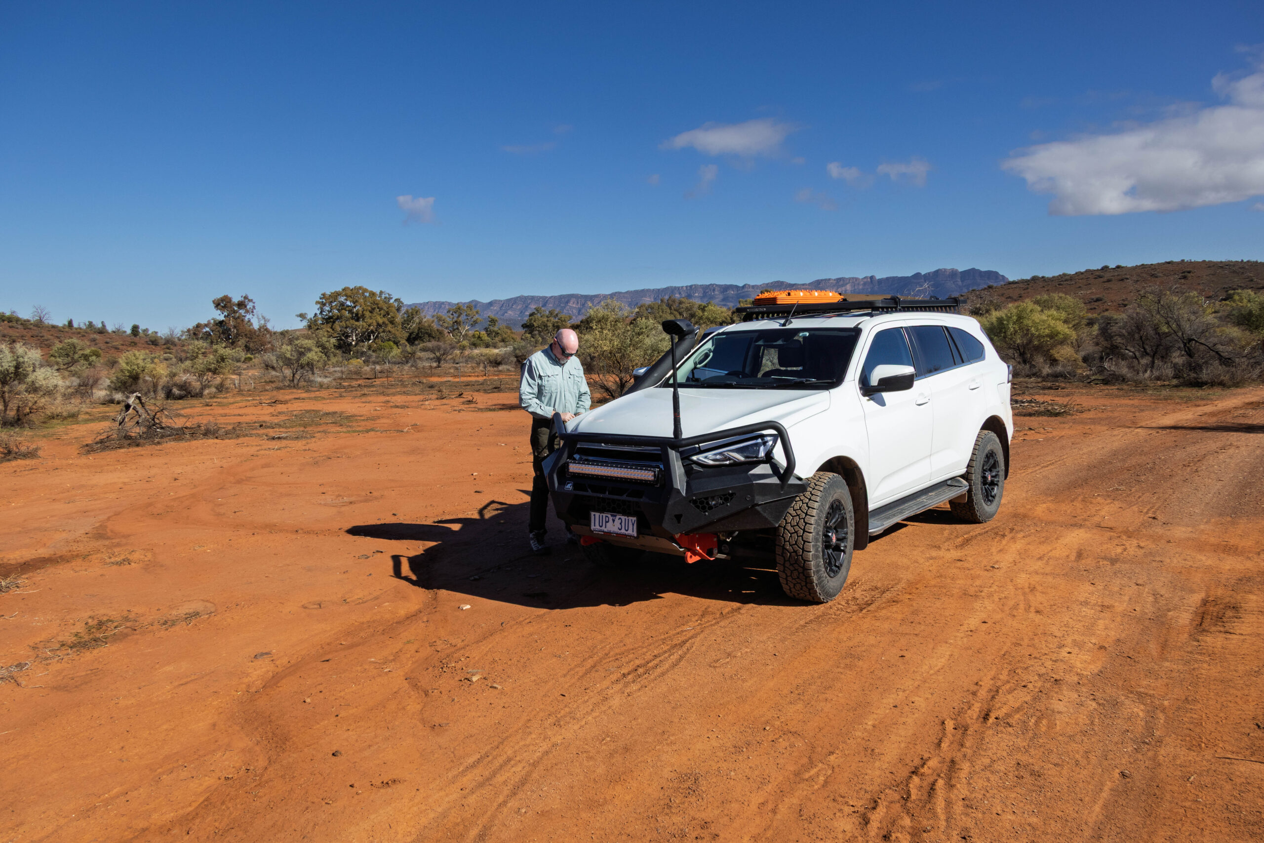
This morning after breakfast we drove over to the office to find out if the red section of the Arkapena track has reopened. The yellow section has already been open for a couple of days but, if we’re going out to do the 4WD tracks we would like to do them both on the same day. Yes, the track is open and we are good to go … after paying a fee to drive on these private 4WD tracks and receive the gate keys to access the tracks.
We headed along the Hawker-Milpena Road and missed the turn off for the Arkapena Track. Oops! We turned the truck around at the Arkaba River and returned to the turn off for the track. We were soon at the gate where I had to jump out to open the gate for Bernie to drive through. Although we were not expecting the yellow section to be rough going, Bernie decided to let the tyres down to 28psi.
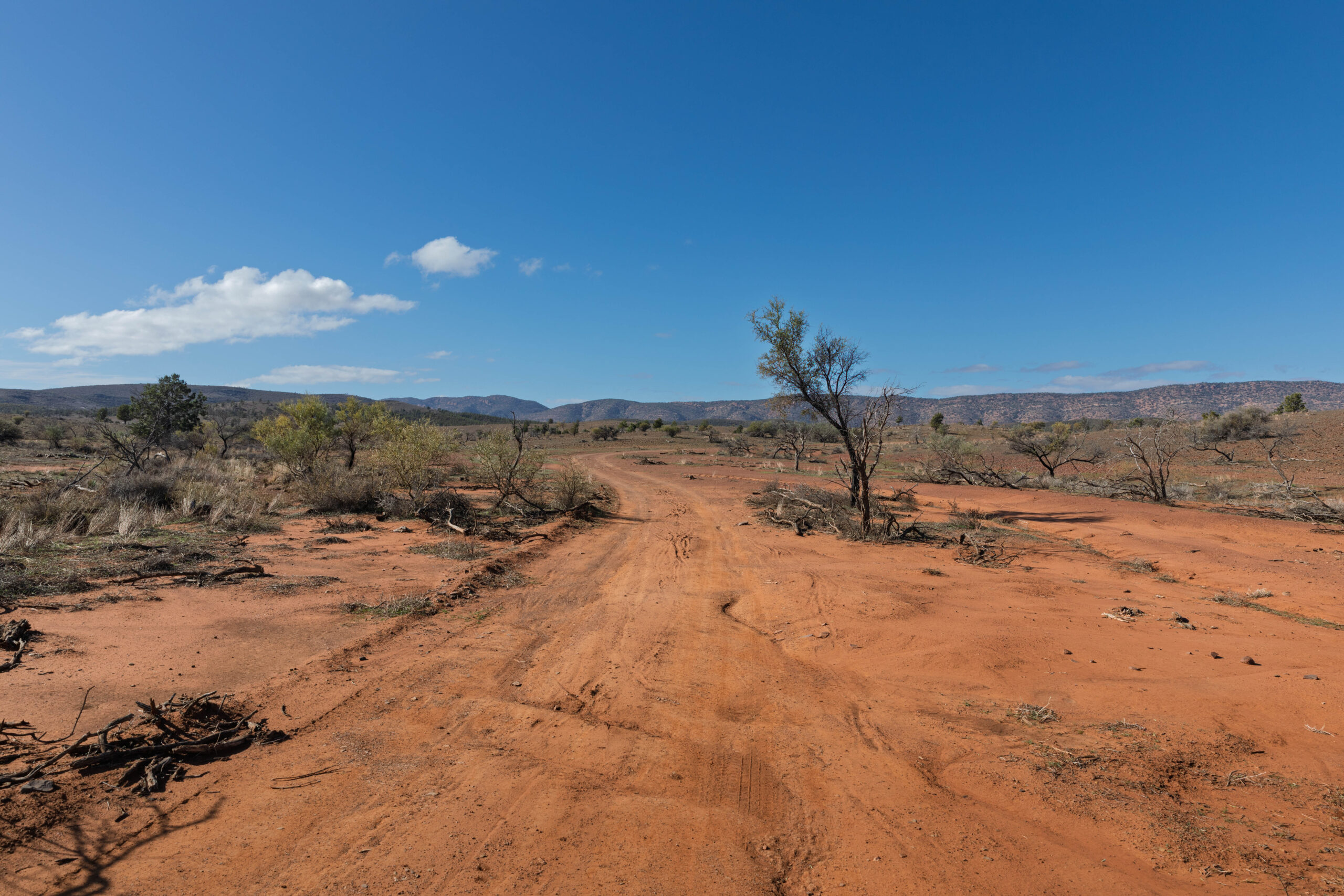
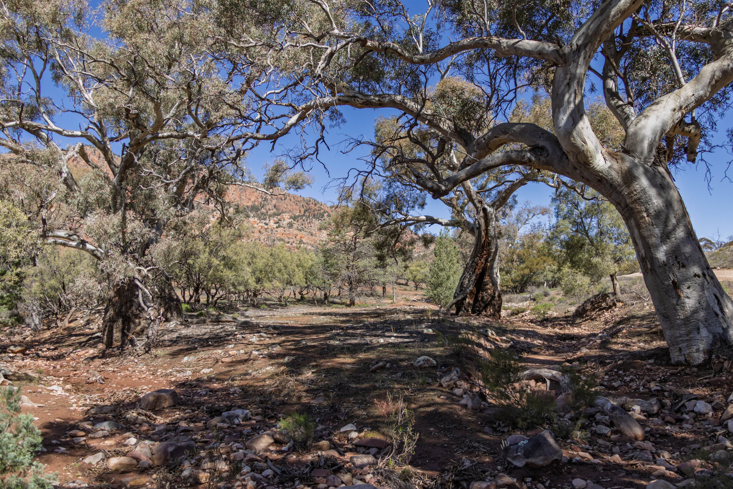
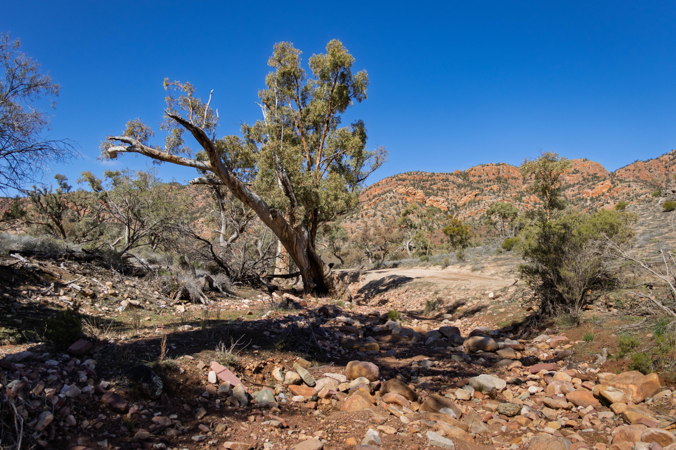
With the tyre pressure reduced we set off along the yellow route which is suitable for low clearance 4WDs. Soon we came to our first river crossing which was … dry. Already the rain that fell recently has all but disappeared. The main thing of note at this, and all the other river/creek crossings, is the river red gums that grow in these occasional water courses. The water may only flow only once or twice a year in most years so these magnificent gum trees rely on flooding every few years to survive in this semi-arid environment.
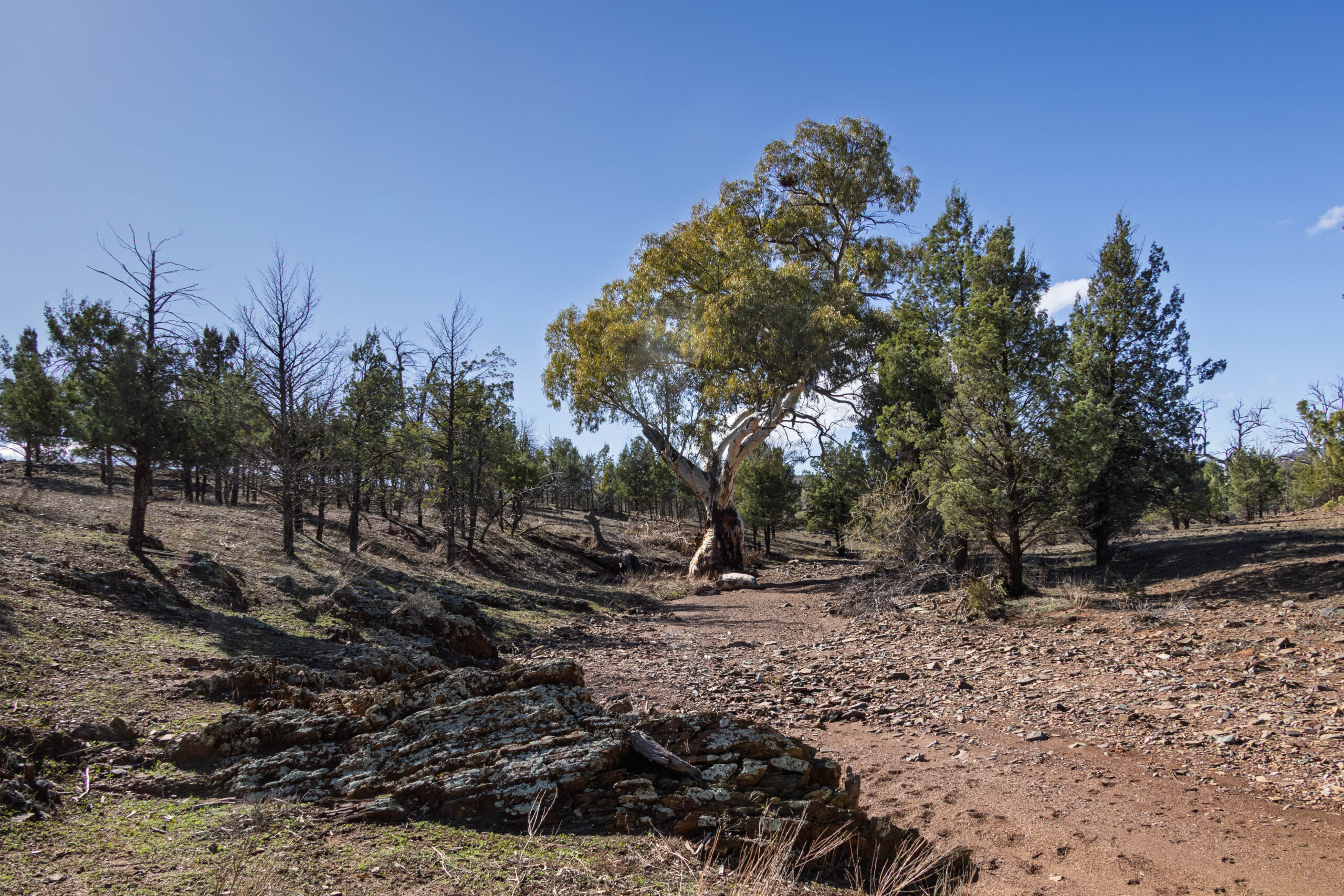
Next we drove into an area where the native pines (Collitris Gloucophylla) grow. These tall green pines regenerated significantly after two consecutive wet years over 1973 and 1974. In favourable conditions these trees can reach heights up to eight metres but few in this harsh environment manage that. The wood is favoured for making fence posts as it contains a resin that is resistant to termites.
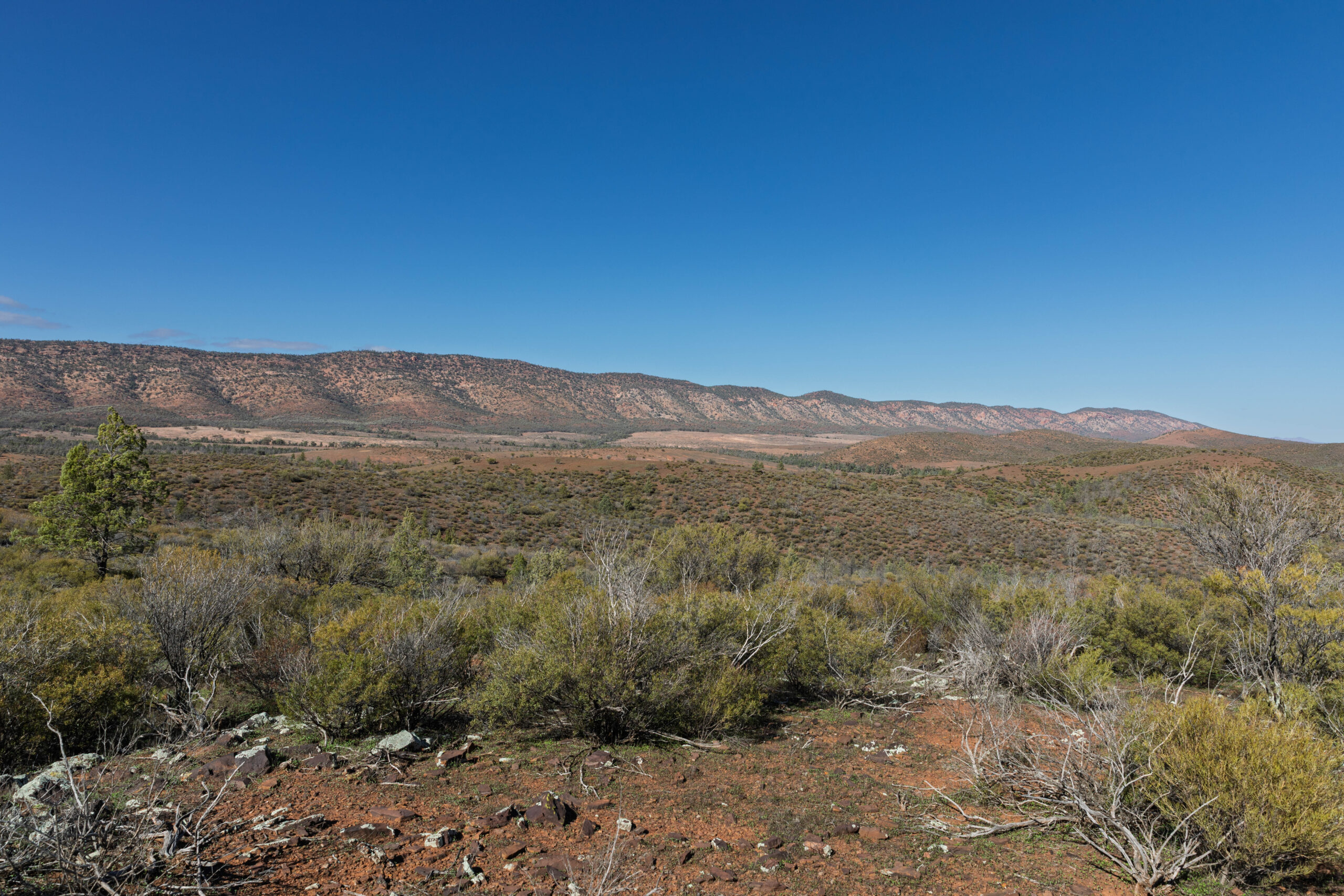
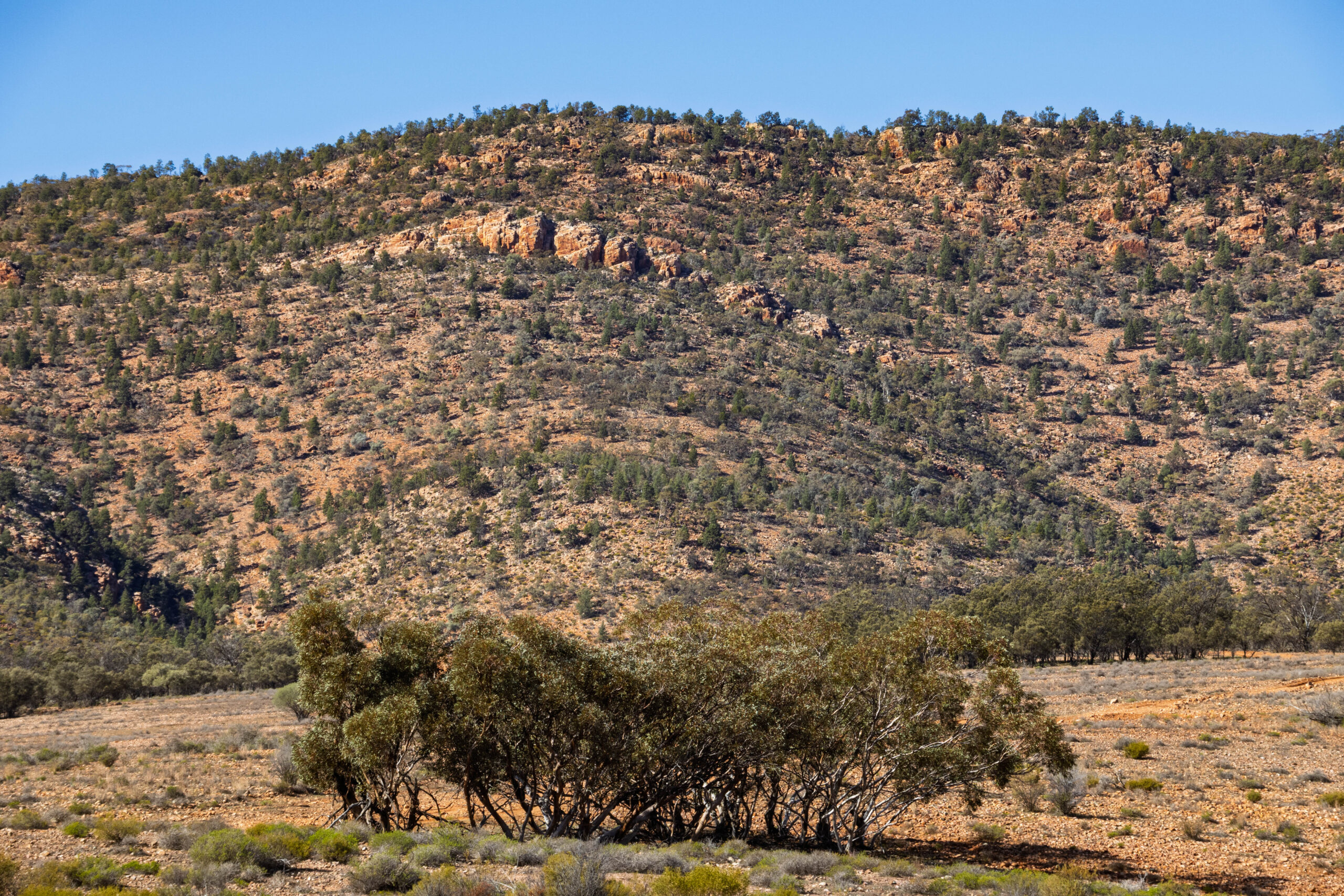
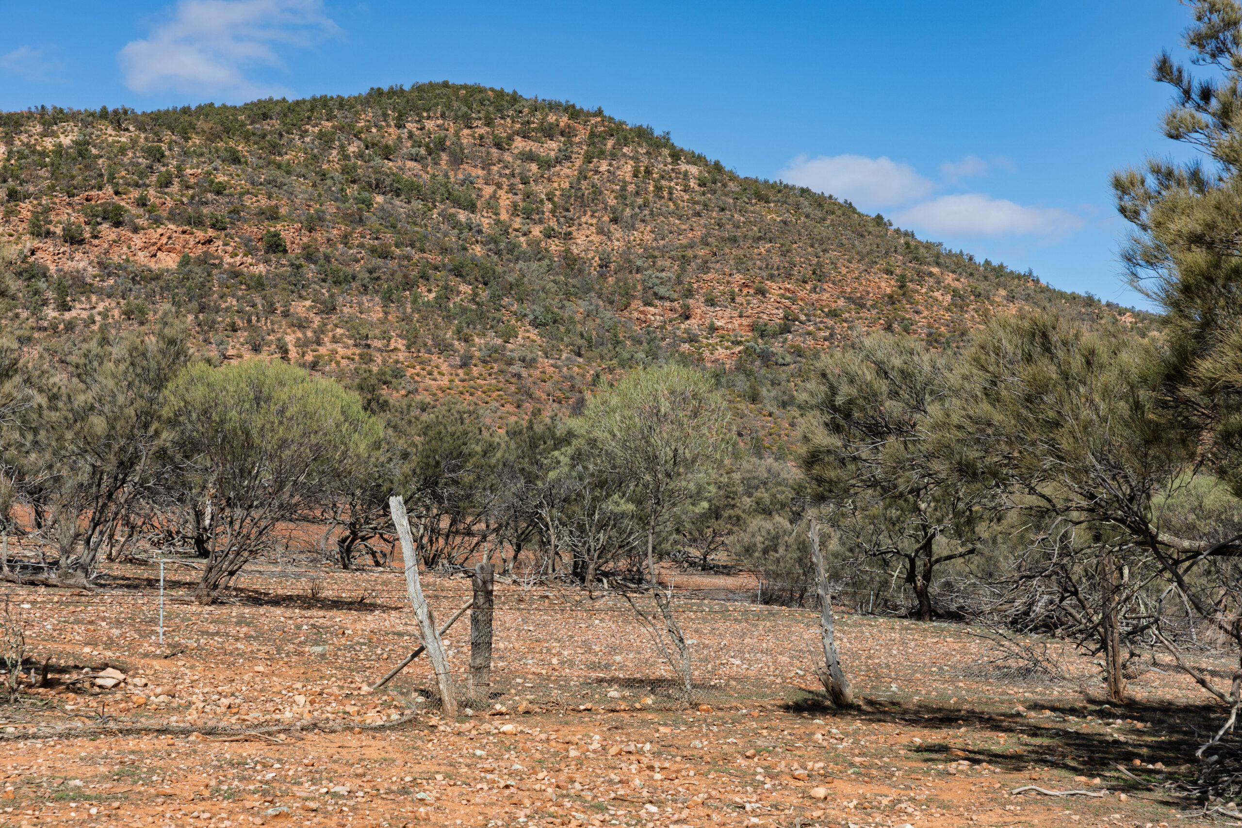
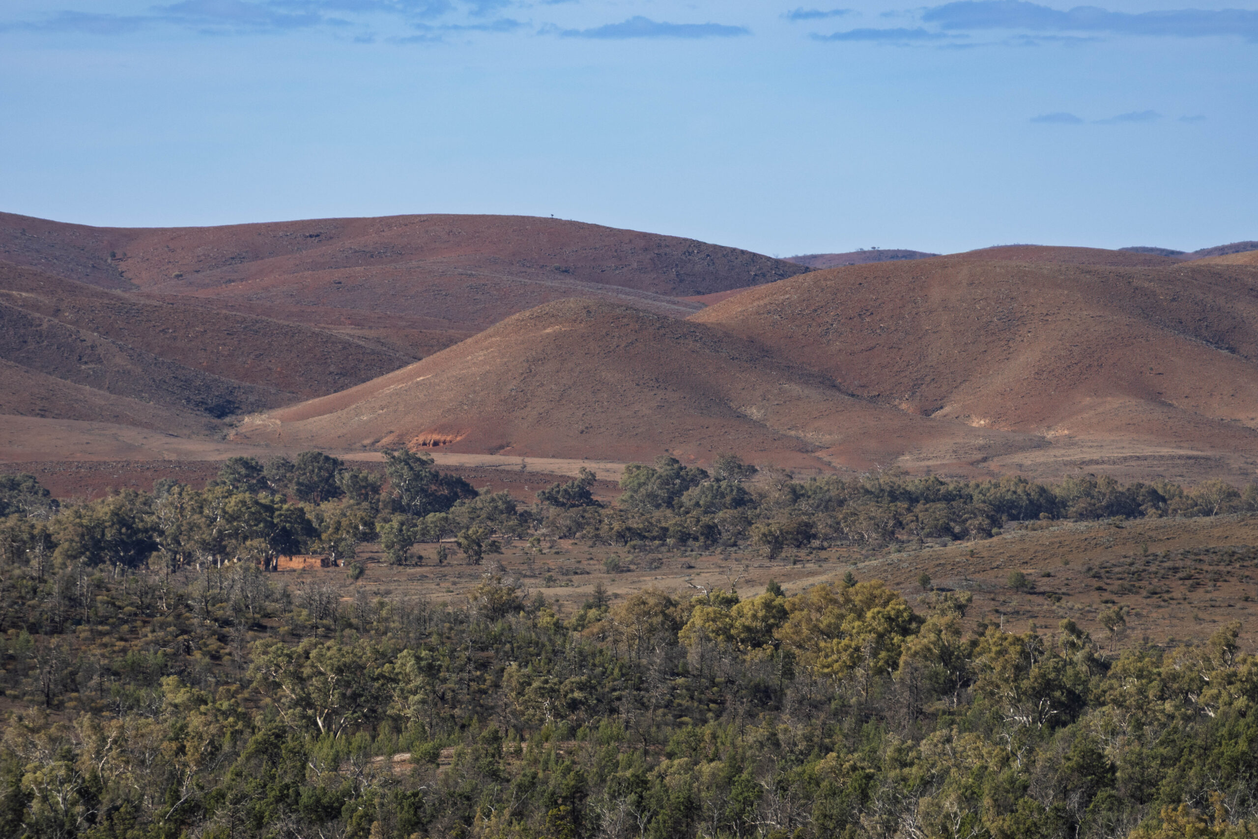
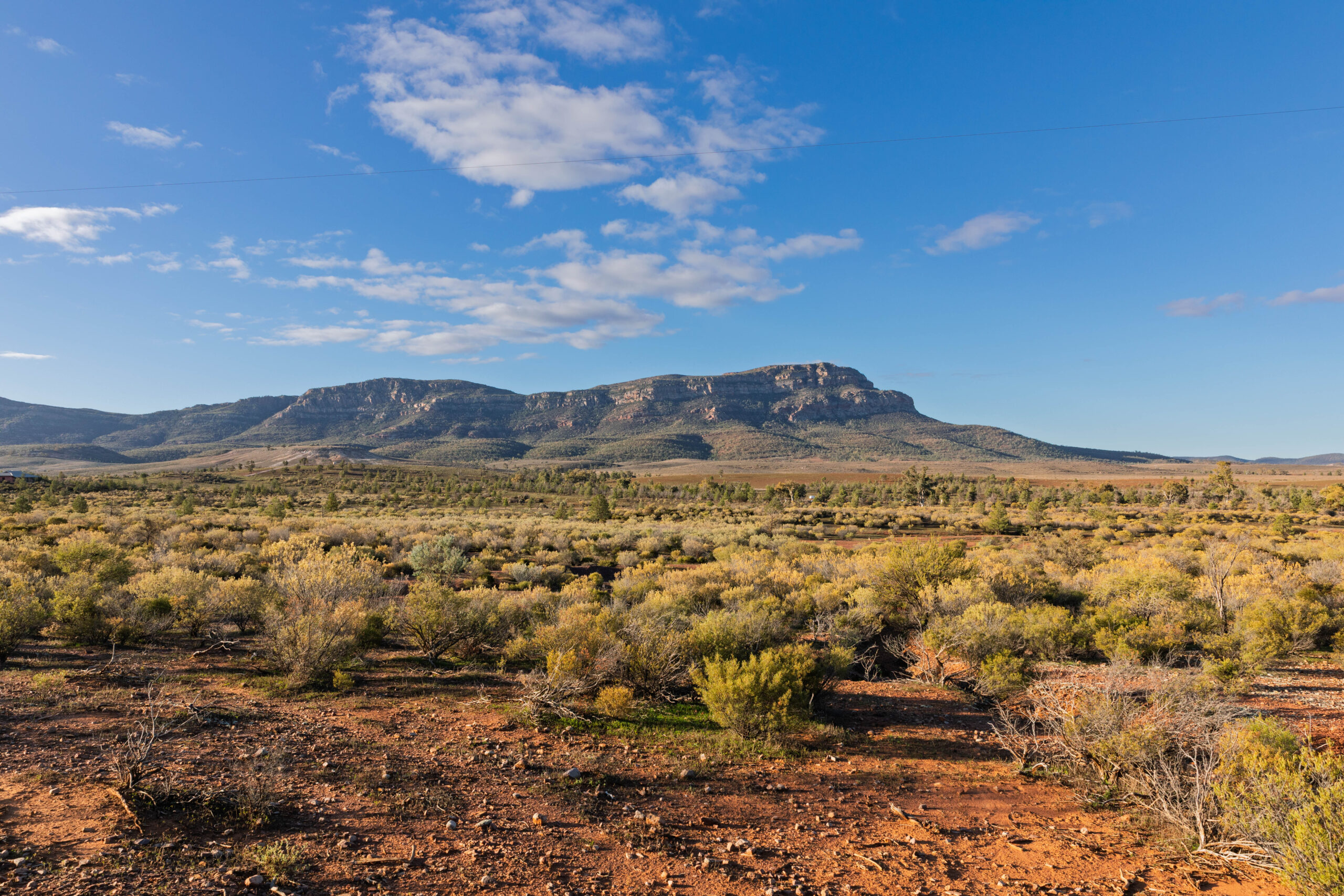
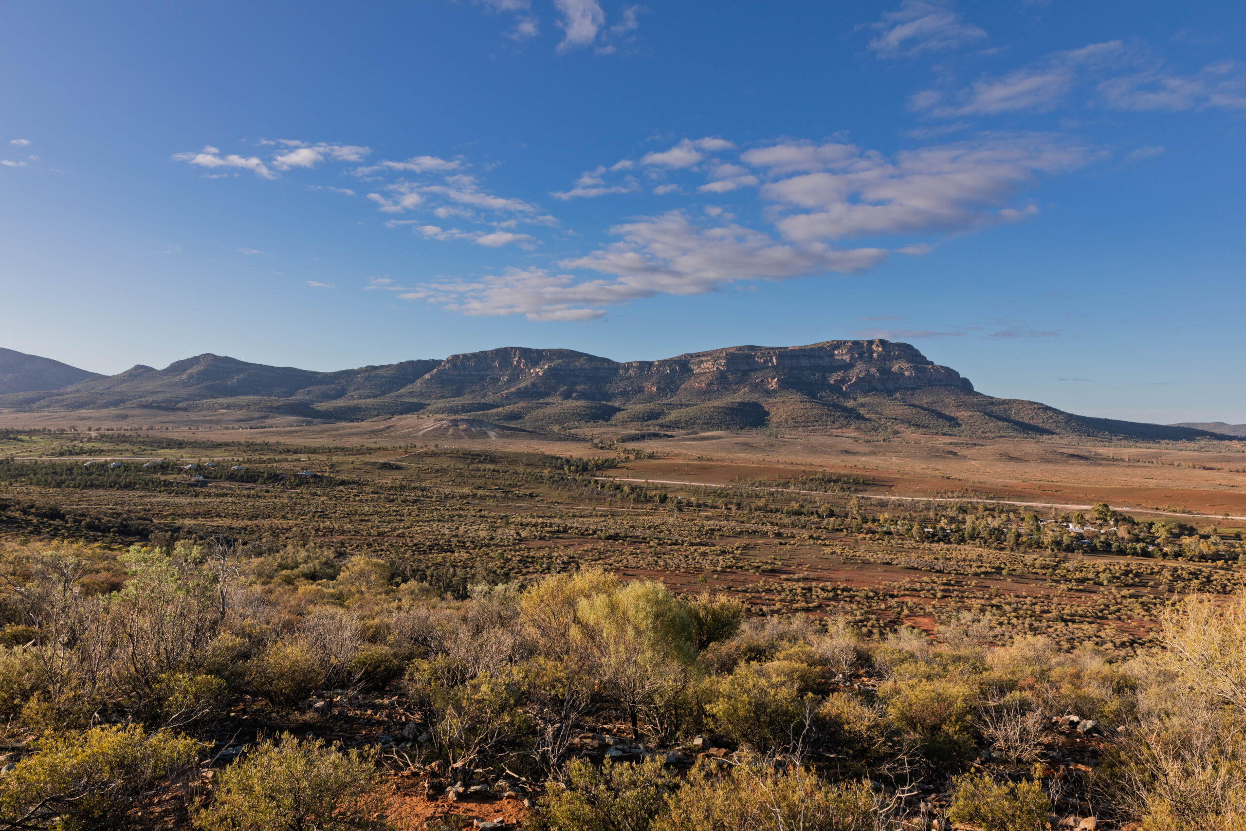
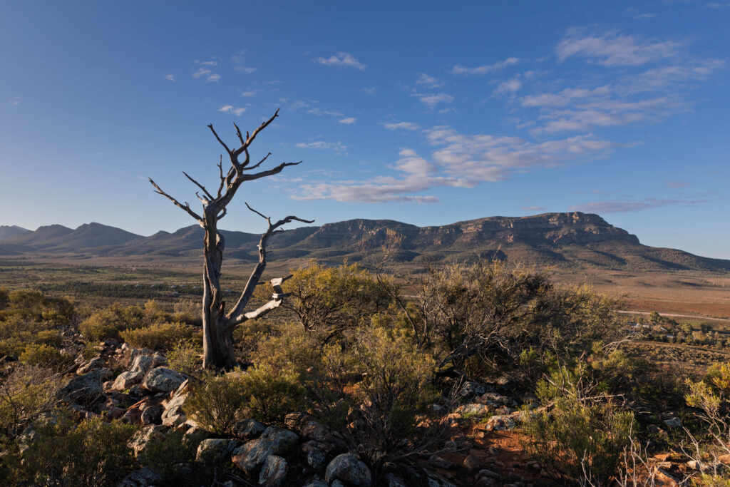
We drove through narrow leaved hop bushes (Dodonoea Viscosa) characterized by their sticky narrow green leaves that are perfect for surviving in the dry climate, before getting up close to the Chace and Elder Range. The range is composed of rock over 560 million years old. The ranges are spectacularly striped having been formed from sedimentary layers that were deposited when this region was covered by a shallow ocean 550-850 million years ago. I would describe the stripes as cream/yellow and red, but the guide tells me that the ranges consist of predominantly red brown Bonney Sandstone and orange red Rawnsley Quartzite.
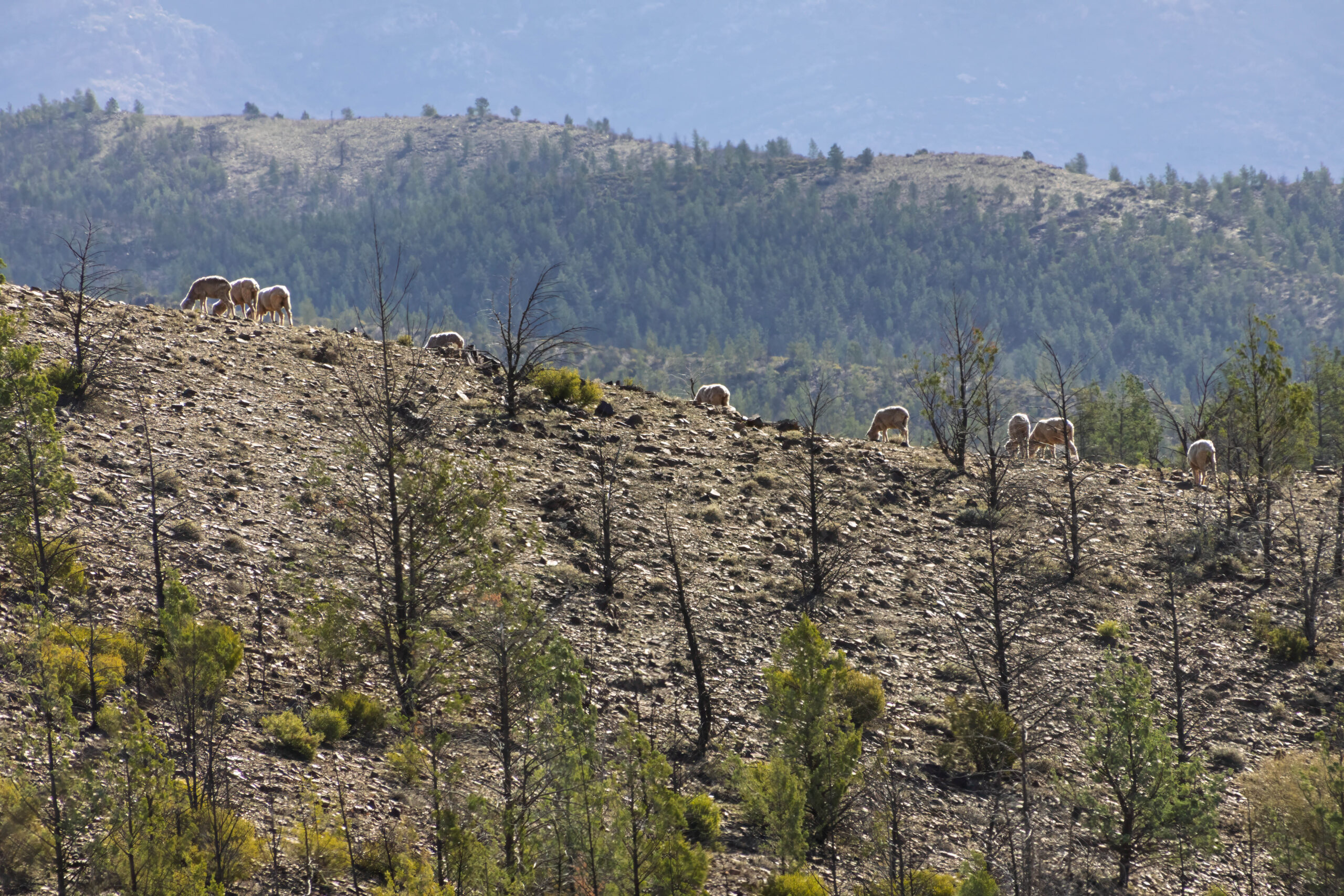
The vegetation changed again with the predominant tree being the black oak (Casuarina Pauper). These medium sized trees have dark grey bark and slender striated branchlets. The trees propagate readily from exposed roots and the sheep in the area will graze on the new growth if more nutritional feed is not available.
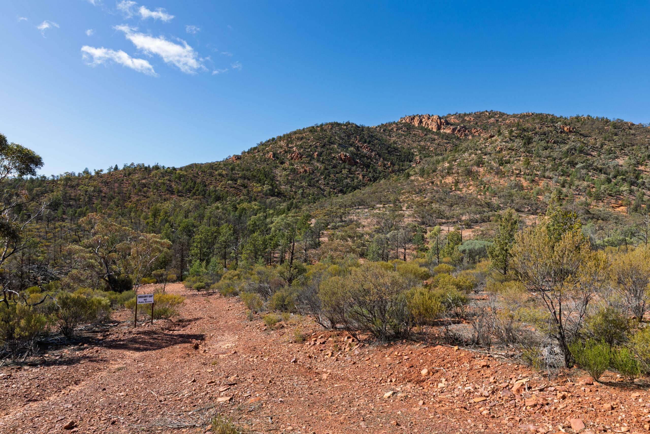
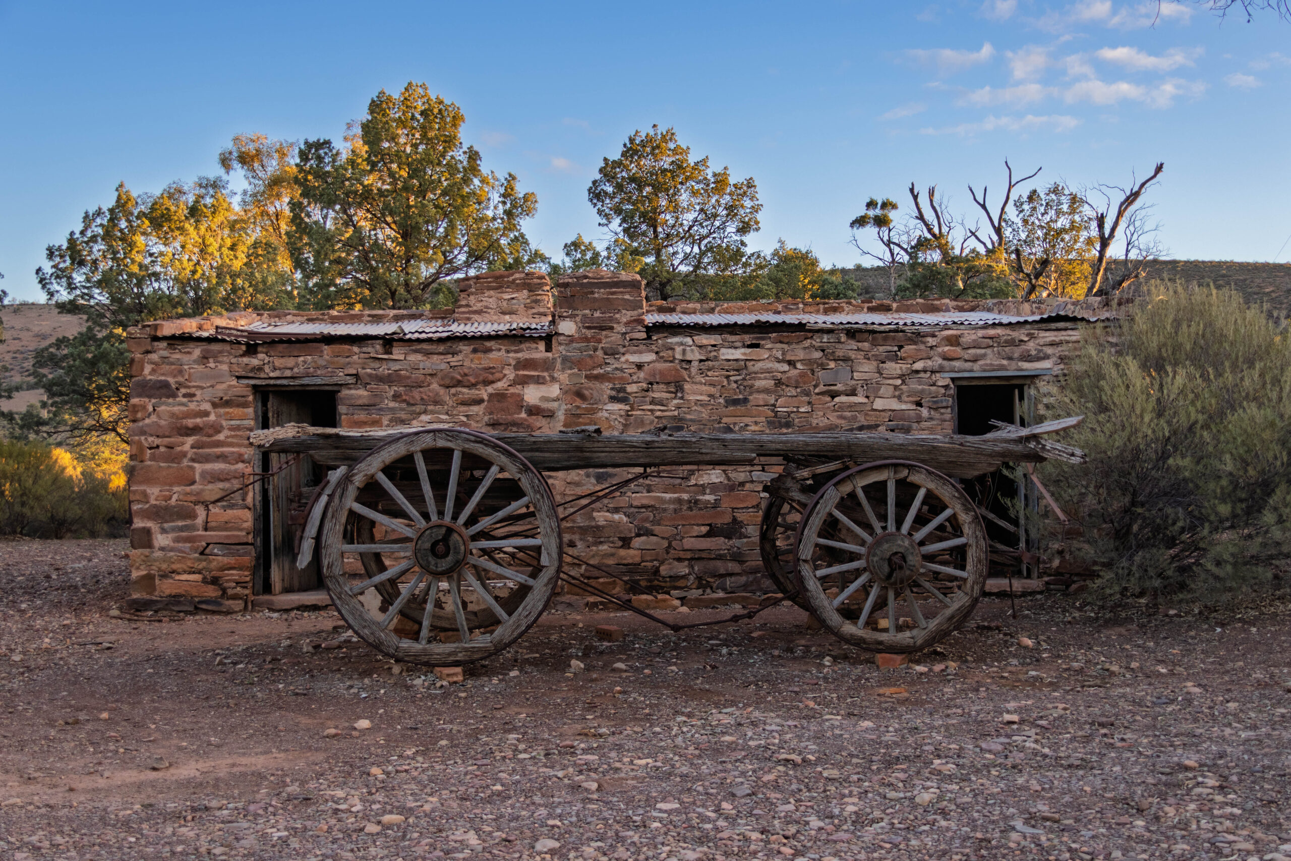
We arrived at Gregory Gap where Bernie put the drone up for its first flight on this holiday and took a few aerial shots of the gap. This gap in the Chace Range was exploited by brothers Ron and Jack Gregory in 1963 when they cleared a track to transport sheep to land they held on the other side of the range.
The next feature of note was a man-made one, the dog fence. These days it is an old and worn wire fence that wouldn’t keep anything out … or in for that matter. In the late 1800s it was built to keep dingoes out of the newly settled farming land. Between 1910 and 2000 dingoes were almost extinct in the Flinders Ranges but over the last two decades many sightings have been reported.
Driving through an area known as the Wonoka formation the vegetation changed again. The surface here is predominantly limestone approximately 570 million years old and bullock bush (Alectryon Oleifolius) a medium sized bush with dark grey bark and olive green foliage thrives here. This is another local plant that sheep will graze on.
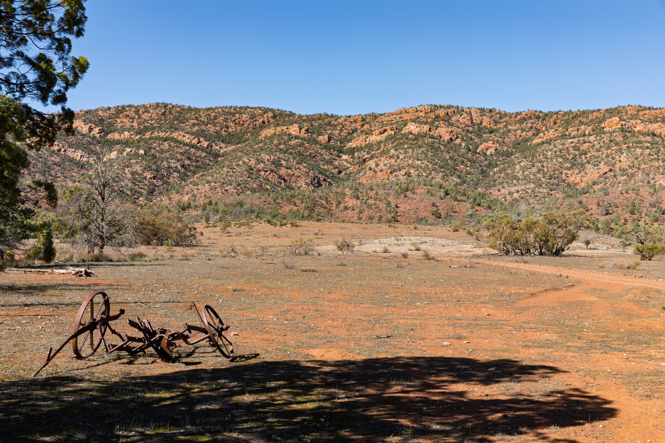
We arrived at the Jim Gehling Camp beside an ancient river red gum. Dr Jim Gehling is a palaeontologist who, together with other scientists, regularly camps here when searching the ridges of the Chace Range for Ediacaran fossils. These are the oldest known animal fossils from between 542 and 635 million years ago. They are mainly soft bodied ocean creatures like jellyfish, sea slugs, sea stars and work like organisms. No dinosaurs here!
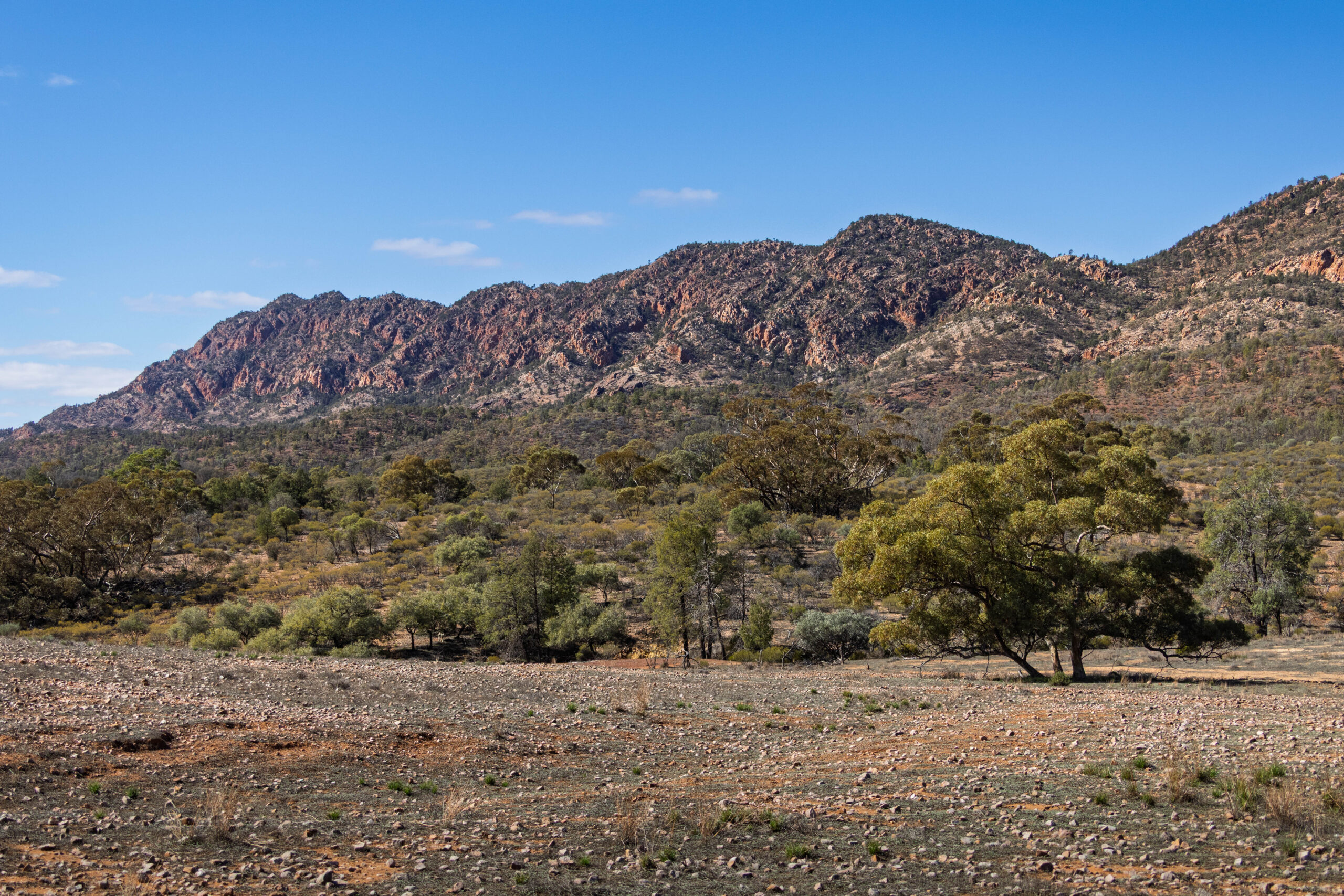
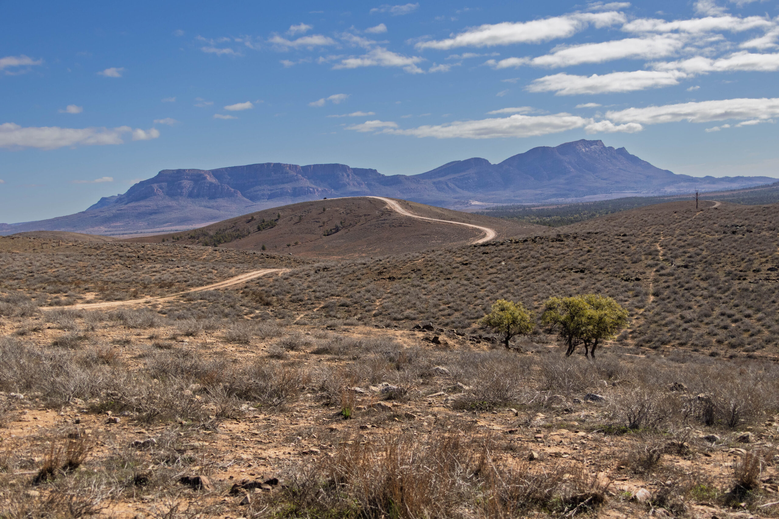
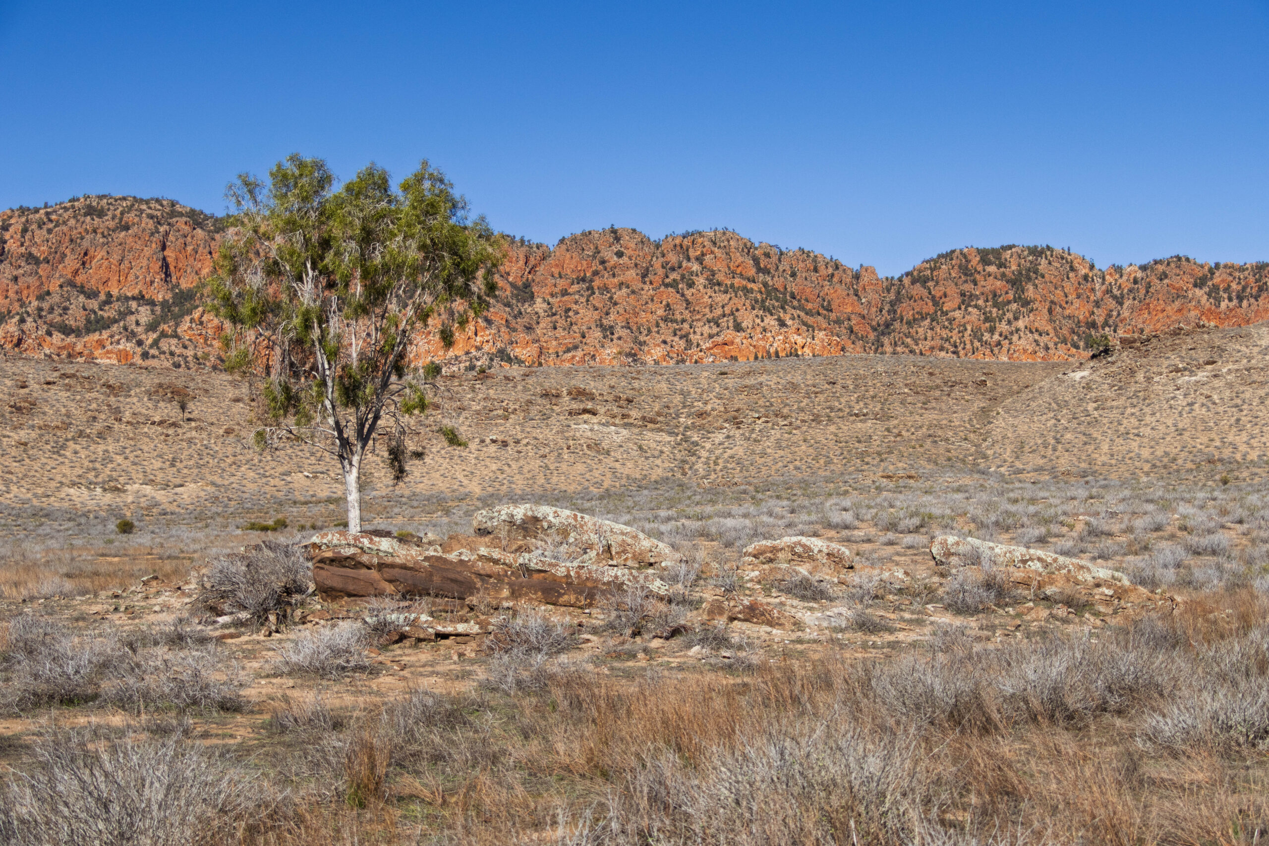
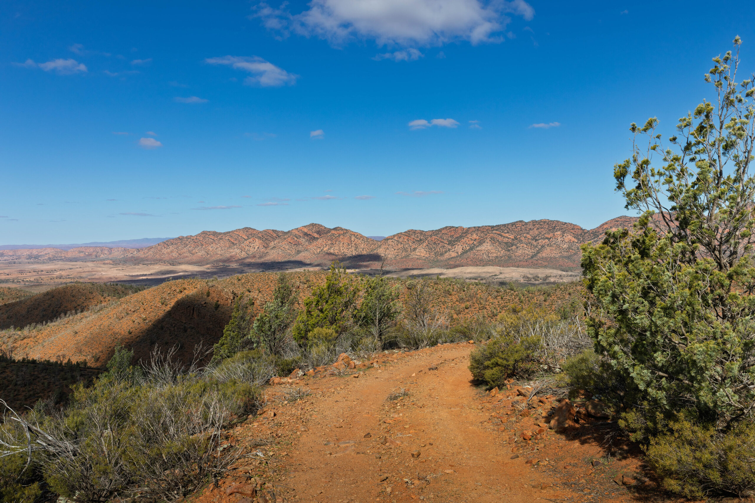
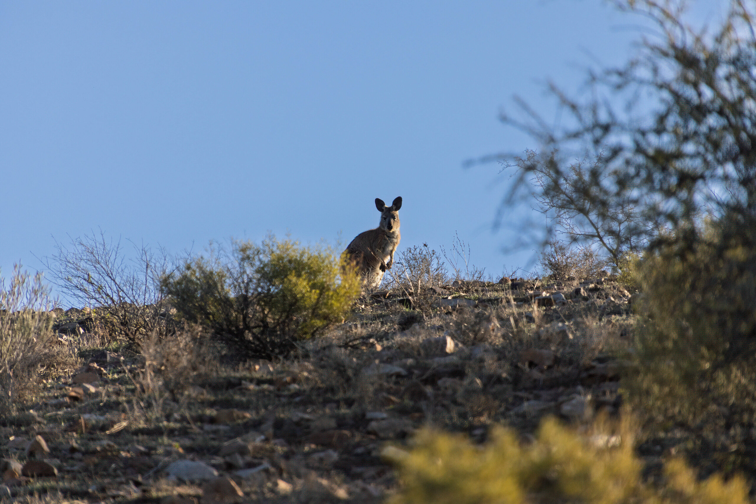
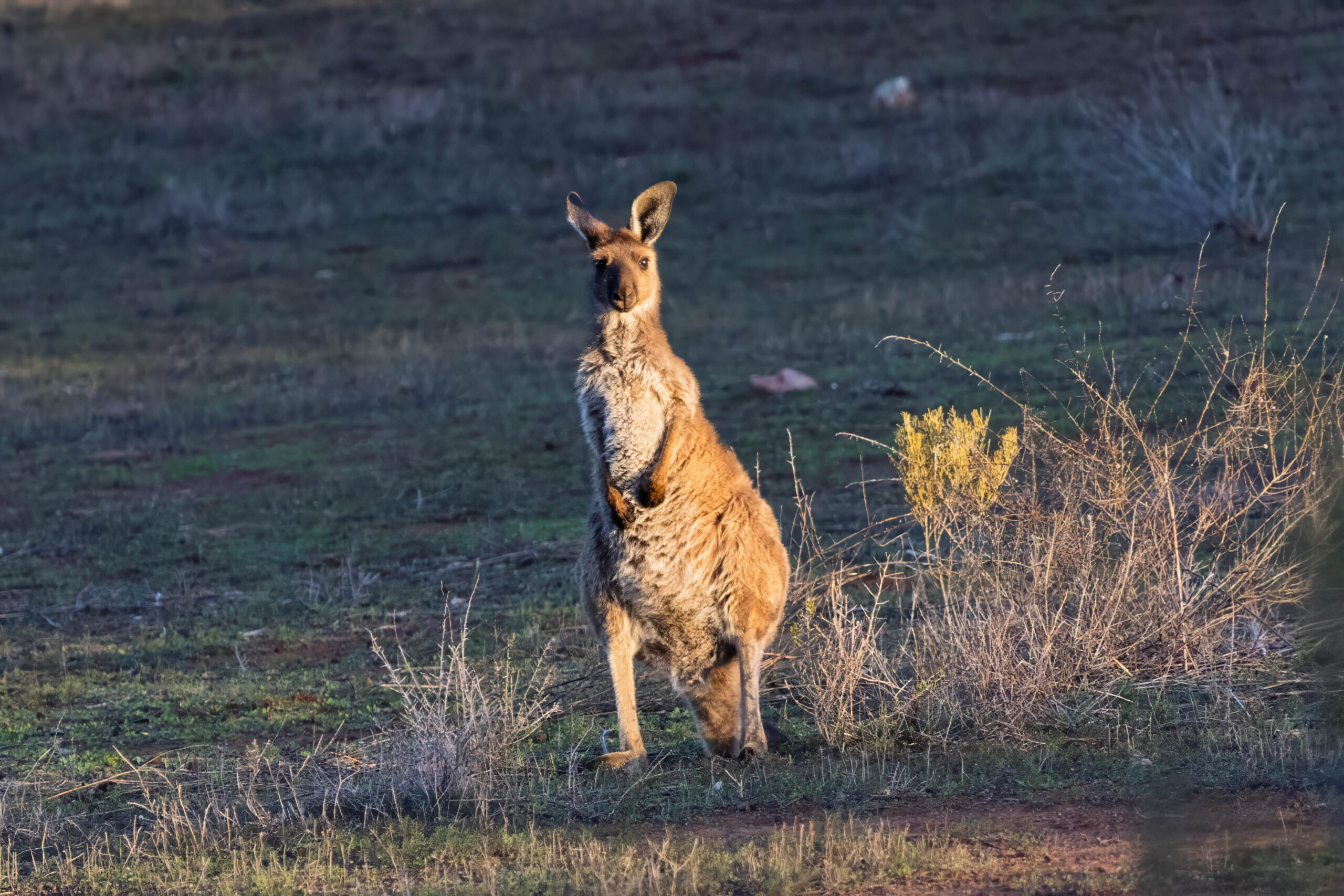
At Martins Well Road we reached the end of the yellow track. We turned left onto the road heading west. As Bernie drove, I spotted a lone tree on an outcrop of rock with the gloriously striated Chace Range behind it. Stop, stop, stop I said. Photo op! I jumped out of the car and tramped around in the saltbush looking for the right vantage point. I snapped a couple of photos then started tramping back towards the truck. My efforts disturbed a kangaroo (or other macropod?) which jumped up out of the brush and bounded away. I did feel bad about disturbing it from where it was snoozing its day away in the sun.
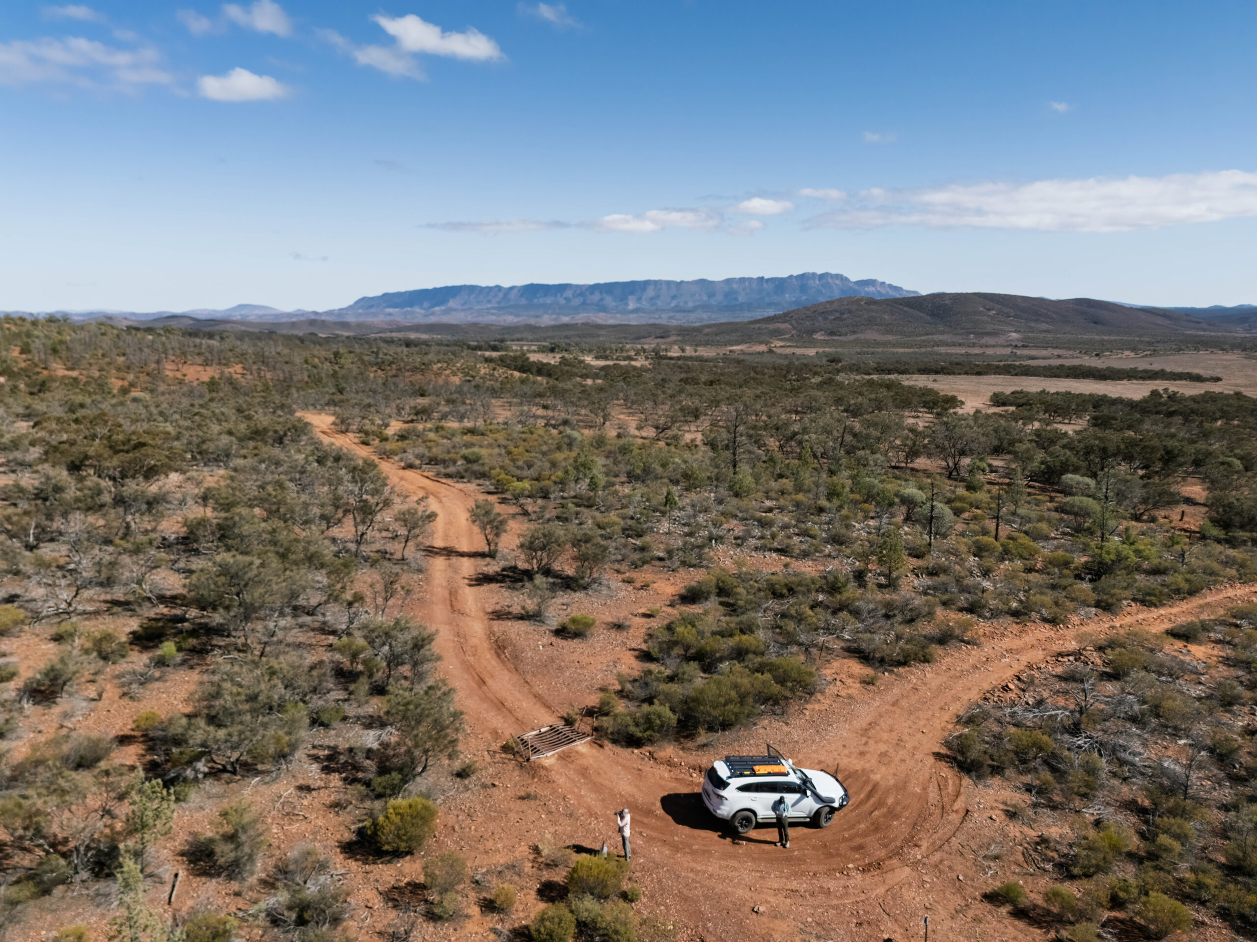
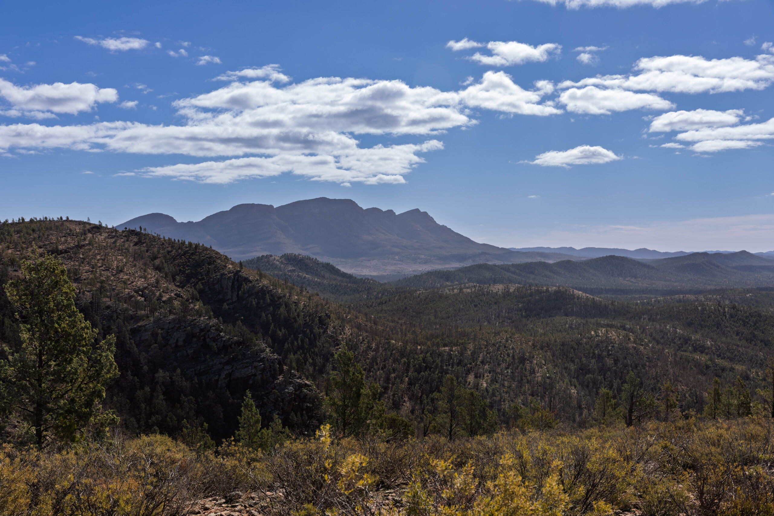
We passed the end of the red track to drive up Pugilist Hill, before commencing the more difficult part of our 4WD. Although the hill is not very high, the 360 degree views were fantastic. From the top we could see the 17 kilometre stretch of Wilpena Pound, Rawnsley Bluff and Red Terrace and the Chace and Elder Ranges. While we were stopped here we decided to make it our lunch break. Bernie put the drone up again to take photos of us having lunch, then he set it to ‘droning’ while we ate. Apparently this is a legitimate function of the drone where it just flies about in a set pattern filming. To me it just seemed like we were eating lunch with blowflies buzzing around, but without the actual blowflies getting in our faces, ha, ha! Oh, and why is it called Pugilist Hill? In the early 1930s two station hands had a fist fight on the top of the hill.
After lunch it was time to undertake the more challenging red route. It started out gently enough driving through a forest of pine trees. We soon arrived at the 4WD gate where our self guided booklet and map told us that we were at the beginning of the steep ascent to Prelinna Lookout. ENGAGE 4WD INTO LOW RANGE it added. I jumped out with the red key to open the gate and then close it again behind the truck.
As we climbed the hill I was able to look at the lichen on the pine trees that our guide mentioned while Bernie was busy keeping the truck on track! Orange lichen grows on the pine trees on the shaded southern side of the slope. Apparently this lichen breaks down the wood and bark of the pine trees replenishing the topsoil with nutrients.
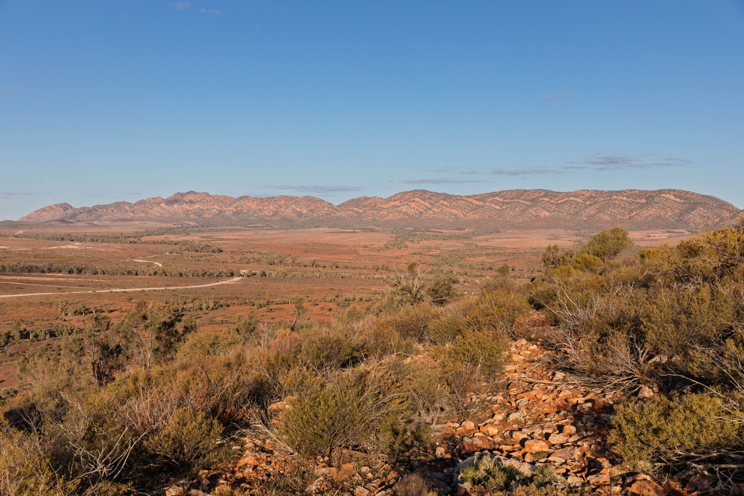
We reached Prelinna Lookout at 680 metres above sea level. More beautiful panoramic views of the central Flinders Ranges, including Wilpena Pound, the ABC Range, Heysen Range, The Bunkers, Druid, Chace, Yourambulla and Elder Ranges. The guide invited us to sign the visitor’s book in the letterbox. Oh dear, despite the book being in a somewhat tattered plastic bag, it was very wet and soggy after the recent rains. I managed to make a legible entry in the book, despite the pages being a bit fragile. We hunted through our gear and found a ziplock bag to replace the holey supermarket produce bag the visitor book was in. Hmmn, not entirely sure if that was a good thing to do or not, or if the book will just sweat more now the plastic bag can’t breathe??
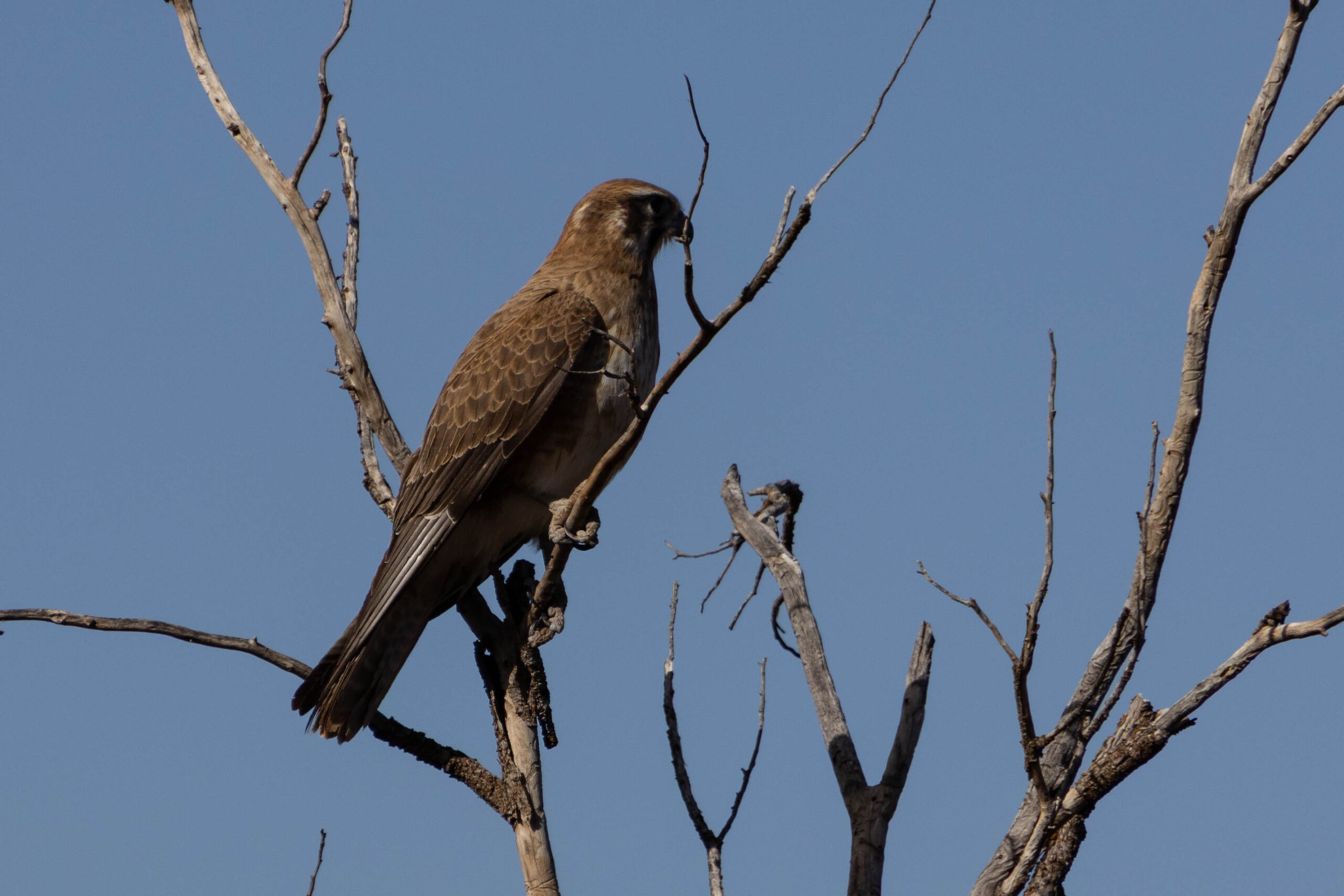
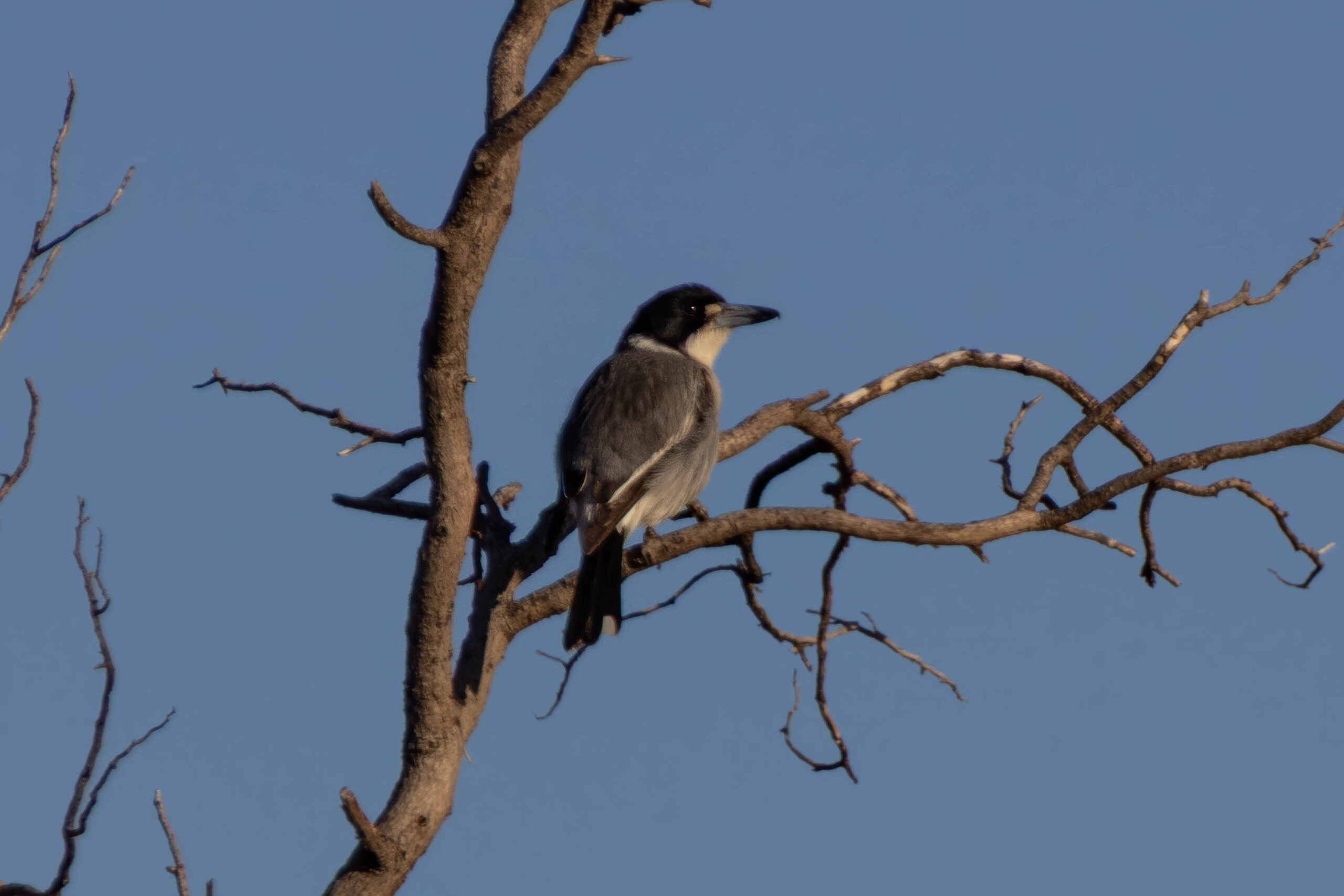
What goes up, must come down, and we were now on the Prelinna Descent. As we made our way down the hill we spotted a whistling kite in a tree by the roadside and managed to snap a photo before it flew off. We also spied a macropod hopping off to the side of the road far too quickly to decide what type of jumping marsupial it was?? In the visitor book someone had made an entry saying they had seen a yellow-footed rock-wallaby on their ascent to Prelinna Lookout. We were somewhat skeptical because we’re not sure this is actually rock-wallaby territory??? I’m just going to stick with recording a general Macropod sighting.
After some fairly exciting driving up and down big red hills we found ourselves at the Wilpena Creek Lookout. From this vantage point we could see, in the middle distance, the line of river red gums that follow the line of Wilpena Creek, with the bald red hills of Upalinna behind. Wilpena Creek is a major creek in the area flowing from Wilpena Pound to Lake Frome which is to the south of Arkaroola.
Reaching the bottom of the hill we made our way along/across Baldoura Creek before reaching the exit gate. Once again it was hard to imagine that this creek was flowing about 10 days ago as it is now completely dry again. We made our way through the gate, stopping on the other side to put air back in the tyres before returning to Rawnsley Park Station via Martins Well Road and Hawker-Wilpena Road.
All of this four wheel driving had been marvellous for our goals, with our Move and Exercise goals achieved hours ago, ha, ha. I mean we did get out of the truck a couple of times but we certainly did not exert ourselves enough to legitimately earn these goals! That being the case we decided that we should go for a walk on one of the tracks behind our cabin.
It was nearly 4.30pm so we couldn’t go far with sunset tonight at 5.37pm. We didn’t want to be stumbling around out there in the dark! We decided to do the gentle climb to Alison Saddle. Although not very high the elevation provided us with more excellent views of the countryside. With the light still good, we decided that we would walk to the top of the hill on the Pines Cave Trail. If we had started this walk earlier in the day we would have been able to complete a two-hour loop walk by combining these trails. After admiring the views from the slightly higher elevation we made our way back down to our cozy cabin for the evening.
Studying the Rawnsley Park Station ‘Walking and cycling trails’ guide we have learnt about Euros … Macropus robustus, not the currency of Europe!! The guide says that these can be seen grazing the lower hills country of Rawnsley Park, particularly in the late afternoon on the walking trail to Alison Saddle. So … that is almost certainly the macropod we saw on the walk we took this afternoon. But were the macropods earlier today also Euros or were they Western Grey Kangaroos (Macropus fuliginosus)?? They look VERY alike so very difficult for a layperson to differentiate, especially at a distance and/or moving.
At 6.00pm Bernie collected our pizza for dinner tonight from the Woolshed Restaurant. We followed that with the Drumsticks purchased yesterday afternoon. Not very healthy! And … we probably didn’t even earn a slack dinner with the amount of effort undertaken for today.
Steps: 17,191 (11.81kms with only 2.56kms on our actual feet!)