Wednesday, 22 October 2025
When we checked out this morning, I took the key and the plastic display holder I had broken down to reception. There was no-one on reception, so I picked up the phone as per the instructions. The phone rang and rang and rang before eventually being picked up by someone (David and Rainbow’s teenage son possibly?) who sounded very much like he had been asleep. I explained the situation and he was like – don’t worry about it. So, I deposited the broken plastic notice holder on the desk and we headed off.
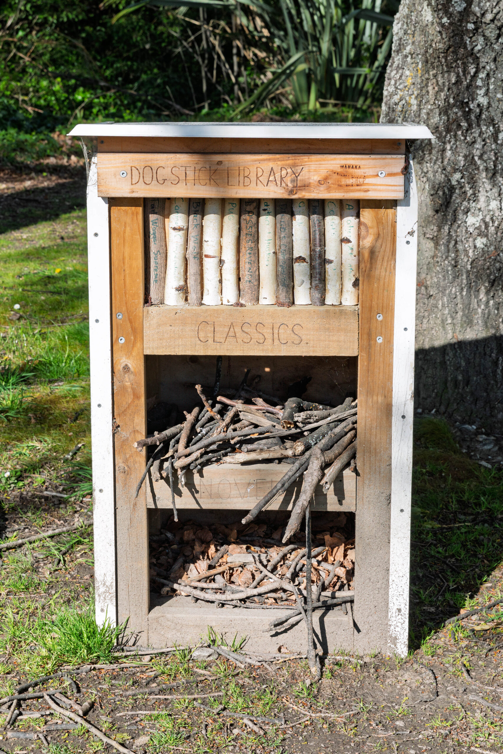
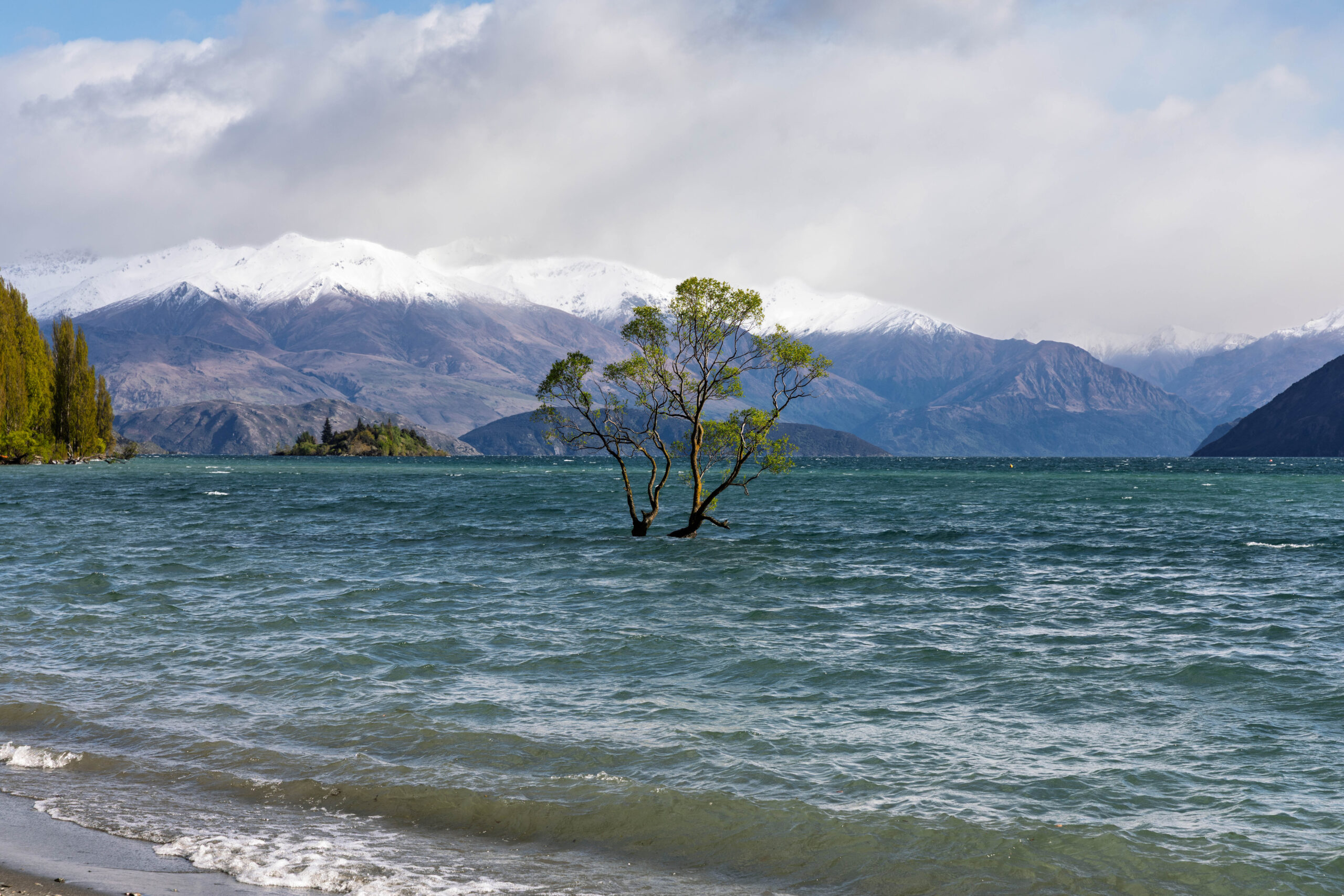
Our first stop was back down at That Wanaka Tree … just in case the mountains behind the tree were looking clearer this morning. What we did notice on our way from the car park to the tree was the Dog Stick Library which we both thought was pretty funny. Arriving at the lakeside the tree, the lake, the mountains all looked much the same as yesterday. We snapped a couple more pics anyway, before programming the SatNav for Lake Tekapo.
We headed out of town past the Transport & Toy Museum, before turning off onto State Highway 8A to travel along the northern side of the Clutha River. When we arrived on Monday we were travelling along the southern side of the river, on State Highway 6 between Queensberry and Wanaka.
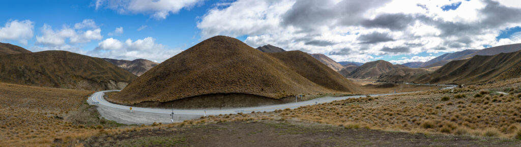
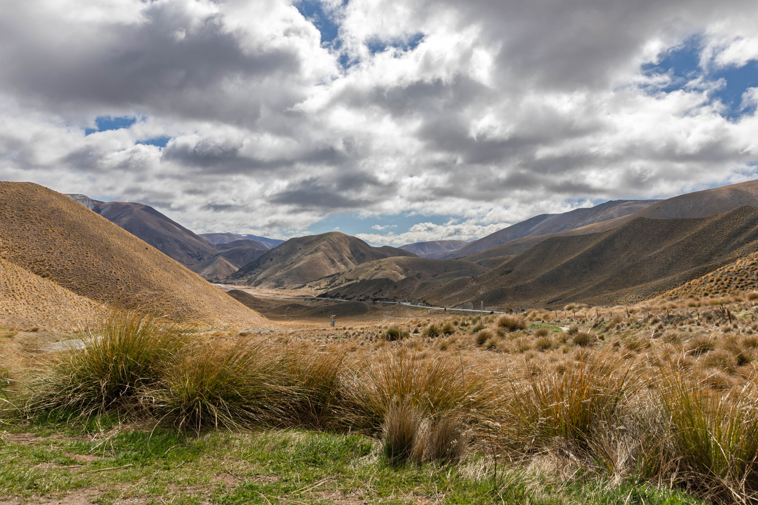
At Tarras we reached a T-intersection where we turned left on State Highway 8. Our journey was very up and down over mountains and through the Lindis Valley. After about an hour on the road, we climbed up to the Lindis Pass where we stopped at the Summit Lookout to take a few photos.
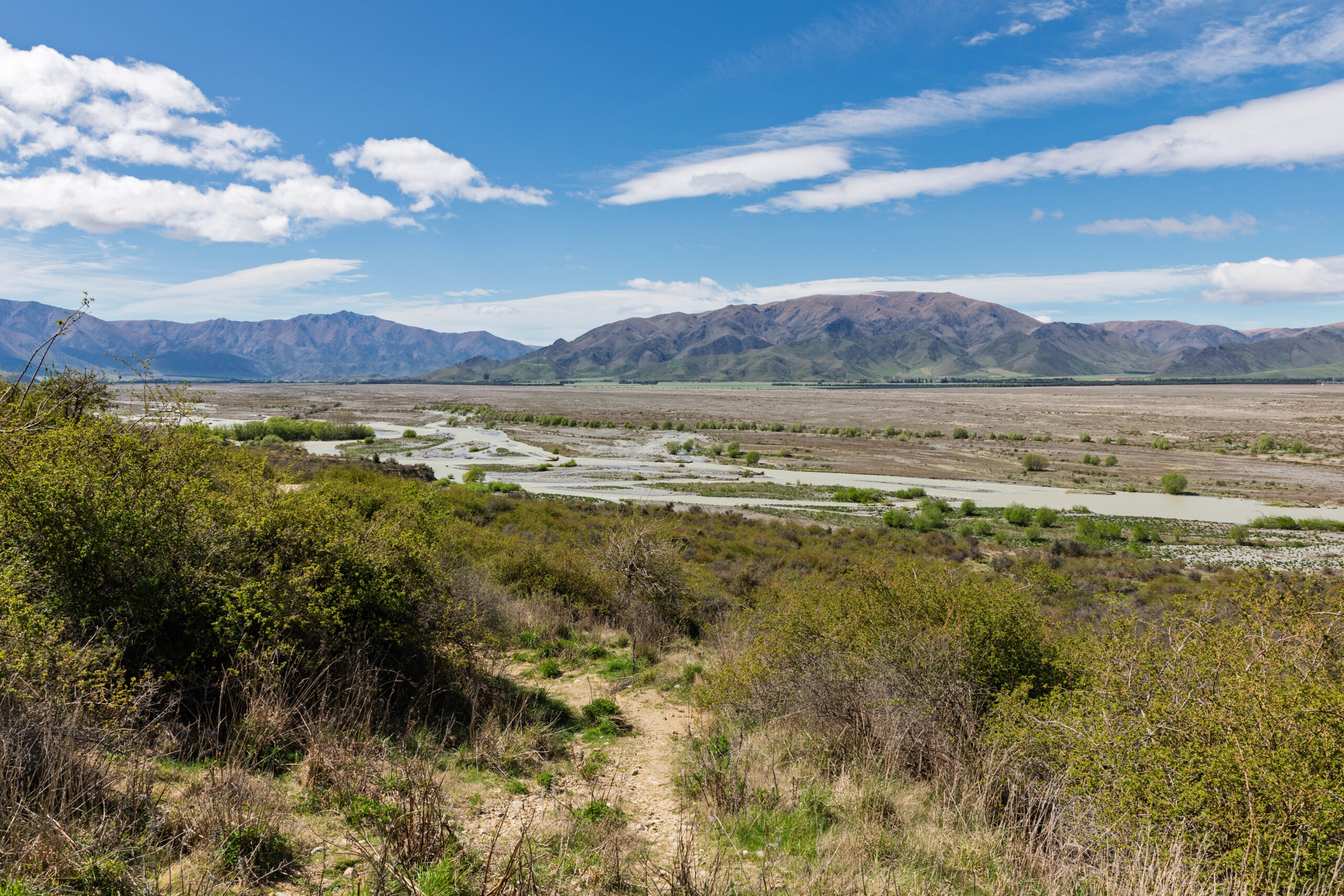
Continuing on State Highway 8, we turned westerly to travel alongside the Ahuri River and through Omarama. On the northern outskirts of Omarama we spotted a sign for the Clay Cliffs Scenic Area. OK, the sun is shining and we have time for sightseeing, we might as well check the cliffs. Something different from lakes and snow covered mountains!
We turned off onto Quailburn Road and then onto the unsealed Hepburn Road. After about six kilometres we found ourselves at a gate telling us that the cliffs are on provide land and we need to put $10.00 into the honesty box to drive the last four kilometres to the car park. We didn’t have a problem with paying except that we only had $20.00 notes. Ah well, $10.00/head isn’t too bad. Bernie put $20.00 in the slot.
There was another car in front of us and they were stuffing around about whether they were going in or not, so I got out to open and close the gate. While I was opening the gate, Bernie told the young couple in the car in front that we had paid $20.00, they could head on in on us. Even then they were dithering but did, eventually, drive through after Bernie and I closed the gate.
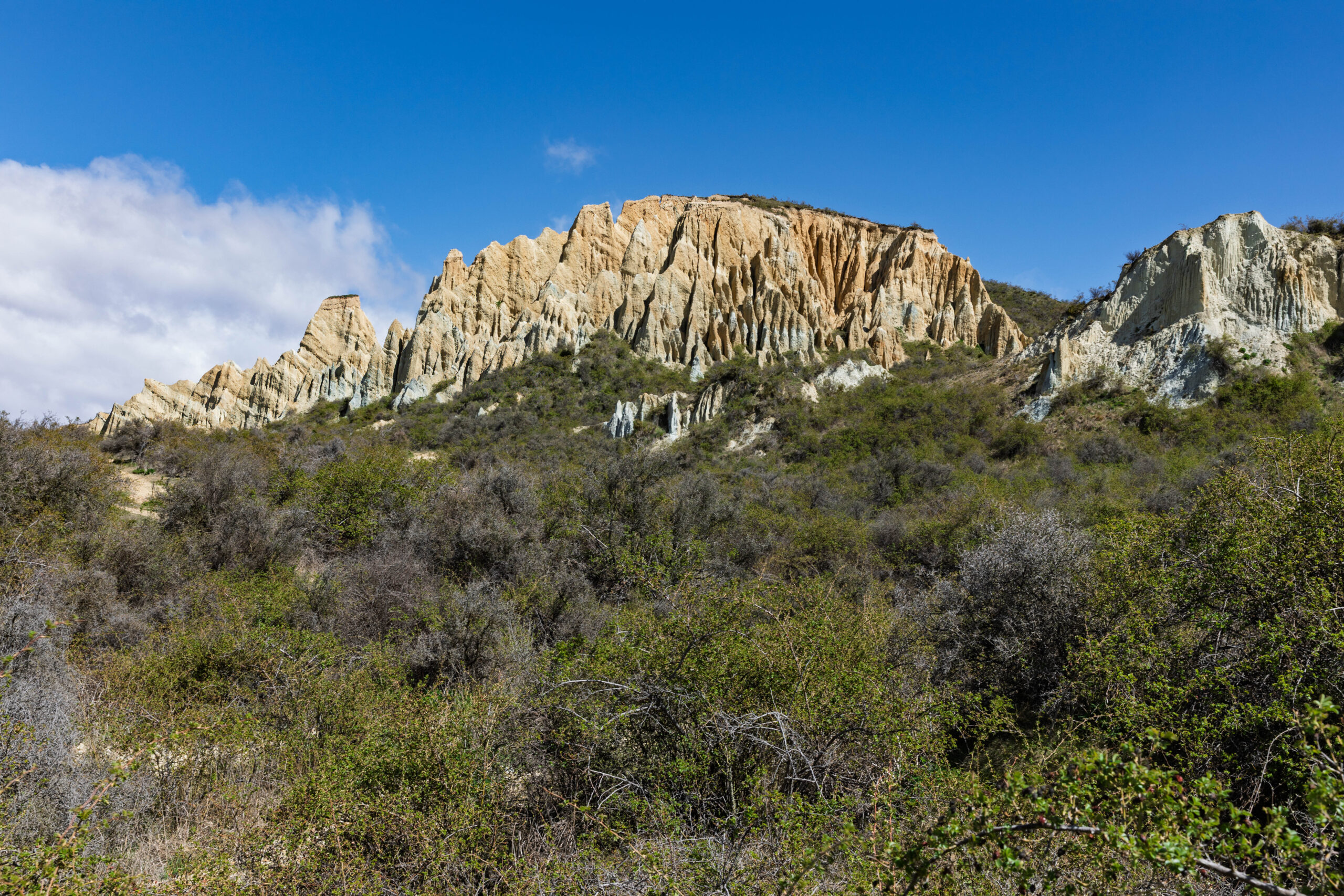
As we were driving out, we were starting to wonder if we were going to get our money’s worth?? There were lots of sheep and cows on the farmers land, but we were not seeing much evidence of the cliffs on the road in. Arriving in the car park was a relief, because we could see some of the tall pinnacles from there.
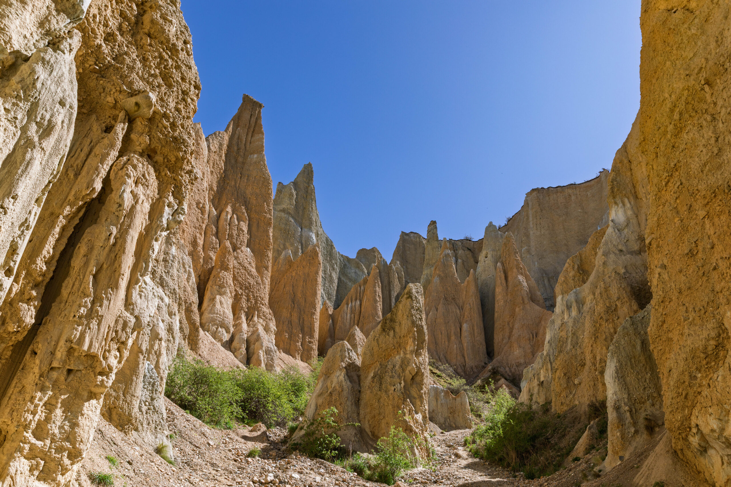
We read the information board, learning that the Clay Cliffs are a classic example of a ‘badlands’ terrain, with steep-walled box canyons and numerous towers and pinnacles. The Clay Cliffs have developed in a tilted sequence of weak, sedimentary deposits. The grey and white sandstone and clay stone formed in an ancient lake that once existed in this area. The yellow and brown layers are gravel conglomerate with silt layers deposited by an ancient river. The erosive action of wind and rain over many thousands of years has created the landscape we see today.
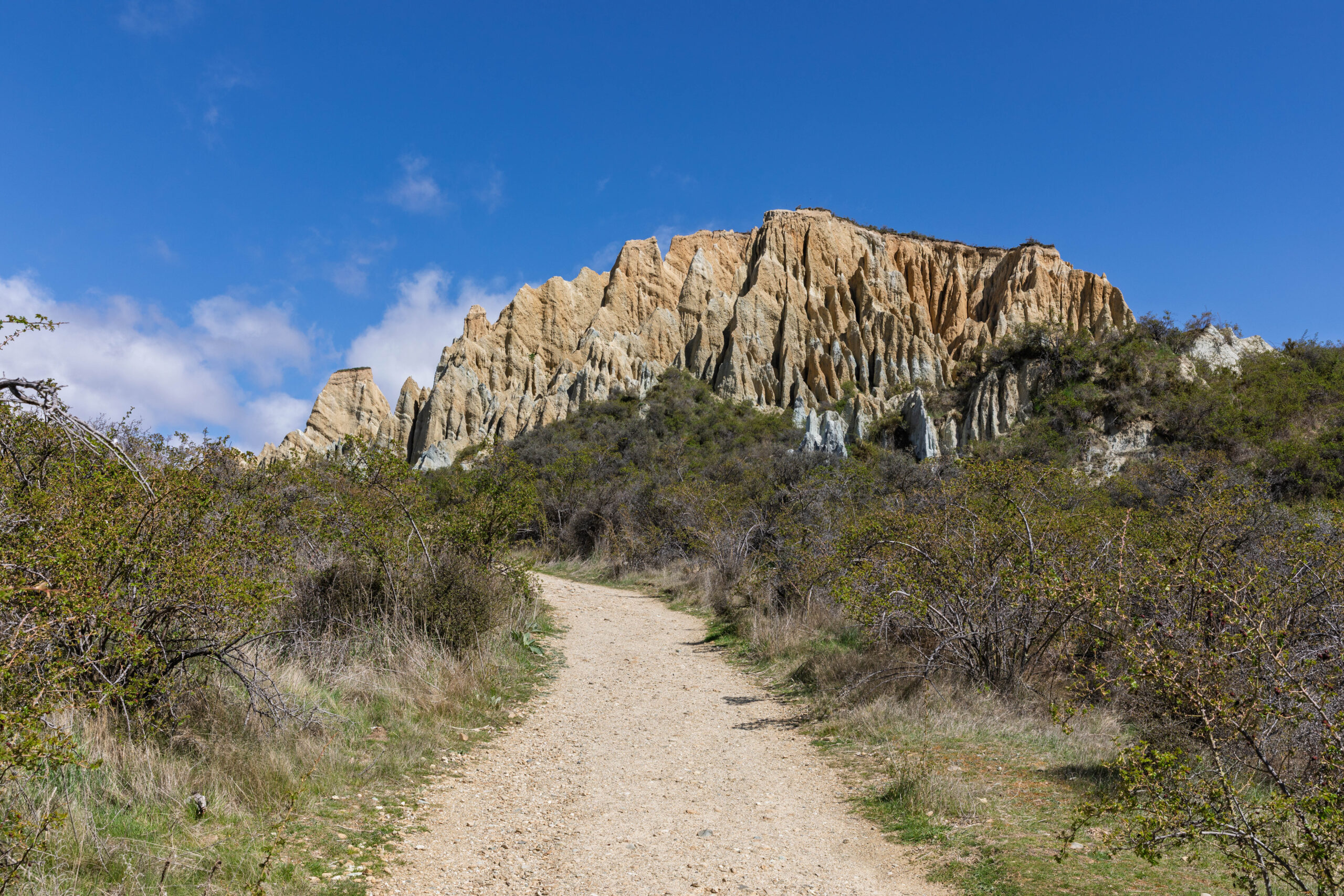
Although we could see the formations from the car park, we took the short walk along the cliffs to see the whole landscape. The formations were a bit otherworldly and reminded us of the landscape at Mungo Lake in Australia and a little bit of the Fairy Chimneys in Cappadocia, Turkey. At the end of the walk we entered one of the canyons where we were surrounded by these strange clay cliffs. There were lots of birds making good use of the pits and holes in the cliff faces for nests.
We re-traced our steps to the car park and then drove back to the main road. We crossed the Ohau River and saw the Ohau Canal that the carries water to the power station on the bank of the river. Arriving in Twizel, we found our way into the town centre and quizzed Syri about cafés, with her suggesting Mint Folk & Co. We parked the car within metres of the spot that Syri had pinpointed as our destination. I was pretty confident that we would be able to find it with our eyes. Bernie checked back with Syri. With his eyes on his phone screen Bernie said, I think we might be going the wrong way. Um, no, I said pointing, it’s right there in front of us.
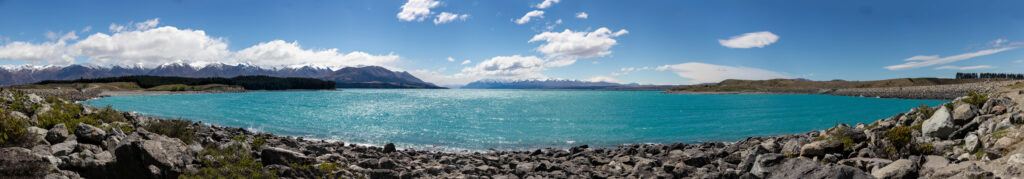
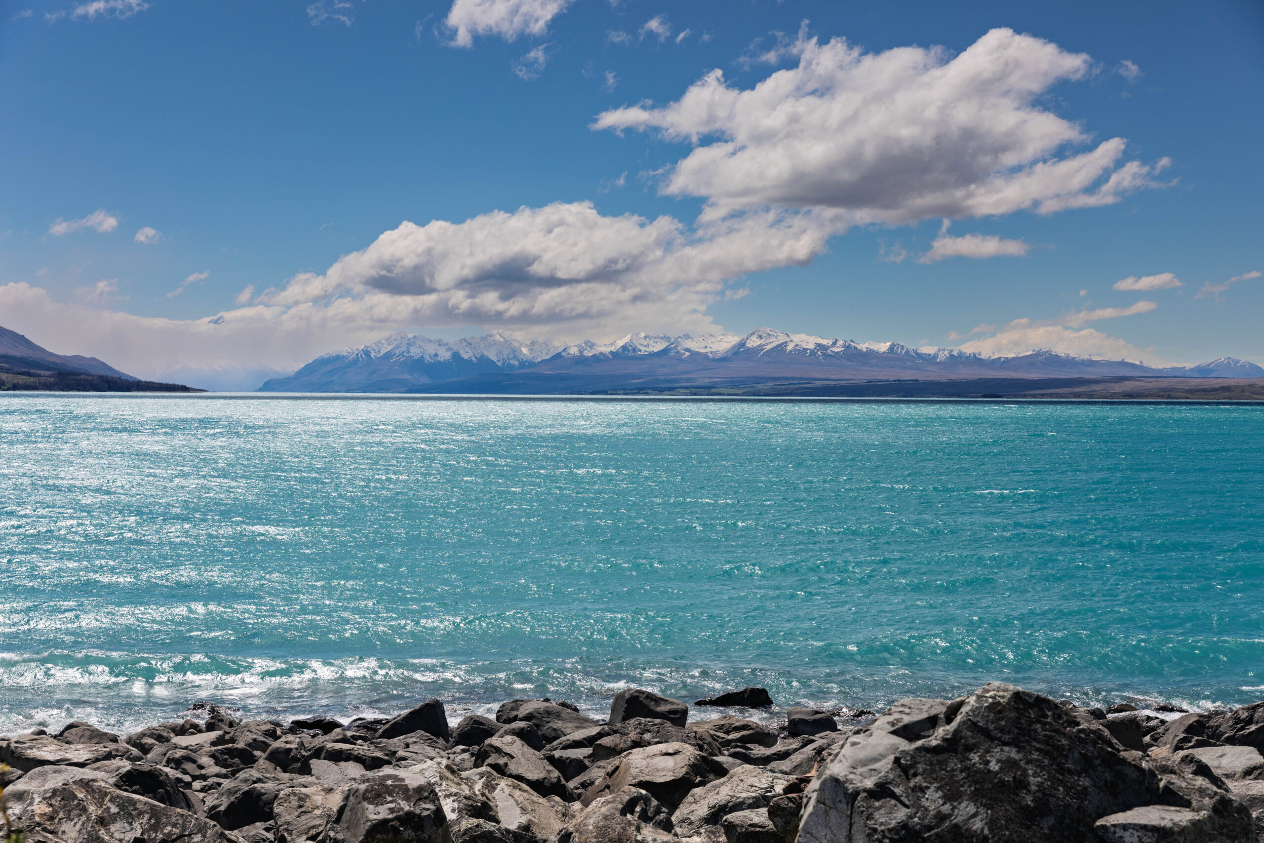
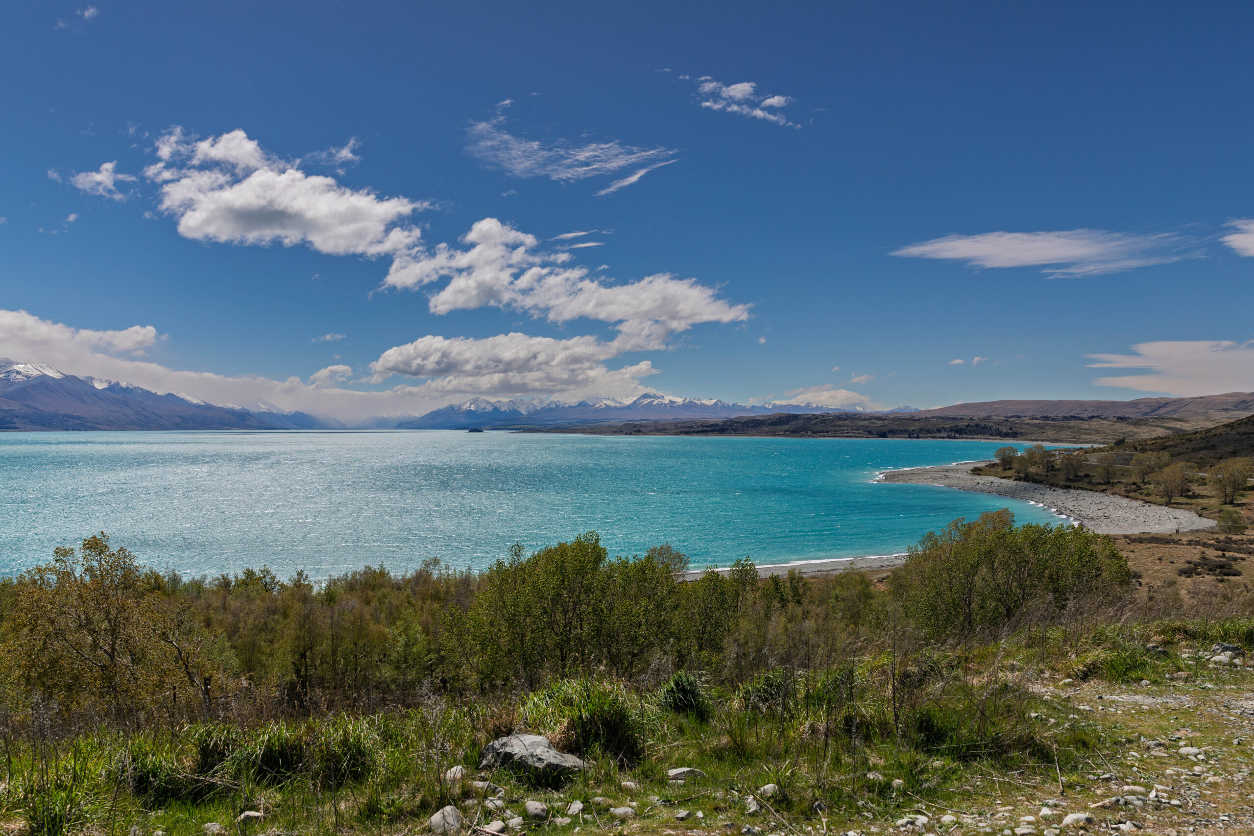
After lunch we continued to Pūkaki, at the southern end of Lake Pūkaki, where we turned left towards Lake Tekapo. We stopped to take a number of photos towards Aoraki/Mount Cook, from various scenic lookouts around the end of the lake. We think we were seeing the Ben Ohau Range on the left and the Burnett Mountains on the right of the lake, with Mt Cook nestled between and behind them obscured by cloud??
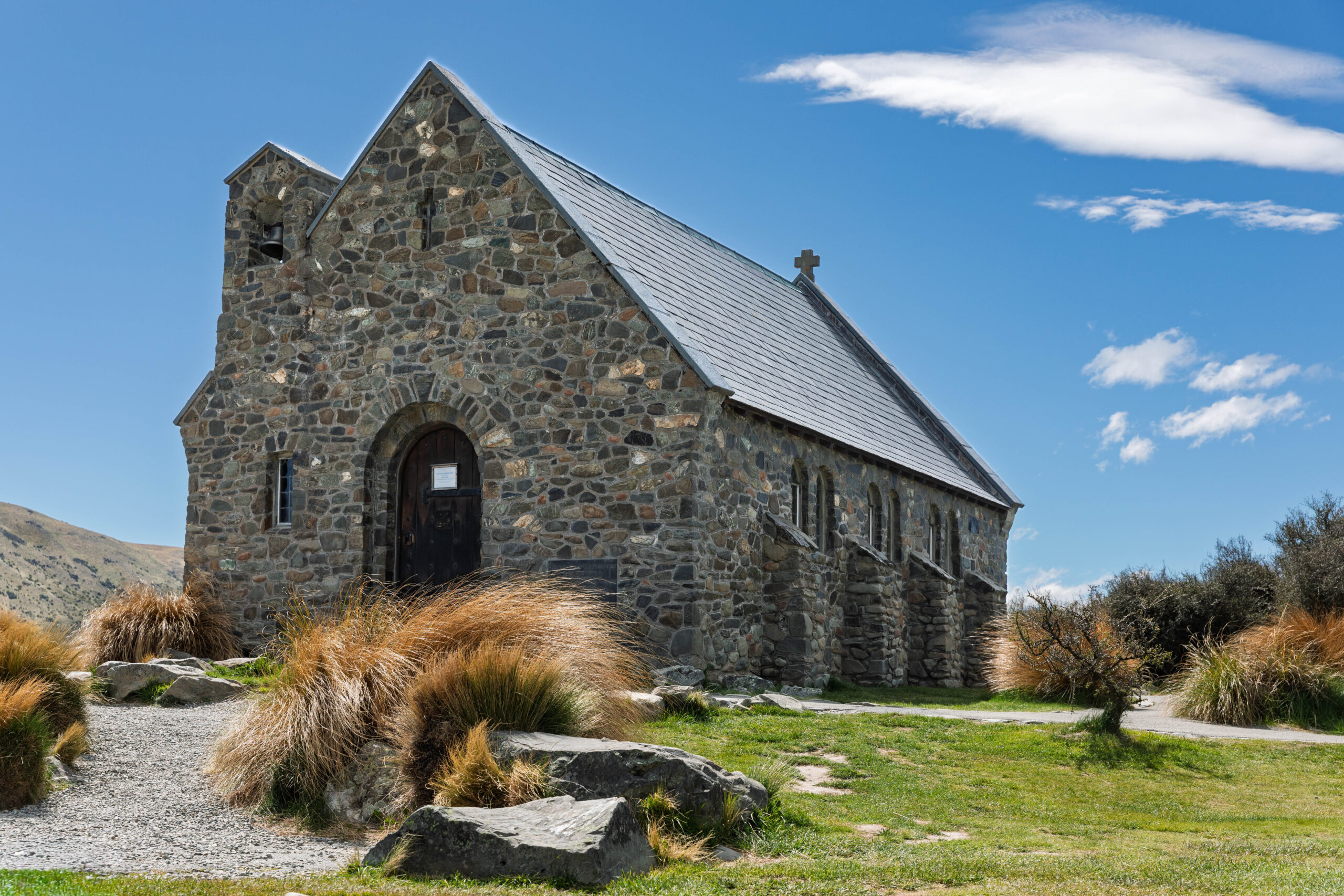
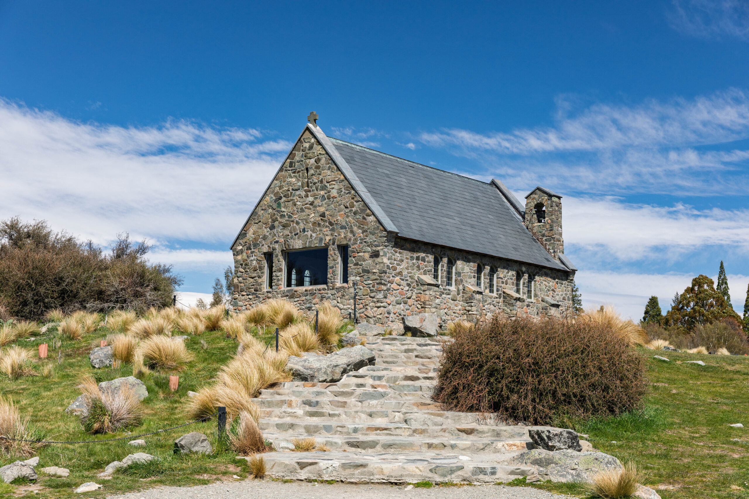
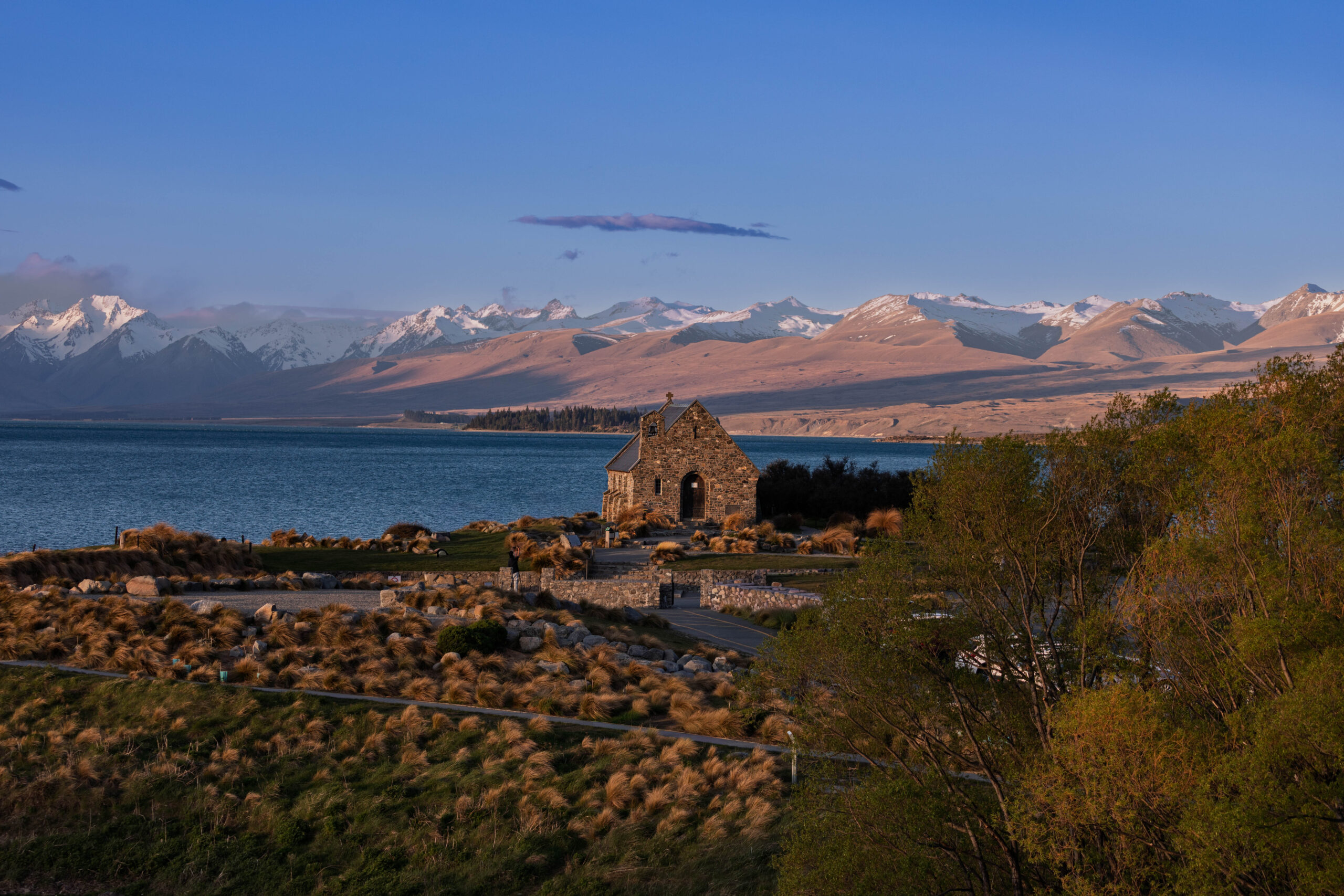
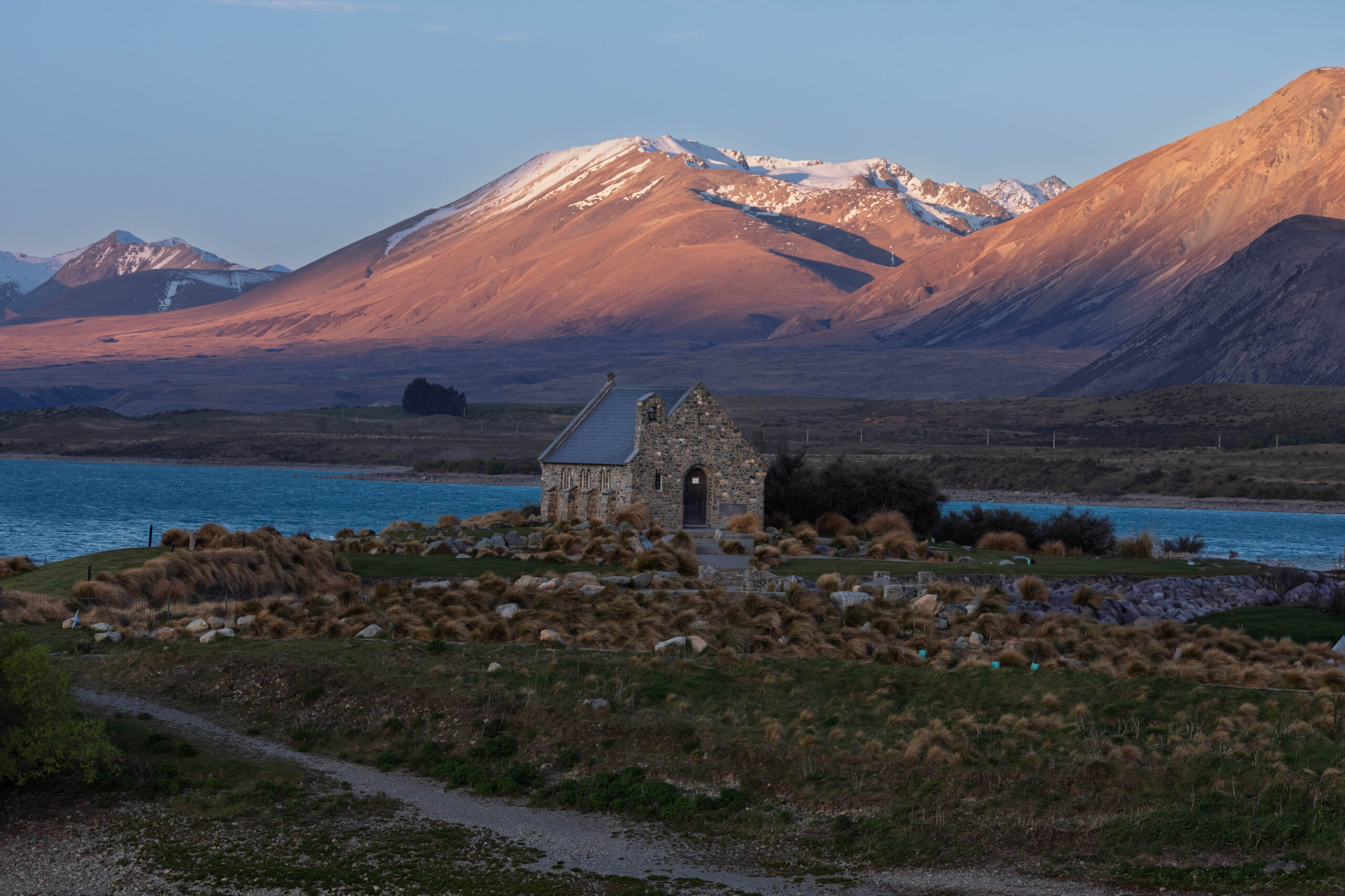
We struck off around Mount Mary and Mount McDonald, crossed the Tekapo Canal and made our way into Tekapo. Bernie had chosen the Church of the Good Shepherd as our destination, so we drove through town and parked up at the church. Opened in 1935 the Church of the Good Shepherd was designed to give the impression of quiet strength and simplicity to embody in the building the essential qualities of the early settlers who endured the tough Mackenzie Country environment. The modest stone church was built firstly to the glory of God and secondly, as a memorial to the pioneers of the district.
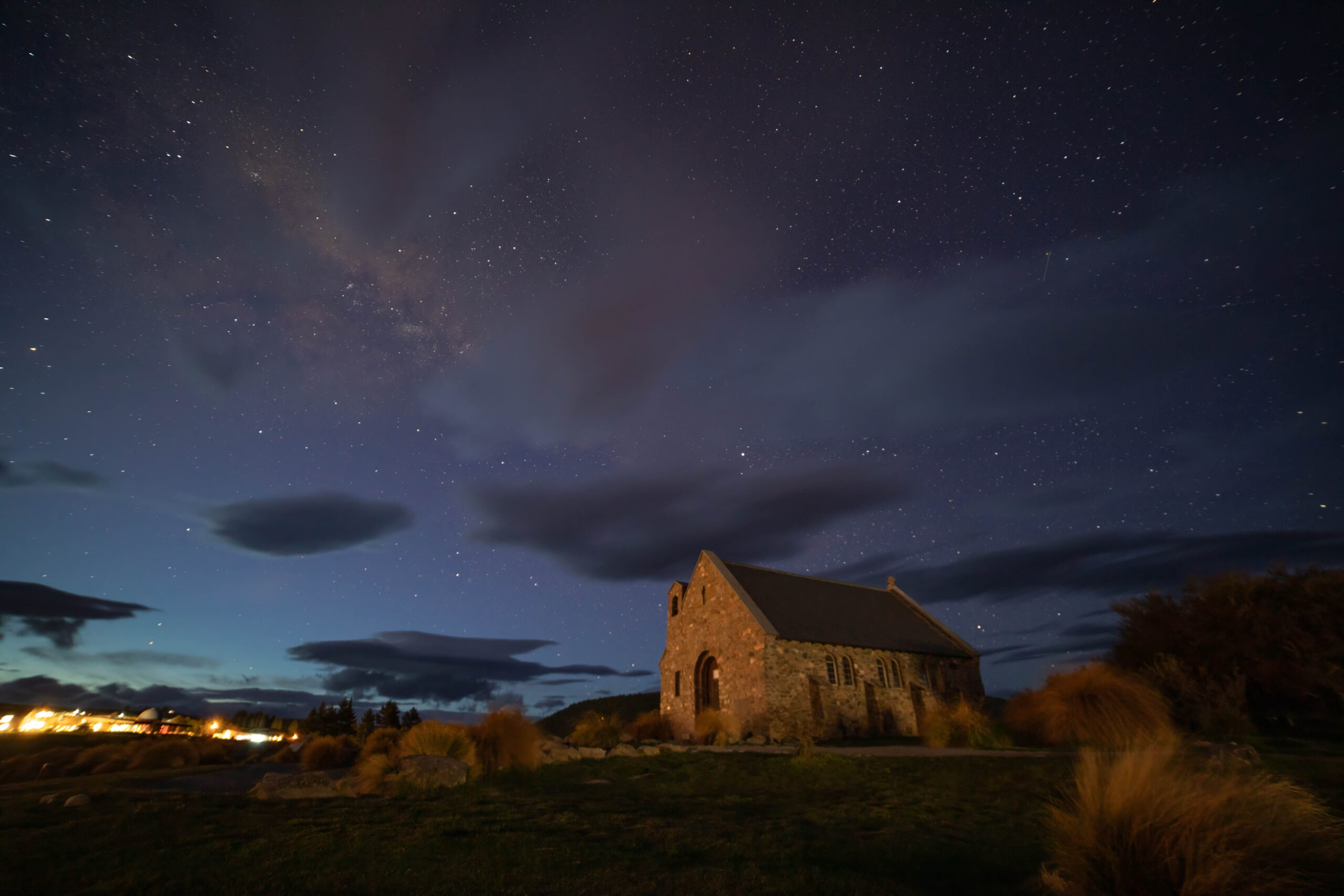
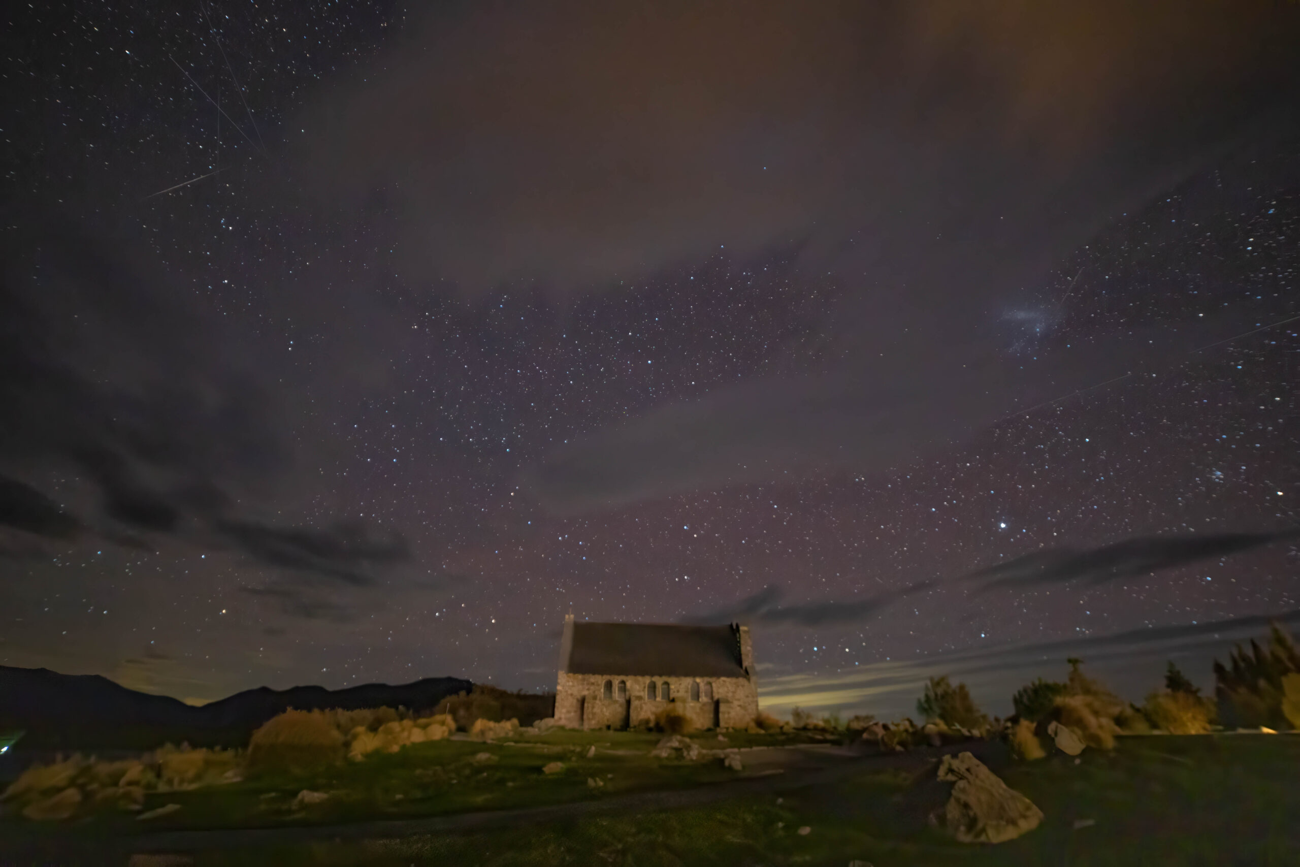
Multiple photos were taken and Bernie consulted his photography app, to check when and where the Milky Way will be later tonight. He has a plan to take a photo with the church in the foreground and the Milky Way in the sky behind it. A whole lot of technical stuff about taking multiple long exposures and then stacking them in another app to create (hopefully) an amazing night photograph of the picturesque little church.
To the supermarket – again – there always seems to be something we decide we need to have, and then to our motel. Tonight we are in a lovely room, with a view over the lake, at the Galaxy Boutique Hotel. Gosh, when we were checking in the receptionist warned us about the terrible weather expected tomorrow. She said that we should make sure all our devices are charged because there could be power outages. We thought we had to worry about there being a deluge of rain coming, but she was warning us about anticipated gale force winds. Today we’ve had glorious weather but we seem destined for more horrible weather tomorrow.
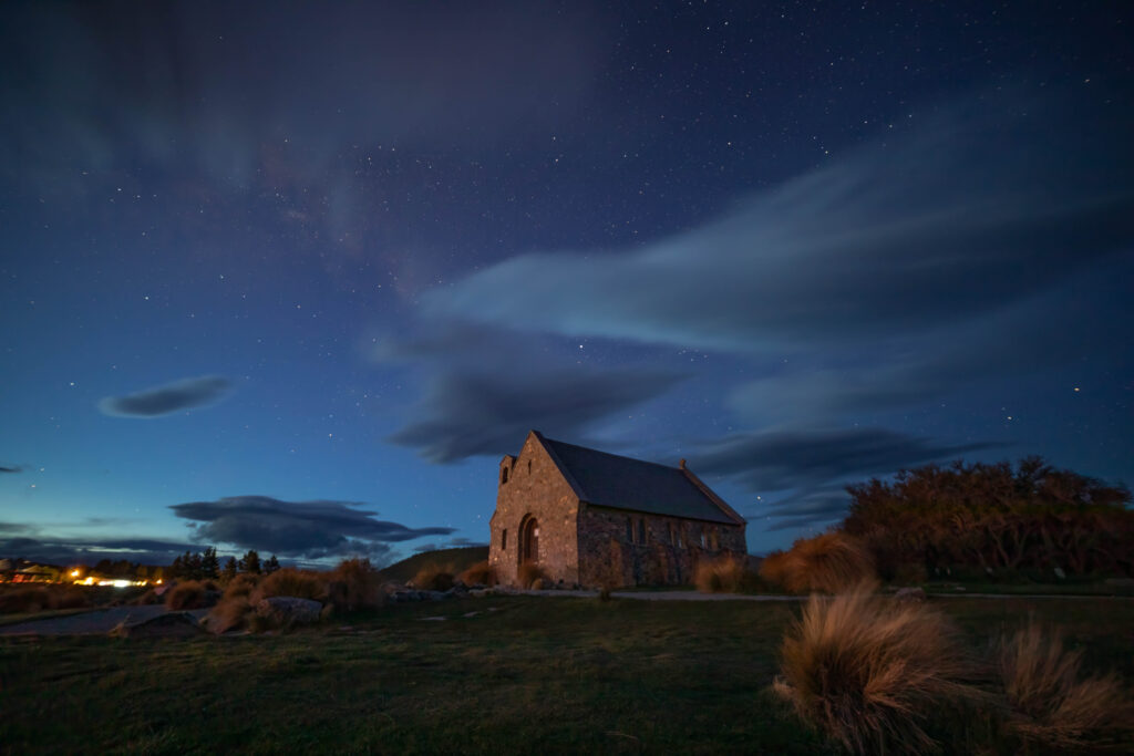
We drove down into town for dinner at the Blue Lake. After eating we drove back to the Church of the Good Shepherd, to take more photos in the late afternoon/dusk lighting. We were hoping for some pink clouds in the background, but that was not to be.
From the church, back to the warmth of our room to wait until about 9.00pm, the time when Bernie expects the Milky Way to be in the sky behind the church. After that there will be more astronomical nerdiness. At 11.00pm, yes, 11.00pm, we will be heading down to the Dark Sky Project, based on the Tekapo lakefront, in the Aoraki MacKenzie International Dark Sky Reserve, the largest gold standard International Dark Sky Reserve in the world.
From their base in town, we will be driven to the summit of Mount John for some guided stargazing from the world-renowned observatory domes in some of the darkest, clearest sky in the Southern Hemisphere. I’m just glad their promotional material says that they will be issuing participants with Extreme Cold Weather jackets to keep us warm. Fingers crossed.
Bloody New Zealand weather. We drove down to the Church of the Good Shepherd about 9.00pm and the clouds were a problem. The section of the sky that was the most cloudy? The bit where the Milky Way should have been. Bernie took some photos anyway so that he could practice stacking the images. And, we were not the only people at the church in the dark. There were a few others with tripods and DSLRs but many others with only their mobile phones and others not attempting photos at all. We’re not sure if perhaps people we expecting the church to be floodlit to make a night time visit worthwhile??
Back in our room we received an email from the Dark Sky Experience, letting us know that our tour to the summit of Mount John has been cancelled for tonight due to the high winds. Very disappointing. We were asked if we wanted to swap to the Crater Experience, but even on this tour use of the telescope was not guaranteed because of the extreme wind conditions.
We could have rebooked to another night ‘if you are in the area for a few days’ but that’s not really practical for us, as we have accommodation booked at Mount Cook for the next two nights – which is more than an hour away. We could request a voucher to rebook at another time in the next 12 months, or receive a full refund. Weighing it all up we decided on a full refund. There didn’t seem to be much point attempting the Crater Experience if it too was going to be compromised.
All of this does not bode well for the extreme weather conditions forecast for tomorrow.
Steps: 12,551 (8.54kms)