Tuesday, 28 February 2026
After four nights in one place, it was time to pack the truck again and keep on heading north. As we drove out of Alice Springs we pulled into the Alice Springs Telegraph Station to post mail in their historic post box. The box is supposed to be cleared twice per week and the mail is franked with a Telegraph Station postmark before being sent on its way. That is the hope anyway. The birthday card may or may not be delivered successfully??
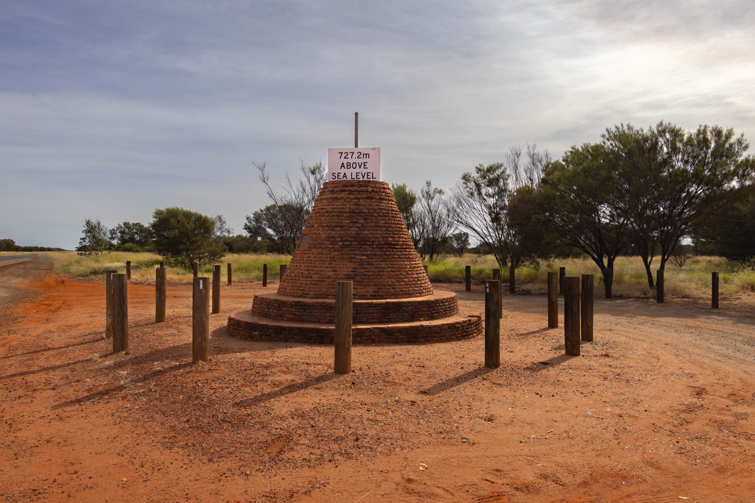
Continuing our journey north, at 20 kilometres out of Alice, we arrived at the Highest Point Cairn. The cairn marks the highest point – 727.2 metres above sea level – on the main route (Stuart Highway) between Adelaide and Darwin, as determined by the Lands and Survey Branch Northern Territory Administration. The cairn, installed in 1962, was designed by Angel Michael Sahariv. Damn, two vehicles towing caravans passed us while we were stopped. The same two rigs that pulled out of the Discovery Park ahead of us this morning. Plenty of long straight stretches of road ahead to pass them on.
Just 10 kilometres further north, we crossed the Tropic of Capricorn. We had planned to stop but there really wasn’t a sign alerting us that the Rest Area coming up on our left was the Tropic of Capricorn Rest Area. We didn’t realise until we were half way past and could see a globe-shaped monument. Oh well, we have criss crossed over the Tropic of Capricorn several times, on two continents, over the last two years, the novelty has worn off a bit. We didn’t turn back for a photo op!
We passed the turn off for the Tanami Road, a rugged 4×4 track that passes through the Tanami Desert on its way to Halls Creek in the Kimberleys. We also rocketed past the Warburton Memorial, nine kilometres north of Burt Creek, without stopping. I am discovering now that it is a memorial to Peter Egerton-Warburton, an explorer and South Australian Police Commissioner, who left this area in 1873 on an expedition to cross the continent from the centre to the west, a feat that earned him the patron’s medal of the Royal Geographical Society. He attributed the party’s survival to their Aboriginal companion, Charley. I suspect that Charley did not accompany him to England in 1874 to collect a medal?!
We noted the turn off for the Plenty Highway, because we will be travelling that way in August, when we go on our delayed tagalong trip into the Simpson Desert. Gosh, even though we have time to spare today, we are not doing a very good job of stopping at the monuments and points of interest on our way. The next opportunity we missed was the Ryans Well Historic Reserve. This is a reserve that has been set up to preserve and protect a well that was hand-dug in 1889 to supply water to travellers and stock along the route of the Overland Telegraph Line. It was named for Ned Ryan, a stonemason who became an expert at sinking wells.
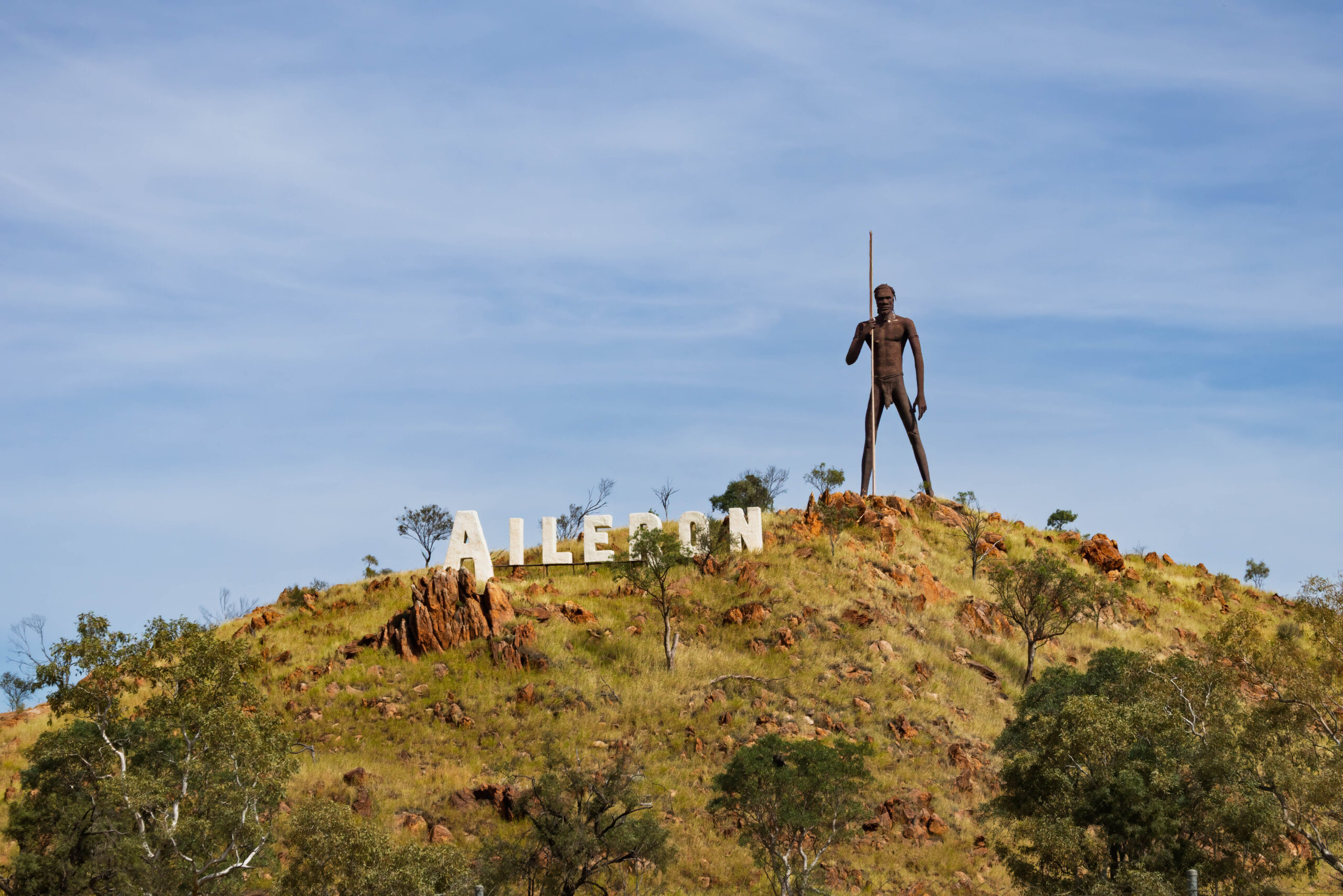
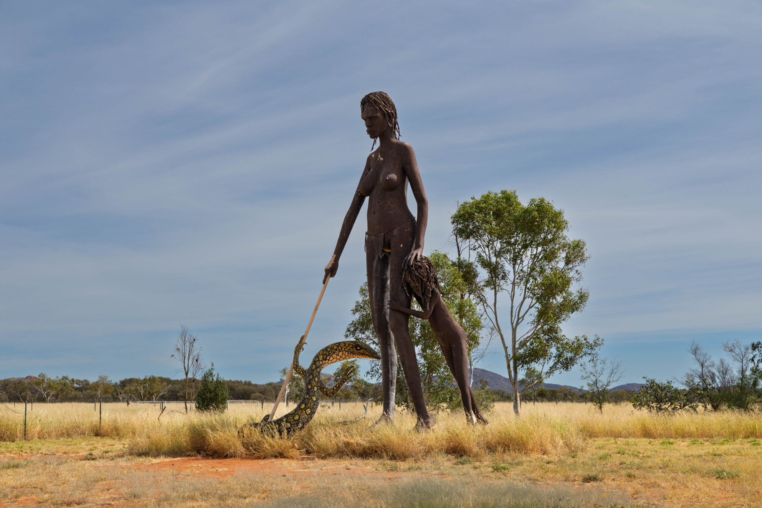
Our next stop was at the Aileron Roadhouse which is currently closed for renovations but campsites and rooms are still available. Having read that it is known for its giant sculptures of an Aboriginal man and woman, we pulled in to look at these. The Aboriginal man stands on a small hill and was easy to spot but not easy to photograph. We had to wander into the camping ground to be able to see it properly. Despite Aileron appearing rather deserted, the camp sites were being watered and it seemed basic but well kept. We couldn’t spot the Aboriginal woman until we were heading back to the highway and we spotted that giant statue near the Aboriginal Art Gallery. The woman was sculpted along with a large monitor lizard and a child.
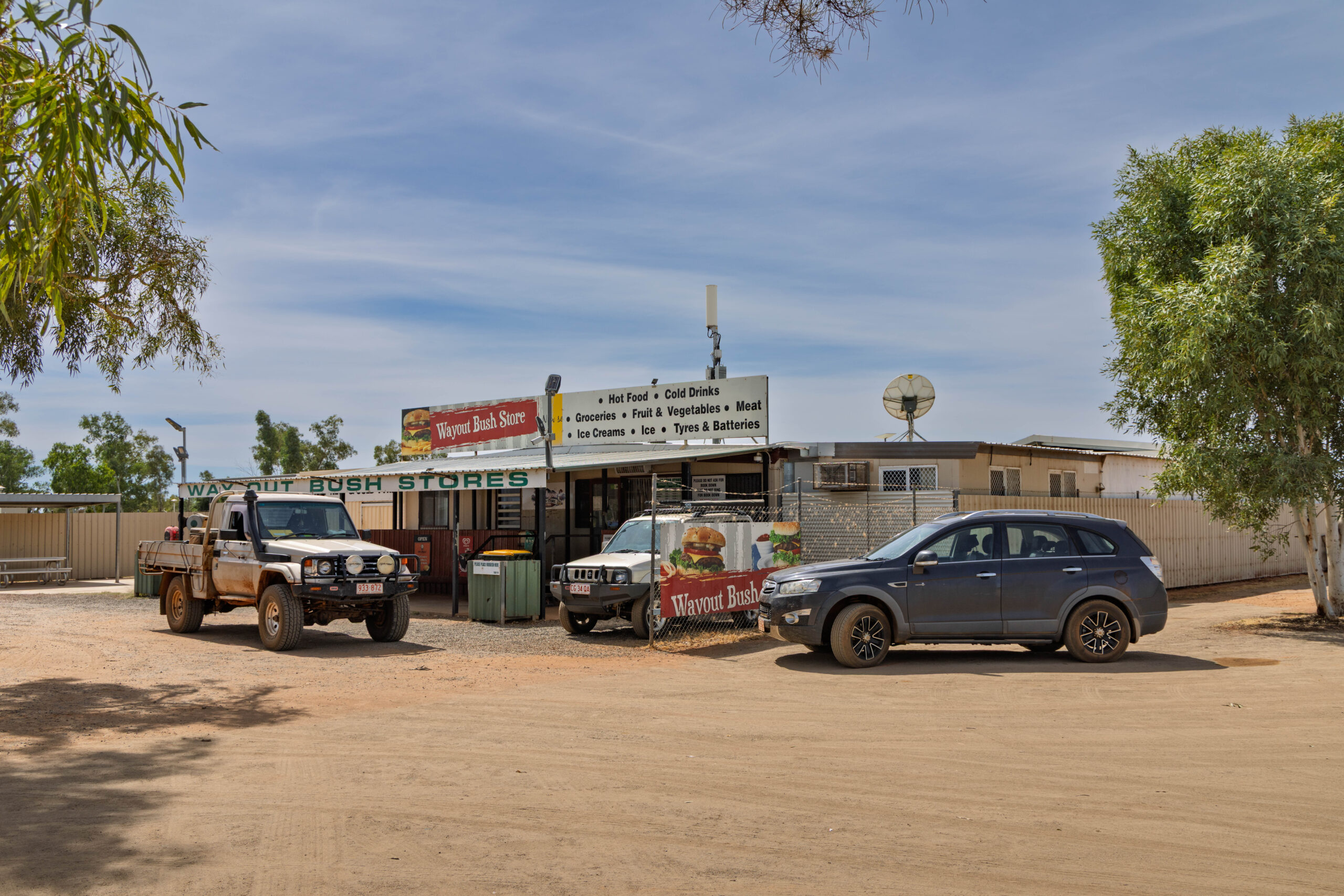
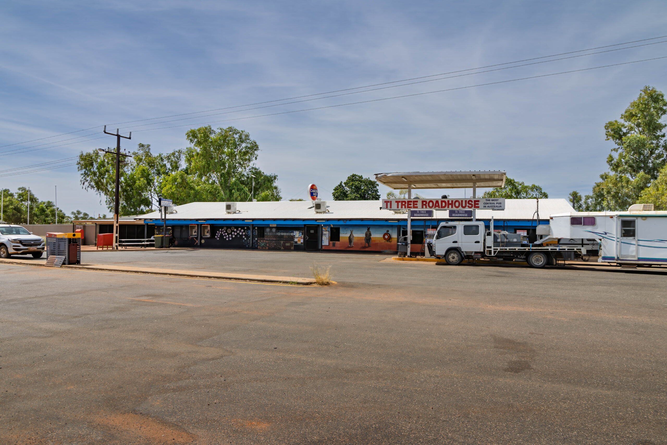
When we reached Ti-Tree we decided it was lunchtime. With three businesses in town we had a choice of where to eat. We pulled into the roadhouse but Bernie decided he thought the Wayout Bush Store on the way into town looked better?? We returned to the Wayout Bush Store, which looked pretty ‘outback’. Despite appearances, their sandwiches were really good. Fresher than the thawed out ones that we were eating at Kings Canyon!
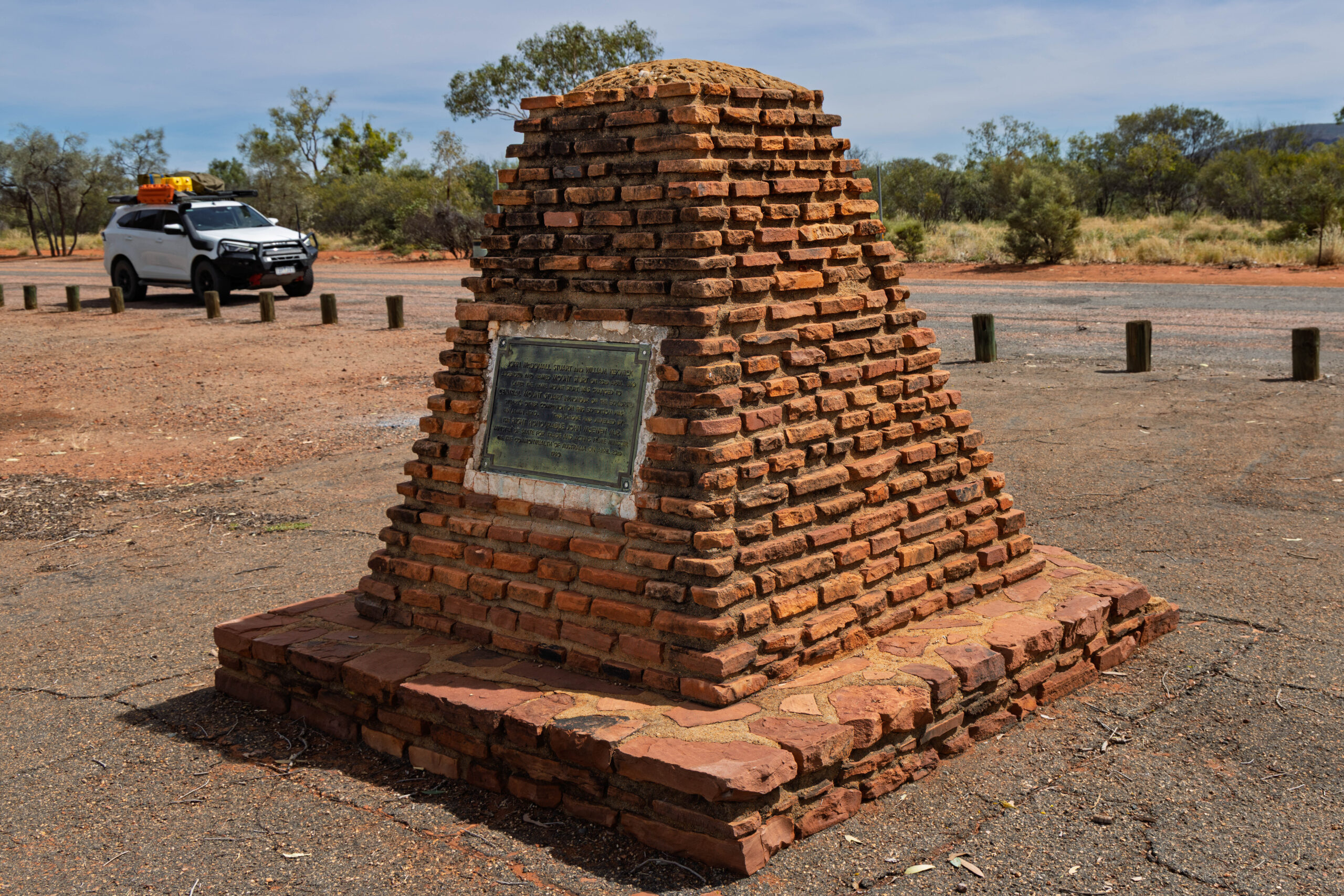
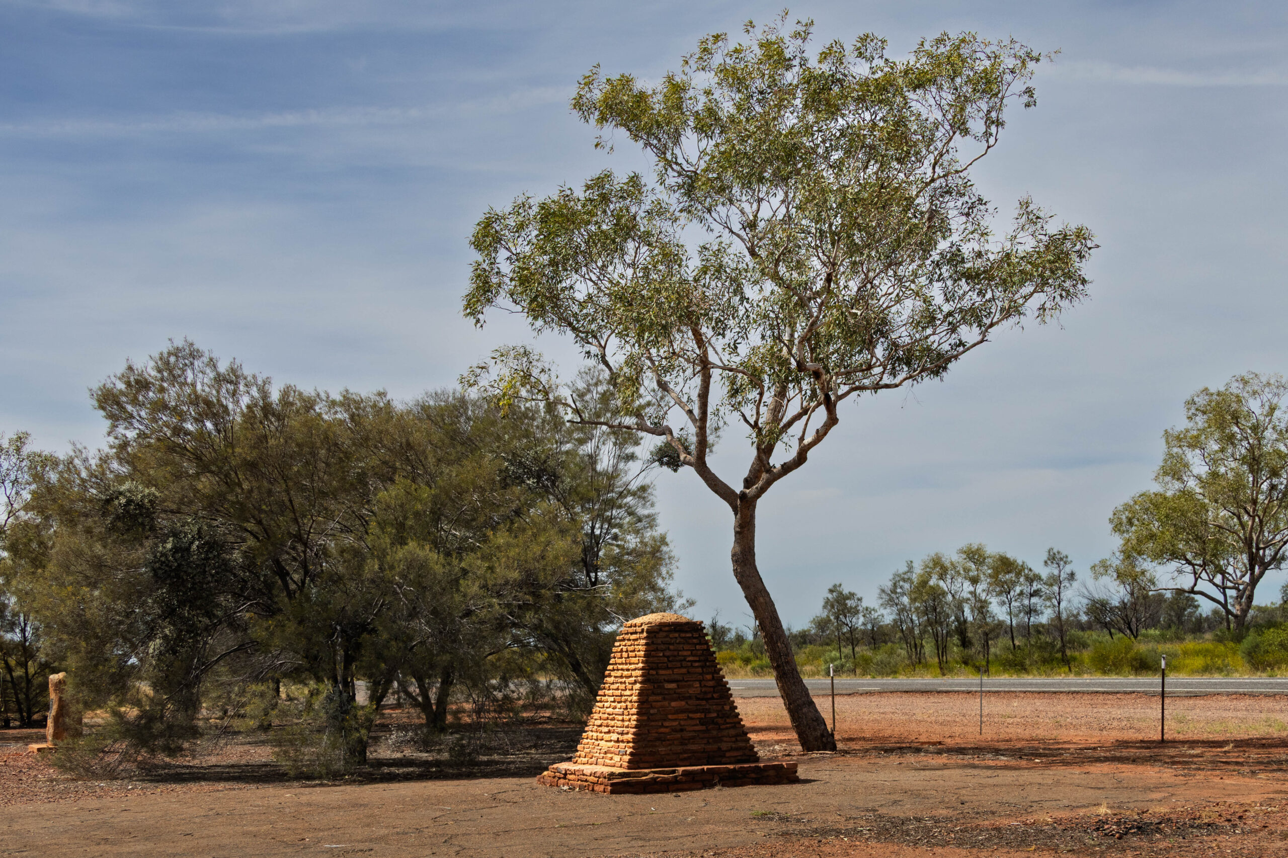
Just up the road we pulled in at the John McDouall Stuart Memorial. This particular memorial (there are others) commemorates Stuart’s 1860 expedition and his discovery of the centre of Australia. It is located near a prominent hill that is known as Central Mount Stuart.
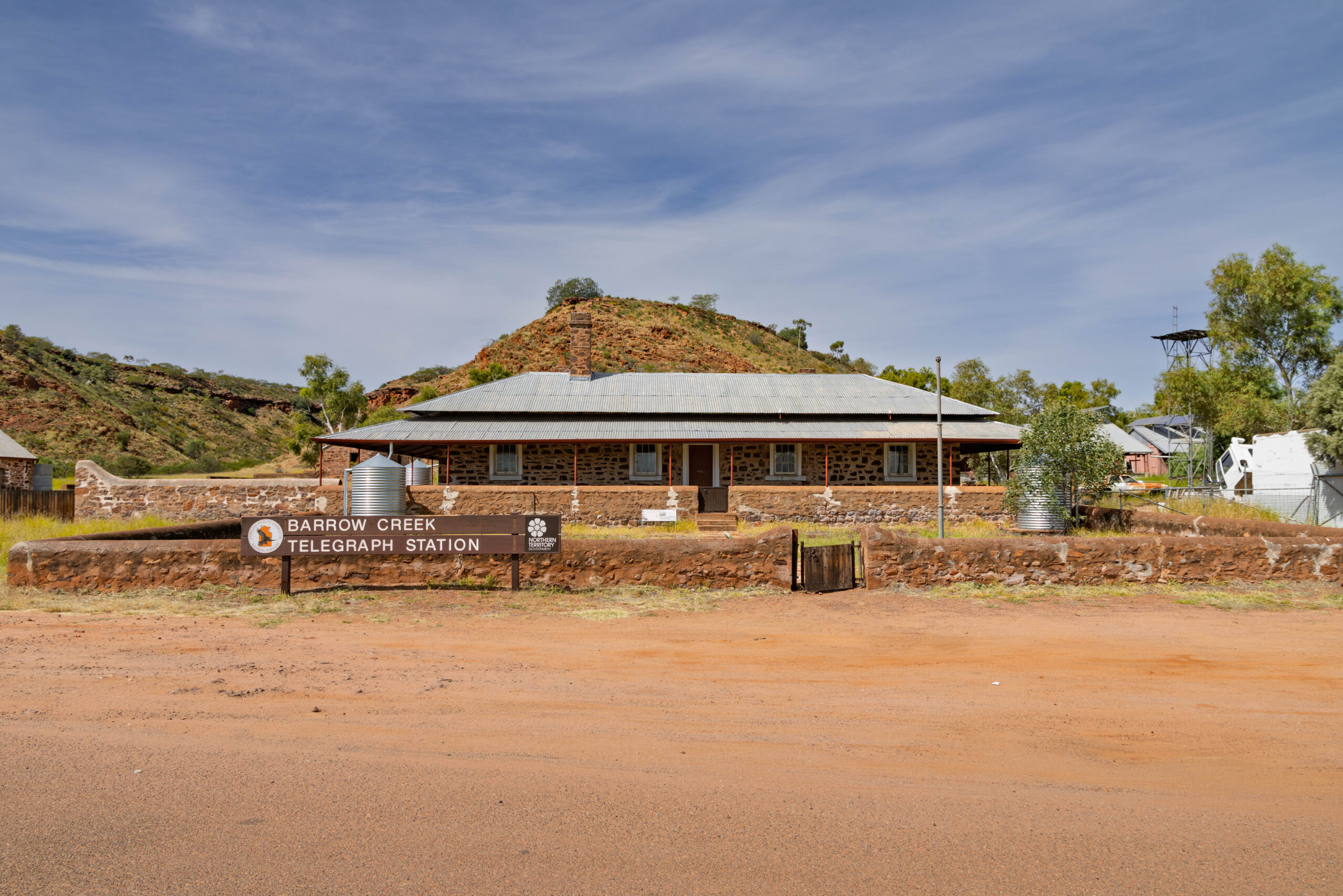
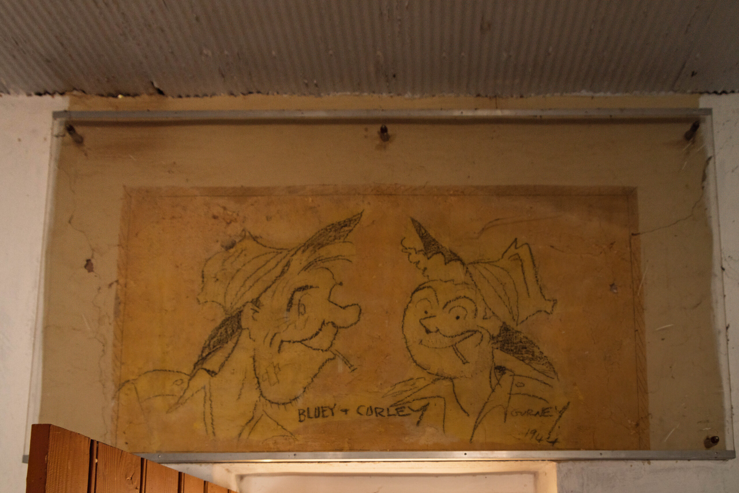
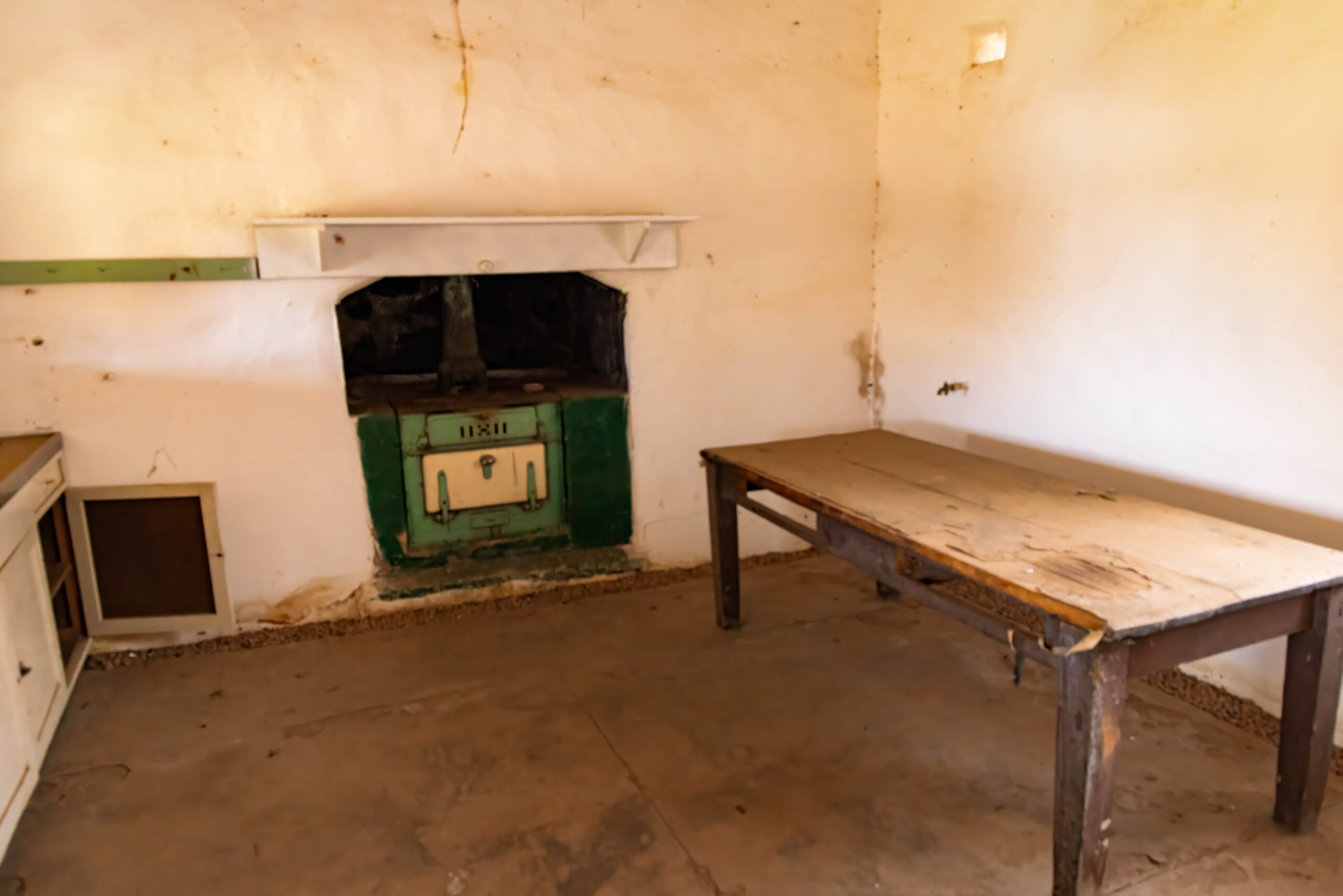
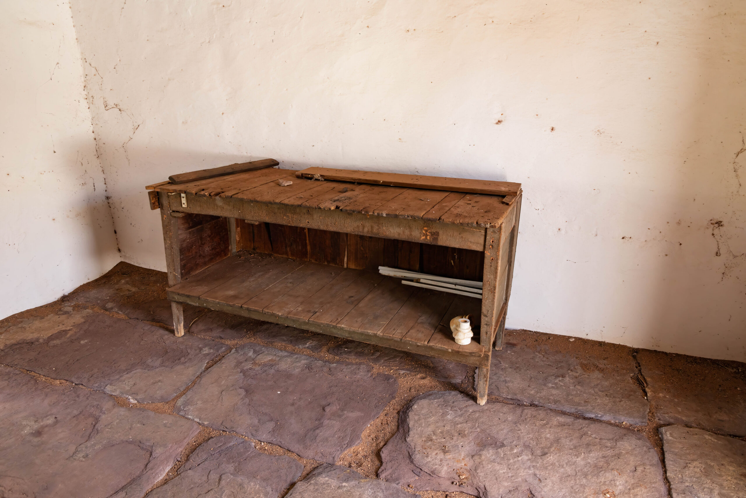
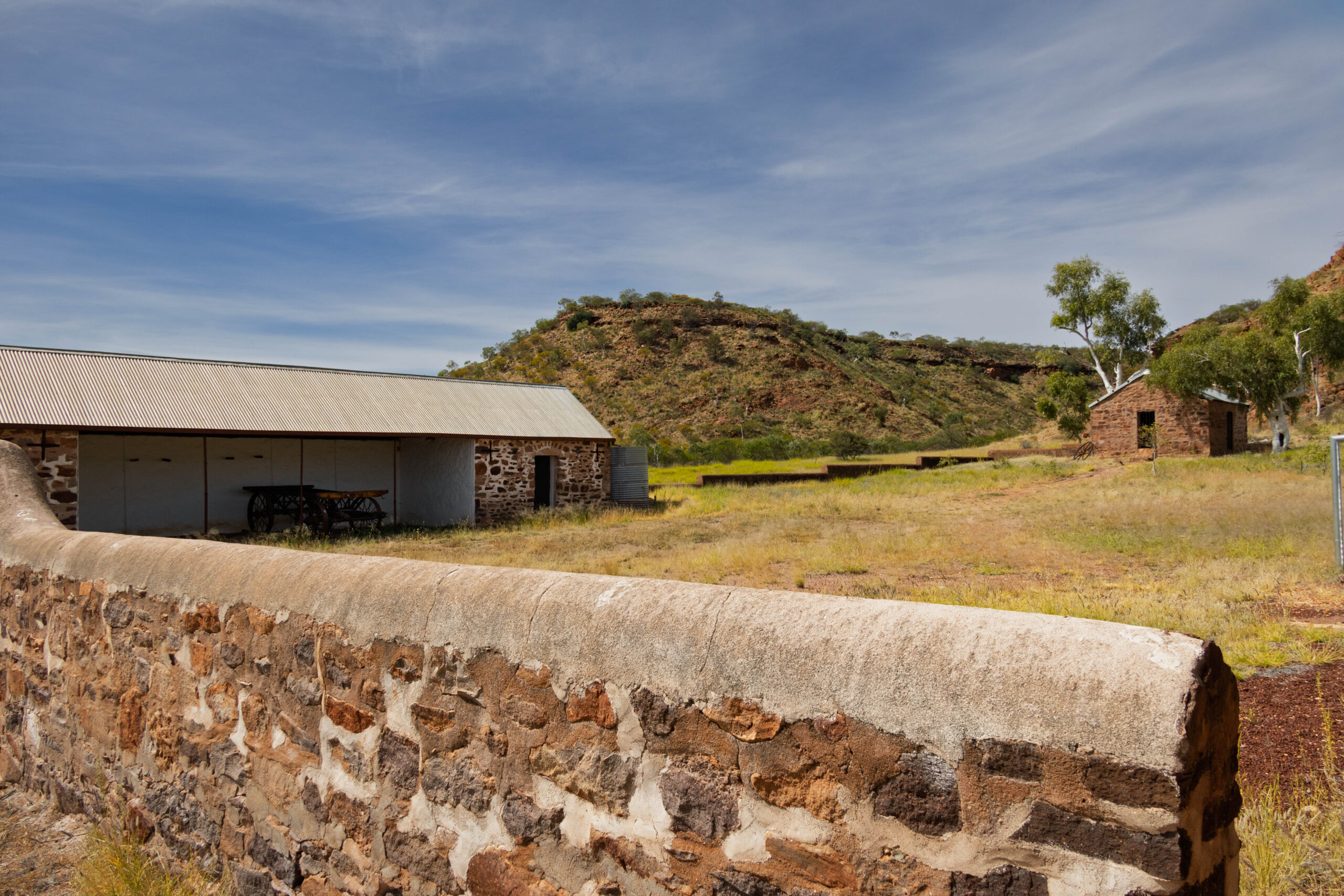
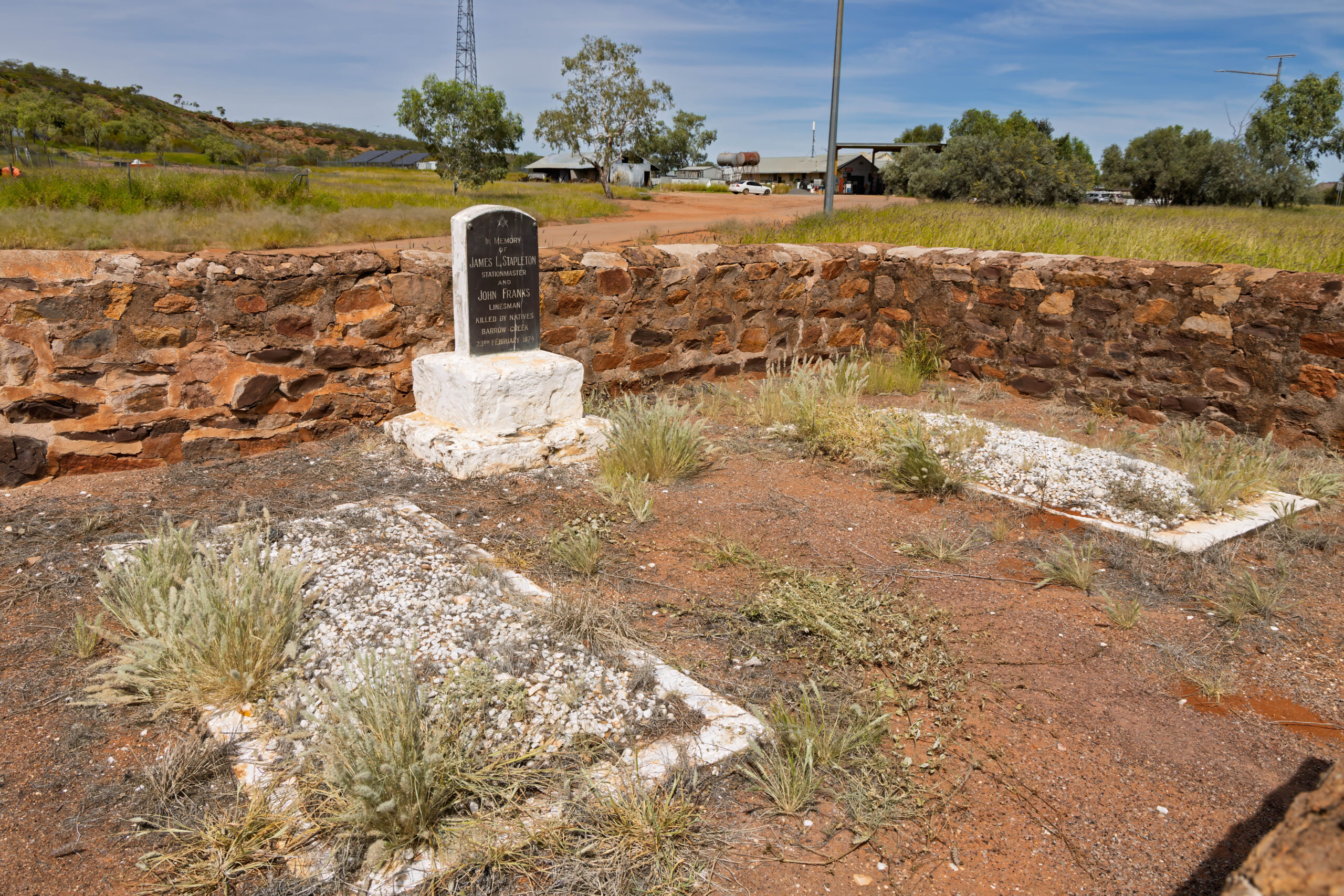
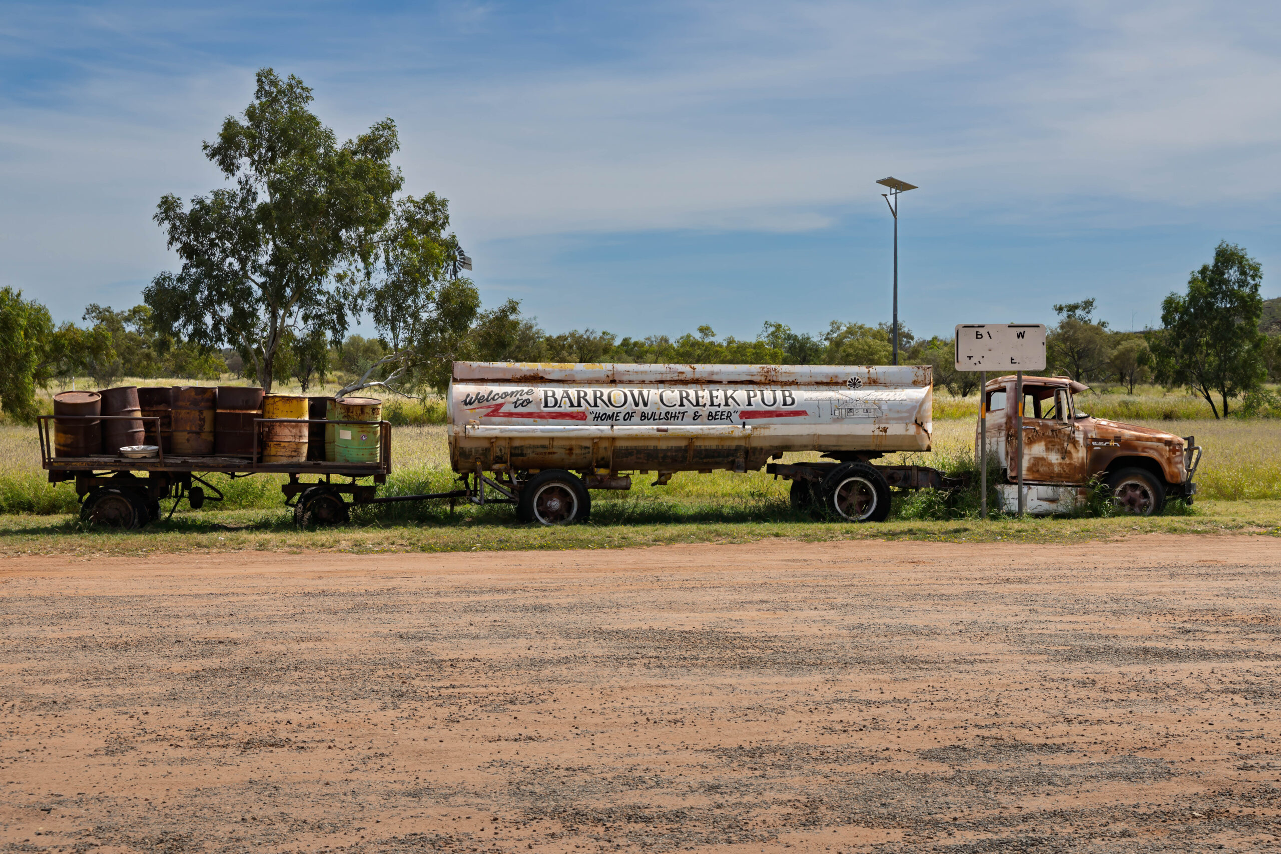
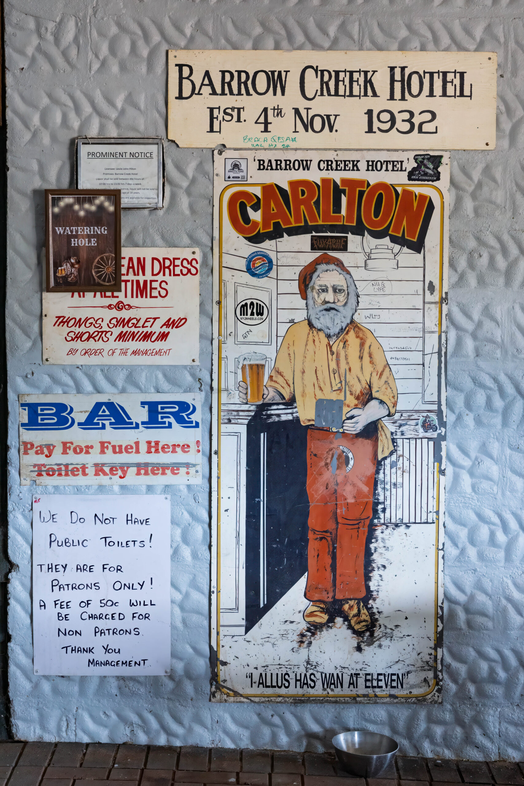
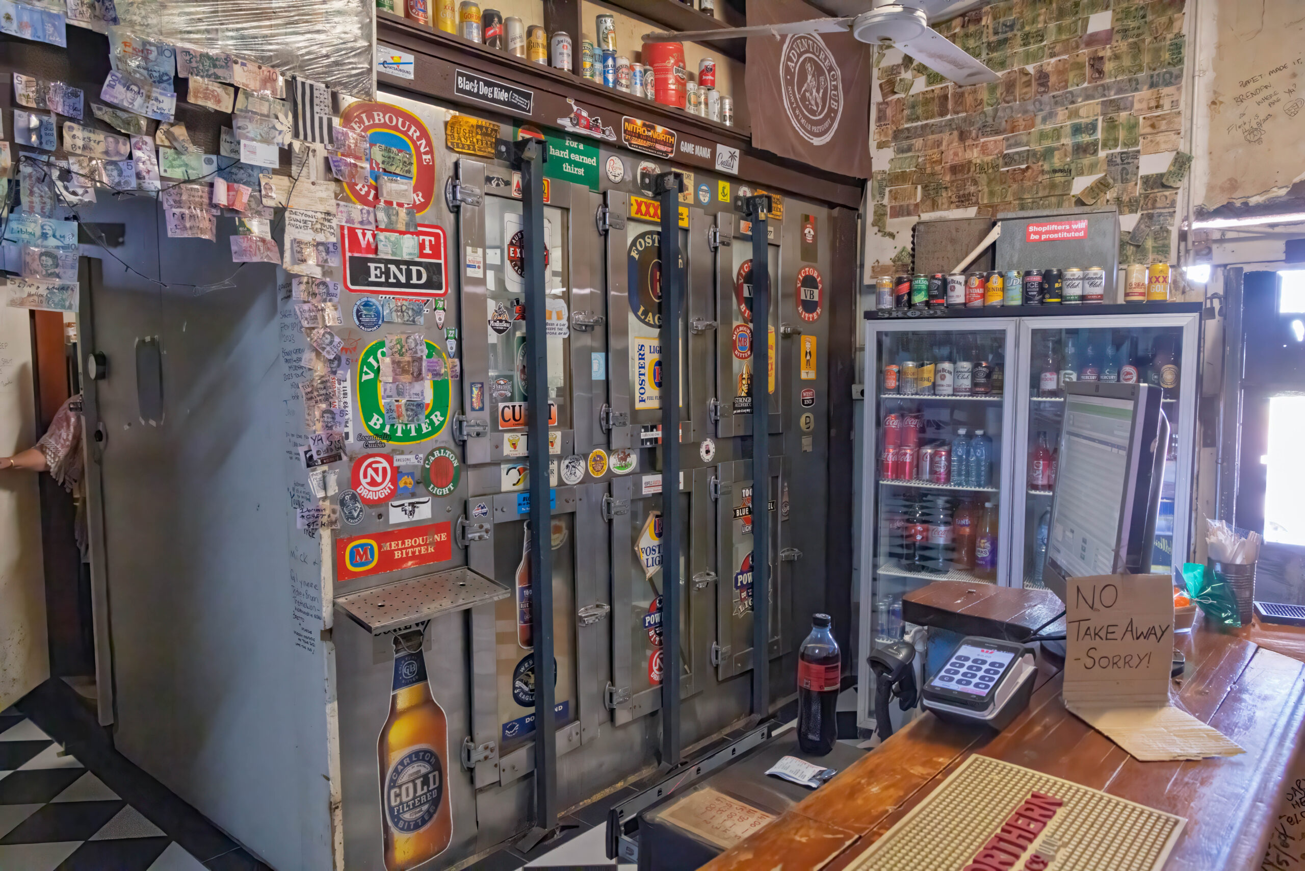
Eighty kilometres further north, our next stop was at the Barrow Creek Telegraph Station which was established in 1872 as another of the relay stations on the Overland Telegraph line. Although the buildings have undergone some restorations, it is not as well preserved as the telegraph station in Alice Springs, but remains one of four original telegraph stations still standing. We popped next door to the Barrow Creek Hotel and purchased (soft) drinks. It was a quiet day in Barrow Creek so we were able to chat with the lady at the bar while we drank our cool drinks. Hailing from Townsville, she has called Central Australia home for a few years now.
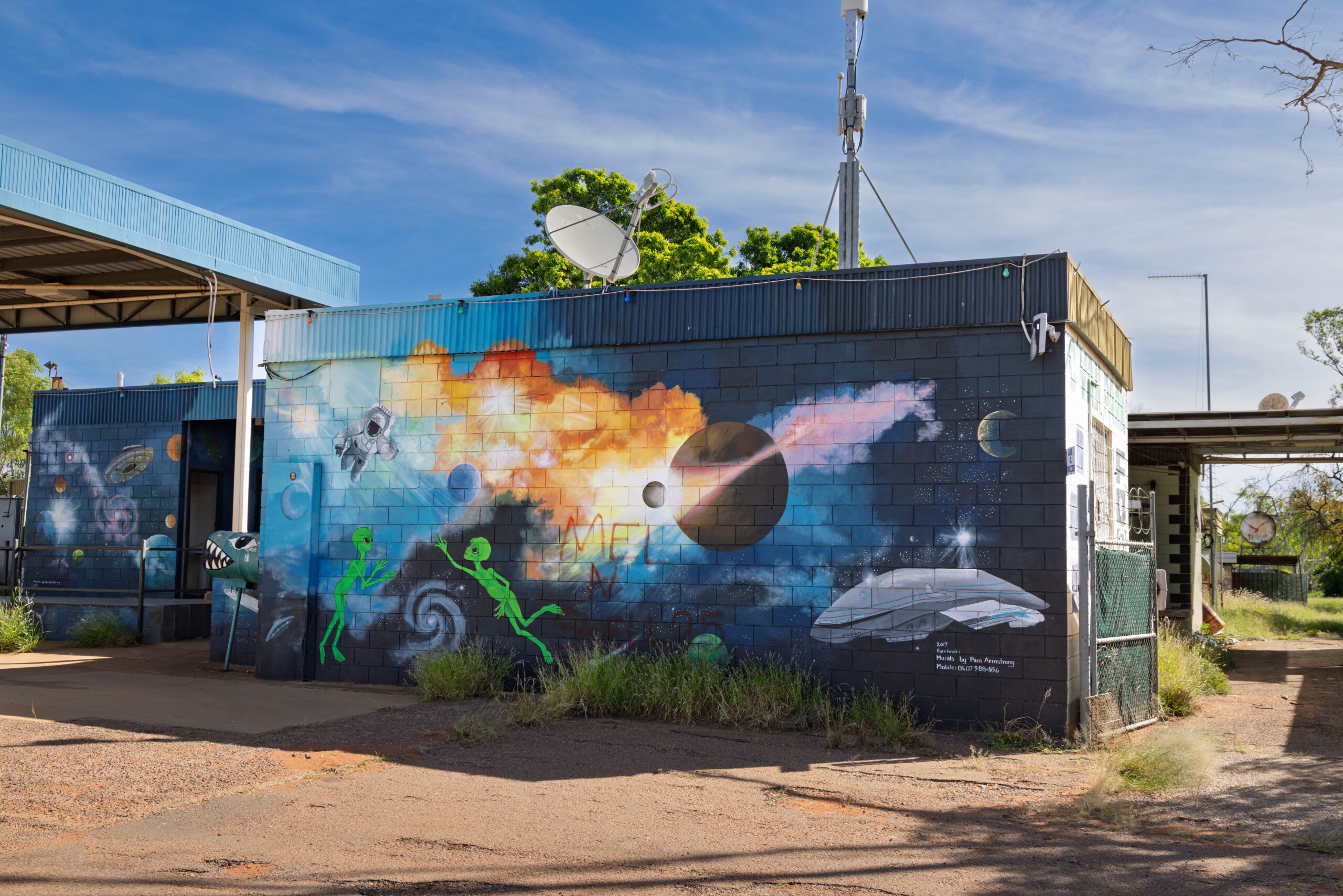
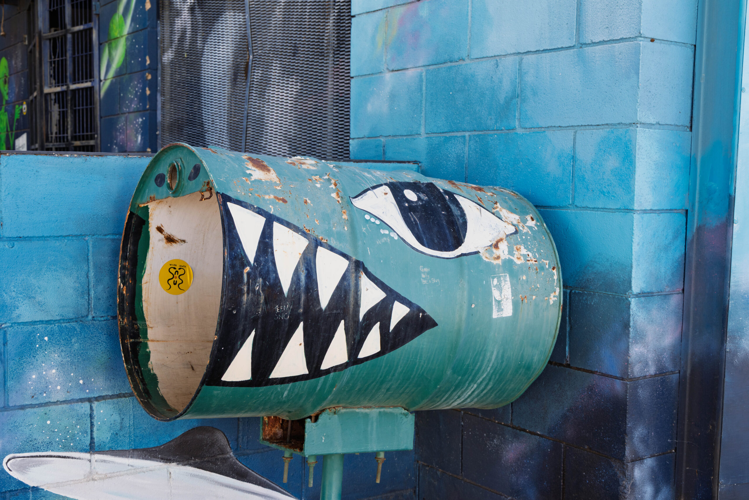
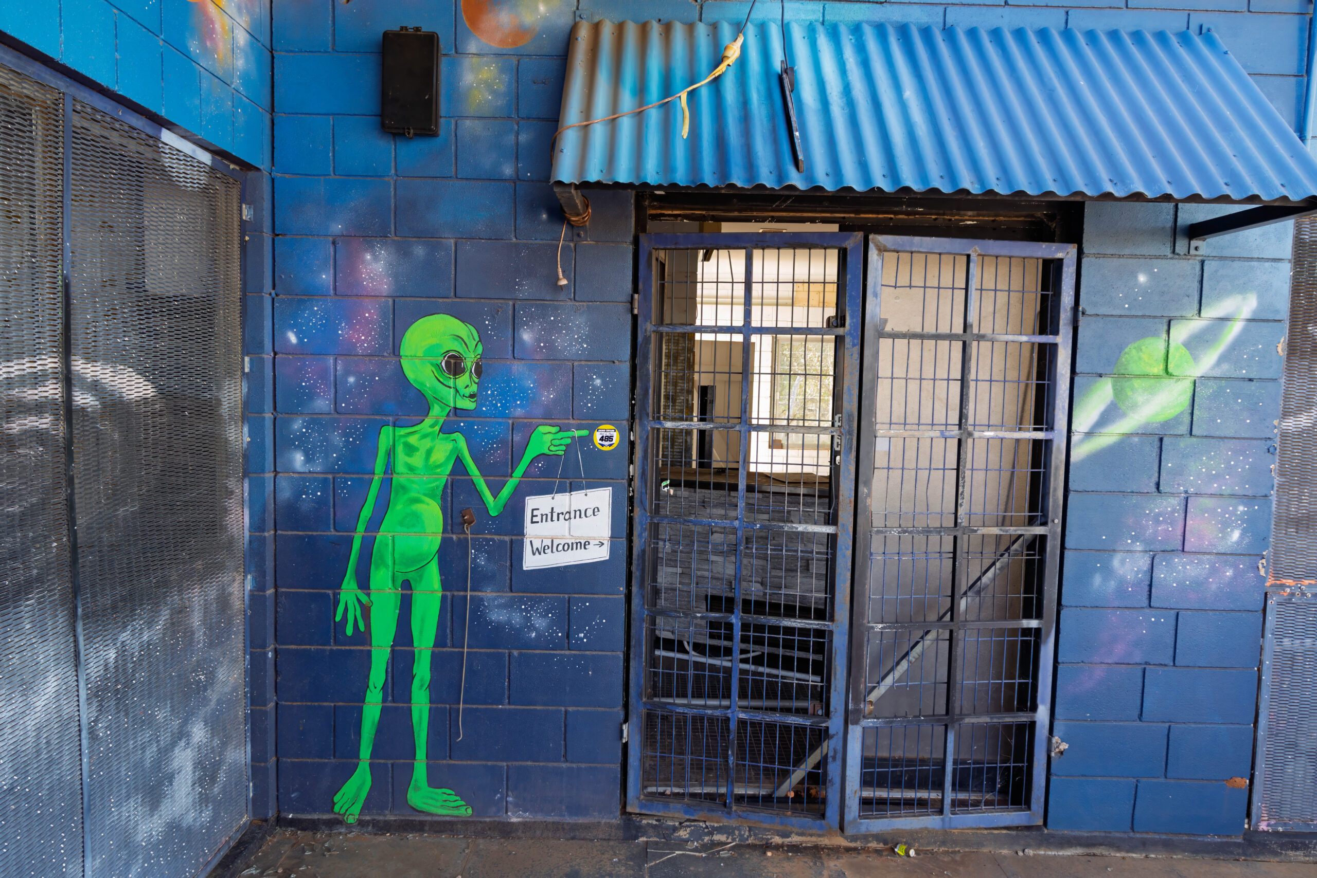
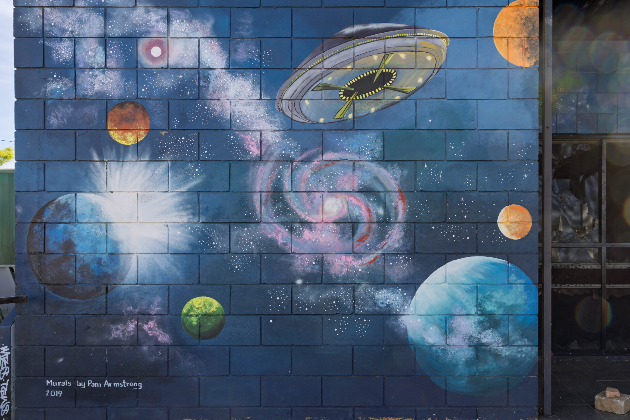
We made a brief stop at the burnt out Wycliffe Well Roadhouse which, before the fire, used to house a UFO Centre because this area around Thring Swamp is allegedly a hotbed of extraterrestrial activity. The alien-themed murals on the external walls are still visible despite the fire, but are fading in the harsh desert environment.
We arrived in Wauchope and pulled into the Devils Marbles Hotel. The windows remain boarded up after the break in last week and a police trailer is sitting out the front with spotlights and CCTV to keep an eye on things. We made our way in and we were checked into our cabin for the night. Despite the recent troubles here, there are quite a few vans behind the roadhouse and most of their rooms seem to be booked.
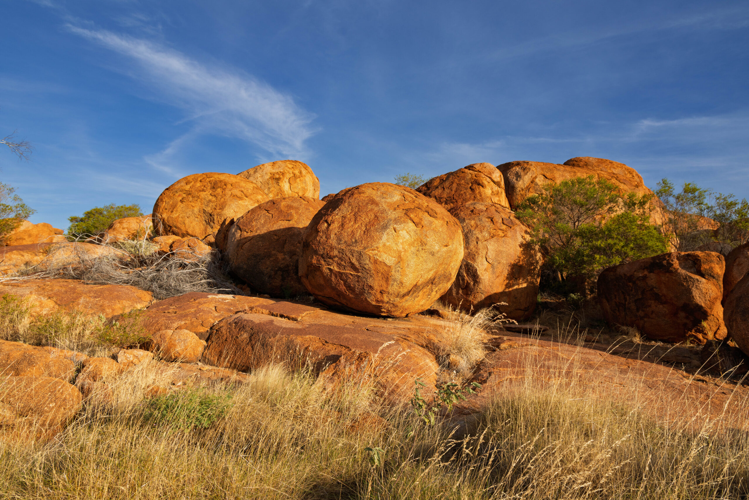
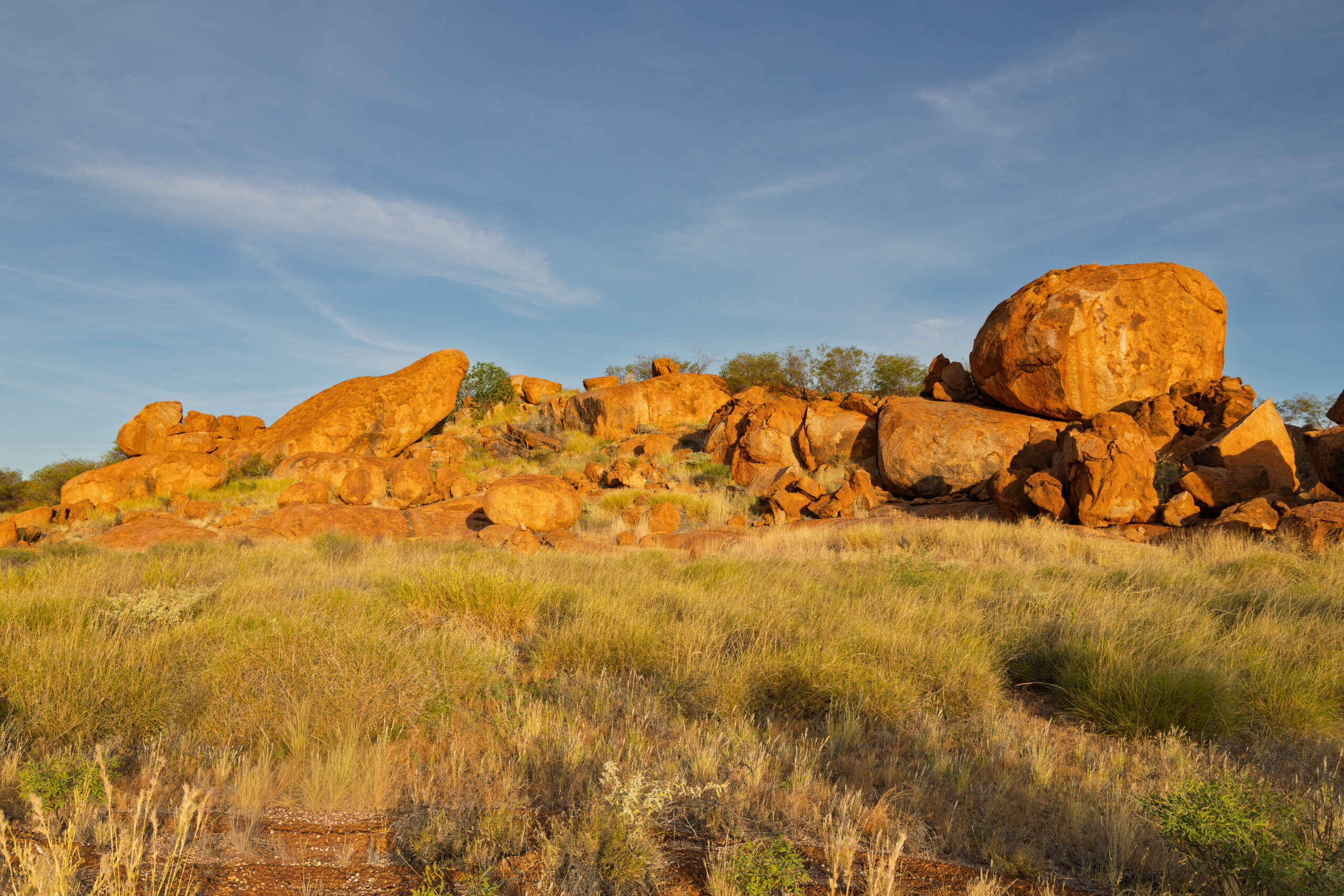
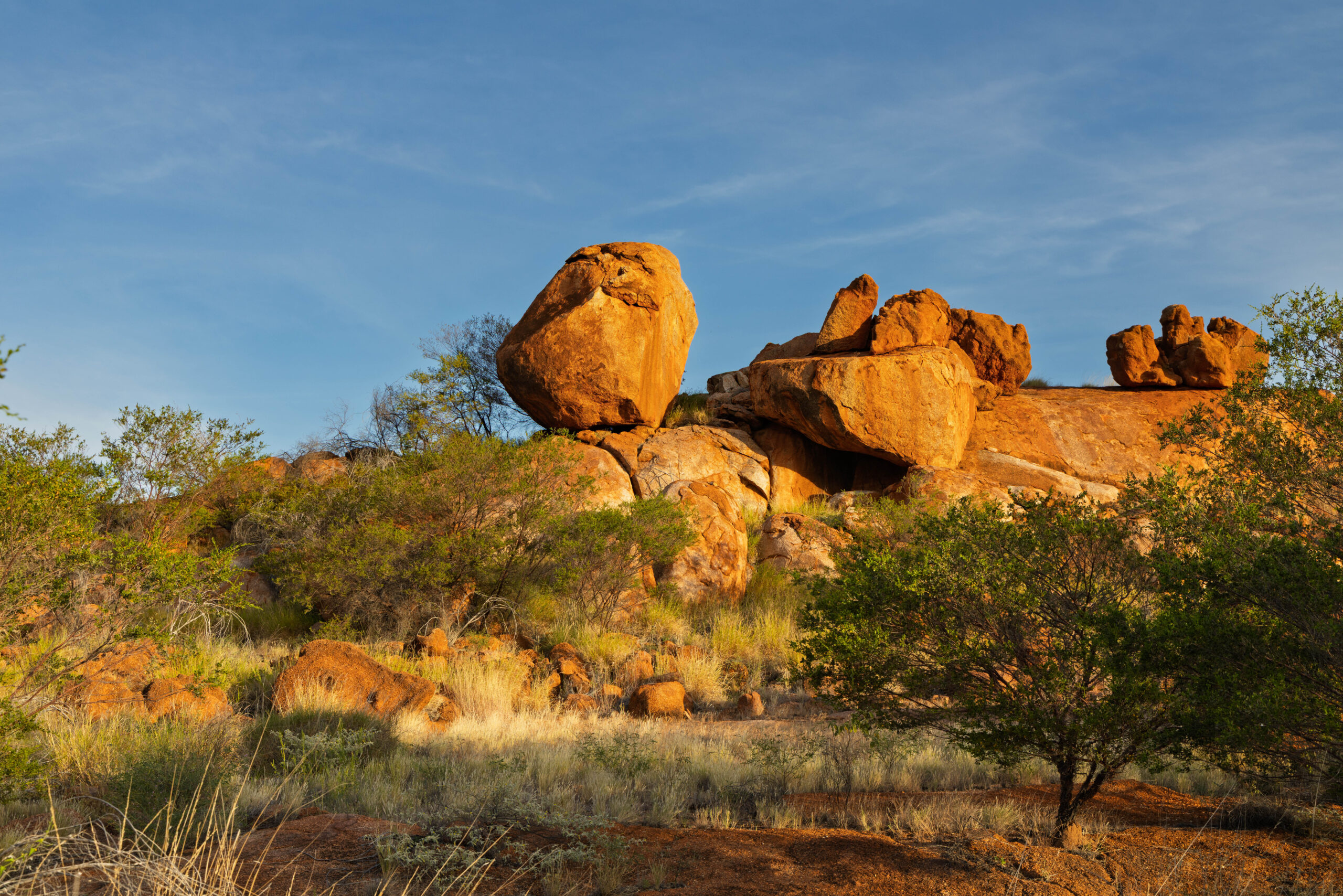
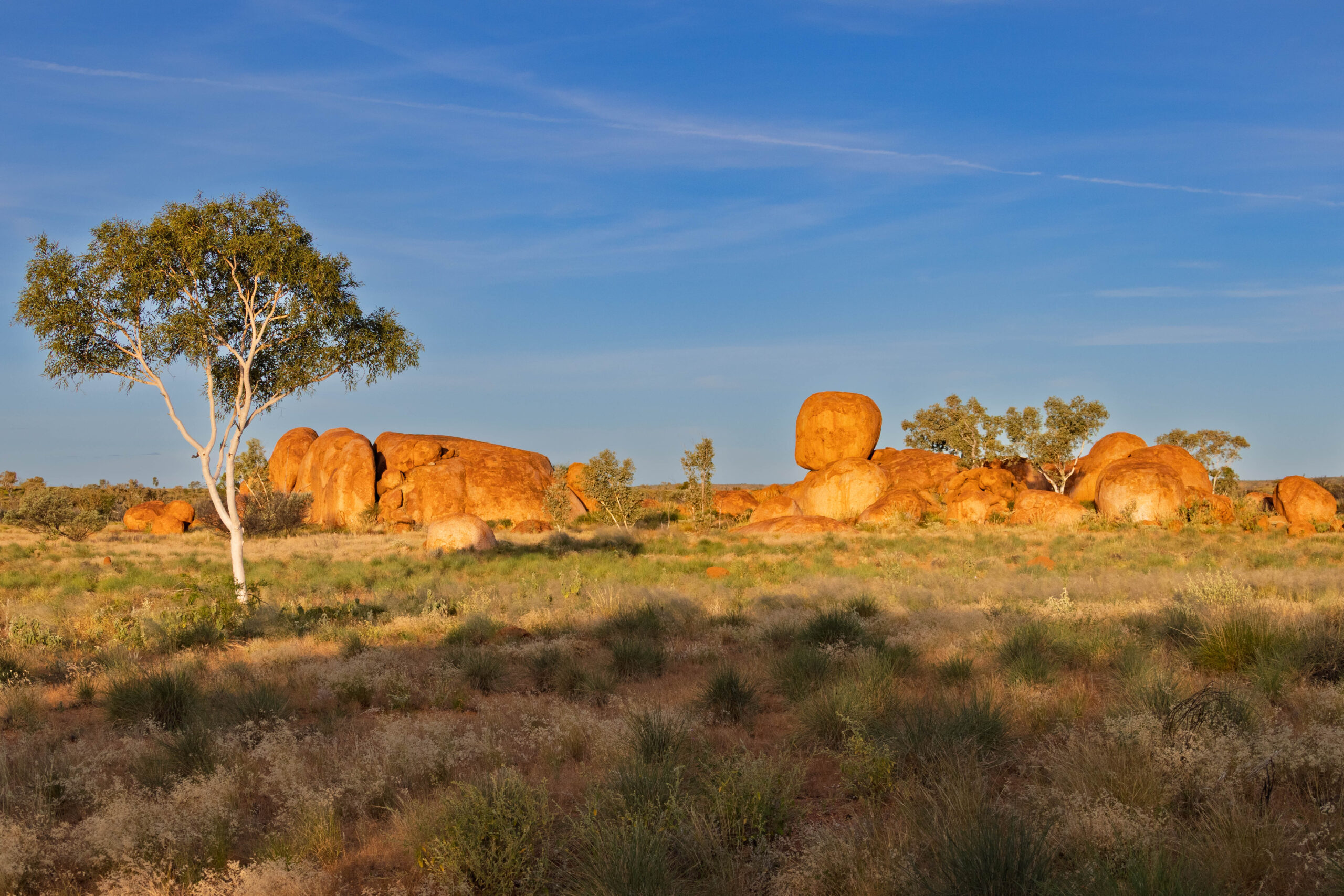
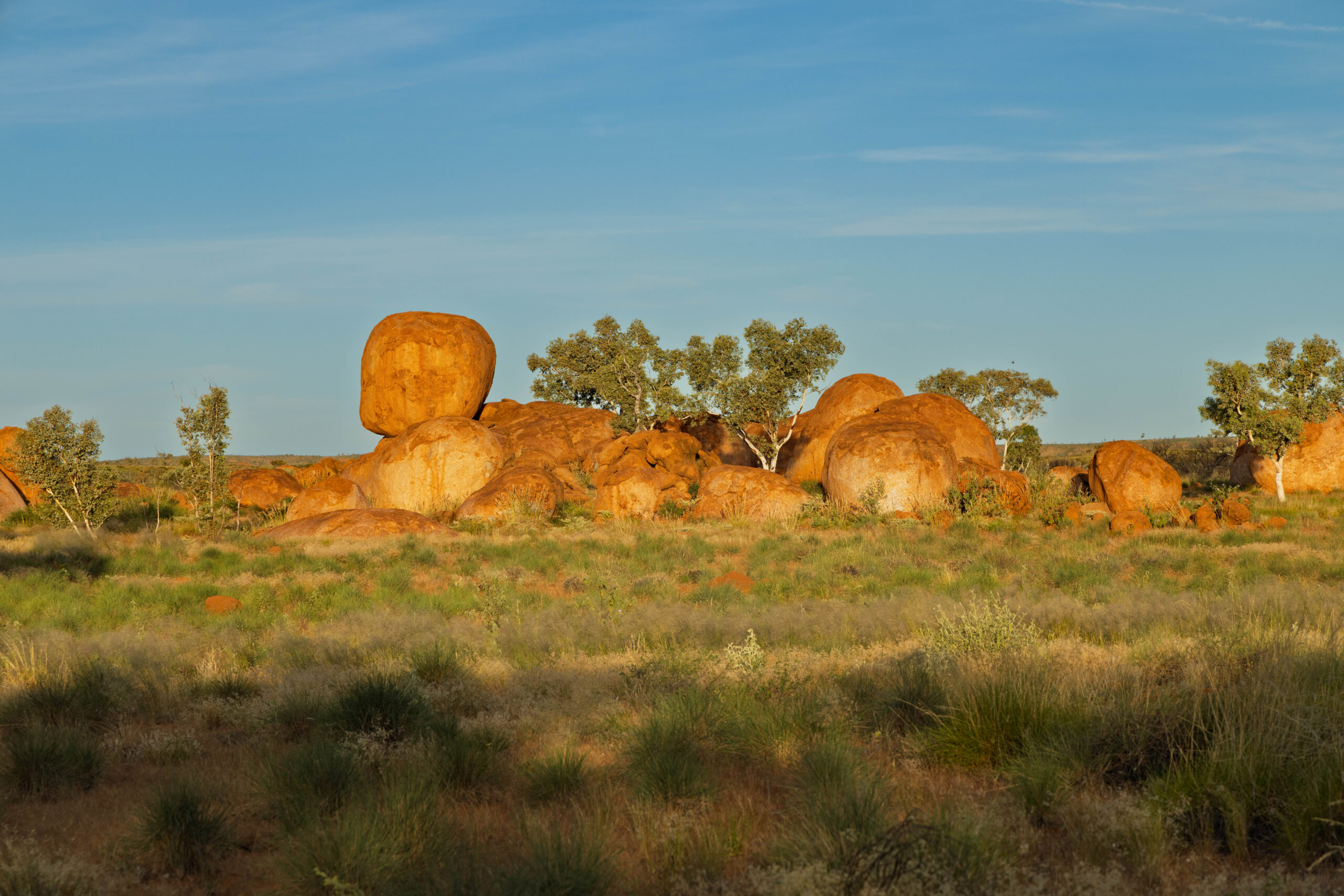
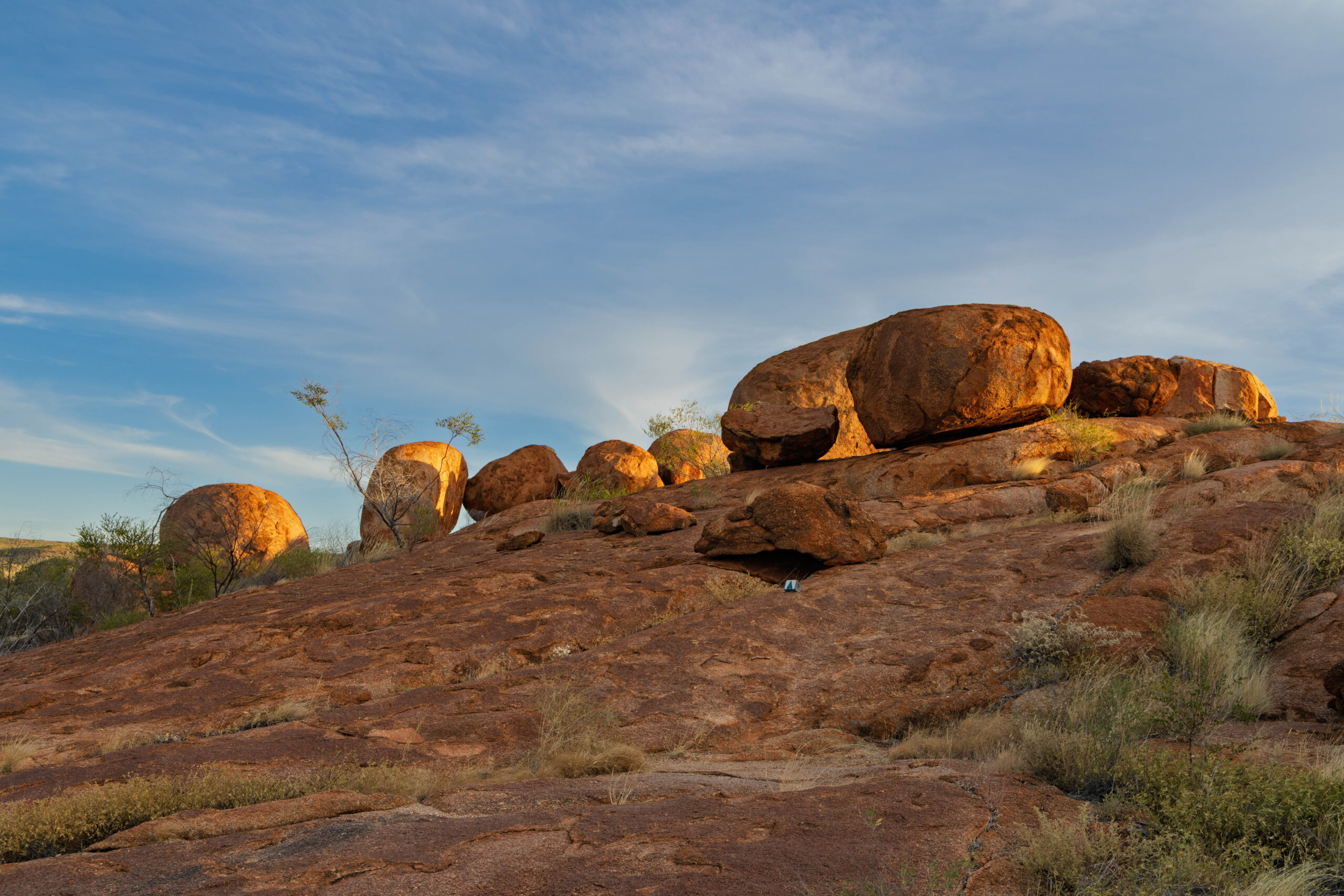
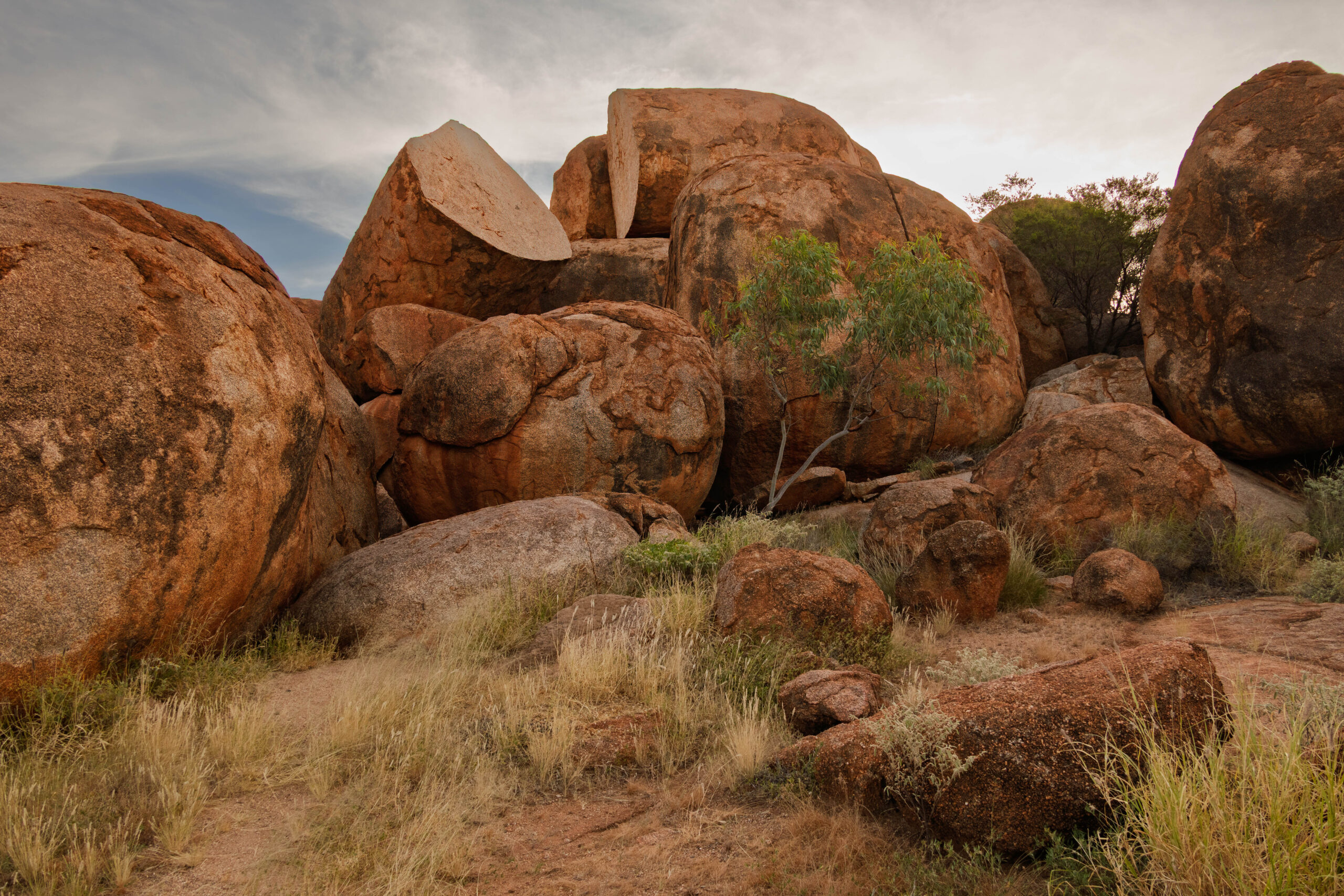
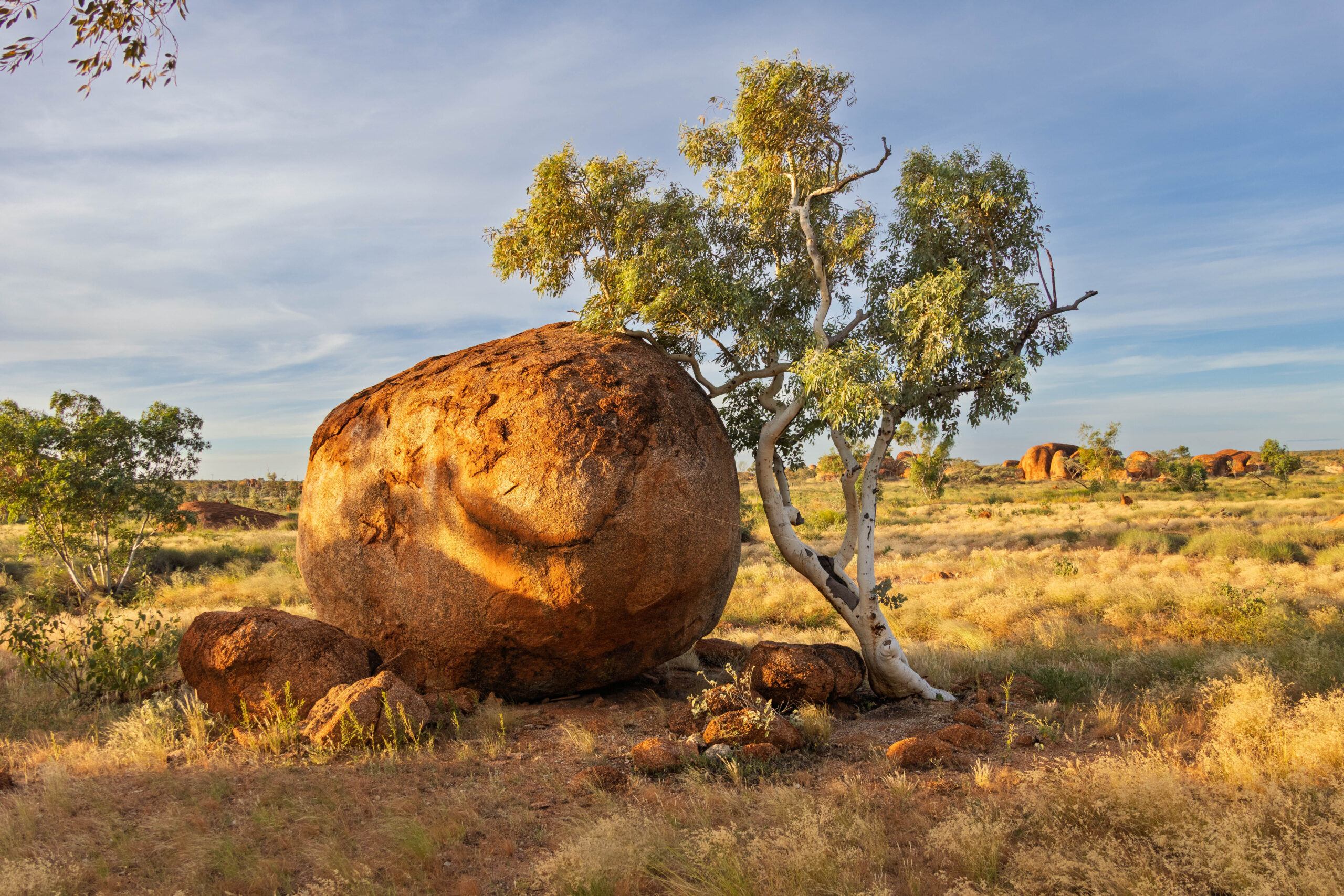
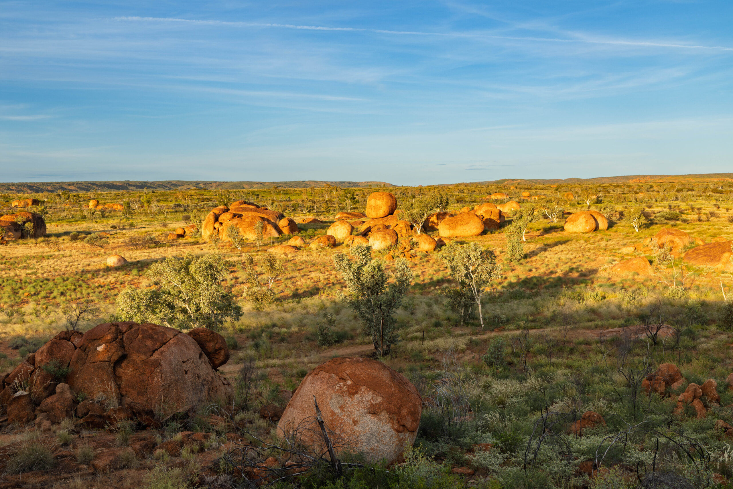
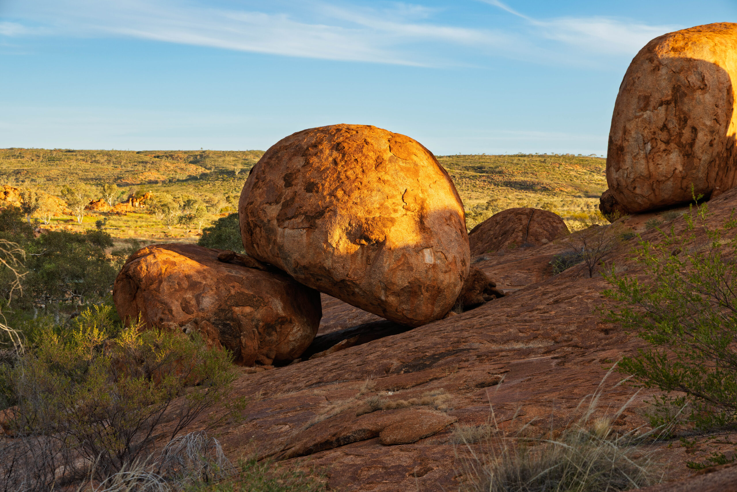
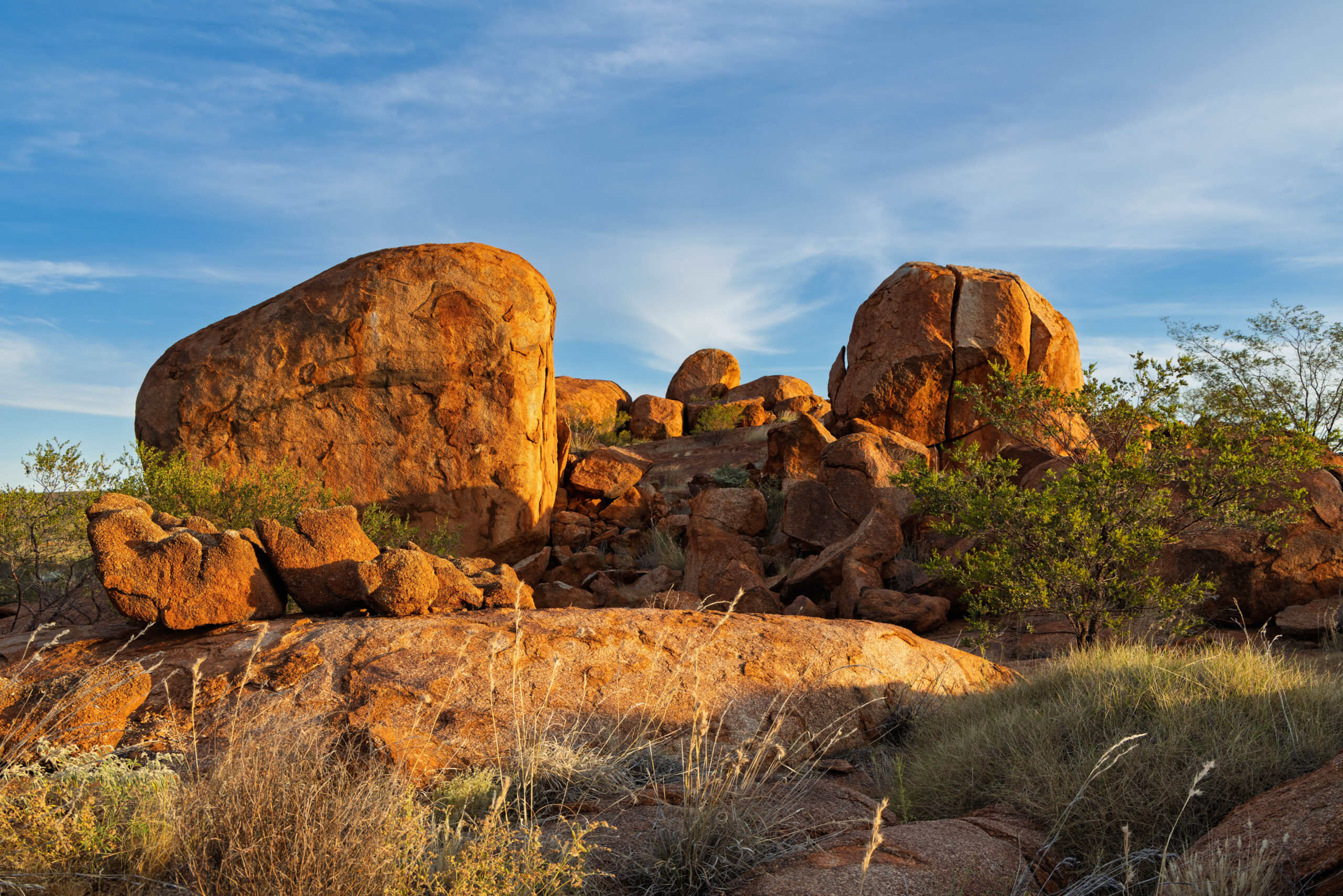
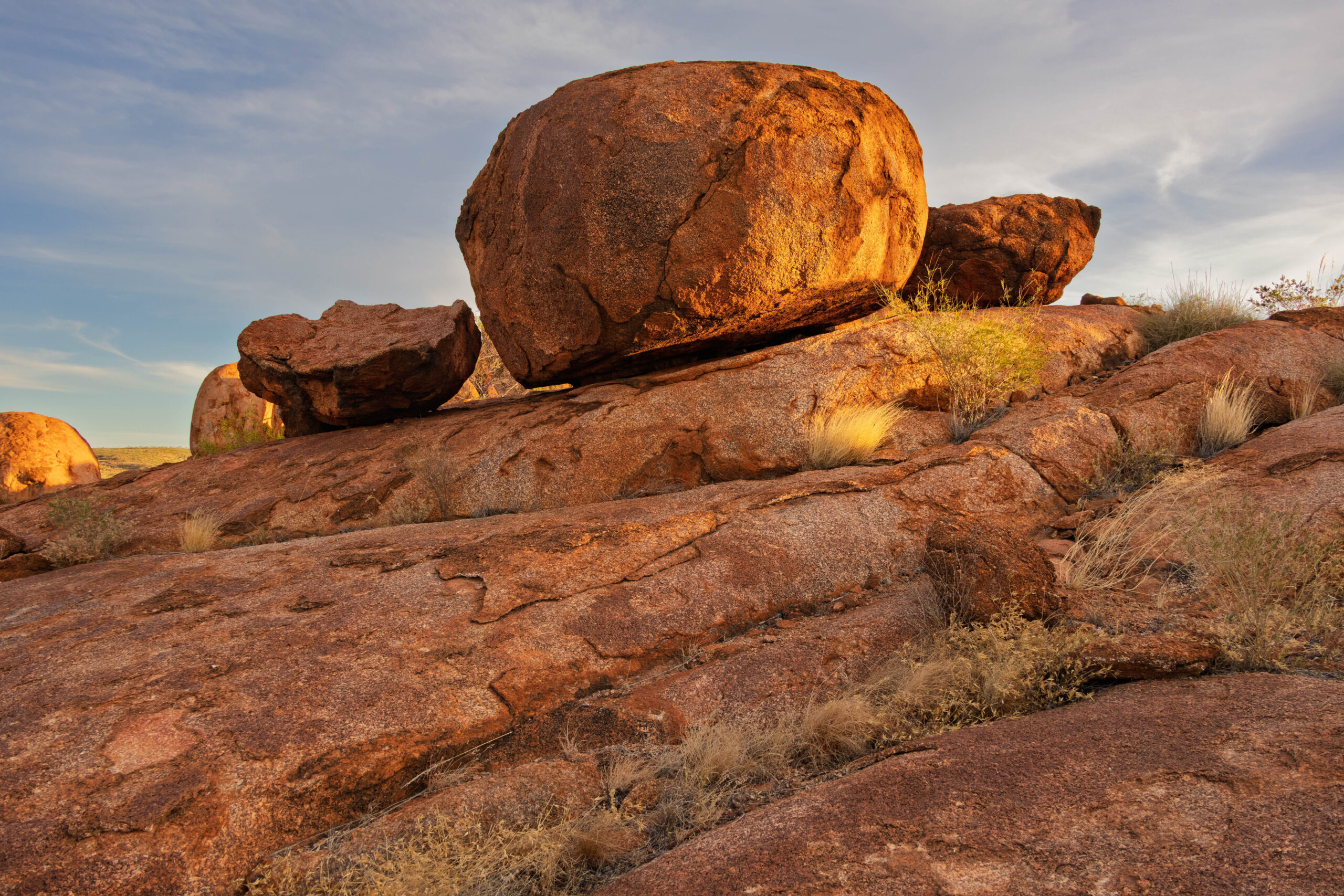
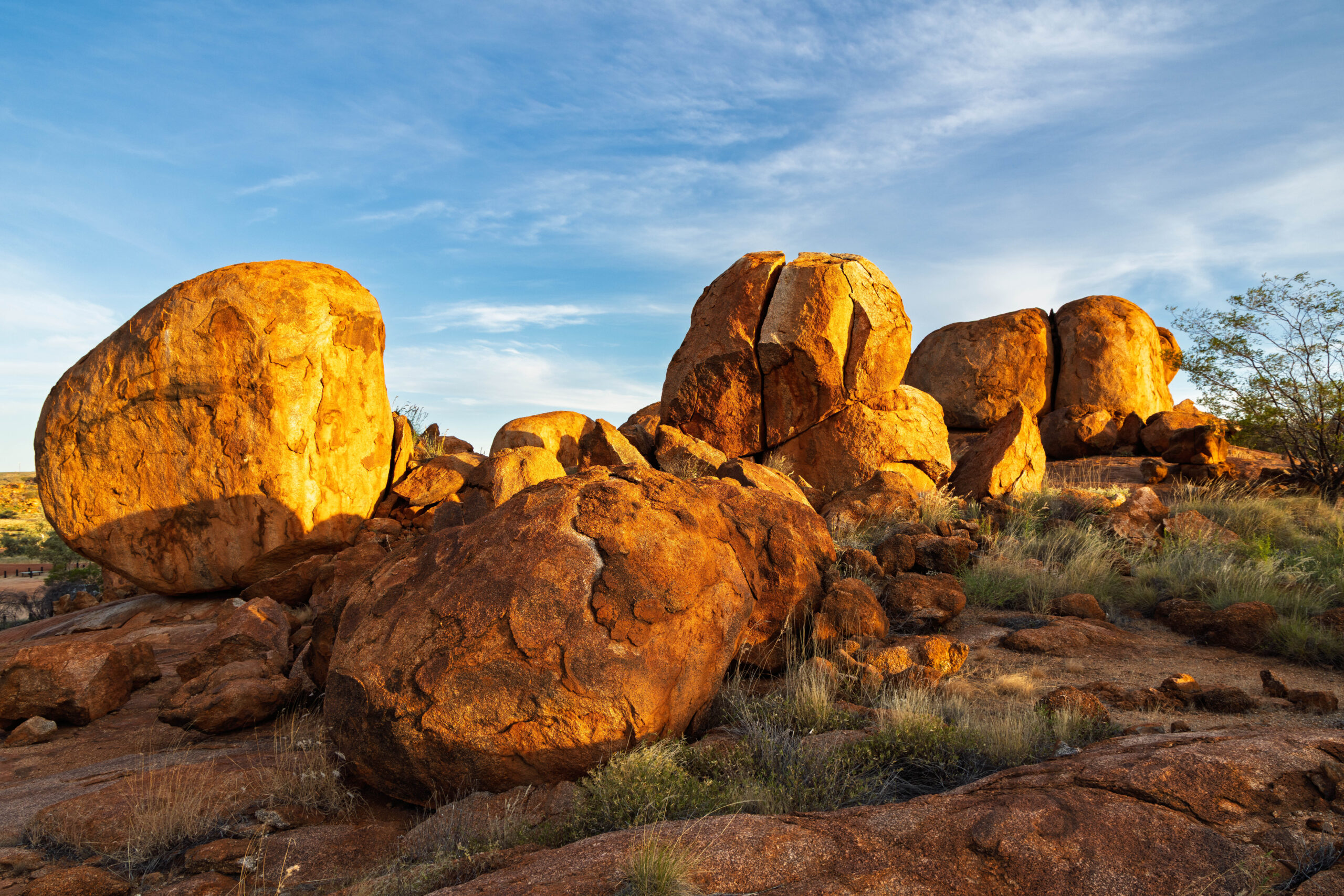
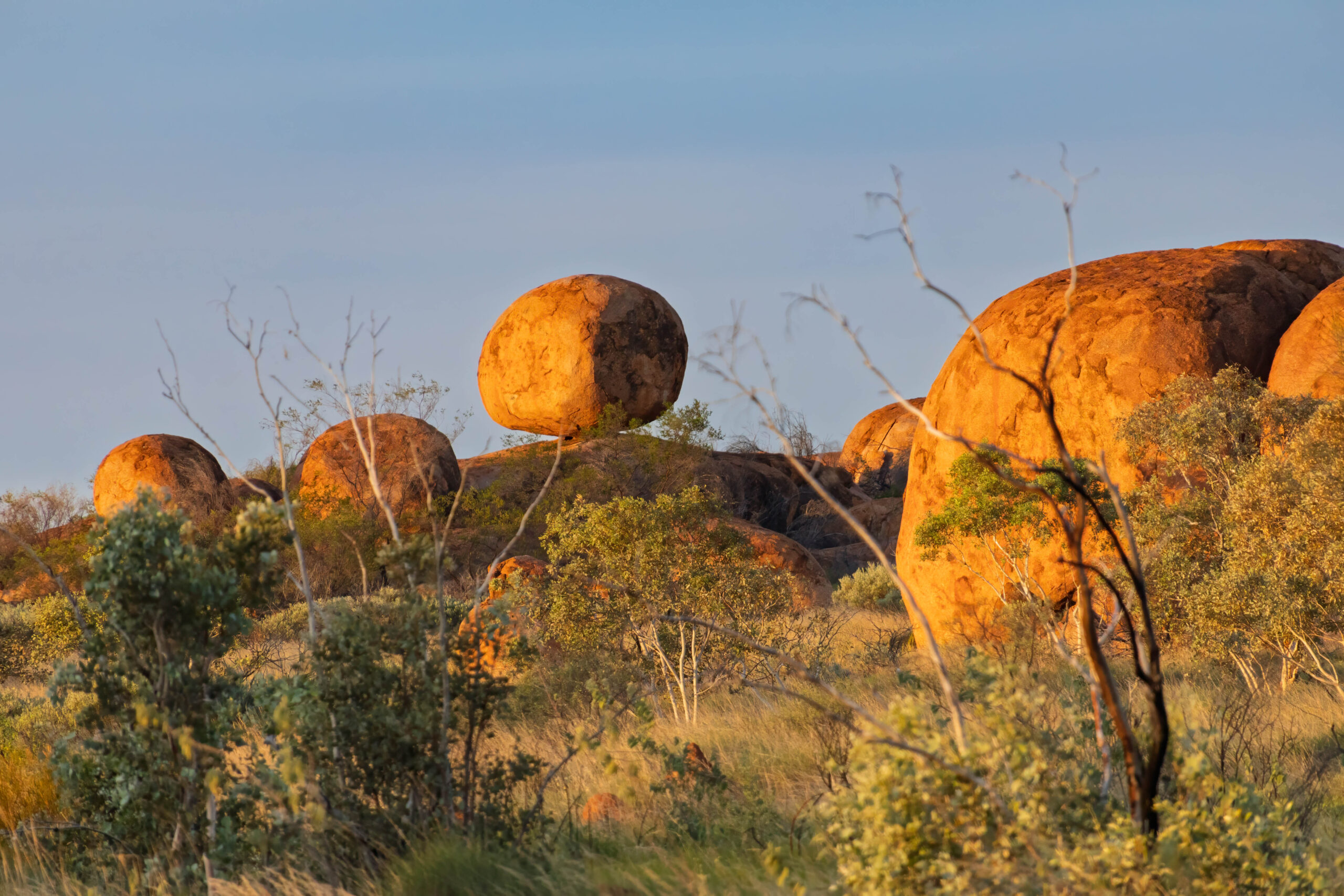
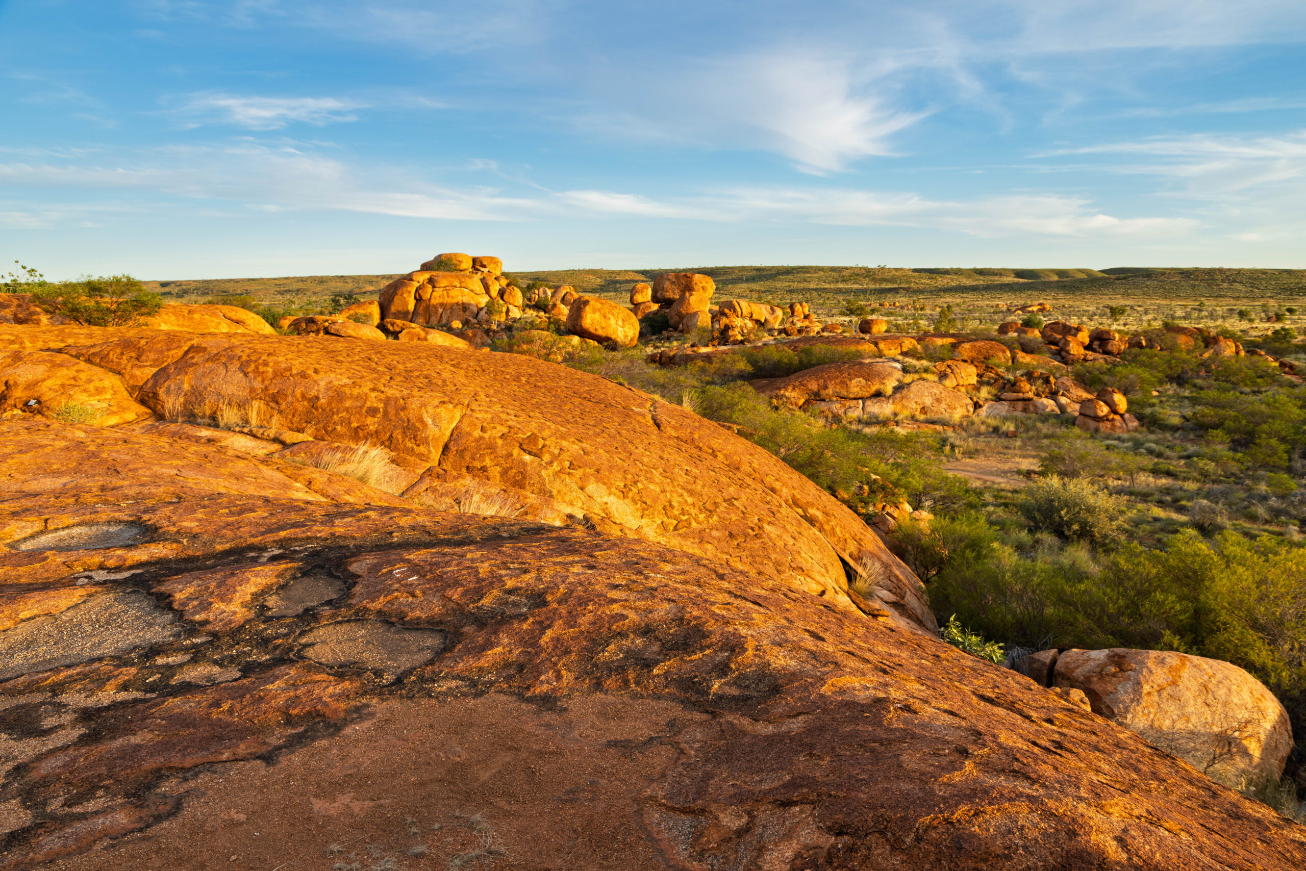
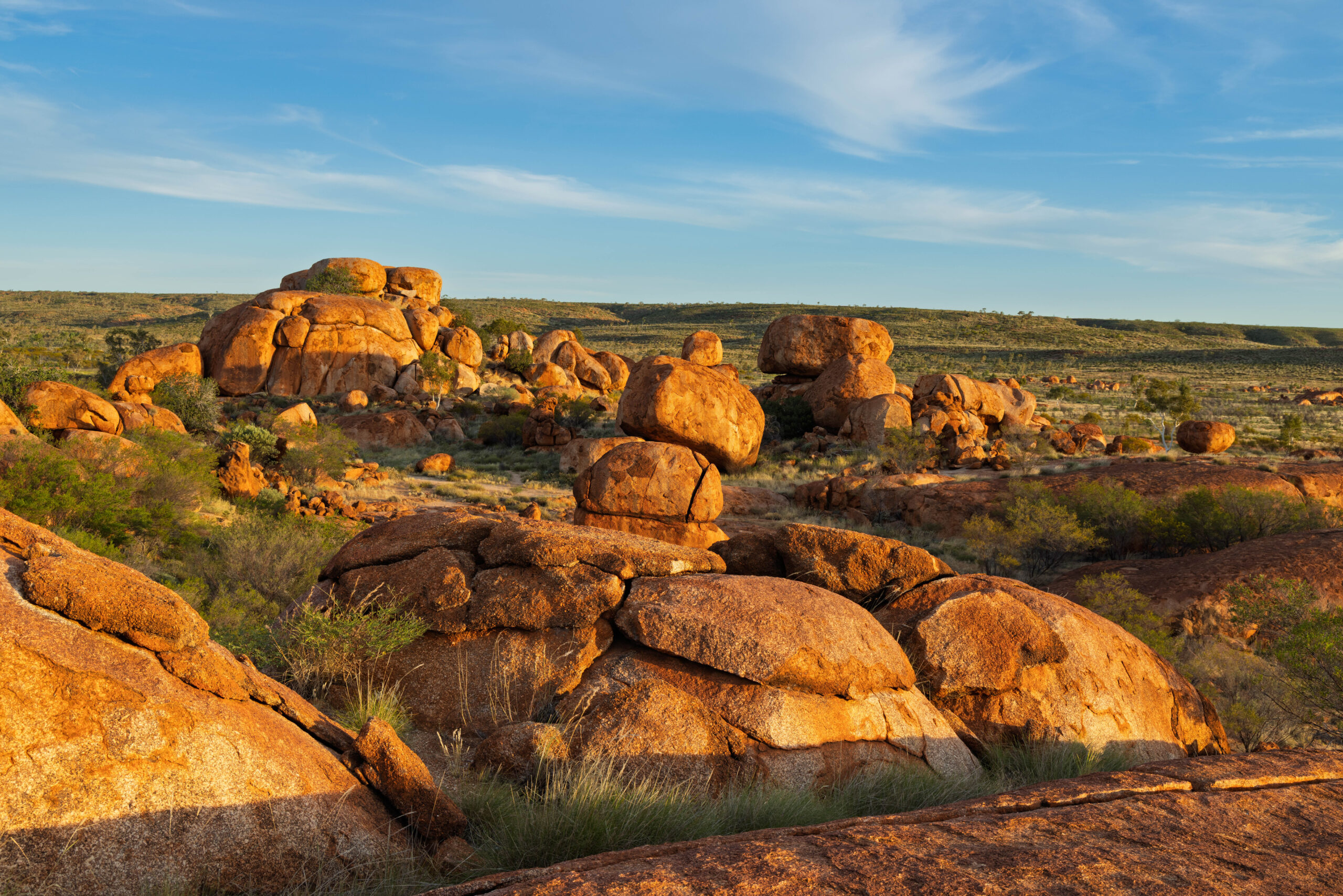
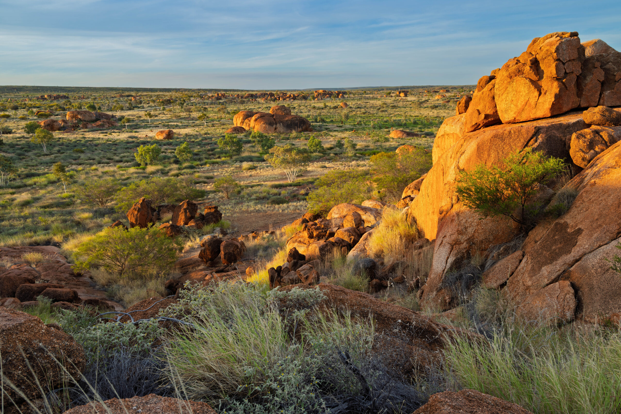
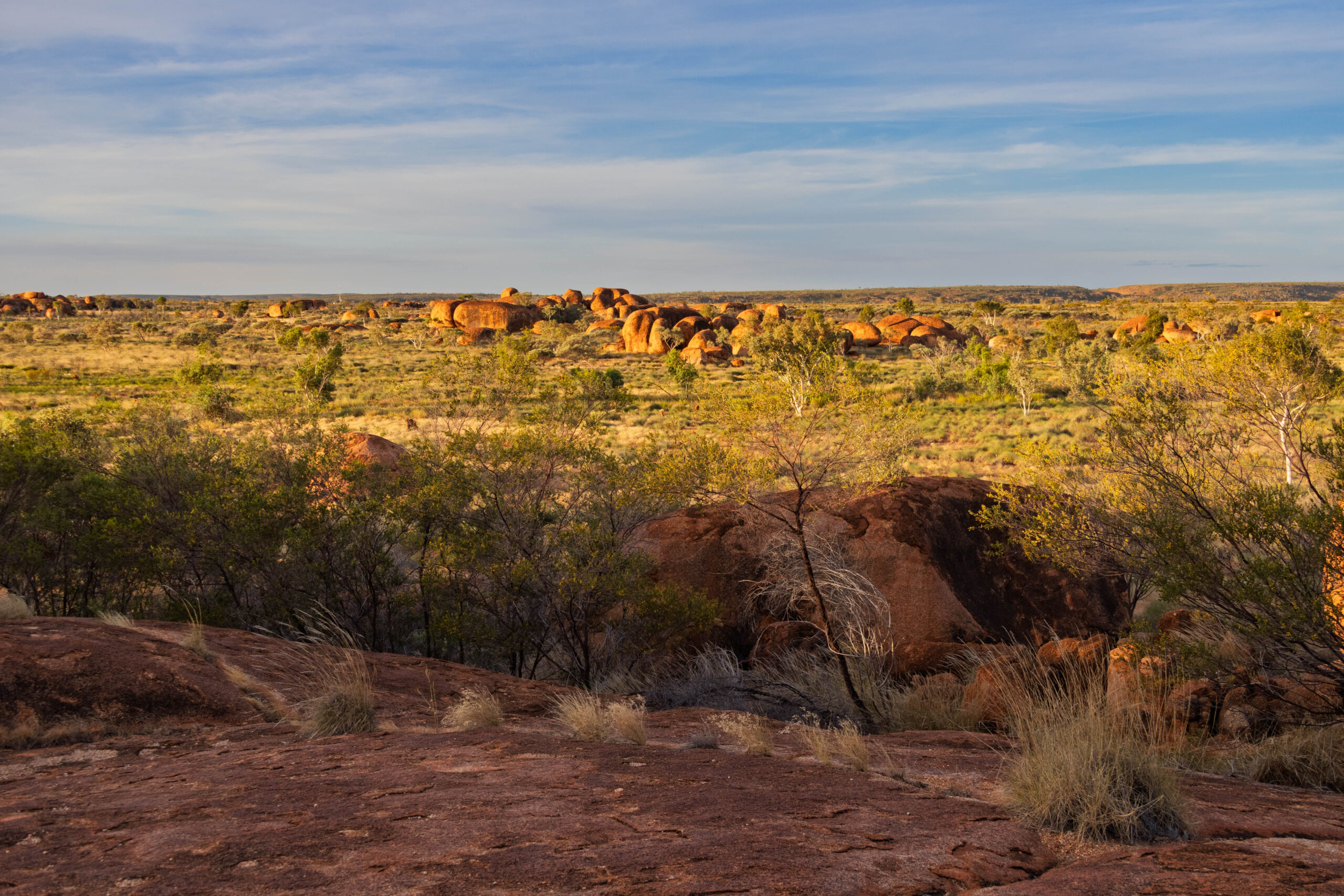
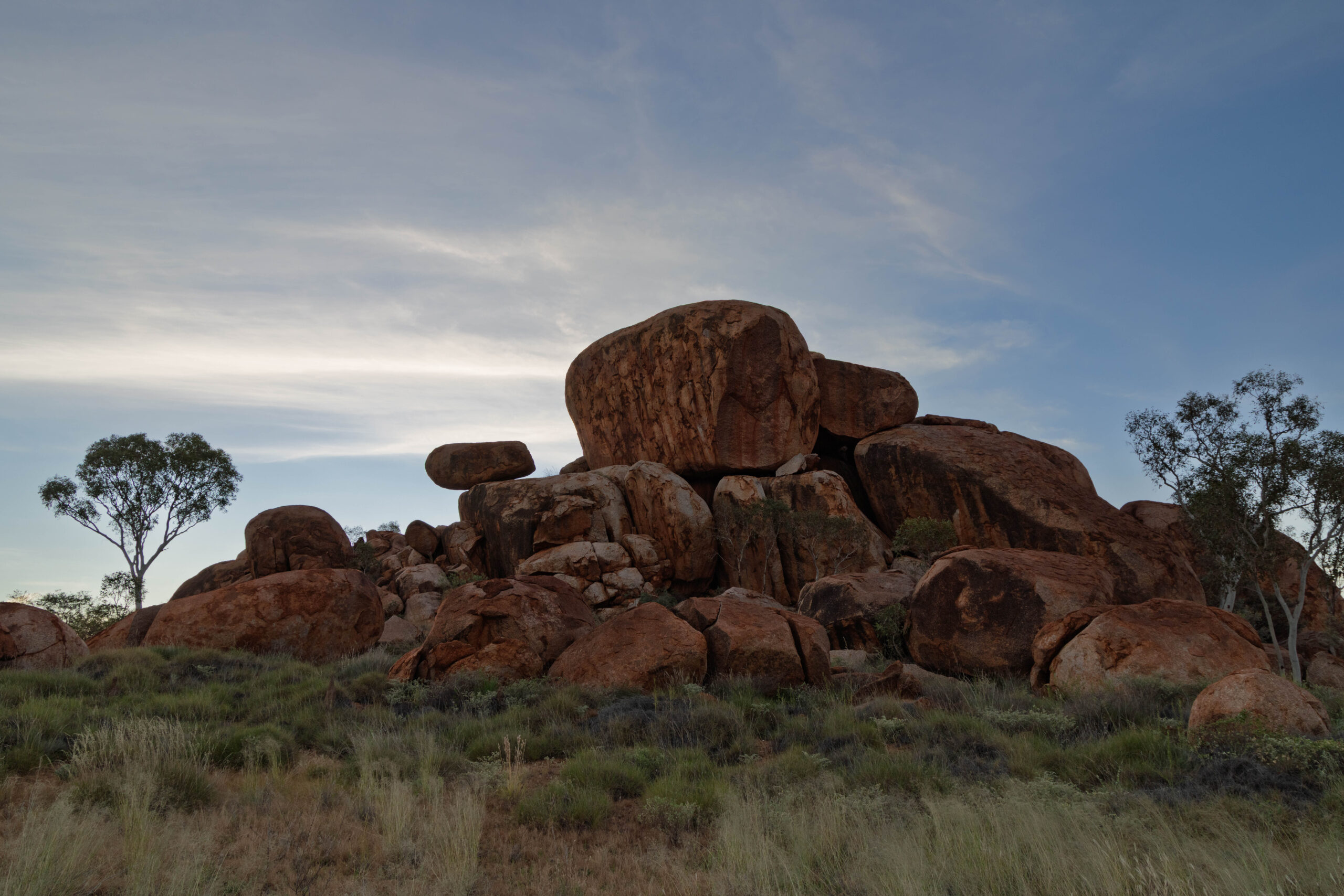
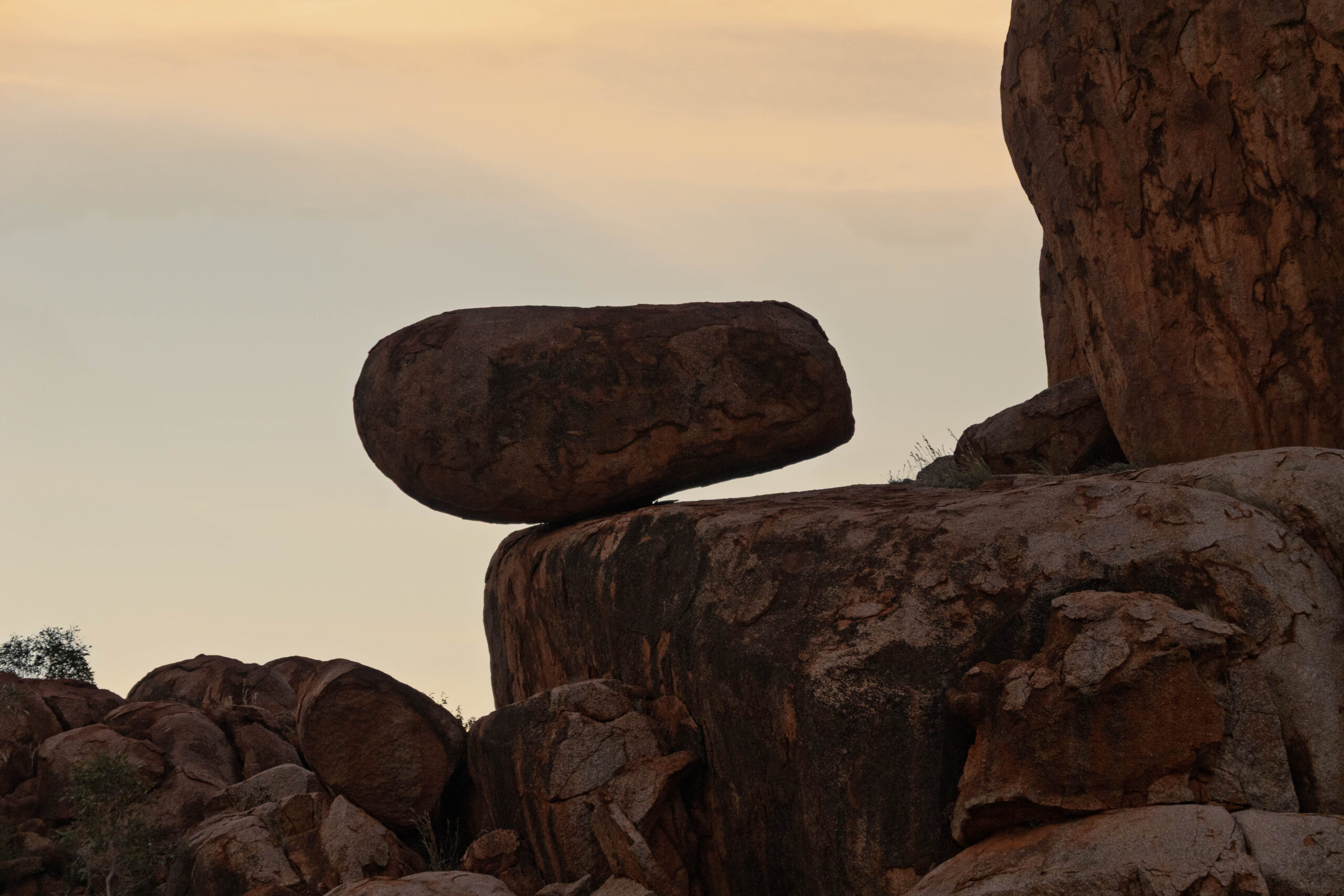
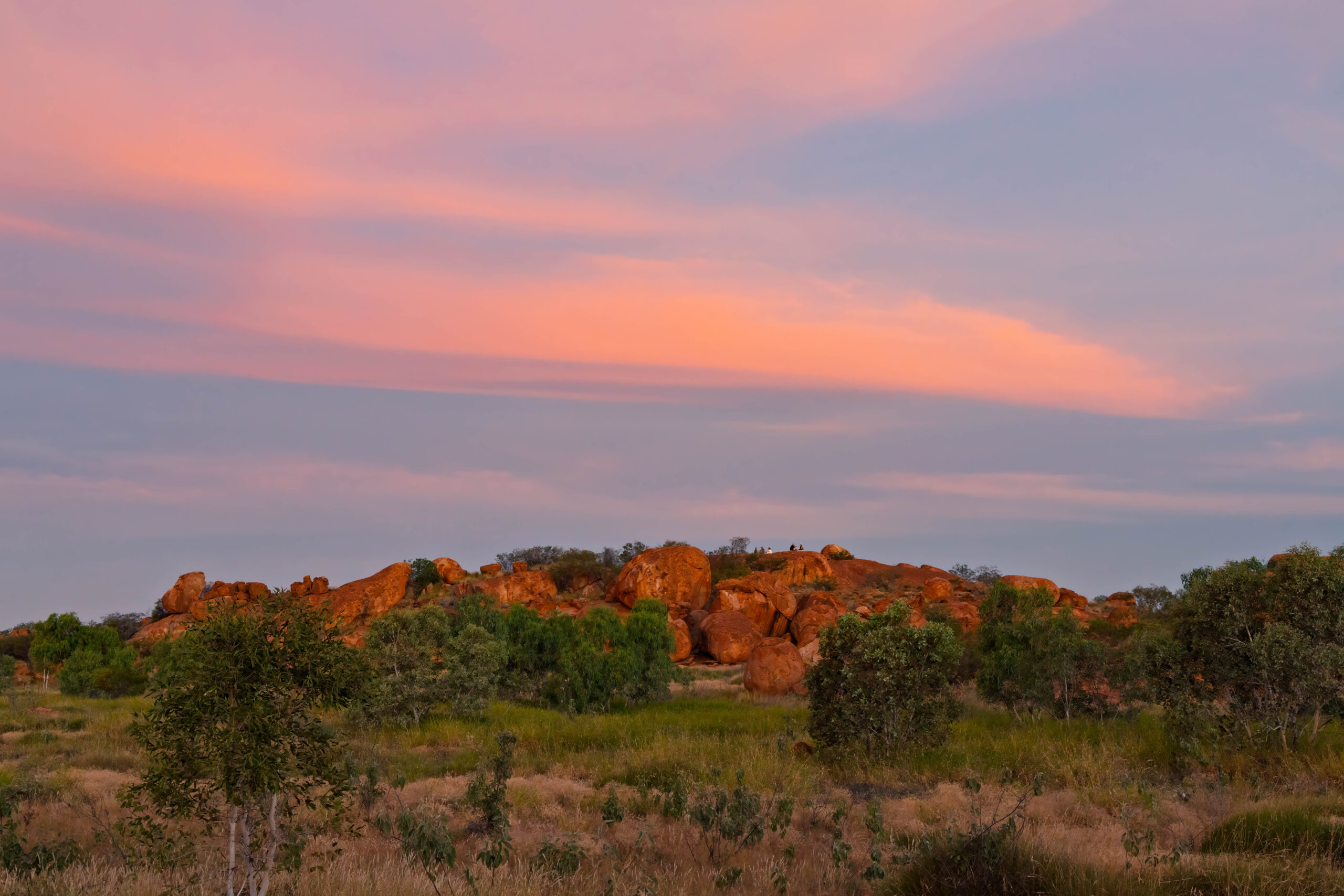
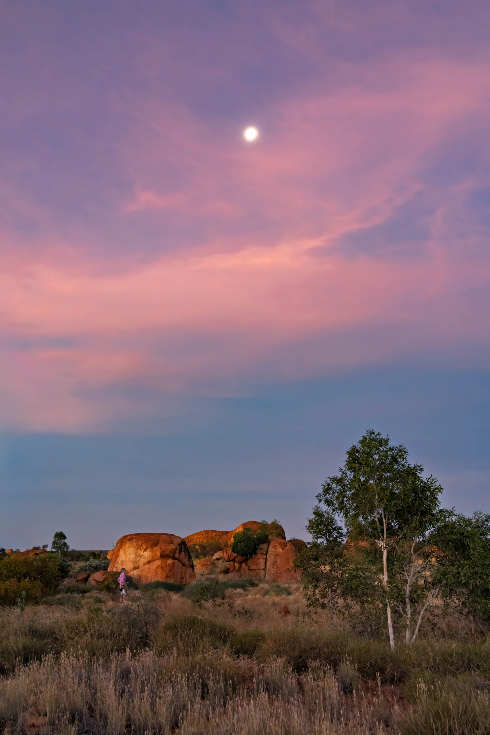
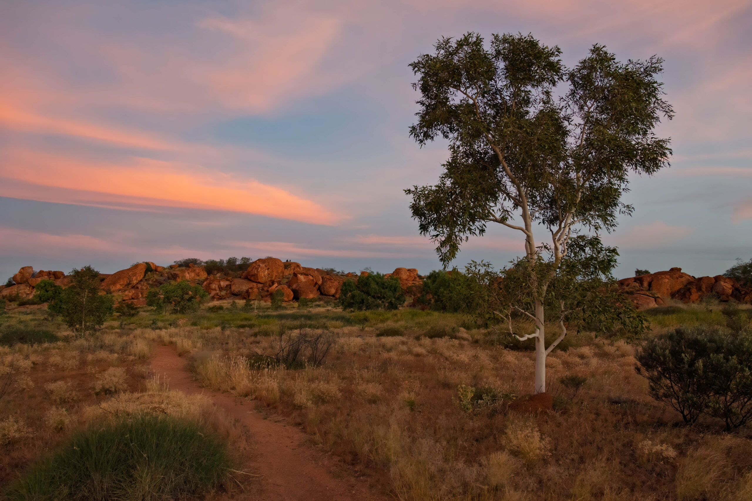
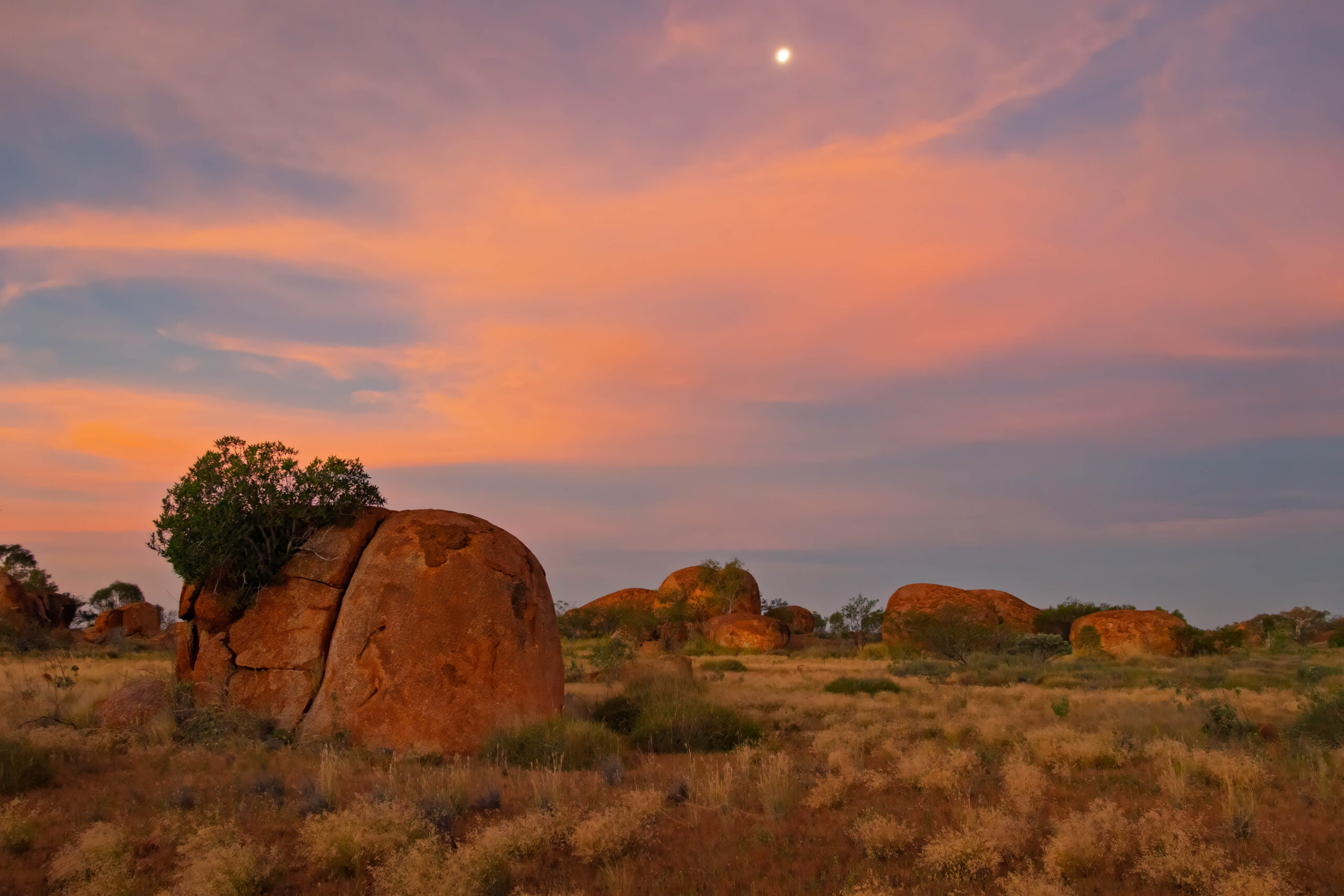
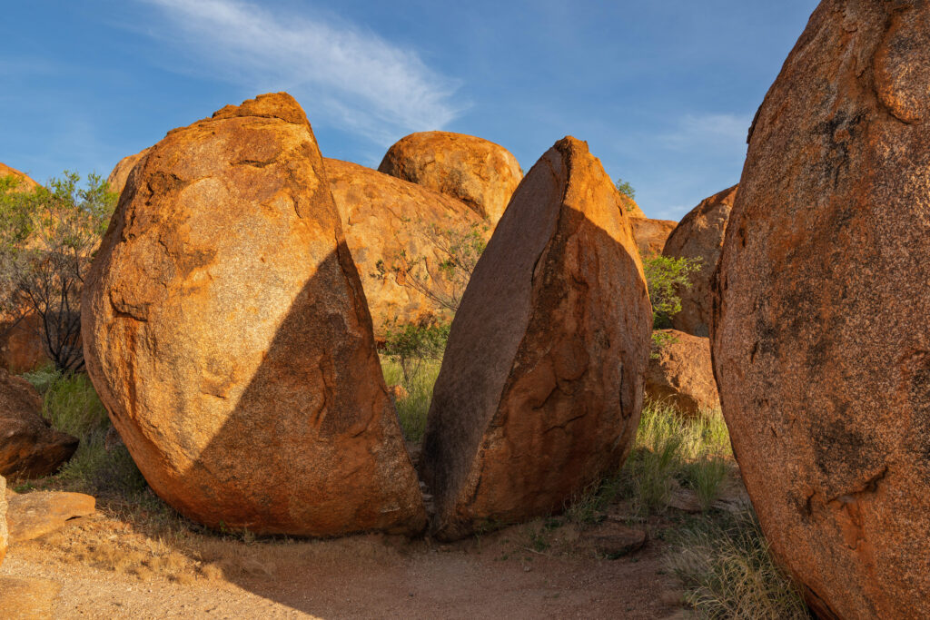
Around 5.00pm we drove out to Karlu Karlu (Devils Marbles) to make the most of the late afternoon light and the reflection of the setting sun on the ‘marbles’. The site was much larger than we had expected, with several hectares covered in scattered, stacked and balancing granite boulders, that are remnants from a solid mass of granite, the bulk of which still lies underneath them. When we arrived we had the site to ourselves, although more people arrived as sunset drew closer. As we wandered down from the Nyanjiki Lookout, we encountered three people heading up with their pizzas and pillows, to settle in for the sunset. Rather than watching the sun sink below the horizon from the lookout, we were more interested in watching the changing light on the marbles.
With dozens of photos of the marbles taken, we headed back to Wauchope. We stopped into or room to take our hiking boots off, deciding we would be safe to walk through the pool area to the bistro in our thongs. Despite the problems they had last week, the kitchen was in full swing offering a good range of meal options. We both had the lamb shanks with mash and veggies tonight. A welcome change from fried food and chips!
Steps: 7,986 (5.10kms)