Wednesday, 24 June 2026
We set out just before 9.00am figuring that leaving any earlier would see us caught up in the worst of the peak hour traffic. Even so, the traffic was quite heavy. The SatNav was programmed to take us to Norseman. There seemed little difference between the three different routes suggested but we decided to select the route on the Great Eastern Highway via Kalgoorlie.
However, almost straight away we ignored Syri and, rather than turning left at Burns Beach Road, we continued south to Shenton Avenue, as Sharon suggested it was a better option for merging onto the Mitchell Freeway. We transitioned from the Mitchell Freeway to the Reid Highway and we heard some chatter on Channel 40. A driver was alerting a truck driver that he was spilling sand and sandblasting all the cars behind. Well, you might think that a truckie would take this on board and perhaps pull over to check his load? But, no, the driver launched into a racist, expletive laden attack against the driver. Pretty ordinary when you’re on a public channel.
Our next turn was onto the Tonkin Highway, at which point I said to Bernie – I don’t think the SatNav is still taking us via Kalgoorlie, I think we are heading towards the Brookton Highway instead. Since there was little difference between the routes, we decided to continue the way Syri was taking us. We turned off the Tonkin Highway onto Mills Road East which saw us driving up a big hill through bushland. If I had been navigating it would not have occurred to me to head off on this short cut?
After a right onto Canning Mills Road and a left onto Chevin Road, we turned onto Brookton Hwy (Highway 40) with instructions to continue straight on for 237 kilometres! The bushland gave way to farmland, where sheep and cows were grazing. The pastoral scenery continued until about 55 Ks out of Brookton, where we could tell we had arrived in WA’s wheat belt.
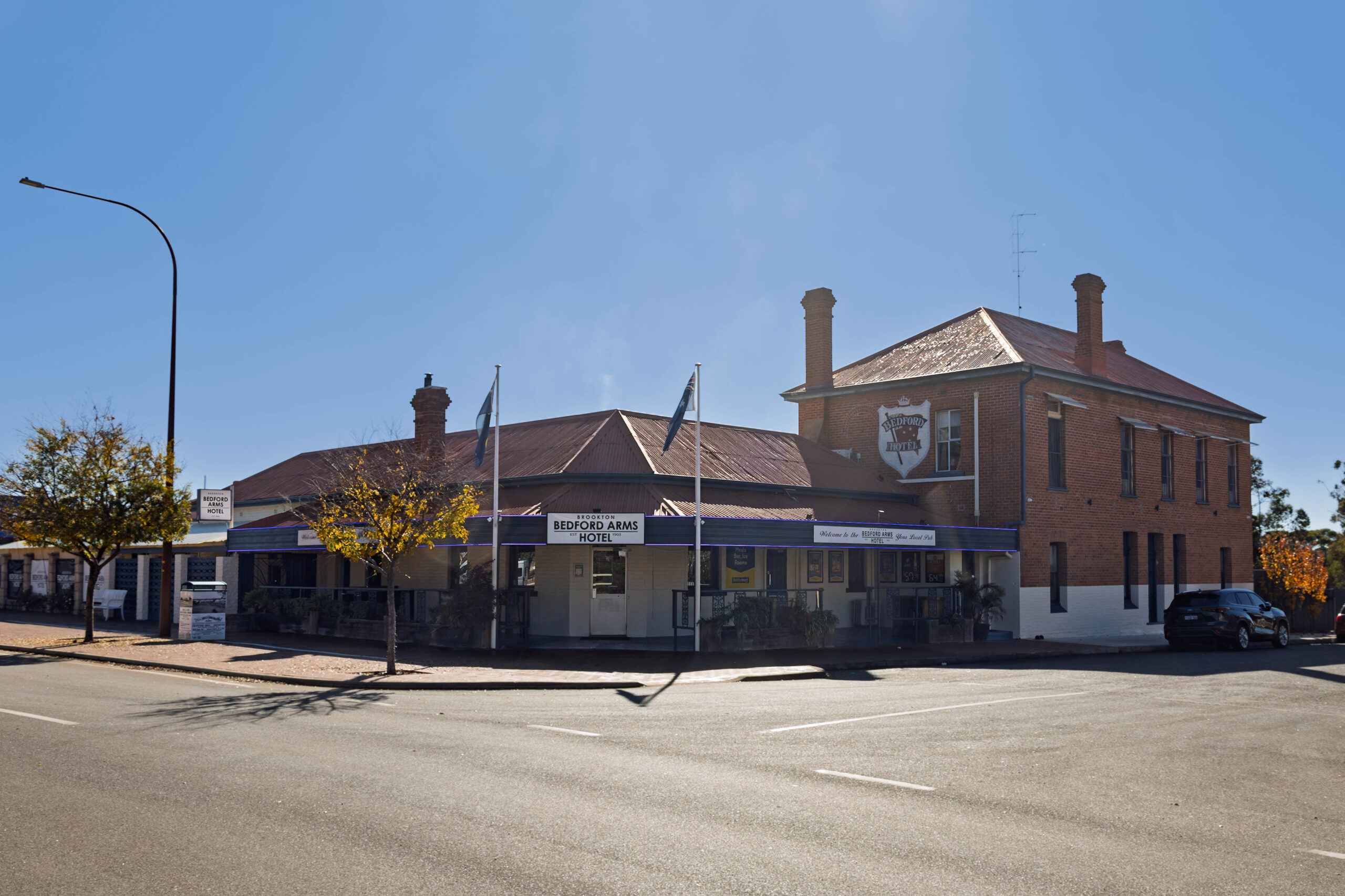
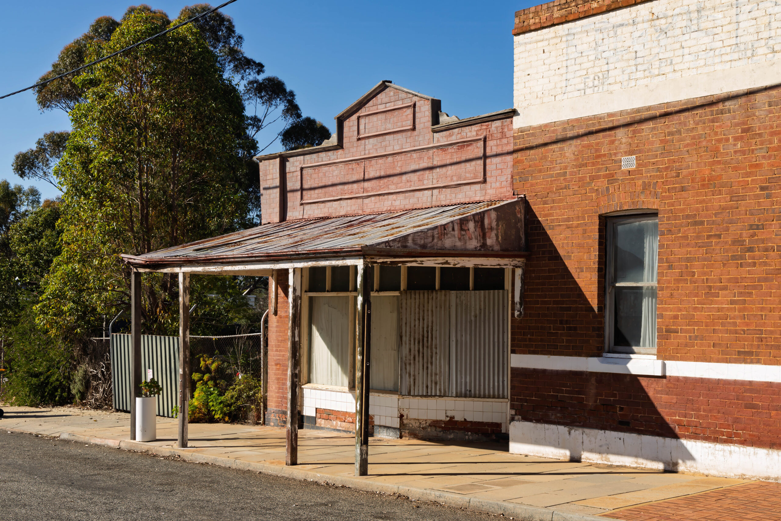
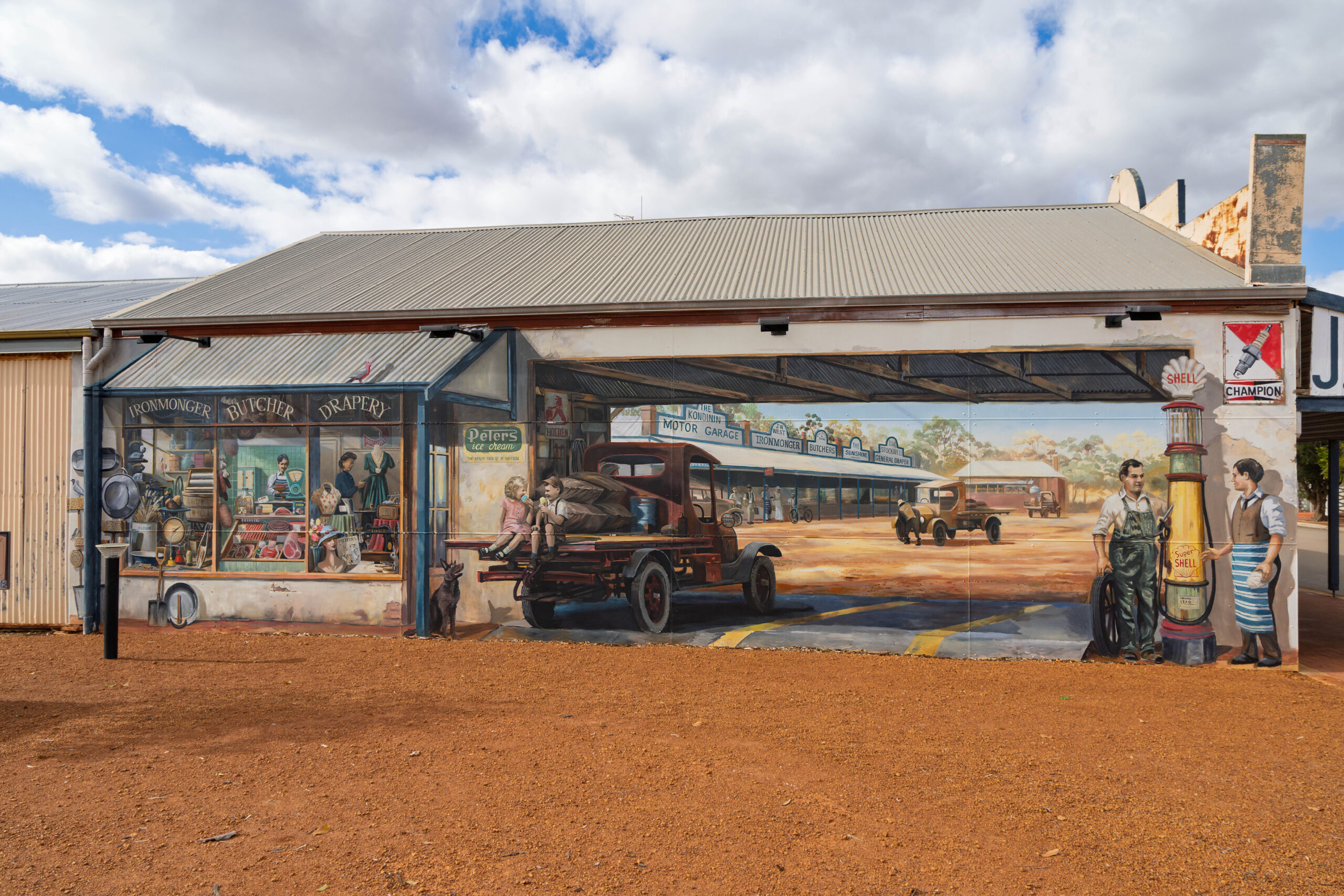
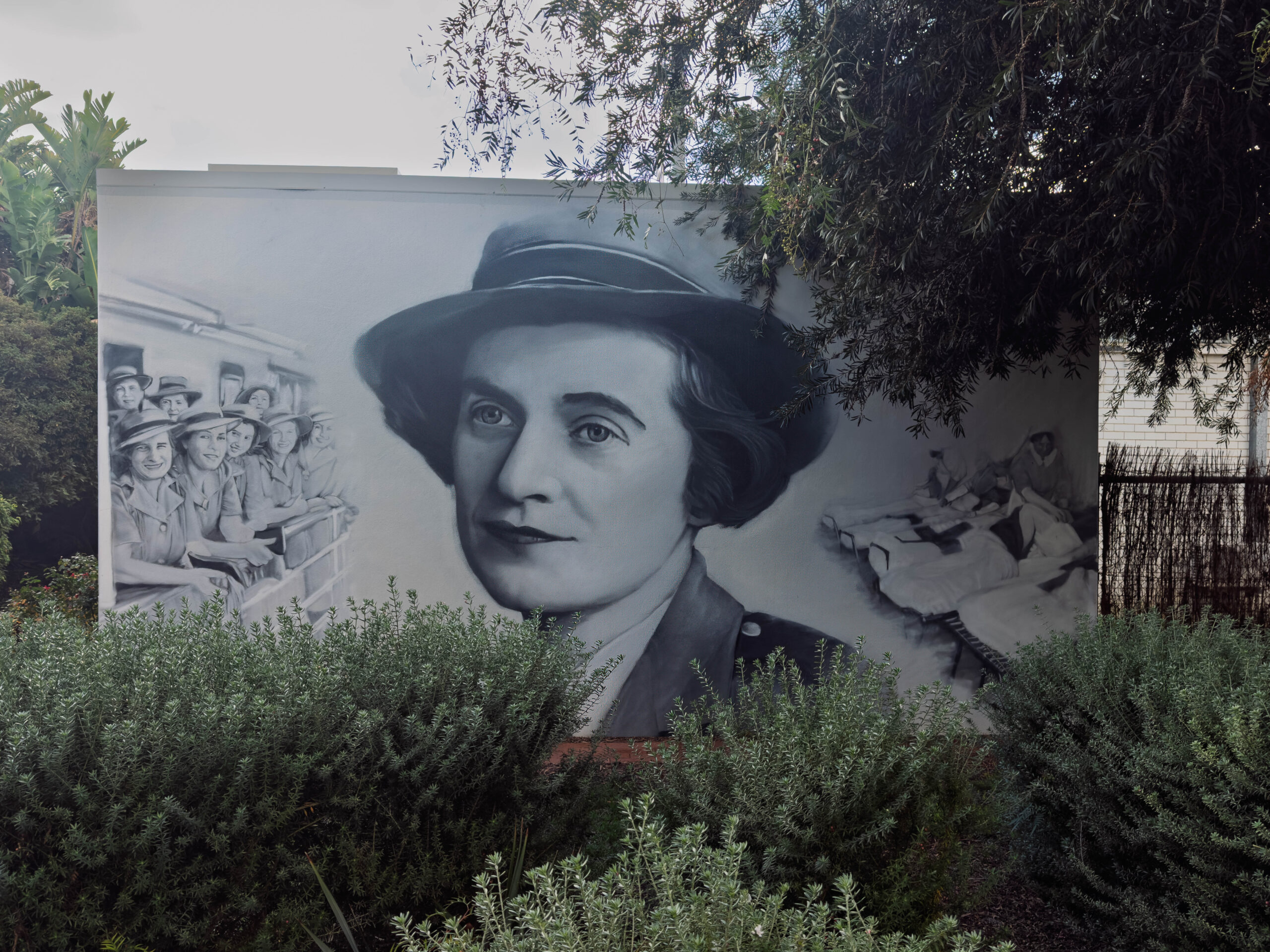
Just before 11.00am we parked the truck in Brookton for a comfort stop and leg stretch. We took photos of a couple of the classic old shopfronts but, unfortunately, not the railway station. The railway station is currently under repair and has most of its roof off. A sign in one of the shopfronts indicated that in 2027 it will be 100 years since the railway connected to Brookton, so it seemed reasonable to assume that the work is in preparation for the centenary next year?
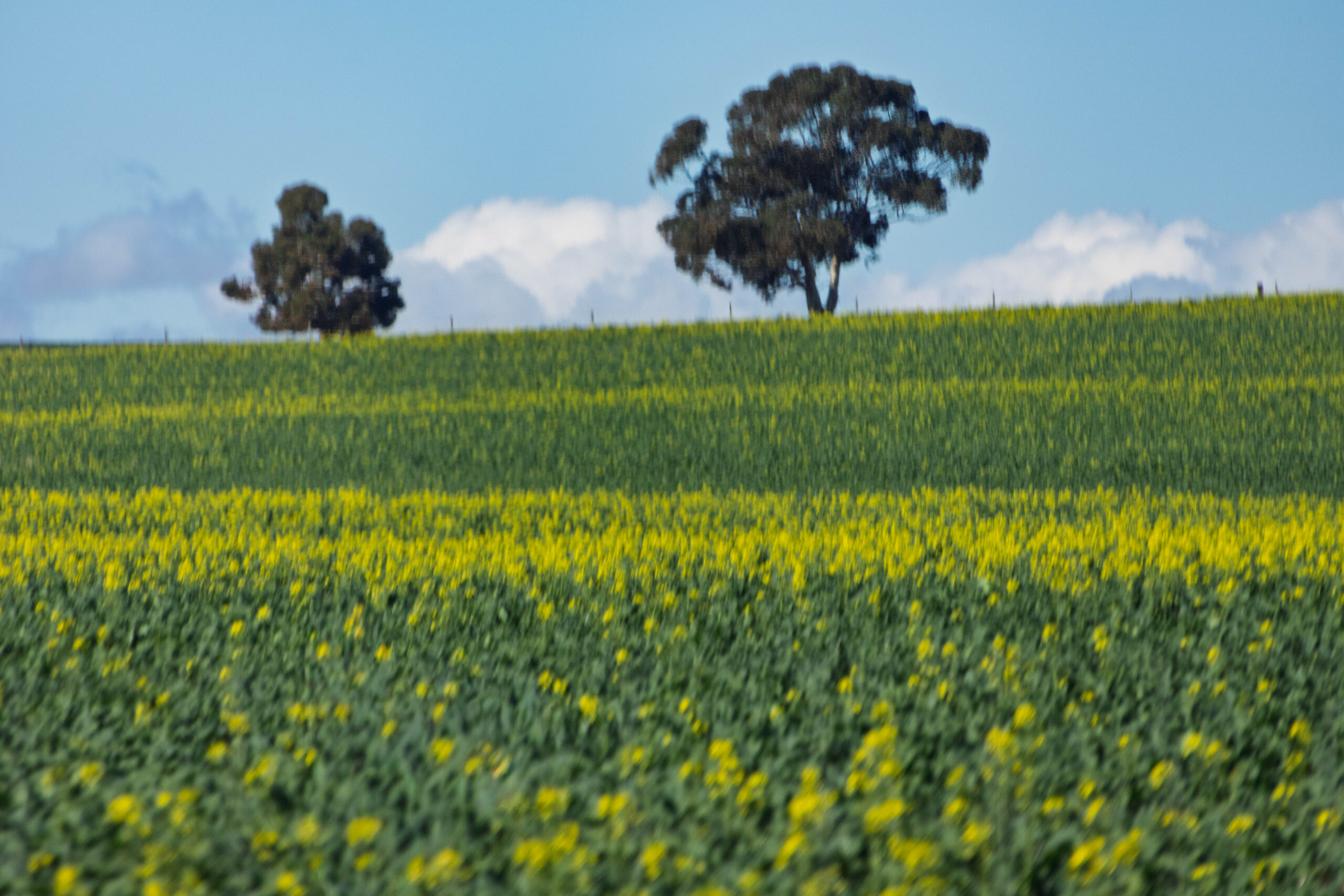
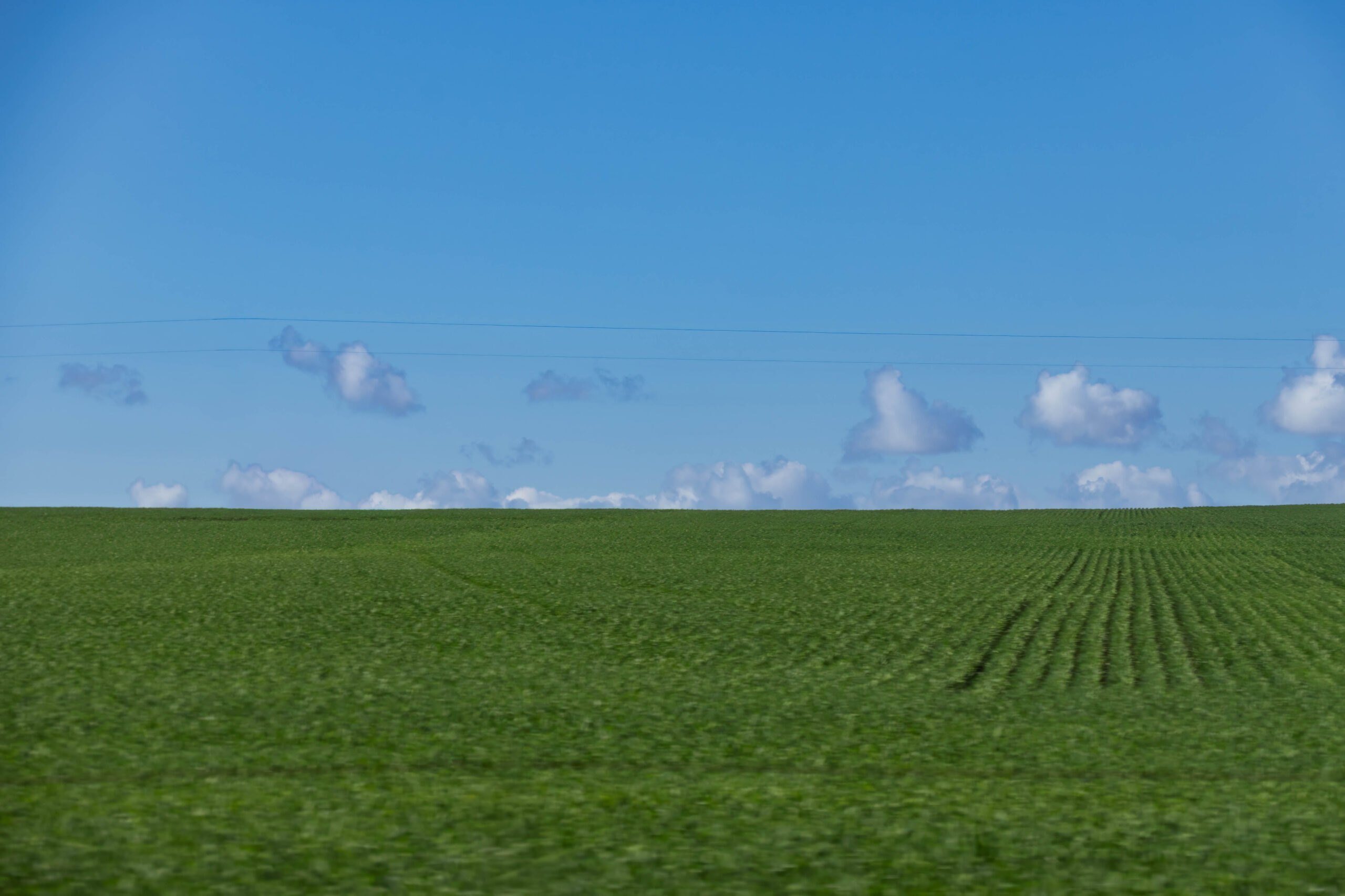
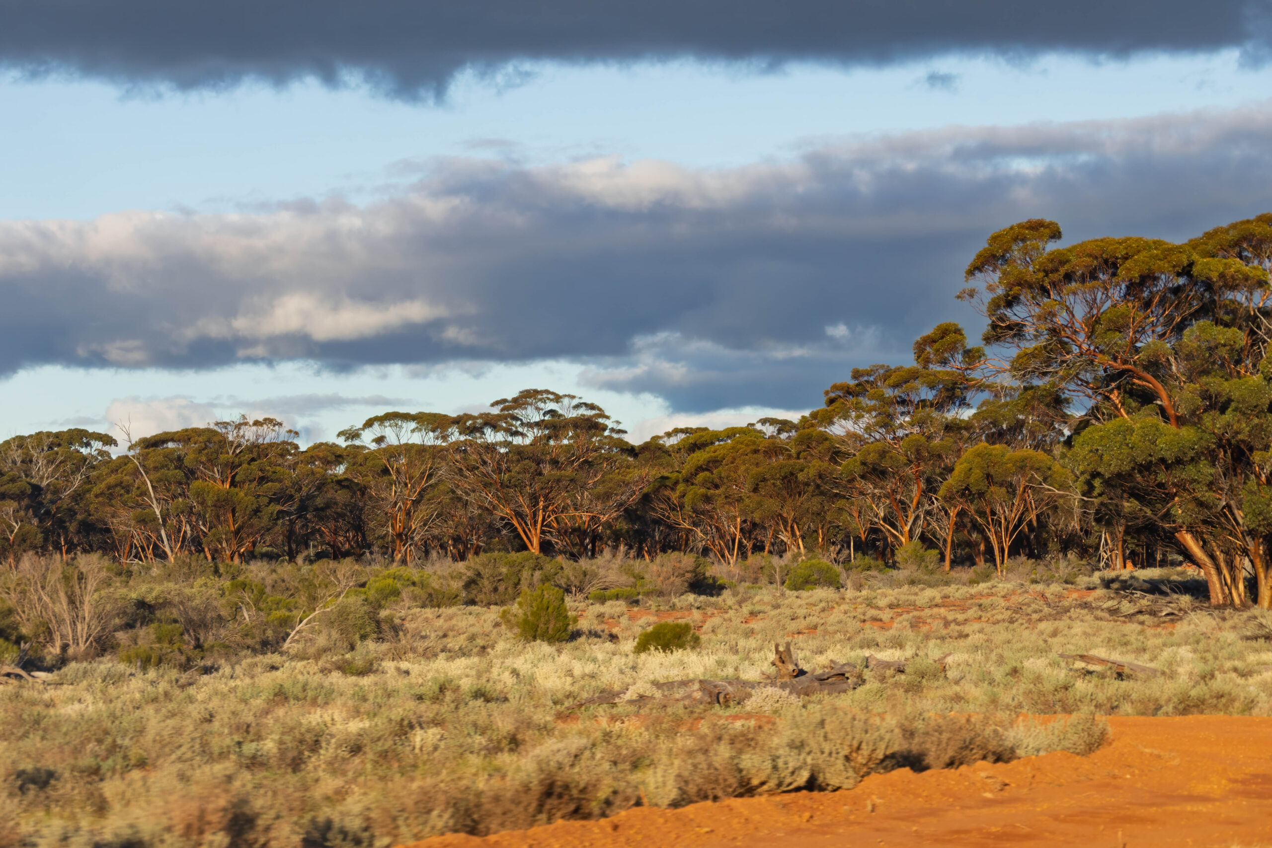
After Brookton we were driving along firmly in the wheat belt … with hints of canola. Some paddocks of canola were just starting to flower so had a hint of yellow to them. We had been able tell that something other than wheat was being grown, because it had a darker, broader leaf than the wheat. We thought it might have been a legume to replenish the soil after a crop of wheat last season but, as soon as we saw the yellow flowers, we knew it was canola.
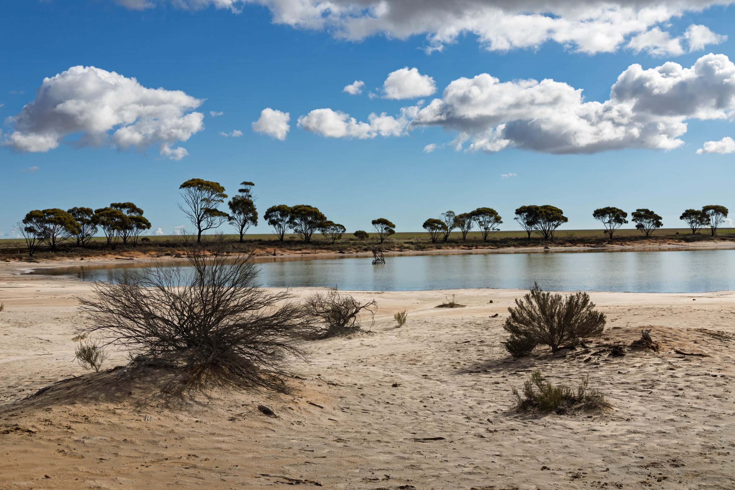
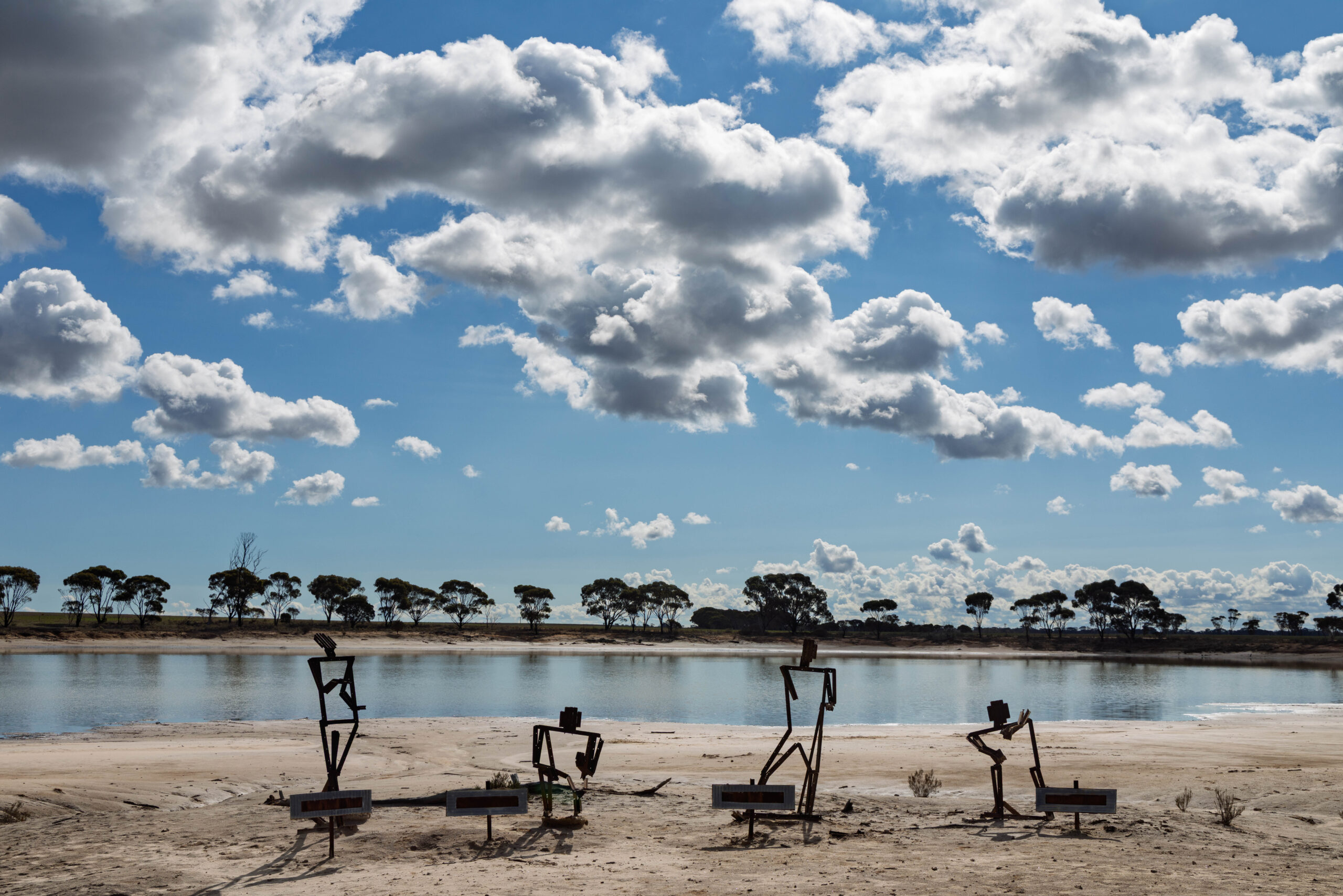
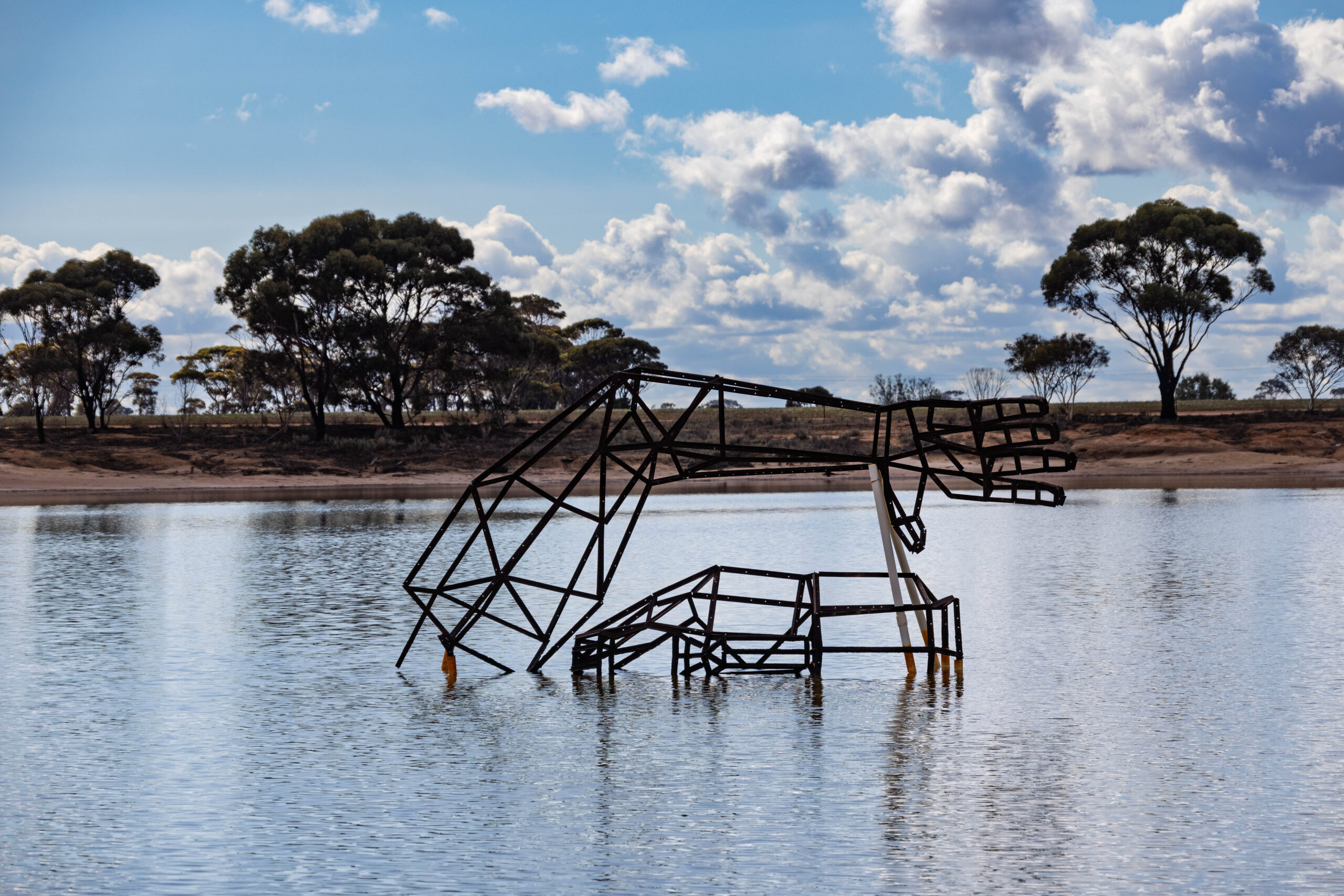
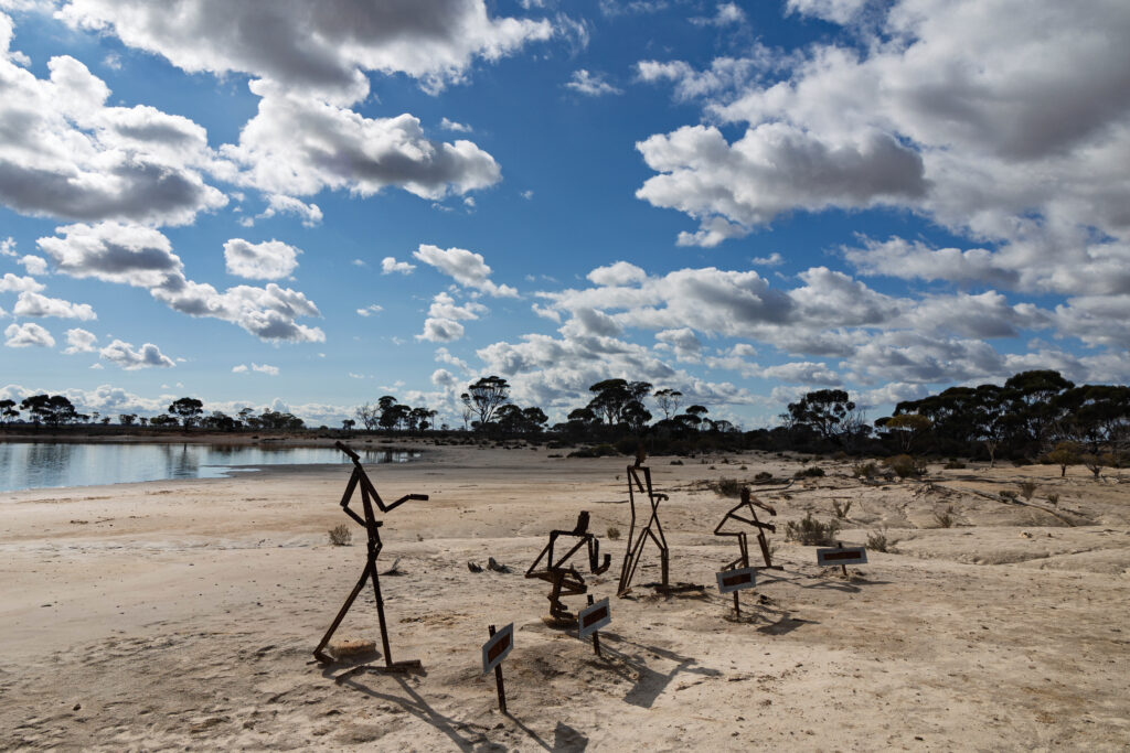
About 12.30pm we happened upon Statue Lake. I had seen something about Statue Lake on Google Maps, but we had decided if we saw it well and good, but we would not go looking for it. The lake was right beside the highway and there was a small lay by to pull into. Hmmn, not very exciting. There was a group of metal figures beside the lake and something else in the lake. Determined to find the angle that revealed what it was, I set off around the edge of the (small) lake. Eventually the sculpture resolved into a … hand? Not sure what it represented really as it seemed quite a random thing to have in the lake. Of course the damp sand/clay had packed onto the soles of my runners so, by the time I re-joined Bernie, I was wearing sand/clay platforms!
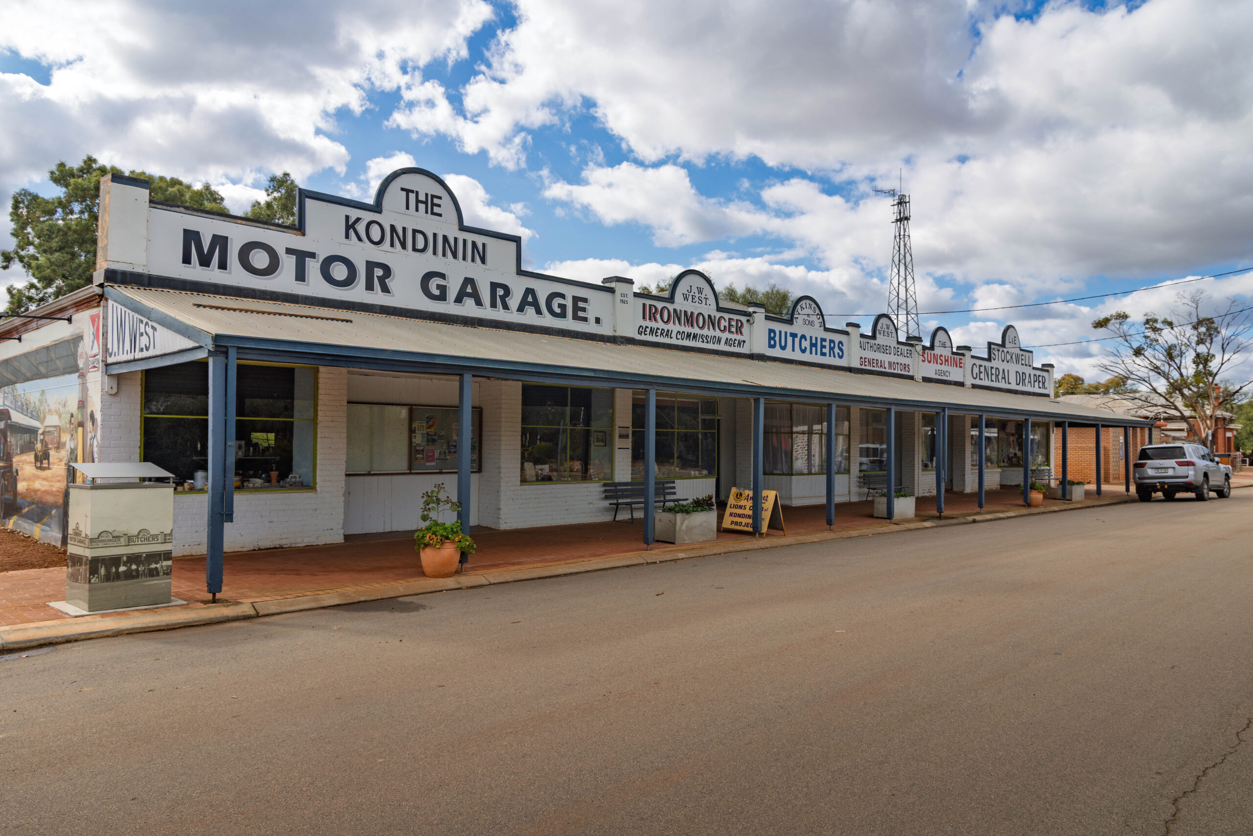
We arrived in Kondinin. While driving Bernie had asked me to Google potential lunch stops. It had been a toss up between The Mallee Tree Café in Corrigin and Acres of Taste in Kondinin. Acres of Taste rated higher, so we had decided to drive through Corrigin and stop in Konindin. Except … I thought Acres of Taste was IN Konindin but, of course, Google does tend to throw up things that are NEAR where you are searching. It turned out that the café we were planning to eat at was 24 kilometres away … in Kulin. Ahem, not the direction we were travelling in and no time today to take any detours.
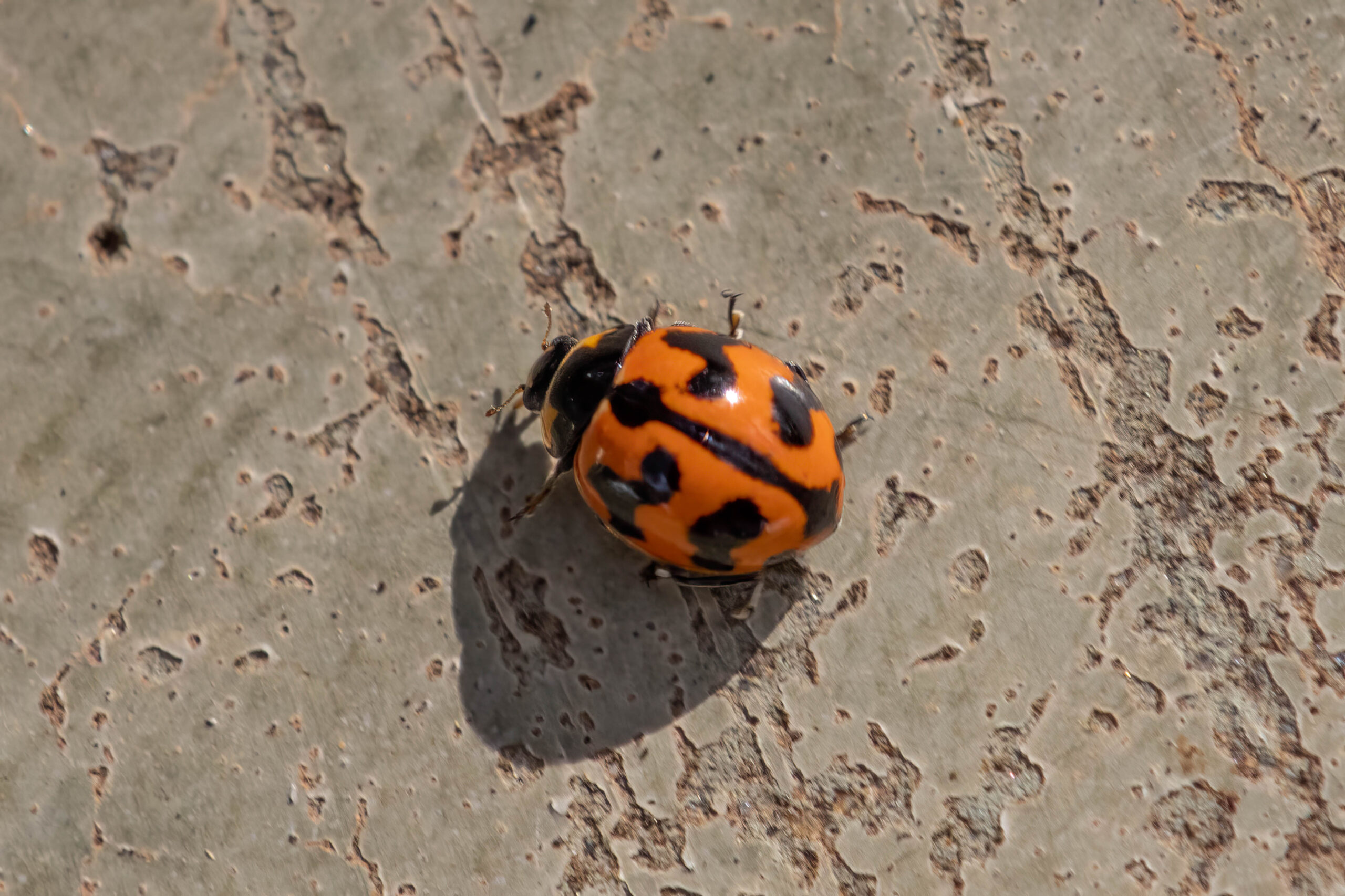
No sandwiches at the IGA, which left us buying white bread sandwiches AGAIN at a servo. We drove back to the park to eat them at the picnic tables under the peppercorn trees which was pleasant, especially with a ladybird joining us on the table. I’m sure ladybirds are supposed to bring good luck or positive vibes or something aren’t they?
We made our way towards the conveniences but, before we could get there, a woman zoomed up to us on her scooter. She had seen us taking photos and wanted to tell us about ALL the local photo opportunities, especially the rock. We thought she meant Wave Rock, which we visited last time we were in the West. No, no, Yeerakine Rock. There’s a tank painted with war horses and a big metal horse and it is where people in this area commemorate ANZAC Day. It’s really beautiful, she told us. I Googled it, when were back in the truck and, yes, it does look beautiful BUT, we really did not have time today for the detour with our new ETA after our lunch break blown out to 6.00pm! Next time, maybe??
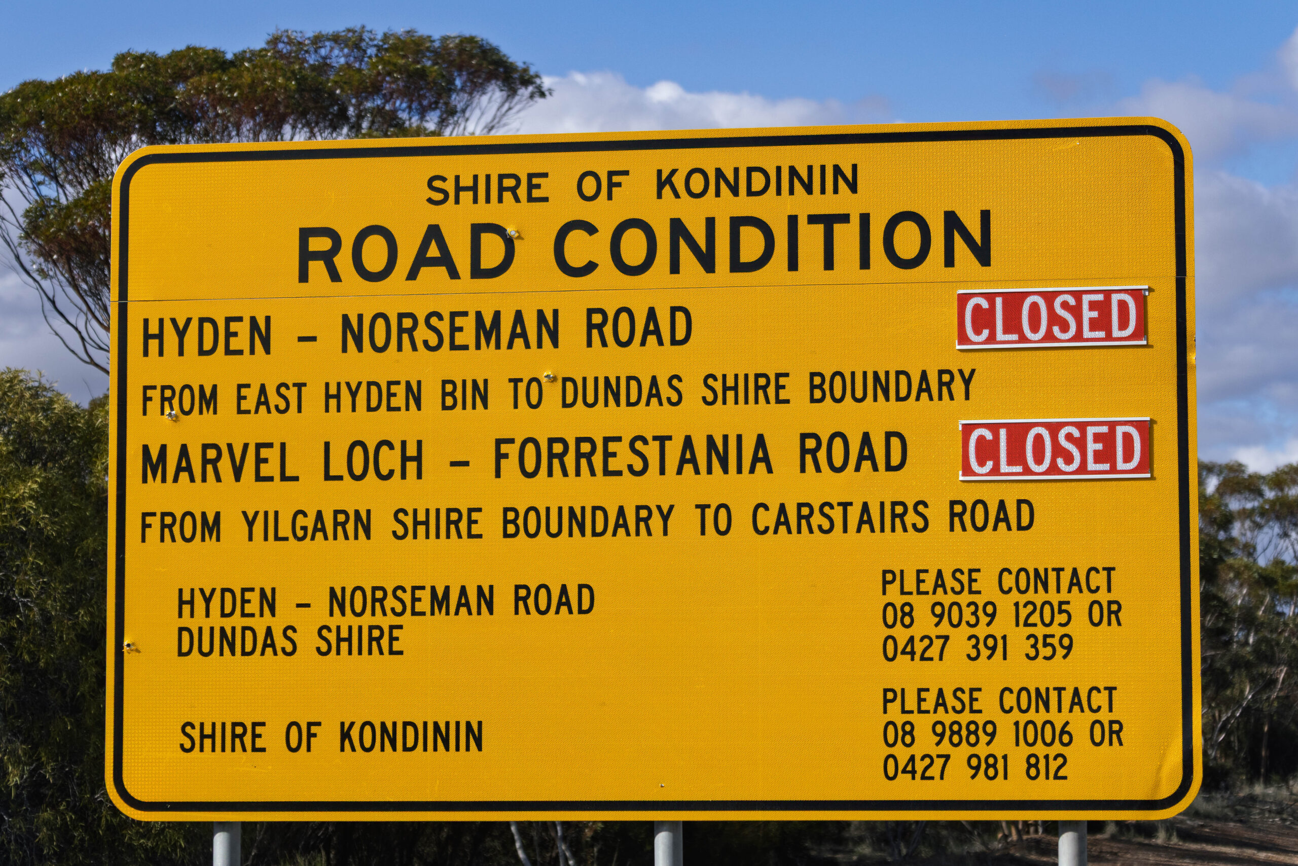
Aaaargh! We had a moment of panic when passing a road condition sign that had road closures on it. We did a U-Turn to check which roads were closed. The road names on it meant nothing to us. Where do those roads go? We were on the Hyden-Norseman Road and, as far as we could tell, it was not one of the roads that was closed. We hoped, fingers crossed.
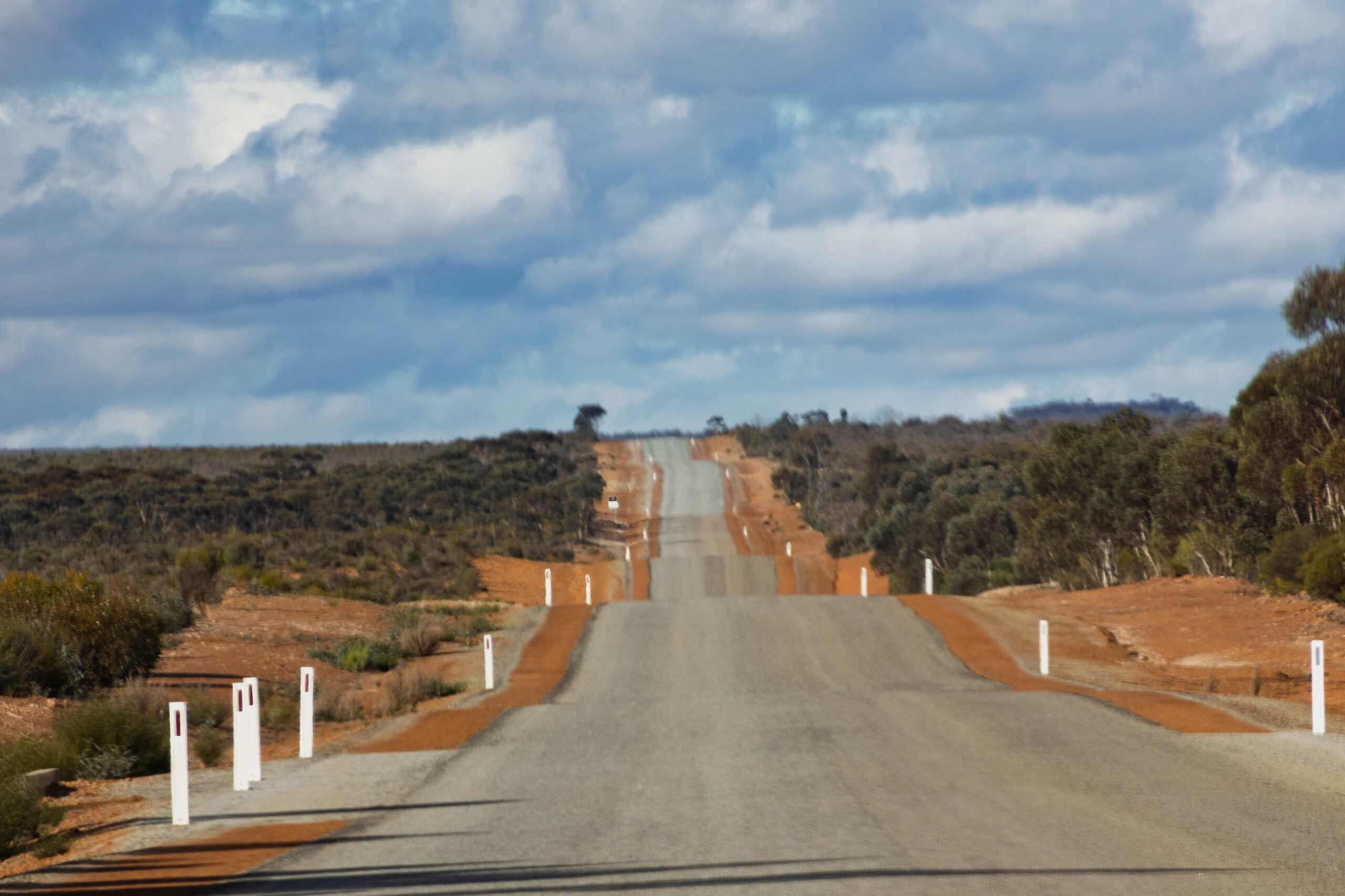
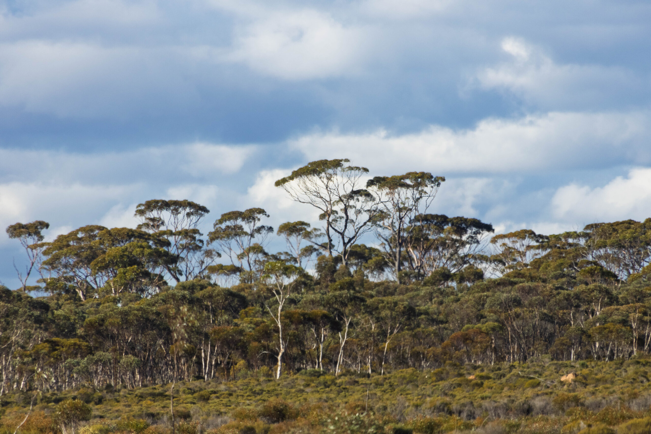
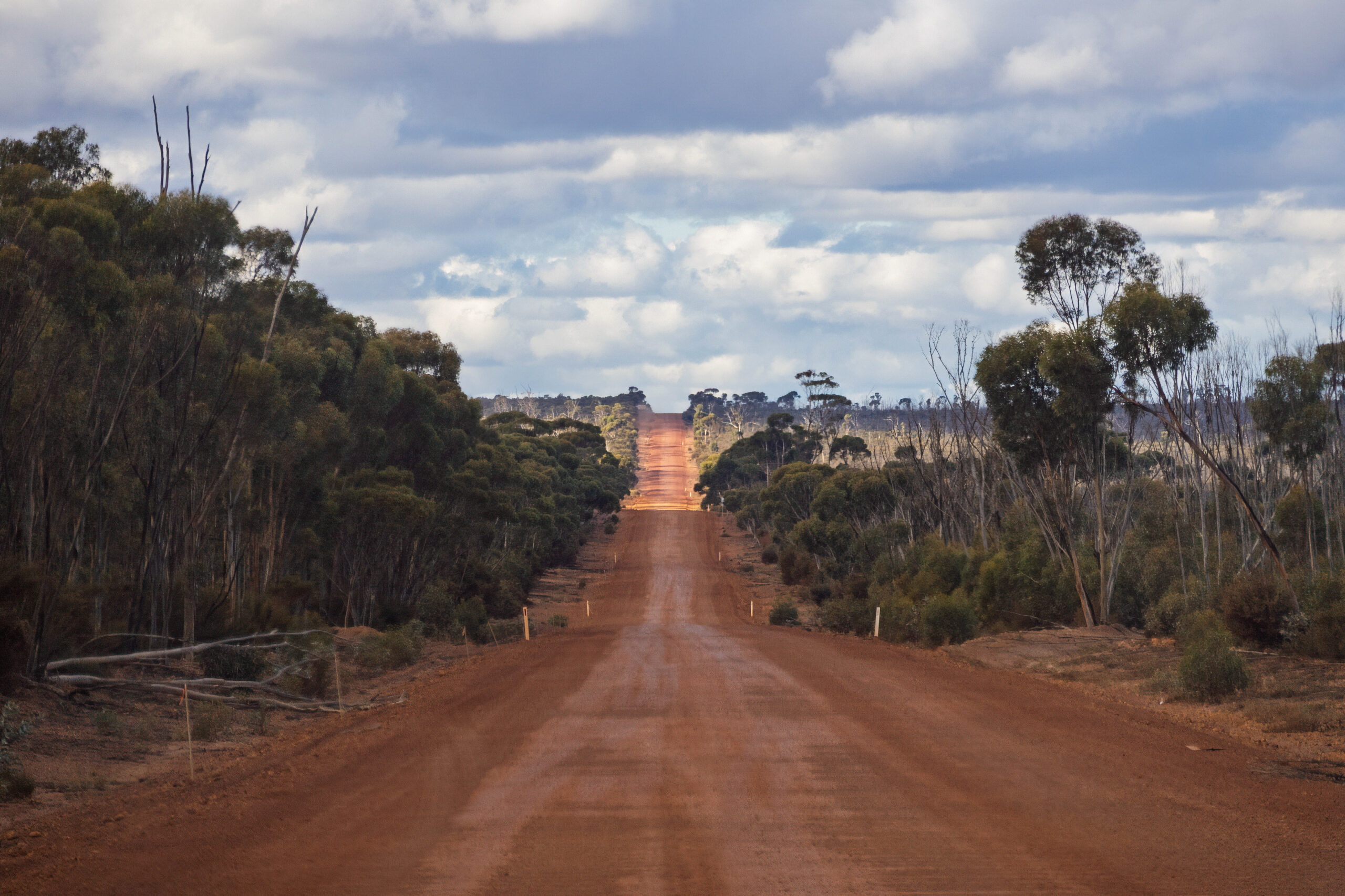
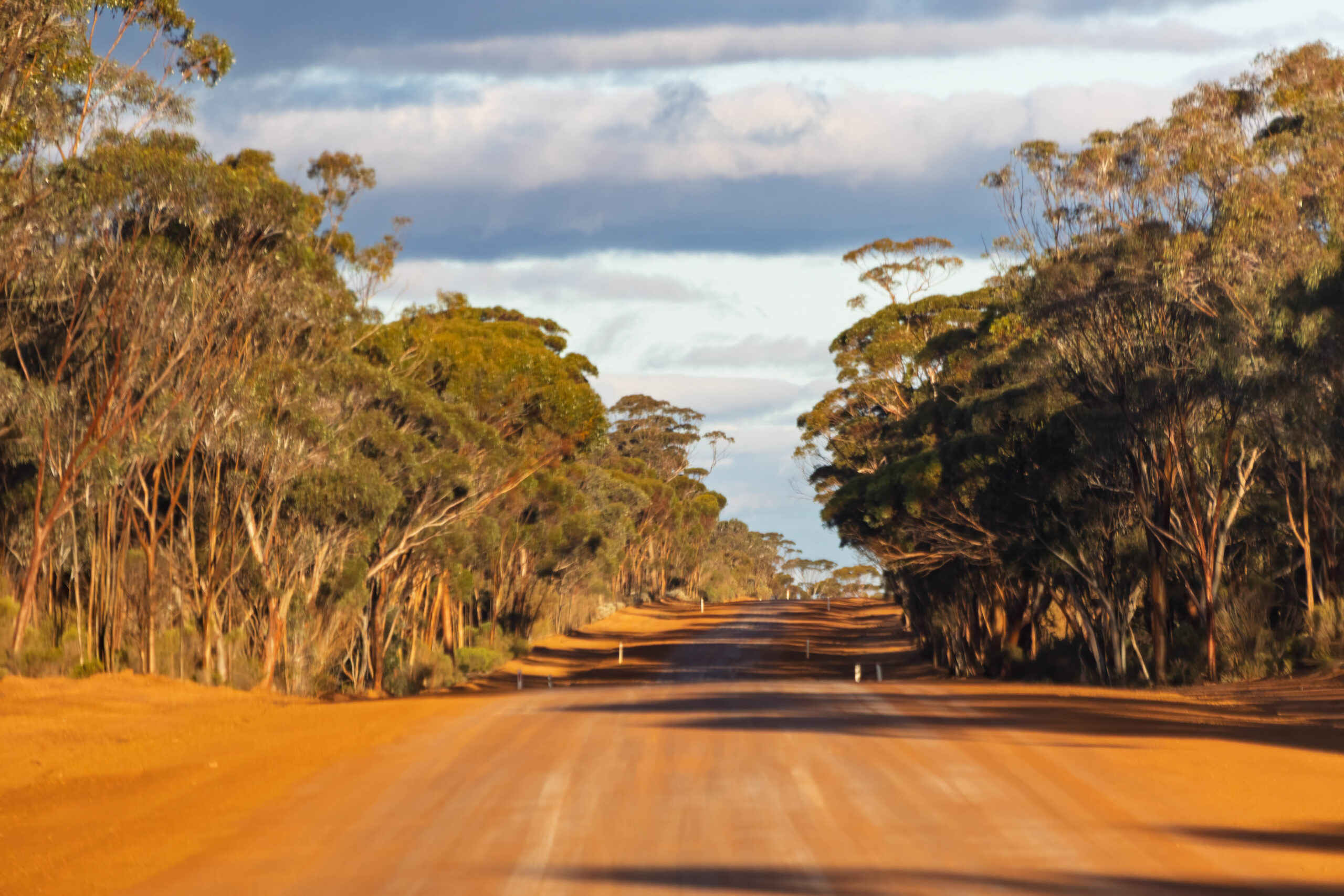
While we were still some 237 kilometres from Norseman, we passed a sign telling us that we had entered The Great Western Woodlands. The roadside vegetation certainly was very woodsy! And then … the sealed road ran out. OMG, we were still more than 200 Ks from Norseman, that’s a lot of driving … on an unsealed road … late in the day. It did, however, explain the disparity between our kilometres to be travelled vs the amount of time it was going to take us to reach our destination. The SatNav was factoring in the slower speed we would need to travel at on an unmade road. We really had no idea that one of the routes we were being offered this morning included more than 200 kilometres of unmade road. For goodness sake, it is one of the main routes to/from Perth and it’s unsealed! Perhaps we didn’t do enough research on this Perth-Norseman bit?
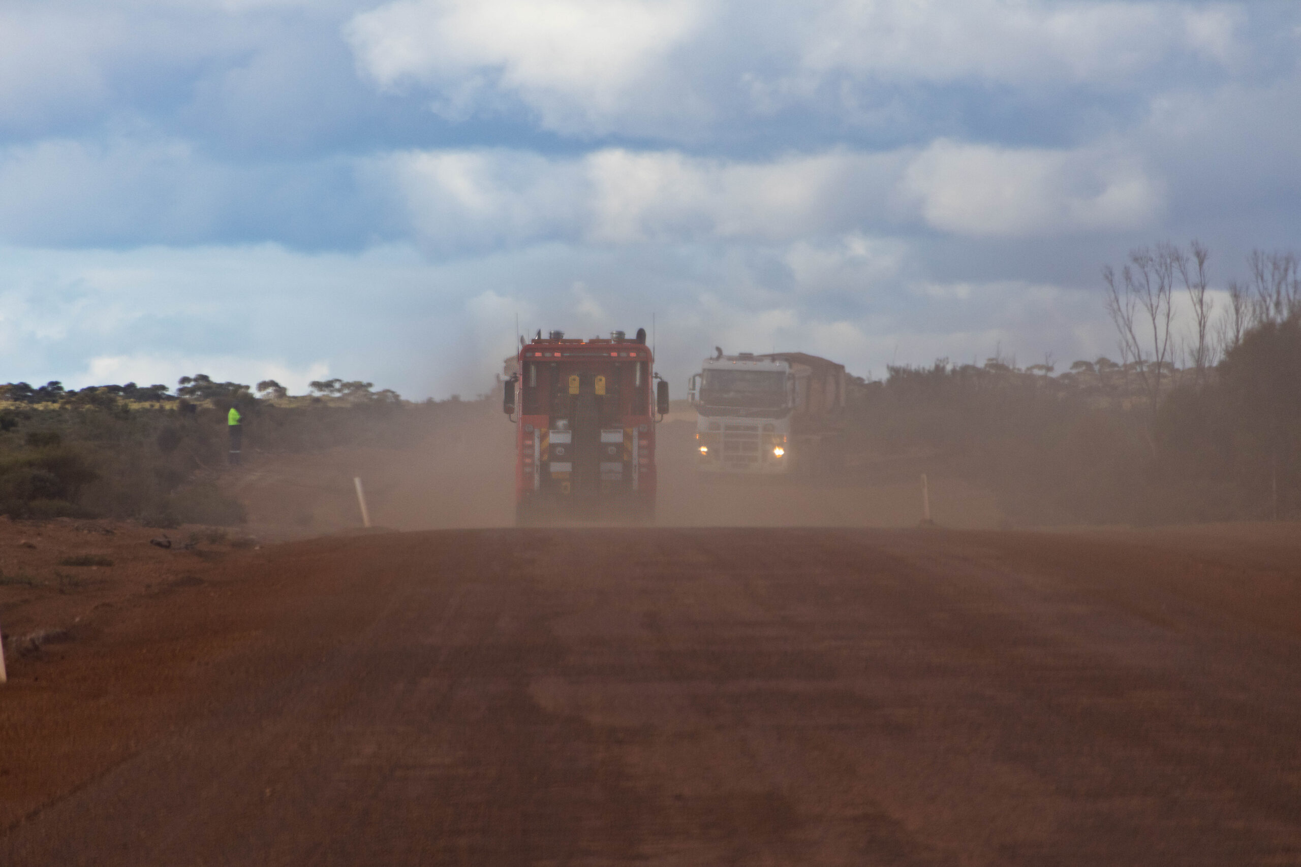
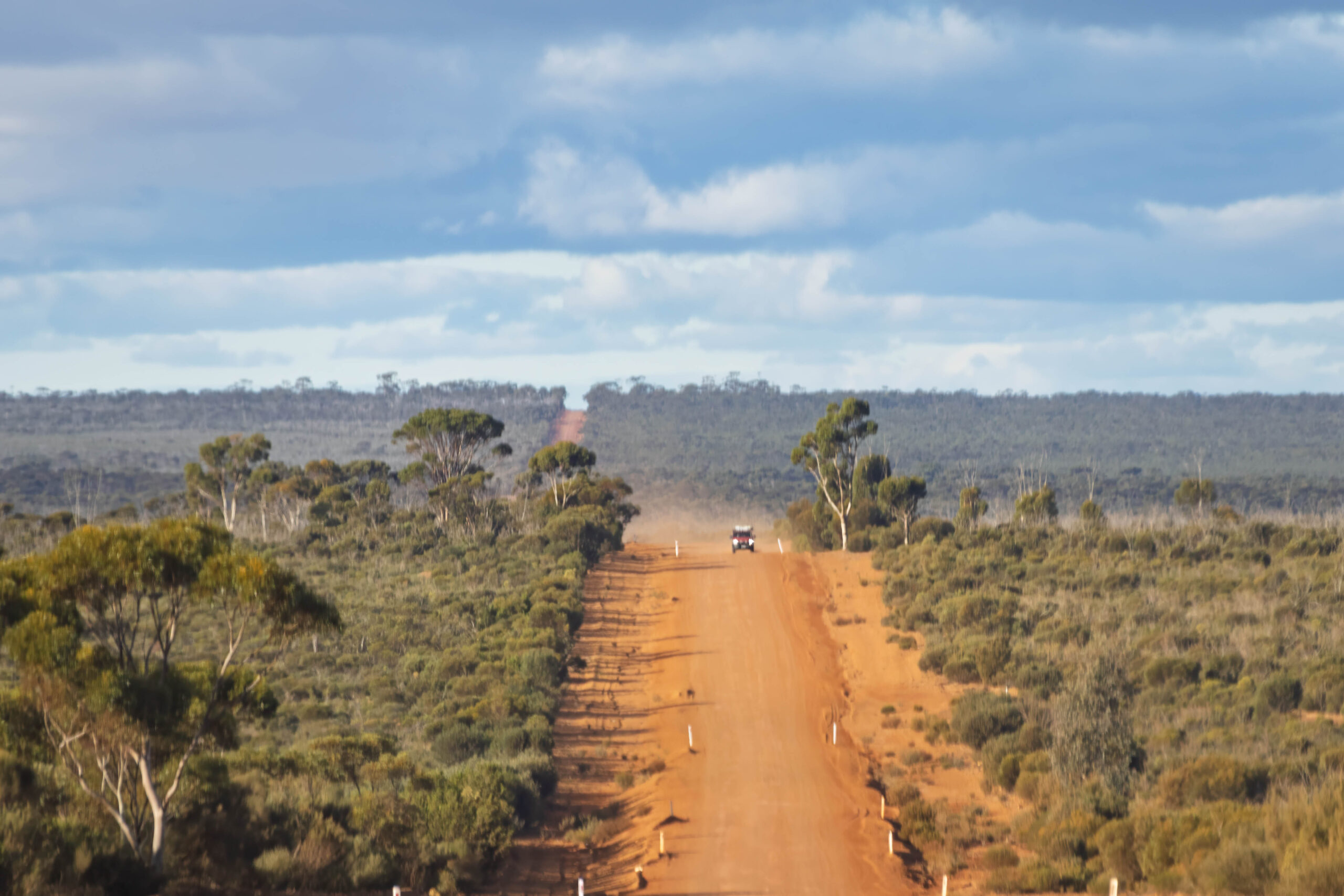
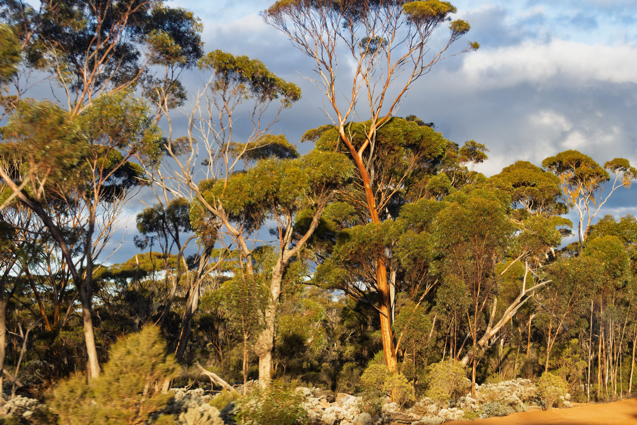
Anyway, continuing through the woodlands, the road really wasn’t too bad. We encountered a broken down road train, where a couple of vehicles had just arrived to render assistance. We had been hearing some chatter about that and a grader which we soon passed, parked up at the Grevillea Hills Rest Area. That left us motoring along behind a road train heading east, eating its dust. We thought all the dust was from the vehicle that pulled up behind the breakdown but, no, there was still this damn road train in front of us. After all the invective on Channel 40 earlier today, we were reluctant to use the radio to ask the road train driver about getting around him.Eventually, though, after about 15 kilometres or so in a dust cloud, we did manage to overtake for some clear air.
At the turnoff for McDermid Rock (Granite and Woodland Discovery Trail) the driver decided that he couldn’t hold 600mls of processed Coke No Sugar in any longer, so he pulled in at the bush toilet. Soon after that we passed the turn off for Victoria Rock Road which heads north to Coolgardie. Around the corner from the road junction we drove past Lake Johnston which had very little water in it at the moment. No time to stop for a photo!
Driving along in the afternoon sun the salmon gums positively glowed. I tried to take some photos, but I’m not really sure if photos do the colour and luminescence of their trunks justice? At around 70Ks out of Norseman we started passing skeletal trees that looked like they had been burnt in a bushfire not too long ago? I Googled it and it would seem that the last fire in this area was five years ago.
Still 46 kilometres from Norseman we drove onto bitumen. This close to Norseman we thought the road might be sealed for the rest of our journey. Nope, it was just another bitumen teaser!! There had been a few of these this afternoon. At around 20 Ks to go, there was shredded rubber all over the road and a septic tank driver pulled over, with his tanker listing to one side. A motor home had just driven straight past the stricken truck, but Bernie pulled alongside to check that help was on the way. Yes, the driver confirmed that he had been able to contact someone who was on their way to assist. Better 20 Ks from Norseman than 120 Ks??! Eeeuuuww, from the smell of it (and the hose from the tanker to the roadside) we think he may have been illegally disposing of his septic waste while he waited to be rescued?? We passed the motor home and continued towards civilisation. Honestly, this first/last section of the trans-continental drive between Perth and Norseman is more rough and isolated than the Nullarbor Plain.
Finally, finally! with only 17 kilometres to go, we were on a bitumen road surface again. Just nine kilometres out of town, we turned right onto the Coolgardie-Esperance Road to conclude the first leg of our journey east when we pulled into the BP Service Station on the edge of Norseman at 5.20pm. Somehow, we had clawed back 40 minutes on our way this afternoon. Bernie drove like a rally driver on that dirt road to have us in Norseman well before the 6.00pm ETA predicted earlier by Syri.
With the tank refilled and the windows squeegeed, ready for a quick getaway in the morning, we found our way to the Ngadju Gateway Motel. Rather uncharacteristically, we hadn’t booked our return trip accommodation until last week. We had to book a two bedroom unit here in Norseman because it was the only accommodation left in town. We should have foreseen that with traffic from north, south and west funneling through Norseman onto the Eyre Highway. And, of course, there is the westbound traffic passing through here too, with at least some of it stopping in Norseman for the night.
The motel has an on-site restaurant so that was the easiest option for dinner. They had slow-cooked lamb shanks on the specials menu tonight. Another patron leaving the restaurant as we arrived gave the lamb shanks an enthusiastic review so, that’s what we went with.
Steps: 4,488 (2.93kms)